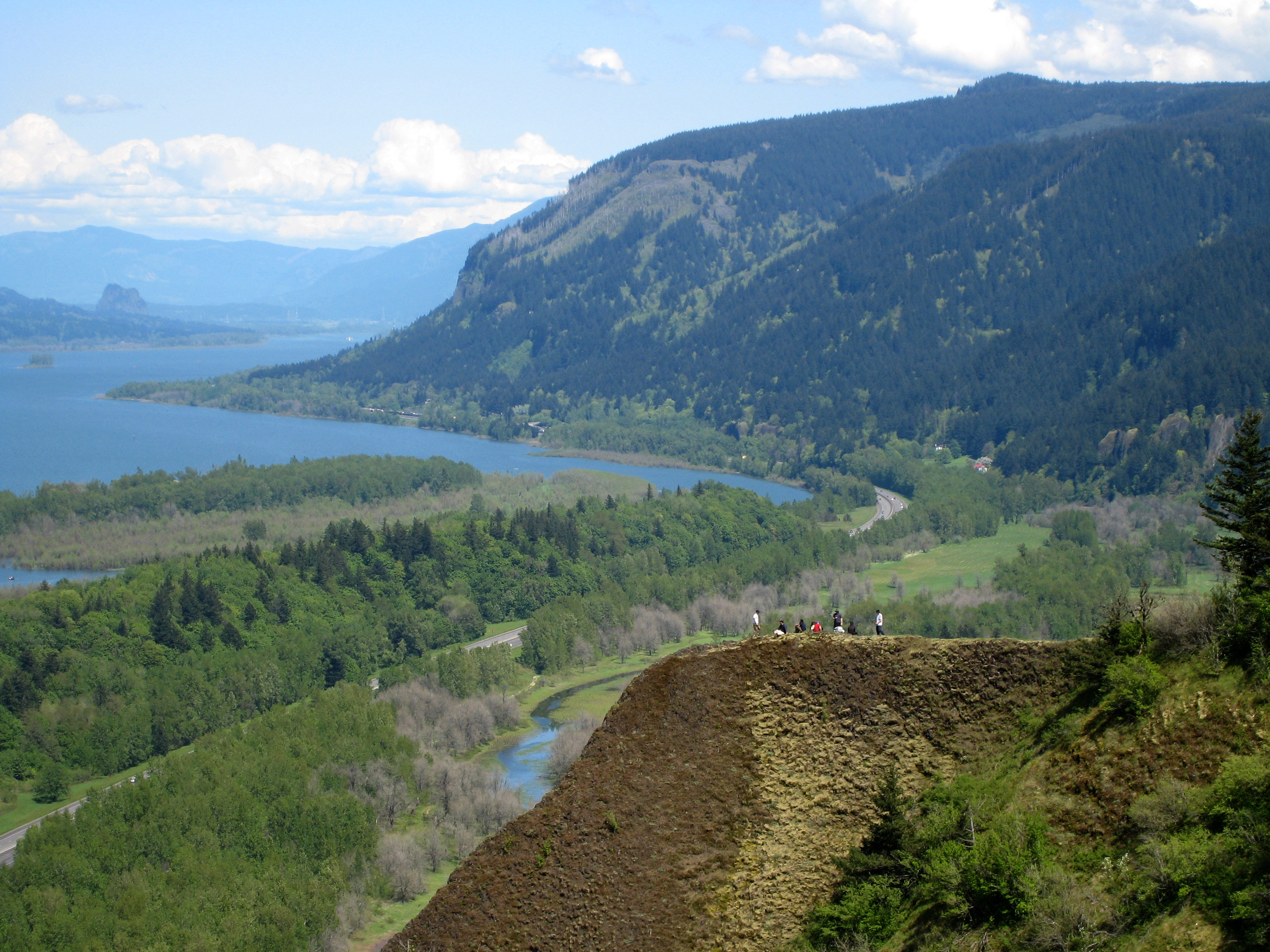
The Columbia River Gorge is a spectacular river canyon some 130 kilometers long where the mighty Columbia, the largest river in the Pacific Northwest, cuts through the Cascade Range, forming the natural border between Oregon (to the south) and Washington (to the north). It is a landscape of basalt walls, forests, dizzying lookouts and one of the greatest concentrations of waterfalls in the United States, a stone's throw from Portland.
Protected as the Columbia River Gorge National Scenic Area, the gorge is famous above all for its falls: the imposing Multnomah Falls, one of the tallest and most photographed in the country, and many others that tumble down the cliffs on the Oregon side along the historic Highway 30. It is also an outdoor paradise: hiking, plus world-famous windsurfing and kitesurfing around Hood River (thanks to the strong winds in the canyon), and lookouts such as Crown Point that take in the whole gorge.
This guide covers the essentials of the Columbia Gorge with a practical eye: the unmissable waterfalls and lookouts, how to drive the Historic Columbia River Highway, the timed-permit system in force in high season for Multnomah Falls, how to get there without a car on the Columbia Gorge Express, when the falls run fullest, and where to sleep and eat. It is the easiest and most popular nature escape from Portland, ideal as a day trip or combined with Mount Hood.
For millennia the gorge was a vital corridor for Indigenous peoples, especially because of the falls and rapids of the river (such as the now-vanished Celilo Falls), one of the great salmon fishing and trading centers of North America. The Lewis and Clark expedition travelled it in 1805-1806 on the way to the Pacific. At the start of the 20th century the Historic Columbia River Highway was built, a pioneering scenic road. The construction of dams in the 20th century (such as Bonneville, in 1937) transformed the river and submerged rapids and thousand-year-old fishing sites. In 1986 Congress created the Columbia River Gorge National Scenic Area, the first of its kind, to protect the landscape and regulate development. The full story is on our history page.
Read the full history ↓The destination of the Oregon Trail pioneers: land of the salmon peoples, of wild Pacific shores, of the impossible blue of Crater Lake and of a green, independent culture with Portland as its banner.
Read the history of Oregon →They depart from Portland, 44 km away. If you book from this link we earn a commission and you pay no more.
No exact prices: a scale from $ (budget) to $$$$$ (luxury), with 2-3 options per category.
Origins, formation and what the sources say.
On 10 March 1957, at ten in the morning, hundreds of people crowded onto the rocks at Celilo, in the heart of the Columbia River Gorge, to witness something no previous generation had imagined possible: the disappearance of a waterfall. Downstream, the gates of The Dalles dam had just closed, and in barely a few hours the reservoir rose and swallowed forever Celilo Falls, a salmon fishery and trading center that Indigenous peoples had used for more than ten thousand years. The thousand-year-old roar of the water went silent beneath the artificial lake, and many of those present wept.
That scene sums up the history of the gorge: a place shaped by colossal forces —lava, ice, apocalyptic floods— and then fought over, transformed and in part sacrificed by human beings. Here waterfalls hang from the walls because of one of the greatest floods the Earth has known; here peoples fished for millennia and Lewis and Clark passed on their way to the Pacific; here one of the world's first scenic highways was built, and also the dams that would change the river forever. To understand the Columbia Gorge is to understand how one and the same landscape can be, at once, a geological wonder, a lost Indigenous sanctuary and a pioneering model of conservation.
The spectacular canyon of the Columbia River Gorge is the result of millions of years of extraordinary geological forces. The basalt walls that define the gorge today formed between about 17 and 6 million years ago, when gigantic lava flows (the so-called Columbia River Basalts) welled up from fissures in the crust and covered an enormous region of what is now Oregon and Washington, stacking layers of volcanic rock hundreds of meters thick. At the same time the Columbia River was cutting its way through, and the slow uplift of the Cascade Range forced the river to slice through the mountains, carving the canyon.
But the most dramatic and decisive episode came at the end of the last ice age, between about 15,000 and 13,000 years ago: the colossal Missoula floods. An enormous glacial lake (Lake Missoula), dammed by a tongue of ice in what is now Montana, broke repeatedly, releasing unimaginable volumes of water all at once. Those catastrophic torrents —some of the largest floods known in Earth's history— swept across the Northwest and funneled violently into the gorge, widening it, polishing its basalt walls and creating its characteristic profile of sheer cliffs.
It was precisely those floods that left the side valleys hanging on the walls, the ones down which the waterfalls now tumble: by abruptly widening and deepening the main canyon, the tributary streams were left 'suspended' high above, giving rise to the dozens of falls —Multnomah among them— that make the gorge famous. The landscape we admire today is thus the signature of lava, ice and water acting on an immense scale.
For more than ten thousand years, the Columbia River Gorge was one of the most important places for the Indigenous peoples of the whole of western North America. The reason was salmon: every year, enormous runs climbed the river to spawn, and the rapids and falls of the gorge concentrated them at points where fishing was extraordinarily abundant. The most celebrated of those places was Celilo Falls (Wy-am), a series of cataracts and rapids that made up one of the most productive salmon fisheries on the continent.
From wooden platforms rigged out over the turbulent water, fishers from peoples such as the Wasco, Wishram, Yakama, Umatilla, Warm Springs and Nez Perce caught salmon with nets and spears, in a tradition handed down through countless generations. Celilo was also a great center of trade and cultural exchange: peoples from very distant regions came to it to trade dried salmon, goods and news, in what is considered one of the oldest and longest-lasting Indigenous marketplaces in North America.
That abundance made the gorge a vital axis of Indigenous life in the Northwest, with villages, sacred sites and routes crossing the canyon. Salmon was not just food but the center of the culture, the economy and the spirituality of these peoples, a relationship that would hold until the dramatic change the 20th century brought.
In 1805, the Lewis and Clark expedition, sent by the United States government to explore the territory toward the Pacific, came down the Columbia River and crossed the gorge on the way to the ocean, leaving one of the first detailed written records of the canyon, its rapids and its inhabitants. The expedition passed through the area both outbound and on the return, and the gorge became part of the imagination of westward expansion.
In the following decades, the gorge was a route of the Oregon Trail (on its final stretch, overland or by river) and a corridor for the settlers arriving in the Willamette Valley. But the milestone that would open it to tourism came at the start of the 20th century: the construction of the Historic Columbia River Highway, opened around 1915-1922. Conceived as a scenic road that would make the most of the beauty of the landscape and show it off, it was a pioneering feat of engineering, with elegant bridges, tunnels and stone walls winding along beside the waterfalls.
That road, one of the first in the United States planned specifically for scenic enjoyment, turned the gorge into an accessible and popular destination, with lookouts such as Vista House at Crown Point and stops at the waterfalls. A good part of that historic route survives and is being restored today as a scenic road and trail, and it is still the loveliest way to travel the canyon.
The 20th century brought the gorge a deep transformation and, for the Indigenous peoples, a painful one: the era of the great dams. As part of the hydroelectric projects driven during the New Deal, the Bonneville dam was built (completed in 1937), followed by others along the Columbia. These dams generated enormous amounts of energy and allowed navigation and irrigation, boosting the economy of the Northwest, but they radically altered the river and its ecosystem.
The most symbolic blow came in 1957, when The Dalles dam came into operation and flooded and silenced Celilo Falls forever, burying that thousand-year-old fishery and trading center under the reservoir. For the river peoples, it was the loss of a sacred place and of the heart of their traditional way of life, an episode still remembered with pain today. The dams also severely hampered salmon migration, despite the fish ladders built to mitigate it.
As awareness grew of the unique value of the landscape and of the pressure of development, a movement to protect the gorge emerged. In 1986, the United States Congress created the Columbia River Gorge National Scenic Area, a special protective designation covering both sides of the river in Oregon and Washington and aiming to preserve its scenic, natural and cultural resources while regulating development. Today the gorge combines its standing as a natural wonder and tourist destination with the living memory of its Indigenous history and of the transformations of the river.