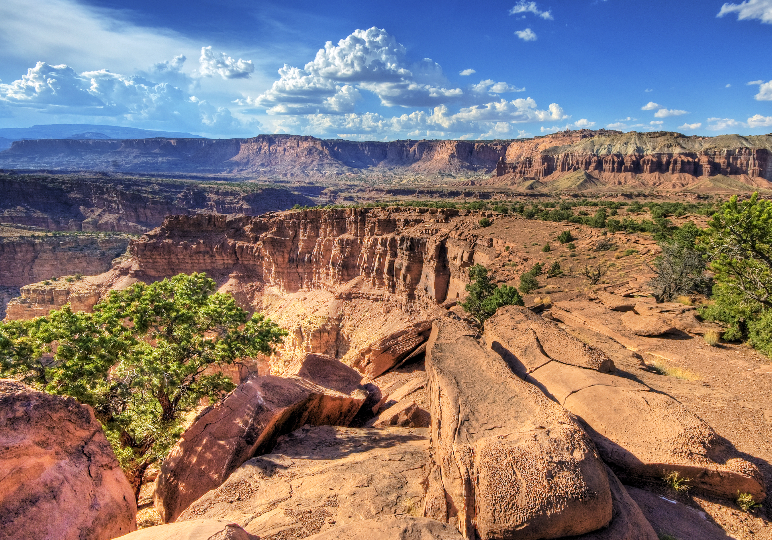
Capitol Reef National Park, in south-central Utah, is the least known of the state's 'Mighty 5', and for exactly that reason one of the quietest and most surprising. It protects the Waterpocket Fold, a giant wrinkle in the earth's crust almost 160 km long: a fold of multicolored striped rock that water has carved into canyons, domes, spires and arches over millions of years.
Its name combines two images: 'Capitol' for the great white sandstone domes that recall the dome of the Capitol building, and 'Reef' because the rock fold formed an impassable barrier for the pioneers, like a reef on dry land. In the heart of the park, beside the Fremont River, Fruita survives: an old Mormon settlement with historic orchards of apple, pear and cherry trees that visitors can pick in season.
This guide covers the essentials of Capitol Reef with a practical eye: the difference between entering the park (free) and driving the Scenic Drive (with a fee), the Fruita orchards and their famous pie, the petroglyphs, the hikes to Hickman Bridge and the canyons, remote Cathedral Valley, and how to use Torrey as a base. It is a park of spectacular scenery, living human history and, still, calm.
The landscape of Capitol Reef revolves around the Waterpocket Fold, a monocline (a step-like fold) almost 160 km long, formed tens of millions of years ago when tectonic forces lifted and bent the rock layers; later erosion turned it into a maze of canyons and domes. The area was inhabited by the Fremont culture, which left petroglyphs behind, and in the 19th century settled by Mormon pioneers who founded Fruita and planted its orchards. Protected as a national monument in 1937, it became a National Park in 1971. The full story is on our history page.
Read the full history ↓The state of red canyons and Mormon pioneers: ancestral territory of Utes, Paiutes, Goshutes and Navajos, settled by Brigham Young's saints from 1847, home of the Great Salt Lake, of the Golden Spike that joined the railroad from coast to coast and of the five most spectacular national parks in the country.
Read the history of Utah →They depart from Bryce Canyon City, 106 km away. If you book from this link we earn a commission and you pay no more.
No exact prices: a scale from $ (budget) to $$$$$ (luxury), with 2-3 options per category.
Origins, formation and what the sources say.
Imagine grabbing a stack of colored blankets laid out on a table and, with one tug, pushing one end down: the once-flat layers suddenly bend into a single giant step. That, on a continental scale and in stone, is the Waterpocket Fold, the backbone of Capitol Reef and one of the most spectacular and best-exposed geological folds in all of North America. It is a 'monocline': a step-like flexure in the rock layers that runs almost 160 km from north to south along the park. Over tens of millions of years, rocks that lie horizontal elsewhere tilt sharply here, exposing one after another layers that would otherwise stay buried kilometers deep.
The fold formed between 50 and 70 million years ago, during the Laramide orogeny, the same episode of tectonic forces that raised the Rocky Mountains. An ancient deep fault in the basement probably moved again and deformed the sedimentary layers above it, creating the flexure. Later erosion, above all by water, carved into that tilted structure a maze of canyons, domes, spires, arches and 'waterpockets' (the natural basins that give the fold its name).
The exposed rocks span almost 200 million years of history, in a striking succession of colors: white sandstones that form the 'Capitol'-style domes, red and golden strata, and layers in greenish and purplish tones. It is, literally, a geology book left open on a rock wall.
Long before the pioneers, the Fremont River valley was home to Indigenous peoples. The most important for this region was the Fremont culture, which flourished roughly between 600 and 1300 AD and which takes its name precisely from the river that crosses the park. They were farmers and hunter-gatherers who grew corn, beans and squash on the fertile land beside the water, supplementing their diet with hunting and gathering.
The Fremont left a valuable legacy of rock art: petroglyph panels carved into the sandstone walls, with broad-shouldered human figures wearing elaborate headdresses, bighorn sheep and geometric motifs. Several of these panels are visible today beside SR-24, reached by boardwalks. They also made pottery, basketry and distinctive clay figurines.
By the 13th century, like other peoples of the Colorado Plateau, the Fremont abandoned the region, probably because of droughts and changes in their way of life. Afterwards the territory was traveled by Ute and Paiute bands, who kept a presence here until the settlers arrived.
For Anglo-American settlers, the Waterpocket Fold was for a long time a formidable obstacle: an impassable wall of rock that reminded them of an ocean reef, hence the word 'Reef' in its name. The other half, 'Capitol', refers to the great white domes of Navajo sandstone that evoke the dome of the Capitol in Washington.
In the late 19th century, Mormon pioneers —members of The Church of Jesus Christ of Latter-day Saints who were settling southern Utah— established themselves in the fertile oasis that the Fremont River created in the middle of the rock. They founded a small farming village they first called Junction and later Fruita, after the fruit orchards they planted, taking advantage of the water and the climate. Only a few families ever lived there, growing fruit, raising livestock and getting by in relative isolation.
The Fruita orchards thrived for decades. When the government acquired the land for the park, it decided to keep them alive as cultural heritage, along with buildings such as the Gifford farmhouse (1908) and the one-room schoolhouse. Today those historic orchards, maintained by the National Park Service, are one of the park's most unusual and best-loved features.
The beauty and singularity of the area began to be officially recognized in the early 20th century. After several years of local campaigning —driven by residents such as Ephraim Pectol and Joseph Hickman, who saw the landscape as both a tourism and a heritage asset—, President Franklin D. Roosevelt declared Capitol Reef National Monument in 1937, protecting an area around the white domes and the Fruita section.
For decades the monument remained remote and little visited, partly because of the lack of good roads. The paving of SR-24 through the Fremont River canyon, completed in the 1960s, improved access and opened the area to more travelers. The monument was gradually expanded to include the full extent of the Waterpocket Fold and areas such as Cathedral Valley.
Finally, on 18 December 1971, Congress upgraded the site's status and created Capitol Reef National Park, with essentially its present boundaries, covering almost 100,000 hectares along the whole fold. One of the most extraordinary and, still today, least crowded landscapes in Utah was now protected.
Today Capitol Reef is one of Utah's 'Mighty 5', but it is still the least visited and, for many, the calmest and most endearing. It gets considerably fewer tourists than Zion, Bryce or Arches, which means you can enjoy its hikes, its orchards and its sunsets with a quiet that is increasingly rare in American parks.
The combination of spectacular nature and living human history is its great signature: few parks let you pick fruit from century-old orchards, buy a homemade pie at a historic farmhouse and walk among thousand-year-old petroglyphs and rock domes all in the same day. The park is also certified as a 'Dark Sky Park' for the exceptional darkness of its skies, ideal for astronomy.
The future brings challenges: rising tourism as the park is 'discovered', the conservation of the fragile orchards and soils, and the effects of climate change and drought on the Fremont River, which is the soul of the oasis. But for now Capitol Reef keeps that quality of an unexpected find: the traveler who arrives expecting one more red-rock park comes across a green oasis, fruit trees heavy with harvest and centuries of history among the folded walls of the Earth.