Viajá con Gus
HomeGuatemalaHuehuetenango
Huehuetenango
🇬🇹 Guatemala · Highlands and the west

Huehuetenango

Jump to what you need
📌Department
Huehuetenango is the capital of the department of the same name, in the far northwest of Guatemala, near the border with Mexico (Chiapas). The city sits in a valley at around 1900 meters of altitude, at the foot of the imposing Sierra de los Cuchumatanes, the highest non-volcanic mountain range in Central America. It's a commercial and service city, the gateway to a region of great cultural diversity, home to several Maya peoples (Mam, Q'anjob'al, Chuj, Akateko, Popti', among others) and to the high country of the Cuchumatanes.
📌Service city
Huehuetenango itself (locals call it 'Huehue') is the main service hub of the northwest: it has hotels in various categories, restaurants, hospitals, banks and ATMs, markets, and a bus terminal with connections to the capital, to Quetzaltenango, to the Mexican border at La Mesilla and to the towns of the department. It's the logical base for climbing into the Cuchumatanes, visiting Todos Santos Cuchumatán or setting out on routes toward the Ixil region and Mexico.
📌Best time to go
The dry season (November to April) is the best for visiting Huehuetenango and, above all, for climbing into the Cuchumatanes and touring the mountain towns, since the roads are in better shape and the views are clearer. The city's climate is temperate, with cool nights; up in the heights of the Cuchumatanes it gets genuinely cold. The rainy season (May to October) makes the landscape lovelier but complicates mountain travel. The patron saint festival (July, in honor of the Virgen del Carmen) livens up the city.
📌Suggested days
Huehuetenango as a city can be seen in a few hours: the central park, the church and, very close by, the archaeological site of Zaculeu. The interesting part is using it as a base. With 1 to 2 days you can combine the city with Zaculeu and a trip up to the Cuchumatanes lookout. With 3 or more days you can add an excursion or a stay in Todos Santos Cuchumatán, other Mam towns and mountain routes. It's also a natural stopover for anyone crossing into Mexico at La Mesilla or coming from there.
💱 GTQ exchange rate
Loading rate…
🌤️ Weather in Huehuetenango
Loading weather…

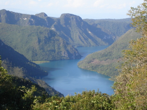
In the far northwest of Guatemala, where the highlands rise toward the highest non-volcanic summits in Central America, sits Huehuetenango: a busy commercial valley city that serves as the gateway to one of the most mountainous, coldest and culturally diverse regions in the country. Behind it rises the Sierra de los Cuchumatanes, a mass of rock and moorland that dominates the horizon and defines the character of the whole region.

'Huehue', as it's affectionately known, isn't a city of great tourist monuments, but it has an unmissable attraction nearby: the Maya ruins of Zaculeu, the ancient capital of the Mam lordship, restored in a peculiar way that sets them apart from any other archaeological site in the country. And, above all, it's the springboard to the Cuchumatanes and their high-altitude towns, like the famous Todos Santos Cuchumatán, where the men's red trousers and the horse race of 1 November are legendary.

This guide covers Huehuetenango with a practical eye: what to see in the city and at Zaculeu, how to get up to the Cuchumatanes lookouts, how to travel on to the Maya towns of the department and how to make the most of Huehue as a base for one of the most authentic and least touristy regions of Guatemala. It's also an obligatory stop for anyone traveling between Guatemala and southern Mexico.

📖 History of Huehuetenango

The Huehuetenango region was, in pre-Hispanic times, the heart of the Mam Maya lordship, whose capital was Zaculeu (which in Mam means, according to the most widespread readings, 'white earth'). Zaculeu was an important political and ceremonial center of the Postclassic, defended by natural ravines. During the Spanish conquest, in 1525, forces commanded by Gonzalo de Alvarado (brother of Pedro de Alvarado) laid siege to Zaculeu; the Mam city, under the leadership of its ruler Kaibil Balam, held out through a long siege before surrendering to hunger. After the conquest, the Spanish founded the town of Huehuetenango; the name comes from Nahuatl and is usually translated as 'place of the elders' or 'place of the ancients', a toponym brought by the conquistadors' Nahuatl-speaking Indigenous allies. During the colonial era, the region was integrated into the Captaincy General of Guatemala as an agricultural and mountain zone. With independence and the organization of the republic, Huehuetenango was constituted as a department. In the 20th century, the ruins of Zaculeu were restored in the 1940s with funding from the United Fruit banana company, an intervention that rebuilt the buildings with a coat of smooth stucco, giving them their present look, distinctive and at the same time controversial among specialists. Today Huehuetenango is a dynamic commercial city and the gateway to the Cuchumatanes. The full history is on our history page.

Read the full history ↓

🗺️ What to see

1
Zaculeu (Maya ruins of the Mam capital)
The ancient capital of the Mam lordship, an archaeological site restored with a distinctive smooth stucco, a few kilometers from the city.
Zaculeu is without question the star attraction of Huehuetenango and one of the most singular archaeological sites in Guatemala. It was the capital of the Mam Maya lordship during the Postclassic period, a political and ceremonial center strategically placed on a plateau ringed by ravines that served as natural defenses. Its name is usually translated from Mam as 'white earth'. Here, in 1525, the Mam people mounted one of the most tenacious resistances to the Spanish conquest, under the leadership of Kaibil Balam, enduring a long siege before surrendering. What makes Zaculeu unmistakable is its appearance. In the 1940s it was restored with funding from the United Fruit banana company, an intervention that coated the pyramids, platforms and plazas with a layer of smooth whitewashed stucco, giving them a polished, geometric look very different from other Maya sites with their stonework exposed. This restoration is both its hallmark and a subject of debate among archaeologists, since it favored the reconstructed appearance over strict archaeological conservation. The result, in any case, is a clean, orderly and highly photogenic site. The visit takes in pyramid temples, a ball court, plazas and platforms, plus a small site museum with pieces found in the excavations, such as ceramics and burials. It's a quiet visit, in green surroundings, ideal for understanding the importance of the Mam people. Getting there: it's a few kilometers from the center of Huehuetenango; reached by taxi, tuk-tuk or local transport in minutes. Best time: any day, preferably in the morning. Tips: bring sunscreen, water and comfortable footwear; there's little shade at the site. Check the hours of the site and the museum.
ℹ️ Distance: A few km from the center of Huehuetenango (taxi/tuk-tuk in minutes) · Best time: Any day, preferably in the morning · Admission: Q5 nationals, Q50 foreigners (source: SIC / Ideas para Viajar, verified July 2026; free only for students from public institutions) · Hours: Mon-Sun 8:00-16:00 (verified July 2026) · Duration: 1 to 2 hours
2
The Cuchumatanes lookout (Mirador Juan Diéguez Olaverri)
A spectacular balcony over the highlands, high in the Sierra de los Cuchumatanes, with a view that inspired famous verses.
Climbing from Huehuetenango toward the heights of the Sierra de los Cuchumatanes you reach one of the most impressive lookouts in Guatemala: the Mirador Juan Diéguez Olaverri, named after the Huehuetenango poet who dedicated verses to these mountains. Set at more than 3000 meters, perched on the edge of the range, it delivers a dizzying panorama over the Huehuetenango valley, the mountain chains and, on clear days, a succession of summits fading into the horizon. The lookout has plaques bearing the poet's verses and is a classic stop on the climb into the Cuchumatanes. The contrast between the temperate valley of the city and the cold high moorland is striking: up here the air is thin and cold, and the landscape changes completely, with grasslands, rocks and an enormous sky. It's one of those places where you grasp the grandeur of this range, the highest in Central America outside the volcanoes. Beyond the lookout, the road continues toward the Cuchumatanes plateau and its towns, in a moorland setting unique in the region. The climb is commonly done as a day trip from Huehuetenango. Getting there: by your own vehicle, taxi or tour from Huehuetenango on the road that climbs into the Cuchumatanes; minibuses to the high-altitude towns also pass through. Best time: clear dry-season days for the best view. Tips: bring warm clothes (it's cold up there), and bear in mind the altitude change is noticeable; go up slowly.
ℹ️ Distance: In the Cuchumatanes, climbing from Huehuetenango (mountain road) · Best time: Clear dry-season days · Admission: Free (open-access lookout) · Duration: Half a day (up and back)
3
Downtown Huehuetenango (central park and church)
The commercial and civic heart of the city, with its central park, the parish church and the buzz of a highland town.
Downtown Huehuetenango revolves around its central park, a lively, tree-shaded space where the life of the city beats. Facing the park stand the parish church (the Cathedral of the Immaculate Conception) and the municipal buildings, in an ensemble that mixes the colonial with the modern. It isn't a monumental historic quarter like Antigua's, but it has the living charm of a commercial highland city, with markets, shops, street vendors and plenty of movement. One curiosity of the central park is its small replica or monument representing the geography of the department, along with details reflecting local pride. Walking through the center, watching people come and go —many women in Maya dress from different municipalities of the department—, browsing the market and trying the local food is the best way to take the pulse of Huehue. The city works above all as a logistical base: here you sleep, eat, change money and organize excursions to Zaculeu, the Cuchumatanes and the towns of the interior. Its location near the Mexican border at La Mesilla also makes it a transit point for international travelers. Getting there: the center is walkable. Best time: any day; the patron saint festival in July (Virgen del Carmen) is the liveliest. Tips: take the chance to sort out logistics (money, supplies, transport) before heading up the mountain, where services are scarce.
ℹ️ Distance: City center; walkable · Best time: Any day; the July patron saint festival is livelier · Admission: Free (open access) · Duration: 1 to 2 hours
4
Todos Santos Cuchumatán (day trip)
The most famous high-altitude Mam town in the region, with its red trousers and its celebrated horse race on 1 November.
From Huehuetenango, the unmissable excursion into the mountains is the one to Todos Santos Cuchumatán, a Mam town set in a high valley of the Sierra de los Cuchumatanes. It's one of the most singular places in Guatemala for the strength with which it preserves its culture: the men wear an unmistakable traditional outfit every day, with red-and-white striped trousers, an embroidered-collar shirt and a straw hat, something increasingly rare in a country where men's Indigenous dress has gradually been lost. Todos Santos is known worldwide for its festival on 1 November (All Saints' Day), whose centerpiece is a wild horse race in which riders gallop from one end to the other for hours, in an event full of color, music and tradition. The rest of the year, the town offers a quiet mountain atmosphere, walks to nearby hamlets, ruins and lookouts, and the chance to learn the Mam language or spend time with the local culture. The journey from Huehuetenango crosses the high Cuchumatanes, with moorland landscapes and spectacular views, before dropping down into the town's valley. It's a mountain route done by local transport (minibuses) or on an excursion. Getting there: by minibus or transport from Huehuetenango along the Cuchumatanes road (several hours of mountain driving). Best time: dry season; 1 November for the horse race (book well in advance). Tips: bring warm clothes, respect local customs and ask permission before photographing. (More detail in our Todos Santos Cuchumatán guide).
ℹ️ Distance: In the Cuchumatanes, several hours from Huehuetenango (mountain minibus) · Best time: Dry season; 1 November for the horse race · Admission: Free (open access to the town) · Duration: A day or more (ideally with an overnight stay)
5
Regional museum and crafts of the department
Textile workshops and markets where you can take in the enormous diversity of Maya dress in the country's most multiethnic department.
Huehuetenango is the department with the greatest diversity of Maya languages in Guatemala: Mam, Q'anjob'al, Chuj, Akateko, Popti' (Jacaltec) and Spanish coexist across its different municipalities, each with its own traditional dress. The city's central market and the small craft shops are a good place to take in that textile diversity, buy weavings and get a look at daily life in a region where the Indigenous and the mestizo mingle constantly. Downtown there are also small exhibits and shops selling the region's coffee (the prestigious 'café Huehue'), worth visiting and tasting before heading up the mountain. It's a complementary stop rather than a major attraction in itself, but one that enriches your understanding of the department before you climb into the Cuchumatanes. Getting there: in the city center, on foot. Best time: market days (check the local calendar) for more bustle. Tips: take the chance to buy high-altitude coffee and a textile as a souvenir before heading up the mountain.
ℹ️ Distance: City center, market and shops near the park · Best time: Market days for more atmosphere · Admission: Free (to wander); purchases separate · Duration: 1 hour
6
Route toward the Ixil region and northern Quiché (can be combined)
A possible extension of the trip toward Nebaj and the Ixil towns, another region of strong Maya identity in the neighboring mountains.
For travelers with more time, Huehuetenango can also serve as a connecting point toward the Ixil region, in the neighboring department of Quiché, an area of high mountains and mist where the Ixil Maya people live, with their own towns (Nebaj, Chajul, Cotzal), their distinctive dress and a history deeply marked by the internal armed conflict. Although it isn't in the department of Huehuetenango itself, the mountain routes crossing the Cuchumatanes connect the two regions, by rural roads and local transport, for the more adventurous travelers. This combination isn't the most common or the simplest logistically —it needs more days and transport with transfers— but for those wanting to dig deeper into the less touristy Guatemala of the western highlands, adding the Ixil region to a visit of Huehuetenango and the Cuchumatanes rounds out a multi-day experience through the Maya mountains of the country's northwest. Getting there: by minibus with transfers from Huehuetenango or Sacapulas, crossing mountain roads. Best time: dry season, given the state of the rural roads. Tips: plan it as a multi-day extension, not a day trip; ask locally about the state of the routes.
ℹ️ Distance: Ixil region (Nebaj), in the neighboring department of Quiché, several hours on mountain roads · Best time: Dry season, given the state of the roads · Admission: Free (access to the towns); transport separate · Duration: A 2-day extension or more
Advertisements
What nobody tells you

💵 Prices

Tickets

TypePrice
Zaculeu (archaeological site and museum)Q5 nationals, Q50 foreigners; open Mon-Sun 8:00-16:00 (source: SIC, verified July 2026)
Cuchumatanes lookout (Juan Diéguez Olaverri)Free (open access)
Downtown Huehuetenango (park and church)Free (open access)
Excursion to Todos Santos CuchumatánFree access to the town; transport/tour separate, Q30-60 by minibus
🔄 updated monthlyOfficial / reference values · double-check when buying

Activities and tours

ActivityPriceDurationOperator
Guided visit to ZaculeuQ5-50 admission; optional guide Q50-1001-2 hLocal and on-site guides
Excursion to the Cuchumatanes and the lookoutQ150-300 on a tour or by taxi with waiting time (verified July 2026)Half a dayHuehuetenango guides and agencies
Excursion or stay in Todos Santos CuchumatánQ30-60 by minibus; lodging separateA day or moreLocal transport and guides
Route to Maya towns of the department (Mam, Q'anjob'al, etc.)Q20-60 per leg by minibusA day or moreLocal transport and guides
🔄 updated monthlyOfficial / reference values · double-check when buying
Advertisements

🚌 How to get there and distances

Getting around

ModePriceDurationNotes
Tuk-tuk (motorized rickshaw)Q5-15 per short ride (cash; verified July 2026)Short ridesThe most used urban transport in 'Huehue': there's no formal city bus network. Handy for getting around town and out to Zaculeu (about Q5/person for a short ride). Paid in CASH; agree the price before getting in. Source: Lonely Planet Guatemala, verified July 2026
TaxiQ20-50 depending on the route (cash; verified July 2026)VariableAvailable downtown and at the terminal; useful for Zaculeu and one-off transfers. Paid in cash; Uber and ride-hailing apps do not operate in the city
Minibuses and local busesQ10-60 depending on the destination (cash on board; verified July 2026)VariableThe backbone of regional transport: they connect the city with the towns of the department, the Cuchumatanes, Todos Santos and the La Mesilla border. They leave from the bus terminal (zona 11) and are paid in cash to the driver's assistant; there's no rechargeable card or QR
On footFreeVariableThe center and the park are comfortably covered on foot
Planning app (real time)Free (mobile data)Huehuetenango has no geolocated city buses, so there's no real-time tracking app for local transport; Moovit mainly maps Guatemala City. For planning people use Google Maps (and Waze to locate the terminal), and for the long-distance buses to the capital, the official site boletos.loshalcones.com.gt, which allows online purchase. Verified July 2026
🔄 updated monthlyOfficial / reference values · double-check when buying

How to get there

RouteAirlines / operatorsAvg. priceDuration
Guatemala City → Huehuetenango (bus)Transportes Los Halcones (7 daily departures, tickets online at boletos.loshalcones.com.gt)From Q145 for the standard service (reclining seat, A/C, insurance; source: Los Halcones / Guatemala.com, verified July 2026)About 6 hours on the Pan-American Highway
Quetzaltenango (Xela) → Huehuetenango (bus or minibus)Regional buses and minibusesQ30-50 approx.About 2 to 3 hours
La Mesilla border (Mexico/Chiapas) → HuehuetenangoLínea Dorada, Trans Galgos Inter, border minibusesUS$ 13-19 (Línea Dorada/Galgos); Q40-60 by minibusAbout 1.5 to 2 hours
Panajachel / Lake Atitlán → Huehuetenango (with a transfer)Tourist shuttles and buses with a transferUS$ 25-40 approx.About half a day depending on connections
🔄 updated monthlyOfficial / reference values · double-check when buying

🏨 Where to stay

No exact prices: a scale from $ (budget) to $$$$$ (luxury), with 2-3 options per category.

CategoryPriceRecommended options
Mid-range hotels in the city$$$$$US$ 35-65 per night; Huehuetenango has several mid-range hotels downtown and around it, with comfortable rooms, wifi and breakfast, aimed at business travelers and tourists using the city as a base
Budget and backpacker lodgings$$$$$US$ 20-35 per night (approx. Q150-270); a wide choice of budget guesthouses and hotels downtown, a favorite with travelers passing to or from Mexico and with those exploring the Cuchumatanes on a tight budget
Mountain lodging in the Cuchumatanes / Todos Santos$$$$$US$ 10-25 per night; in the high-altitude towns (such as Todos Santos Cuchumatán) and on the Cuchumatanes plateau there are basic guesthouses and family homes, with simple comforts and plenty of warm clothing needed against the cold

🍴 Where to eat

TypePriceOptions / signature dish
Comedores and Guatemalan cooking$$$$$Q30-60 per dish; downtown comedores and restaurants serving typical Guatemalan food: broths, recados, meats, beans, tortillas and hearty breakfasts. Good prices and generous portions
Mid-range restaurants$$$$$Q60-150 per dish; a few better-standard restaurants in the city offer meats, international food and more elaborate options, several attached to hotels
Huehuetenango coffee$$$$$Q15-40 per cup; the department is one of Guatemala's great high-altitude coffee regions (café Huehue, highly prized internationally). The local coffee in the city's cafés is worth trying
Advertisements

📖 History of Huehuetenango

Origins, formation and what the sources say.

The Mam Maya lordship and its capital, Zaculeu

Long before the Spanish arrived, the region of present-day Huehuetenango was the heart of the Mam Maya lordship, one of the Maya peoples of the Guatemalan highlands. Its political and ceremonial capital was Zaculeu, a city set on a plateau protected by natural ravines, a few kilometers from the center of the modern city. The name Zaculeu is usually translated from Mam as 'white earth'.

Zaculeu flourished above all during the Maya Postclassic period, when the Guatemalan highlands were divided among different lordships —Mam, K'iche', Kaqchikel, among others— that competed and warred with each other. The city had pyramid temples, plazas, ceremonial platforms and a ball court, and was the center of the Mam rulers' power. Its geographical position, on terrain ringed by ravines, gave it considerable defensive value.

The Mam people, still today one of the most numerous Maya communities in Guatemala, spread across Huehuetenango, San Marcos and Quetzaltenango, preserve their language and much of their traditions. Zaculeu is the monumental testimony of their pre-Hispanic past and the setting of one of the most dramatic episodes of the conquest of the highlands.

The meaning of 'Zaculeu'
The most widespread translation of the name Zaculeu, from the Mam language, is 'white earth'. As with many Maya toponyms, there are variants in the spelling and nuances in the interpretation depending on the source, but the sense of 'white earth/place' is the most accepted.
Source: https://es.wikipedia.org/wiki/Zaculeu

The siege of Zaculeu and the conquest (1525)

The conquest of the Mam region was one of the harshest episodes of the Spanish campaign in the Guatemalan highlands. In 1525, after the submission of the K'iche' and the Kaqchikel, forces commanded by Gonzalo de Alvarado —brother of the conquistador Pedro de Alvarado—, backed by Indigenous allies, marched against the Mam lordship and laid siege to its capital, Zaculeu.

The city, defended by its ruler Kaibil Balam and making the most of its natural defenses, withstood a prolonged siege. The Spanish, unable to take it by assault against the ravines that surrounded it, chose to encircle it and cut off its supplies. After weeks of blockade, hunger and lack of water made the situation inside the city untenable, and Kaibil Balam finally surrendered. The fall of Zaculeu marked the end of the Mam lordship's organized resistance and the incorporation of the region into Spanish rule.

The name of Kaibil Balam became forever associated with Mam resistance, to the point that, in the 20th century, a controversial elite force of the Guatemalan army took that name. The siege of Zaculeu is remembered as one of the great episodes of Indigenous defense against the conquest on Guatemalan soil.

Surrender through hunger
The historical sources agree that Zaculeu was not taken by direct assault but through a siege that cut off supplies, and that its ruler Kaibil Balam surrendered when hunger made resistance untenable, in 1525. Details about the exact length of the blockade and the figures involved vary between the chronicles.
Source: https://es.wikipedia.org/wiki/Zaculeu

The colonial founding and the origin of the name

After the conquest, the Spanish founded the town of Huehuetenango in the valley next to Zaculeu, and it became the administrative and religious center of the region during the colonial era. The Maya population was reorganized into 'pueblos de indios' under the colonial system, and the area was integrated into the Captaincy General of Guatemala as an agricultural, cattle-raising and mountain region.

The name 'Huehuetenango' does not come from the Mam language but from Nahuatl, the tongue of the peoples of central Mexico. The Spanish conquistadors arrived accompanied by numerous Nahuatl-speaking Indigenous allies, who tended to name the places they incorporated in their own language. 'Huehuetenango' is usually translated as 'place of the elders' or 'place of the ancients' (from 'huehue', old or elder, and 'tenango', walled place or place of). It's a pattern repeated in many Guatemalan toponyms of Nahuatl origin imposed at the time of the conquest.

Through the colonial era, the region remained relatively apart from the great centers of power, keeping a strong Indigenous presence and a rural economy. The parish church and the street grid of the center took shape in these centuries, laying the foundations of the city that would later become the departmental capital.

The Nahuatl origin of the toponym
The sources agree that 'Huehuetenango' is a toponym of Nahuatl origin, brought by the conquistadors' Mexican Indigenous allies, and that it is usually translated as 'place of the elders' or 'place of the ancients'. There are nuances in the exact translation of the components, but the Nahuatl origin and the general sense are widely accepted.
Source: https://es.wikipedia.org/wiki/Huehuetenango

The republican department and the coffee region

With the independence of Central America in 1821 and the organization of Guatemala as a republic, Huehuetenango was constituted as one of the country's departments, with the city of the same name as its capital. It's one of the largest and most ethnically diverse departments in Guatemala, with several Maya peoples —Mam, Q'anjob'al, Chuj, Akateko, Popti' (Jacaltec), among others— spread across its mountains and valleys, alongside a mestizo population.

The liberal reforms of the late 19th century drove the coffee economy across Guatemala, and Huehuetenango proved especially suited to high-altitude cultivation. In time, 'café Huehue' won great international prestige for its quality, thanks to the department's great altitudes, microclimates and soils. Coffee growing became one of the region's economic pillars, alongside subsistence agriculture, border trade with Mexico and migration.

Huehuetenango's location, near the border with Chiapas (Mexico), always gave it the character of a place of passage and exchange. The La Mesilla border crossing, an hour and a half from the city, is one of the main land crossings between Guatemala and Mexico, which reinforces Huehue's role as the gateway to the northwest and a transit point for travelers, goods and migrants.

The prestige of café Huehue
Huehuetenango coffee is recognized as one of the most prized denominations of origin and high-altitude coffee regions in Guatemala. Its quality is attributed to the department's great altitudes, dry microclimates and soils. Anacafé and various specialist sources rank it among the country's best coffees.
Source: https://www.anacafe.org/

The controversial restoration of Zaculeu and the Huehue of today

One of the most curious chapters in Huehuetenango's modern history is the restoration of the ruins of Zaculeu. In the 1940s, the US banana company United Fruit funded the excavation and reconstruction of the site, in an intervention led by the archaeologists of the day. The result was spectacular and, at the same time, controversial: instead of leaving the structures with their stonework exposed, as at most Maya sites, the temples and platforms were coated with a layer of smooth whitewashed stucco, giving them a polished, geometric and almost 'new' appearance.

This restoration made Zaculeu unique in its appearance, highly photogenic and instructive for visitors, but it also drew criticism from specialists, who note that it favored visual reconstruction over strict archaeological conservation and erased part of the information held in the original surfaces. Today it's considered a historical example of mid-20th-century restoration criteria.

Today, Huehuetenango is a dynamic commercial city and the main gateway to northwestern Guatemala: to the Sierra de los Cuchumatanes, to the Mam and Q'anjob'al towns, to Todos Santos Cuchumatán and to the border with Mexico. It combines the weight of its pre-Hispanic history —embodied in Zaculeu and the Mam people—, its coffee tradition and its role as a crossroads, in a mountain setting that makes it unmistakable within the Guatemalan highlands.

The 1940s restoration and the debate around it
The sources agree that Zaculeu was restored in the 1940s with funding from the United Fruit Company, and that the intervention coated the structures in smooth stucco, giving them their present appearance. This restoration is valued for its instructive and photogenic effect, but criticized by archaeologists for its impact on the site's authenticity and conservation.
Source: https://es.wikipedia.org/wiki/Zaculeu

📚 Bibliography

  • Wikipedia (ES) — «Huehuetenango»: https://es.wikipedia.org/wiki/Huehuetenango
  • Wikipedia (ES) — «Huehuetenango (departamento)»: https://es.wikipedia.org/wiki/Huehuetenango_(departamento)
  • Wikipedia (ES) — «Zaculeu»: https://es.wikipedia.org/wiki/Zaculeu
  • Wikipedia (ES) — «Mam (etnia)»: https://es.wikipedia.org/wiki/Mam_(etnia)
  • Wikipedia (ES) — «Conquista de Guatemala»: https://es.wikipedia.org/wiki/Conquista_de_Guatemala
  • Wikipedia (ES) — «Sierra de los Cuchumatanes»: https://es.wikipedia.org/wiki/Sierra_de_los_Cuchumatanes
  • Wikipedia (ES) — «Café de Guatemala»: https://es.wikipedia.org/wiki/Caf%C3%A9_de_Guatemala
  • Anacafé (Asociación Nacional del Café de Guatemala): https://www.anacafe.org/
  • INGUAT (Instituto Guatemalteco de Turismo): https://visitguatemala.gt/

❓ Frequently asked questions

What is there to see in Huehuetenango?+
The great attraction nearby is Zaculeu, the Maya ruins of the capital of the Mam lordship, restored with a distinctive smooth stucco (admission Q5 nationals, Q50 foreigners). In the city you can visit the central park and the church, but the real value is using Huehue as a base for climbing into the Sierra de los Cuchumatanes (with its famous free lookout) and taking excursions to high-altitude towns like Todos Santos Cuchumatán.
How do I get to Huehuetenango?+
From Guatemala City there are direct buses (Transportes Los Halcones, from Q145, with 7 daily departures and online purchase at boletos.loshalcones.com.gt) along the Pan-American Highway, in about 6 hours. From Quetzaltenango (Xela) it's about 2 to 3 hours (Q30-50). It's also the first major center after crossing the Mexican border at La Mesilla (Chiapas), an hour and a half to two hours away. The bus terminal (zona 11) concentrates the regional connections (verified July 2026).
How do I get around Huehuetenango and how do I pay for transport?+
Within the city there are no urban buses: to get around downtown or out to Zaculeu people use tuk-tuks (Q5/person for short rides) and taxis (Q20-50). For the towns of the department, the Cuchumatanes, Todos Santos and the La Mesilla border, minibuses and buses leave from the terminal (zona 11). Everything is paid in CASH in quetzales, to the driver's assistant in the case of buses; there's no rechargeable card or QR and Uber doesn't work. It's worth carrying small change (verified July 2026).
Is Zaculeu worth visiting?+
Yes, it's a singular site: the ancient capital of the Mam people, the setting of a tenacious resistance to the conquest in 1525. Its 1940s restoration, with smooth whitewashed stucco, gives it a look unique among Maya sites (both photogenic and debated by archaeologists). It has temples, a ball court and a small museum. It's a few minutes from downtown and admission costs just Q5 for nationals (Q50 foreigners).
Do I need warm clothes?+
In the city (1900 m) the climate is temperate with cool nights, but if you go up into the Sierra de los Cuchumatanes —which tops 3000 meters— it gets genuinely cold, especially at night and in the dry season. Bring warm layers, rain gear and suitable footwear if you're heading into the mountains or to high-altitude towns like Todos Santos.
Is it a good base for exploring the region?+
Yes. Huehuetenango is the service hub of northwestern Guatemala: here you sleep, eat, change money and organize excursions to Zaculeu, the Cuchumatanes, Todos Santos and other Maya towns of the department. It's also a stopover for those traveling between Guatemala and southern Mexico.
Why is Huehuetenango coffee famous?+
The department of Huehuetenango is one of the most recognized high-altitude coffee regions in Guatemala. 'Café Huehue' enjoys great international prestige for its quality, a product of the region's great altitudes and soils. Trying a good local coffee in the city (Q15-40 per cup) is almost obligatory.
Sources consulted (15)
Still planning?
Explore more destinations in Guatemala
See all destinations →
Advertisements
Image credits
Photos from Wikimedia Commons, each under its own licence (CC BY, CC BY-SA or public domain). Open each file to see its author and licence.
Yolnabaj2