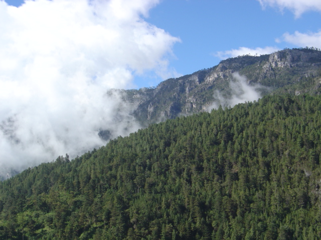
There's a high, cold, rocky Guatemala, very different from the picture of volcanoes and tropical jungle: that of the Sierra de los Cuchumatanes, the roof of non-volcanic Central America. This enormous massif in the northwest of the country, with peaks brushing 3,800 meters, unfolds an overwhelming landscape of endless páramos, limestone rock, forests, deep valleys and Maya villages that seem to hang from the slopes.
The Cuchumatanes are not mountains of eruptions and craters, but of limestone lifted by the folding of the earth's crust. That's why their shape is different: great high plateaus, curious rock formations, sheep grazing the páramo and an enormous sky. Up top, cold and wind shape a world apart, home to Mam, Q'anjob'al, Chuj and Popti' Maya communities that hold on to their languages, dress and traditions with remarkable strength.
This guide covers the Sierra de los Cuchumatanes with a practical eye: how to reach this remote region from Huehuetenango, which viewpoints and landscapes not to miss, which highland villages to visit (such as the famous Todos Santos Cuchumatán) and how to take on one of Guatemala's great mountain traverses, the multi-day trek that crosses the range to Nebaj. It's a destination for travelers after wild nature, living Maya culture and the experience of standing, quite literally, at the top of the country.
The Sierra de los Cuchumatanes is an ancient geological formation, raised by the folding of sedimentary rock —above all limestone— over millions of years, which sets it apart from the volcanic chain of southern Guatemala. It is the highest non-volcanic range in Central America. These mountains have been inhabited since pre-Hispanic times by Maya peoples: Mam in the central and southern parts (Huehuetenango, Todos Santos), and Q'anjob'al, Chuj, Akateko and Popti' (Jacaltec) toward the north. The rugged terrain and cold climate favored isolation and the survival of these cultures. During the 16th-century conquest, the Mam region was subdued after the siege of Zaculeu (1525), and the mountain towns were folded into the colonial system as hard-to-reach 'pueblos de indios'. The name 'Cuchumatanes' is of Maya origin, with interpretations usually linking it to ideas like 'that which came together with great force' or references to the joining of the mountains, though its exact etymology is debated. Through the republican era the range remained a remote, agricultural region with a strong Indigenous presence. In the 20th century it felt the impact of the internal armed conflict and, more recently, intense migration. Today the Cuchumatanes are valued for their high-altitude biodiversity, their unique landscapes and their Maya cultural heritage. The full history is on our history page.
Read the full history ↓The far northwestern department, dominated by the Sierra de los Cuchumatanes, the highest non-volcanic range in Central America: land of the old Mam kingdom of Zaculeu, of many Maya peoples and languages, of high moorland and of a world-famous coffee.
Read the history of Huehuetenango →They depart from Quetzaltenango, 76 km away. If you book from this link we earn a commission and you pay no more.
No exact prices: a scale from $ (budget) to $$$$$ (luxury), with 2-3 options per category.
Origins, formation and what the sources say.
Guatemala is volcano country: almost all its mountains spat fire at some point. The Cuchumatanes are the great exception. There were no eruptions here but an extremely slow collision of plates which, over millions of years, lifted the floor of an ancient sea until it became the roof of all non-volcanic Central America, with peaks brushing 3,800 meters. That's why, when you climb into the range, the landscape disorients you: instead of perfect cones, frozen plateaus strewn with limestone open up, with sheep grazing beneath an immense sky. And that geological oddity explains much of its human history.
The Sierra de los Cuchumatanes does indeed have a geological history that sets it apart from Guatemala's other great mountains. While the chain running along the south of the country is volcanic in origin —with cones, craters and eruptions that are still active— the Cuchumatanes are a massif formed by the folding and uplift of sedimentary rock, above all limestone, over millions of years. That makes them the highest non-volcanic mountain range in all of Central America, with peaks above 3,800 meters.
Their limestone origin explains the range's characteristic features: the vast high plateaus, the eroded rock formations, the karst phenomena (caves, sinkholes, underground drainage) and a relief of large elevated surfaces rather than isolated peaks. The cold high-altitude climate and the age of the massif have shaped a páramo landscape unique in the region, with vegetation adapted to low temperatures and altitude.
This particular geology has always conditioned human life in the range: the cold, the altitude and the ruggedness of the terrain made the Cuchumatanes a region hard to inhabit and hard to control, which favored the isolation of its communities and the survival of their cultures. The range is, in a sense, a world apart within Guatemala, both for its nature and for its people.
The Sierra de los Cuchumatanes has been inhabited since pre-Hispanic times by various Maya peoples, which makes it one of the most ethnically and linguistically diverse regions in Guatemala. In its central and southern parts, especially around Huehuetenango and Todos Santos, the Mam predominate, one of the largest Maya groups in the country. Toward the north and the interior of the range live the Q'anjob'al, Chuj, Akateko and Popti' (Jacaltec) peoples, each with their own Maya language and traditions.
That diversity shows in a succession of towns and hamlets —Todos Santos, Soloma, Santa Eulalia, San Juan Ixcoy, San Mateo Ixtatán, Nentón, among many others— where different Maya languages are spoken and different dress is worn, in an extraordinary cultural mosaic. The rugged terrain and the isolation helped each community preserve its identity, its forms of organization and its spirituality, in which Maya and Catholic elements live side by side.
Life in the range has always revolved around highland farming —maize as the staple, along with potatoes, broad beans and other cold-adapted crops— sheep raising (whose wool goes into textiles and warm clothing) and exchange between communities. Places such as the salt works of San Mateo Ixtatán also show economic activities unique to the region, with pre-Hispanic roots.
Bringing the range under Spanish rule was, as in other mountain regions, difficult and late. The conquest of the Mam people culminated in 1525 with the siege of their capital, Zaculeu, by the forces of Gonzalo de Alvarado. From then on, the mountain towns were folded into the colonial system of the Captaincy General of Guatemala, reorganized as 'pueblos de indios' around mission churches. Even so, the remoteness and the ruggedness of the terrain always limited the effective presence of colonial power at these altitudes.
The range's own name, 'Cuchumatanes', is of Maya origin, though its exact etymology is debated. The most widespread interpretations tend to link it to ideas such as 'that which came together with great force' or to references to the joining or gathering of the mountains, alluding to the imposing bulk of the massif. As with many old place names, different sources offer varied and not always consistent versions of its meaning.
Through the colonial period and later the republican era, the range remained a remote, deeply rural region with a strong Indigenous presence, outside the country's major economic processes. That marginalization had a cost in terms of development, but it also helped preserve the rich cultural and linguistic heritage of its peoples.
Like other rural, Indigenous regions of the Guatemalan highlands, the Sierra de los Cuchumatanes and the department of Huehuetenango felt the impact of the internal armed conflict that ravaged the country between 1960 and 1996. The region's Maya communities suffered, to varying degrees, the violence, militarization and displacement of those years, especially in the harshest decades of the conflict. The memory of those events is part of the historical backdrop of many towns in the range.
In the decades after the Peace Accords of 1996, another phenomenon profoundly transformed the region: migration, above all to the United States. Huehuetenango and the towns of the Cuchumatanes became one of the country's highest-emigration areas, and the remittances migrants send home became a pillar of the local economy, with a visible impact on daily life, construction and commerce in the towns.
This combination of historical isolation, conflict and migration has shaped the range's contemporary reality: a region of enormous cultural and natural wealth, but also facing development challenges, and deeply connected, through its migrants, to distant communities abroad. Understanding that backdrop helps you better appreciate the complexity of life in the Cuchumatanes today.
Today the Sierra de los Cuchumatanes is valued as much for its natural heritage as for its cultural wealth. Environmentally, the massif harbors high-altitude ecosystems unique in the region: pine and other forests, páramos, cold-adapted vegetation and a distinctive biodiversity, with animal and plant species particular to these heights. Some areas of the range are protected or recognized for their ecological value, and the region is the object of scientific and conservation interest.
Culturally, the Cuchumatanes are a living mosaic of Maya peoples who keep their languages, dress, markets and festivals, with Todos Santos Cuchumatán as the most famous example. That combination of extreme nature and living culture has made the range a destination for small-scale, adventurous tourism: hiking, multi-day trekking (such as the route to Nebaj), visits to viewpoints and villages, and cultural encounters.
It is, however, still an emerging and responsibly minded form of tourism, far from the big circuits. To travel the Cuchumatanes today means entering one of the highest, coldest and most authentic regions of Guatemala, respecting the fragility of its natural environment and the identity of its communities. For the curious, well-prepared traveler, the reward is one of the most intense mountain and cultural experiences the country has to offer.