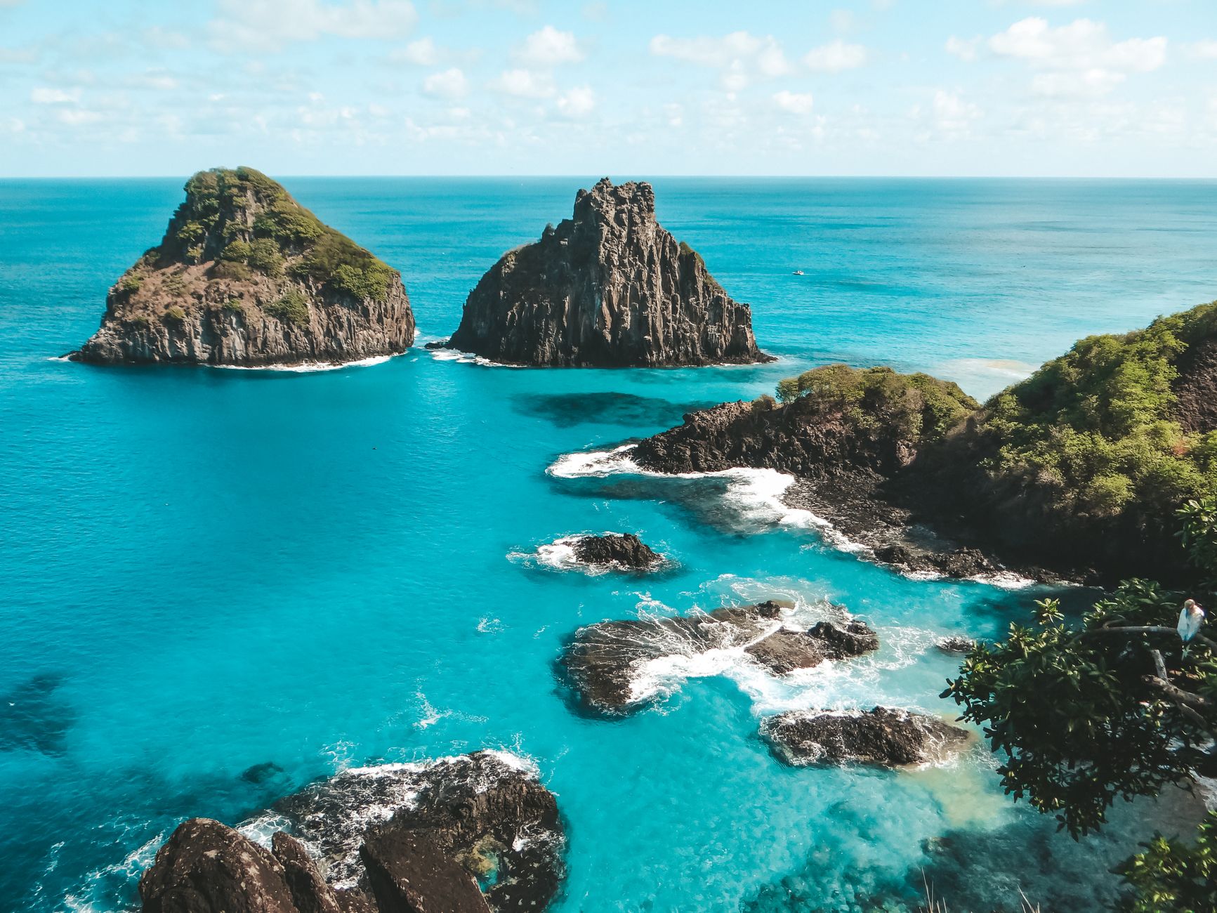
Fernando de Noronha is, for many people, the most spectacular beach destination in Brazil: a volcanic archipelago lost in the Atlantic, some 545 km from Recife, made up of 21 islands and islets of which only the largest is inhabited. When Amerigo Vespucci sighted it in 1503 he is said to have exclaimed 'O Paraíso é aqui' ('Paradise is here'), and the phrase still describes the place well: water of an impossible turquoise, green cliffs, an extraordinarily rich marine life —spinner dolphins, turtles, sharks, rays and shoals of colourful fish— and an unmistakable profile, the Morro Dois Irmãos rising over the Baía dos Porcos. Administratively it's a State District of Pernambuco; in practice it's a nature sanctuary.
What makes Noronha different from any other Brazilian beach is that it's genuinely protected and controlled. Around 70% of the archipelago has been a Parque Nacional Marinho since 1988, and the whole area has been a UNESCO World Heritage Site since 2001 (listed together with the Atol das Rocas). To preserve it there's a visitor cap and two compulsory fees that every tourist pays: the Taxa de Preservação Ambiental (TPA), charged for each day of your stay, and entry to the Parque Nacional Marinho (PARNAMAR, managed by ICMBio), a ticket valid for several days that gives access to the protected beaches and attractions such as Sancho, Atalaia, Leão and Sueste. This is no small detail: factor them into your budget and, in the case of the park, pay in advance so you don't waste time.
Getting there has its own mystique: there are flights from only two Northeast capitals, Recife (REC) and Natal (NAT), of just over an hour, to the island's single airport (FEN). Once you're there, life moves slowly, to the rhythm of the tides: dawns at the Mirante dos Golfinhos watching spinner dolphins come into the bay, boat days skirting islets, snorkelling with turtles at Sueste, the guided trail to the natural pools of Atalaia (with a cap and a timed slot), world-class diving with visibility of tens of metres, and sunsets from the Forte dos Remédios with the Morro do Pico cut out against the sky. Expensive, demanding on logistics and with strict rules, yes; but few places give back so much.
The Fernando de Noronha archipelago is volcanic in origin and rose out of the Atlantic millions of years ago; its highest peak, the Morro do Pico (321 m), is the eroded remnant of that formation. It was sighted by a Portuguese expedition on 10 August 1503 —commanded by Gonçalo Coelho, financed by the Lisbon merchant Fernão de Loronha (from whom the island takes its name) and with the navigator Amerigo Vespucci on board, credited with the phrase 'O Paraíso é aqui'. In 1504 the Portuguese Crown granted the island to Fernão de Loronha, making it the first hereditary captaincy in Brazil. During the 17th and 18th centuries it was coveted and occupied by the Dutch, the English and the French; after a French settlement, Portugal sent troops from Recife in 1737 who expelled the French and, to secure possession, built the Forte dos Remédios and a system of small forts along the coast. For more than two centuries (from 1737 to the middle of the 20th century) Noronha served as a penal colony: first for common prisoners and then, between 1938 and 1945, as a prison for political detainees (later the governor Miguel Arraes was held there, in 1964). During the Second World War, because of its strategic position in the South Atlantic, it hosted an air base operated with United States support (1942), a link on the route to Africa. Charles Darwin, on his famous voyage aboard HMS Beagle, had passed through the island in February 1832 and noted its volcanic nature. In 1988 the Parque Nacional Marinho was created and in 2001 UNESCO declared the archipelago a Natural World Heritage Site together with the Atol das Rocas. Today it's a State District of Pernambuco and a model of sustainable tourism with a visitor cap. The full story is on our history page.
Read the full history ↓The historic heart of the sugar-growing Northeast: the richest captaincy of the colony, stage of Nassau's Dutch Brazil and of the Guararapes battles, hotbed of the greatest republican rebellions of the Empire. Land of frevo and maracatu, of the handsome pair Recife and Olinda, and of the ocean jewel of Fernando de Noronha.
Read the history of Pernambuco →If you book from here we earn a commission and you pay no more. Prices and availability come from Civitatis.
No exact prices: a scale from $ (budget) to $$$$$ (luxury), with 2-3 options per category.
Origins, formation and what the sources say.
Fernando de Noronha isn't a 'continental' island that broke away from the mainland but an oceanic archipelago of volcanic origin: it rose from the floor of the South Atlantic through the activity of a magmatic hotspot, and what we see above the water today is barely the eroded summit of an enormous volcanic formation whose base sinks hundreds of metres below the surface. The whole is made up of 21 islands, islets and rocks, of which only the largest —the main island— is inhabited.
The geological symbol of the archipelago is the Morro do Pico, a conical hill 321 metres high that rises behind the inhabited area and is the highest point in Noronha. It's a volcanic plug: the hardened, eroded remnant of the old volcanic conduit, left standing when the softer material around it wore away over millions of years of surf, wind and rain. The cliffs, the twin hills (Dois Irmãos) and the rocks that break the surface between the beaches are all witnesses to that igneous past.
That volcanic nature is no minor detail for the history of the place: it explains the abrupt relief, the pools and natural basins among the rocks, the seabed rich in structure —walls and arches— that makes diving here extraordinary, and the fragility of an ecosystem isolated in the middle of the ocean. It was also the first thing recorded in writing by one of its most famous visitors: the young naturalist Charles Darwin, passing through the island in 1832, immediately noted that its makeup was volcanic and described the conical hill that dominated the landscape.
The archipelago was sighted by Europeans on 10 August 1503, during a Portuguese expedition exploring the coast of newly 'discovered' Brazil. The fleet was commanded by Captain Gonçalo Coelho, had been financed by a private trading consortium headed by the Lisbon merchant Fernão de Loronha (also written Fernão de Noronha) and carried on board, as observer and chronicler, the Italian navigator Amerigo Vespucci. Tradition has it that it was Vespucci who, approaching that deserted and lush island —shortly after one of the expedition's ships was wrecked—, exclaimed 'O Paraíso é aqui' ('Paradise is here'). At first they named it the island of São Lourenço, after the saint's day.
Very shortly afterwards, in January 1504, King Manuel I of Portugal granted the island to Fernão de Loronha as a reward for financing the expedition, making it the first hereditary captaincy in Brazil: that is, the first piece of the new territory handed over by the Crown to a private individual under the system of donatary captaincies that would soon be applied on a large scale along the mainland coast. In time the archipelago's name derived from that of its first donatary, and the island came to be called Fernando de Noronha.
During the 16th century the island saw little effective occupation and served above all as a landmark and shelter on the Atlantic routes. Its value was strategic rather than productive: a forward position in the middle of the ocean, on the way between Europe, Africa and the rest of Brazil. That same position would make it, in the following centuries, an object of dispute between the colonial powers.
Because of its strategic position in the Atlantic, during the 17th and 18th centuries Fernando de Noronha was coveted and intermittently occupied by several powers that rivalled Portugal. In the context of the Dutch invasions of the Brazilian Northeast, the Dutch controlled the island at various points in the 17th century, folding it into their domain in the region. The English and, above all, the French also set their sights on it: the French East India Company went as far as settling the island around 1736.
The Portuguese response was decisive. In October 1737 the Crown dispatched a military expedition from Recife under Colonel João Lobo de Lacerda, with some 250 soldiers, which expelled the French —with virtually no resistance— and took effective possession of the archipelago. To secure that possession permanently, the Portuguese immediately began fortifying the island: they built the Forte de Nossa Senhora dos Remédios, in a commanding position over the bay of Santo Antônio and the anchorage, as the archipelago's main defensive structure, and complemented it with a whole system of small forts and batteries spread along the coast to cover the various landing points.
That 18th-century defensive system is the root of the historic heritage you can visit on the island today: the ruins of the Forte dos Remédios, now one of the best sunset viewpoints in Noronha, and the traces of the other small forts are the built memory of the era when the archipelago was, above all, a military key to the South Atlantic that Portugal was not prepared to lose.
For much of its modern history, Fernando de Noronha was not a tourist paradise but, literally, a jail. From the consolidation of Portuguese rule in the 18th century and through the 19th and part of the 20th, the archipelago worked as a penal colony and maximum-security prison: its isolation in the middle of the ocean, with no chance of escape, made it ideal for confining prisoners. The Vila dos Remédios itself was conceived and adapted as a fortified prison settlement: a walled village, planned by military engineers, where prisoners lived and worked under guard.
Common criminals passed through its cells for generations, and so did political prisoners at various times. Between 1938 and 1945 the island served specifically as a political prison, in the days of Getúlio Vargas's Estado Novo. Decades later, after the military coup of 1964, the governor of Pernambuco, Miguel Arraes, was held there, in one of the episodes that best illustrate how the archipelago kept being used as a place of exile for opponents.
That prison past, which lasted more than two centuries, left a deep mark: much of the island's built heritage —walls, outbuildings, the very layout of the Vila dos Remédios— comes from the penal era, and the historic deforestation of the archipelago (much of its woodland was felled to stop prisoners building rafts and escaping) explains part of today's landscape. Going 'from prison to paradise' is, in fact, one of the most repeated ways of telling the story of Noronha.
Fernando de Noronha's position in the middle of the South Atlantic, at the ocean's narrowest 'waist' between America and Africa, became decisive once again during the Second World War. Brazil sided with the Allies, and the archipelago took on enormous military value: it was a piece of the air and surveillance route linking the Brazilian Northeast —above all Natal, the 'Trampolim da Vitória'— with the African continent (the Natal-Dakar route), along which aircraft, supplies and troops moved towards the fronts in Europe and Africa.
In January 1942 the Destacamento Mixto de Fernando de Noronha was created, a military force combining infantry and artillery (field, coastal and anti-aircraft) to defend the island. That same year, under the military cooperation agreements between Brazil and the United States, an airfield operated with US support was built on the island, part of the Allied effort to control the South Atlantic against Axis submarines. During the war the archipelago was closed, militarised and under strict control.
That 1940s aviation infrastructure is also the direct forerunner of the island's current airport: the runway that receives tourist flights from Recife and Natal today has its roots in that war effort. Once the war ended, its military importance faded, but Noronha's strategic status —and the presence of defence and tracking installations— continued to shape its history for much of the 20th century, before its definitive conversion into an ecological sanctuary and tourist destination.
The great transformation of Fernando de Noronha came in the last decades of the 20th century, when it stopped being a jail and a military stronghold and became a model of conservation. In 1988 the Parque Nacional Marinho de Fernando de Noronha was created, protecting around 70% of the archipelago —both its land surface and the waters around it— under federal management (today by ICMBio). With the park came the rules that define today's destination: access control, restricted areas, regulated trails and the idea that tourism only works if it's limited.
International recognition came in 2001, when UNESCO declared the group formed by Fernando de Noronha and the nearby Atol das Rocas a Natural World Heritage Site, for its exceptional value as a refuge of South Atlantic marine biodiversity: a feeding, breeding and nursery area for turtles, dolphins, birds and fish. That listing consolidated the island's conservation calling and reinforced the need to protect it.
Administratively, Fernando de Noronha is today a State District of Pernambuco, run directly by that state's government despite being geographically closer to Rio Grande do Norte. And in tourism terms it's a benchmark for sustainable management: to get in you pay two fees —the Taxa de Preservação Ambiental (TPA), per day of stay, and entry to the Parque Nacional Marinho— and there's a visitor cap that limits how many people can be on the island. Attractions such as the Trilha do Atalaia run on advance booking and timed swimming. So the archipelago that was a prison and a war base completed its most improbable turn: today it protects itself from its own success in order to keep deserving the phrase that, legend has it, Vespucci uttered in 1503: 'O Paraíso é aqui'.
Among the archipelago's distinguished visitors there's one who passed through almost unnoticed but left a mark on the history of science: Charles Darwin. On 20 February 1832 the young naturalist —then just 22— made a brief stop at Fernando de Noronha during the voyage of HMS Beagle, the expedition that would circle the globe and become the foundation of his ideas on evolution. The Beagle had sailed from England at the end of December 1831 and, before putting in at Salvador de Bahia at the end of the month, made this fleeting call at the island.
Darwin came ashore only briefly, but long enough to observe and take notes. He described the island as dense woodland and, above all, immediately recognised its volcanic origin: in his diary he wrote that 'the constitution of this island is volcanic, though probably not of recent date', and singled out as its most notable feature a very tall conical hill with steep sides —the Morro do Pico— which is still the geological symbol of the archipelago. His observations would later appear in 'The Voyage of the Beagle'.
That one of the most influential scientists in history set foot in Noronha and got its volcanic nature right at a glance is one of those curiosities that tie the small Atlantic island to the great history of ideas. For today's visitor, looking at the Morro do Pico from the Praia da Conceição or from the Forte dos Remédios is, without knowing it, repeating the very scene Darwin noted down almost two centuries ago.