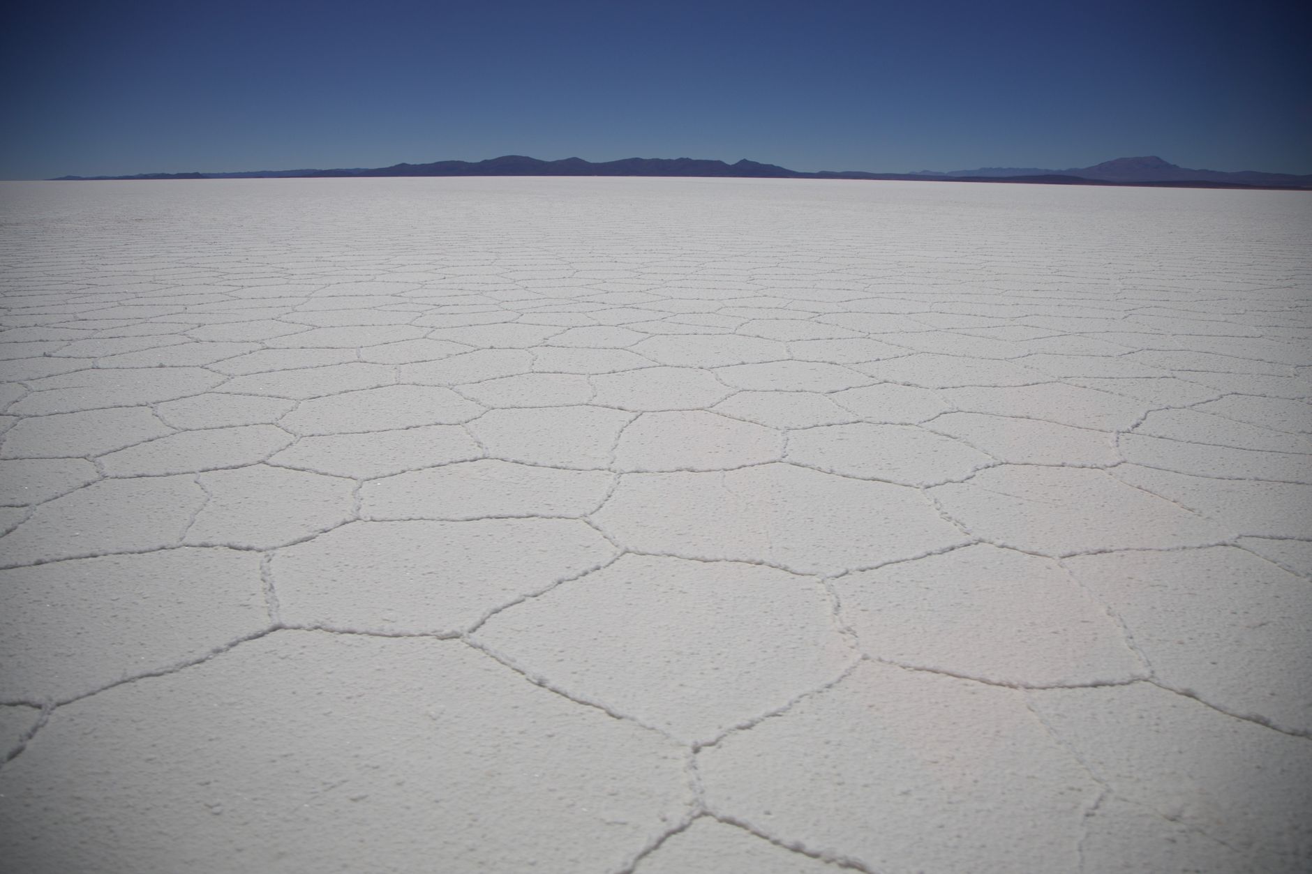
Some landscapes look like another planet, and the Salar de Uyuni is one of them. Picture a white, perfectly flat plain stretching to the horizon in every direction, so vast that the eye loses its reference points and sky and ground blur together. It's more than 10,000 square kilometers of salt at 3,656 meters of altitude, the largest salt desert in the world, in the heart of the southwestern Bolivian altiplano. The dusty altiplano town of Uyuni is the gateway to this wonder, and every morning the convoys of 4x4s head out from its streets into the endless white.
The salt flat changes its skin with the seasons. In the rainy season, a thin sheet of water turns it into the largest natural mirror on the planet: the sky doubles itself on the ground and walking across it is like floating among clouds. In the dry season, the surface cracks into thousands of hexagonal polygons of salt, a fascinating geometric texture, perfect for the famous perspective photos that play with your sense of scale. But Uyuni is much more than the salt flat: it's the portal to a south of lagoons stained red and green by minerals and algae, geysers steaming at dawn, stone deserts, pink flamingos and volcanoes brushing six thousand meters.
This guide covers Uyuni and its surroundings with a practical, warm eye: what the town and its services are like, what to see on the salt flat and in the Eduardo Avaroa Reserve, how to choose and live the 1- to 3-day tours, how to cross into Chile, how to get around and what to keep in mind about the altitude, the cold and the sun. Southern Bolivia is one of those trips you remember for life, and it pays to plan it with a little thought so you can enjoy it fully.
The Salar de Uyuni is the dry bed of ancient prehistoric lakes. Tens of thousands of years ago, much of the altiplano was covered by enormous lakes — among them Minchin and Tauca — which, as they evaporated with climate change, left behind these immense salt crusts: the Salar de Uyuni and the neighboring Salar de Coipasa. Beneath that salt crust lies one of the world's largest lithium reserves, now key for batteries, which has put this remote corner on the map of the global economy. For the Andean peoples of the region — Aymara and Quechua — the salt flat and the volcanoes around it, such as Tunupa, are charged with myth and sacredness. The town of Uyuni, by contrast, is relatively young: it was born and grew at the end of the 19th century as a railway hub, the meeting point of the lines connecting the altiplano mines with the Pacific ports, at the height of the mining boom. All that is left of those years of railway splendor and later decline are the old locomotives rusting on the edge of town in the famous Cementerio de Trenes. The full story, with the prehistoric lakes, the lithium, the railway and the peoples of the altiplano, is on our history page.
Read the full history ↓The department of silver and of the salt flats: home of the Cerro Rico that financed the Spanish Empire and of the Casa de la Moneda, of the Salar de Uyuni —the largest salt desert in the world and one of the great lithium reserves— and of the colored lagoons of the Eduardo Avaroa Reserve, on the highest and most desolate altiplano in the country, cradle of the hero Eduardo Avaroa.
Read the history of Potosí →If you book from here we earn a commission and you pay no more. Prices and availability come from Civitatis.
No exact prices: a scale from $ (budget) to $$$$$ (luxury), with 2-3 options per category.
Origins, formation and what the sources say.
When scientists need to calibrate the altimeters of the satellites orbiting Earth, they point their instruments at a remote corner of the Bolivian altiplano: there is no surface on the planet as large, as flat and as stable as the Salar de Uyuni. That perfection is no accident: it is the floor of a vanished inland sea. During the wetter periods of the Pleistocene, tens of thousands of years ago, meltwater from the cordillera and the rains formed gigantic lakes in this closed basin, with no outlet to the sea, where the rivers emptied without being able to escape. Geologists have identified several of those lake stages, associated with ancient lakes such as the Minchin and, more recently, the Tauca, which came to cover tens of thousands of square kilometers.
In an endorheic basin like this one, water can only leave by evaporation, and in the dry, sunny climate of the altiplano evaporation is intense. As the climate turned more arid, those great lakes dried out, leaving behind the salts they carried dissolved. That is how the immense white crusts we know today were formed: the Salar de Uyuni and, further north, the Salar de Coipasa, along with smaller salt lakes. Present-day Lake Poopó and Lake Titicaca are other remnants, still holding water, of that larger system.
The result is one of the flattest surfaces on the planet: a salt plain of some 10,582 km² at 3,656 meters above sea level, with a crust several meters thick in places. Its extraordinary horizontality even makes it a reference for calibrating satellites. Under the solid crust hides a brine extremely rich in minerals, the product of those evaporated lakes, holding a treasure that is strategic today: one of the largest lithium reserves in the world.
Long before the railway lines arrived, the altiplano around the salt flat was inhabited by Aymara- and Quechua-speaking Andean peoples, heirs to ancient cultures that adapted to one of the harshest environments on the continent: cold, altitude, aridity and wind. They lived off herding llamas and alpacas, growing potatoes and quinoa in the more favorable spots, and salt, which they cut from the salt flat and traded with distant regions on the backs of llama caravans.
The salt flat and the volcanoes around it are deeply woven into the Andean worldview. The most famous of those myths revolves around the Tunupa volcano, which rises at the northern end of the salt flat. One legend tells that the mountains were living beings: Tunupa, a giantess, is said to have wept milk and tears after a heartbreak or after nursing her child, and those tears mixed with the milk are said to have formed the salt flat. That is why many locals hold that the place should not be called Salar de Uyuni but Salar de Tunupa.
These stories are not mere curiosities: they reflect a way of understanding the landscape in which the mountains, the lagoons and the earth are sacred and alive. Even today the communities of the area keep rites of respect for the Pachamama (mother earth) and for the apus, the tutelary mountains. Archaeological finds, such as the pre-Inca mummies preserved in caves at the foot of Tunupa, next to the village of Coquesa, confirm that this remote region was inhabited and significant from very ancient times.
Unlike the salt flat, which is thousands of years old, the town of Uyuni has an exact birth date: 11 July 1889, when a resolution signed by president Aniceto Arce ordered the creation of a town at kilometer 610 of the railway line climbing up from Antofagasta toward the mines of Pulacayo and Huanchaca, at the time one of the largest silver deposits in the world. Arce, a mining businessman himself, had driven that railway forward to get Bolivian minerals out to the Pacific ports; grateful residents wanted to name the new town 'Ciudad Arce', but the president turned down the honor and the place kept its Aymara name: Uyuni.
Thanks to its strategic location, Uyuni soon became the great railway hub of the southern altiplano: the lines connecting the mining centers with the Chilean coast, with Oruro and, later, with the Argentine border all met and branched off there. The arrival of the train gave the town decades of prosperity and bustle, with workshops, depots, an imposing station and a population that grew up around railway work. Much of the street layout still recognizable today was built in those years.
As the 20th century wore on, the mining crisis, changing transport technologies and economic restructuring gradually stripped that railway hub of its importance. Many locomotives and wagons were taken out of service and ended up abandoned on the edge of town, where the wind, the cold and the altiplano salt slowly rusted them. That collection of rusting machines is today the famous Train Cemetery, one of Uyuni's most photographed postcards and a melancholy monument to the golden age of the altiplano railway.
For centuries, the salt flat's great resource was the salt itself. Altiplano communities extracted it by hand —as they still do in Colchani—, gathering and drying the white blocks to consume them, trade them and carry them by llama caravan to distant regions. Salt was both currency and livelihood, and it left its mark on local culture and economy.
But in recent decades the salt flat has taken on a completely new value. Under its white crust, in the brine left behind by the ancient lakes, lies one of the largest concentrations of lithium in the world. Lithium is a key metal for the rechargeable batteries that power phones, computers and, above all, electric vehicles, which has made it a strategic resource in the global energy transition. Suddenly this remote corner of the altiplano started to figure in the plans of the world economy.
Exploiting that lithium presents Bolivia with enormous opportunities and, at the same time, major challenges: how to industrialize the resource, how to share out its benefits and how to protect such a fragile ecosystem and a landscape that is also a tourism treasure. The balance between lithium mining, tourism and the life of the altiplano communities is one of the great contemporary debates around the Salar de Uyuni, a place where the prehistoric past and the technological future shake hands.
South of the salt flat stretches a territory of colored lagoons, geysers, deserts and volcanoes that was declared a protected area for its natural value. The Eduardo Avaroa Andean Fauna National Reserve, created in the 20th century, protects one of the most extraordinary altiplano ecosystems in South America, with Laguna Colorada, Laguna Verde, the Sol de Mañana geysers, the Siloli desert and dozens of smaller lagoons dotted with flamingos.
The reserve's name honors Eduardo Abaroa, a Bolivian hero of the War of the Pacific (1879), remembered for his stand at the battle of the Topáter bridge. Beyond the tribute, the area serves a fundamental ecological function: safeguarding the three South American flamingo species —among them the James's flamingo, rediscovered in the 20th century in these very lagoons—, as well as vicuñas, vizcachas, Andean foxes and a flora adapted to extreme conditions of altitude, cold and aridity.
The reserve is today one of Bolivia's most visited destinations and the natural complement to the salt flat on the great southern tourist circuit. But its fragility demands responsible tourism: the growing number of vehicles and visitors, on top of the pressure over resources such as water and lithium, poses the challenge of conserving this unique landscape. The entrance fee travelers pay contributes to its management, and respect for the wildlife, the sites and the communities is key for this corner of the planet to keep amazing future generations.
For much of the 20th century, after the railway's decline, Uyuni was a remote altiplano town, little known outside Bolivia. Life revolved around salt, border trade and the remains of railway work. Few imagined that this white, inhospitable landscape would become one of the most coveted destinations in world tourism.
That changed in recent decades, as images of the salt flat spread: the mirror effect of the rainy season, the perspective photos over the salt hexagons, the unreal sunrises and sunsets and the cleanest starry skies on the planet went around the world through photography and social media. The Salar de Uyuni started appearing on every list of landscapes you cannot miss, and Uyuni turned into a bustling gateway, with dozens of tour agencies, hotels and services for travelers from all over the world.
Today the Bolivian south —the salt flat, the colored lagoons, the geysers and the deserts— is one of South America's great circuits, often chained together with the crossing to San Pedro de Atacama, in Chile, or with the route from Tupiza. That tourism boom coexists with the new lithium era and with the challenge of preserving a fragile ecosystem. Uyuni thus embodies the meeting of very different times: the prehistoric lakes, the Andean myths, the epic of the railway, the lithium economy and the astonished gaze of the contemporary traveler before one of the most extraordinary landscapes on Earth.