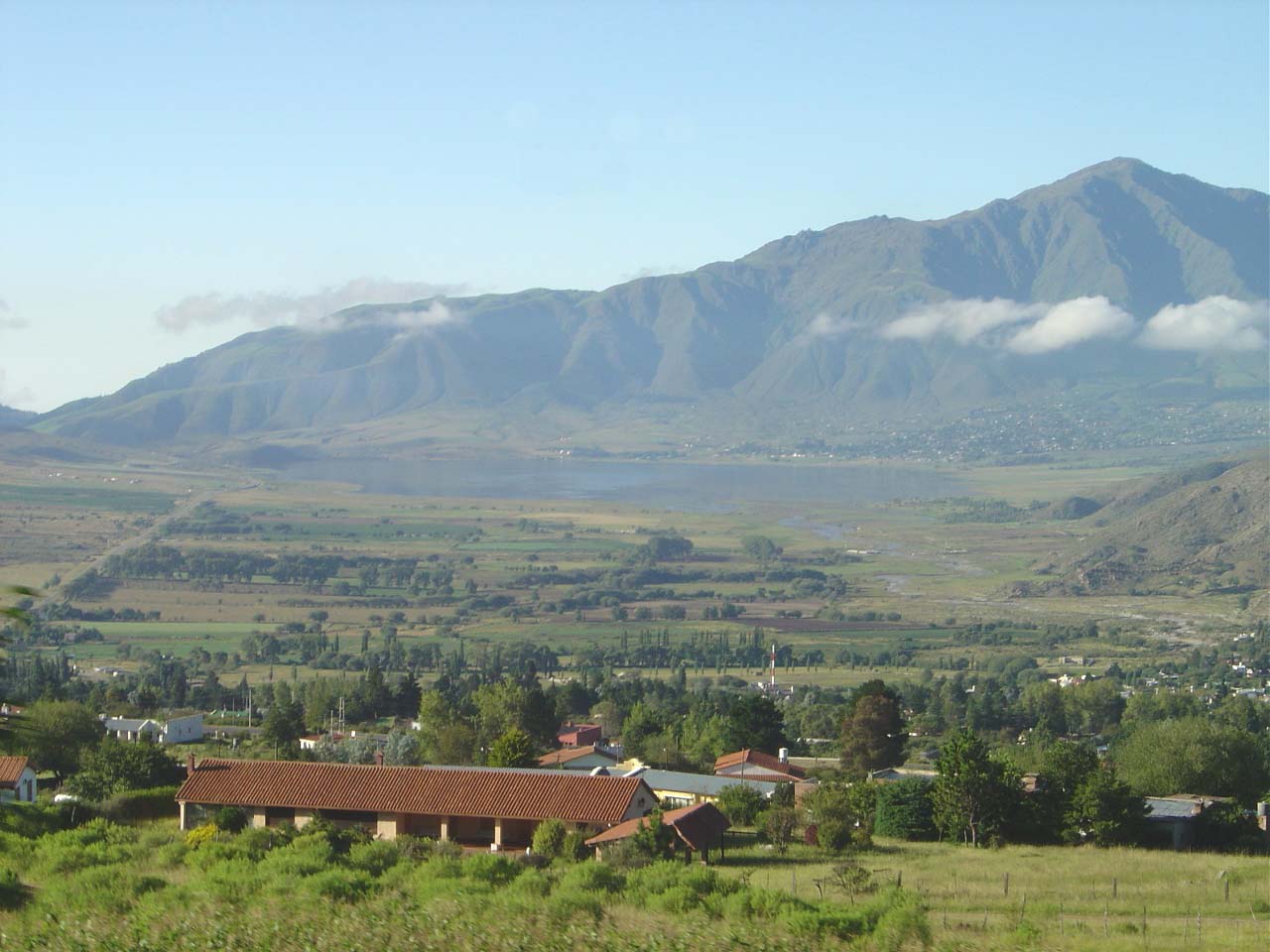
Tafí del Valle is a high valley at the heart of the Tucumán stretch of the Valles Calchaquíes, some 2,000 metres above sea level, ringed by the summits of the Aconquija and a landscape of grassland, rivers and enormous skies. Its mild, dry climate made it, more than a century ago, the favourite summer refuge of the people of Tucumán, who come up to escape the heat of the lowlands. The name, of pre-Hispanic roots, is usually translated as "town of the splendid entrance" or linked to the idea of a beautiful valley.
Getting there is part of the trip too: from San Miguel de Tucumán you climb on RN38 to Acheral and then on RP307, crossing the Quebrada de los Sosa, a stretch of subtropical yungas cloud forest with rivers and waterfalls that in a few kilometres rises from lush green to the cool air of the valley. It is one of the finest ascents in northern Argentina.
Tafí's great symbol is its menhirs: huge stones carved by the Tafí culture more than two thousand years ago, now gathered in the Parque de los Menhires at El Mollar, on the shore of the La Angostura reservoir. To that add the cheesemaking tradition —Tafí is the birthplace of tafinisto cheese and host of the Fiesta Nacional del Queso— the Jesuit legacy, and the option of carrying on into the Valles Calchaquíes across the imposing Abra del Infiernillo.
The Tafí valley was inhabited more than two thousand years ago by the Tafí culture, the oldest farming and pottery-making society in Tucumán, which left the celebrated menhirs as its legacy. In colonial times the Jesuits arrived, adding this land to the Society of Jesus around 1718 and driving the cheesemaking tradition that is still alive. The full story, from the menhirs to the Jesuits and today's Tafí, is on our history page.
Read the full history ↓The 'Garden of the Republic': the smallest province and one of the most densely populated, Diaguita land and home to the ruins of Quilmes, cradle of the Independence declared in 1816, of sugar and of the Calchaquí valleys.
Read the history of Tucumán →If you book from here we earn a commission and you pay no more. Prices and availability come from Civitatis.
No exact prices: a scale from $ (budget) to $$$$$ (luxury), with 2-3 options per category.
Origins, formation and what the sources say.
There are stones in this valley that were already standing when Rome was a young empire. The menhirs of Tafí —monoliths carved with faces and figures more than two thousand years ago— are the signature of the Tafí culture, held to be the oldest farming and pottery-making society in what is now Tucumán province. And they are only the visible part of a much longer story: that of a high valley that was, in turn, a pre-Hispanic sanctuary, a Jesuit estancia, a cheesemaking cradle and a summer refuge. Even the name comes from far back: 'Tafí' is said to derive from the Cacán 'Taktikllakta', usually translated as 'town of the splendid entrance'.
The Tafí culture developed in the west of what is now the province and was made up of farming peoples who grew maize above all on terraces and stepped fields, raised llamas and rounded out their diet with hunting. They lived in clusters of circular stone dwellings joined by a central courtyard, whose remains can still be made out at sites such as Las Margaritas or the pucará hillfort in the El Pelao area, and they buried their dead in urns and stone cists beneath the floors of their houses.
Archaeologists usually divide this culture into two broad phases: Tafí I, or 'La Angostura' (roughly 300 BC to AD 400), and Tafí II, or 'Carapunco' (AD 400 to 900). What remains of those communities is the growing terraces, the stone enclosures and, above all, the monuments that made the valley famous: the menhirs. That pre-Hispanic root is still present in Tafí's identity, in its place names and in the pottery of the region.
The menhirs of Tafí are a set of stone monoliths carved by the valley's inhabitants more than two thousand years ago. Some reach 3 metres in height and weigh several tonnes, and many carry engravings of human faces, animals and geometric or amorphous figures. The word 'menhir' is Celtic in origin and means 'long stone', but a more fitting term for these stones would be the Quechua 'huanca', or 'wanka', which names the stones that protect and encourage crops and livestock.
Today these monoliths are kept in the open-air museum Los Menhires, at El Mollar, on the shore of the La Angostura reservoir, where they were gathered for protection. It is one of the most important concentrations of megalithic art in South America: some fifty stones planted facing the Aconquija mountains. Moving them and bringing them together in the park also became one of the loudest heritage controversies in Argentine archaeology, which deserves a chapter of its own.
In 1977, in the middle of the military dictatorship, the menhirs were torn out of their places. The de facto government of Antonio Domingo Bussi in Tucumán decided to remove the monoliths scattered across the valley —many were still standing where their carvers had planted them, others were on private land, and local people were forced to hand over the pieces they had on their property— and gather them in a brand-new 'Parque Provincial Los Menhires' at El Mollar, for purely tourist purposes and with no scientific criteria at all.
For archaeology it was a disaster: taking the stones out of their original context destroyed much of their scientific value —the position, the orientation and the association of each menhir with dwelling or growing sites were unrecoverable data— and a blanket of silence was drawn over the damage the pieces suffered in transit. For decades the menhirs stayed in that park as a decontextualised attraction, while archaeologists and residents demanded that something be put right.
The answer came only with the new century. On the initiative of the people of El Mollar themselves, a Menhir Restitution Plan was set in motion, begun in 2000, and on 24 March 2002 —a date chosen quite deliberately, the anniversary of the 1976 coup— the pieces began to be moved to the La Sala site, next to the main square of El Mollar, where the archaeological reserve the public visits today now stands. The saga of the menhirs ended up as a case study in heritage, memory and community: the stones the dictatorship moved by decree were resettled, at least in part, by the will of the local people.
In colonial times the Tafí valley passed into the hands of the Society of Jesus. Around 1718 this land was acquired by the Jesuits, who set up an estancia devoted to raising livestock and to farm production, and left a deep mark on life in the valley. They are credited with the origin of one of the oldest industries in Tucumán: cheesemaking, which in time became tafinisto cheese, semi-hard and made by hand, today the culinary symbol of the area.
When Charles III expelled the Jesuits from all Spanish dominions in 1767, the Tafí estancia was confiscated and passed, through the Junta de Temporalidades, into the hands of private families, who carried on the livestock and cheesemaking work. The recipe outlived the empire, independence and two centuries of changing owners: cheese went on being made generation after generation in the outposts and estancias of the valley, with cow's milk and natural rennet, just as it was then.
Concrete traces of that Jesuit legacy remain: the chapel and complex of La Banda —today the La Banda Jesuit Museum, restored and reopened in 2024— and the Las Carreras estancia, which keeps the rural and cheesemaking tradition alive. Every February, Tafí del Valle holds the Fiesta Nacional del Queso, with parades of gaucho associations, criollo horsemanship displays, regional markets and the Golden Cheese competition.
The Tafí valley was never an isolated place: a branch of the Inca Road, the great Andean network, ran through here, climbing up from Amaicha, crossing what is now the Abra del Infiernillo and dropping down the Quebrada del Portugués toward the Tucumán area. Later the conquistadors advanced along that same ancestral route: Diego de Rojas, setting out from Cusco in 1543, crossed by way of Amaicha del Valle and climbed along the Infiernillo river over the peaks of the Aconquija, in the first Spanish expedition to set foot on what is now Argentine territory from the north.
Today the Abra del Infiernillo, at 3,042 metres above sea level, is still the gateway between Tafí and the Valles Calchaquíes: from there RP307 drops down toward Amaicha del Valle and, further on, toward the Quilmes ruins and the Santa María and Cafayate area. That role as a crossroads —between the Tucumán yungas cloud forest, the high valley and the arid Calchaquí valleys— explains much of Tafí's cultural richness: within a few kilometres three ecological tiers and three thousand years of human movement live side by side.
For much of its history, getting up to Tafí was a small adventure: well into the 20th century the valley was reached on bridle paths, on horseback or by mule, climbing through the forest of the Quebrada de los Sosa. The opening of provincial route 307, which winds up from Acheral between yungas forest and waterfalls, changed the valley's fate: families from Tucumán discovered that two and a half hours from the capital there was a mild, dry microclimate at 2,000 metres, perfect for escaping the oppressive heat of the lowlands.
So, over the course of the 20th century, Tafí del Valle established itself as the hill refuge of the people of Tucumán. Estancias, inns and cabins gradually shaped a destination for resting, trekking, horseback riding and water activities on the La Angostura reservoir, which since the 1960s has mirrored the peaks of the Aconquija at the southern head of the valley.
Today Tafí combines its enormous pre-Hispanic legacy —the menhirs, the Tafí culture— with its Jesuit and cheesemaking inheritance and an imposing natural setting. It is a base for exploring El Mollar, climbing Cerro de la Cruz or Cerro El Pelao, visiting the La Banda Jesuit Museum and carrying on toward the Valles Calchaquíes over the Abra del Infiernillo. Ancient history, handmade cheese and mountains come together in a single high valley.