Viajá con Gus
Home › Zimbabwe › Nyanga
Nyanga
🇿🇼 Zimbabwe · The Eastern Highlands

Nyanga

🪪 What do I need to enter Zimbabwe?Pick your citizenship and we tell you the visa, the days and the paperwork, with the official source.

By leaving your email and citizenship you agree to receive the documents you asked for and weekly travel news. You can unsubscribe whenever you want. How we handle your data.
Jump to what you need
📍Region
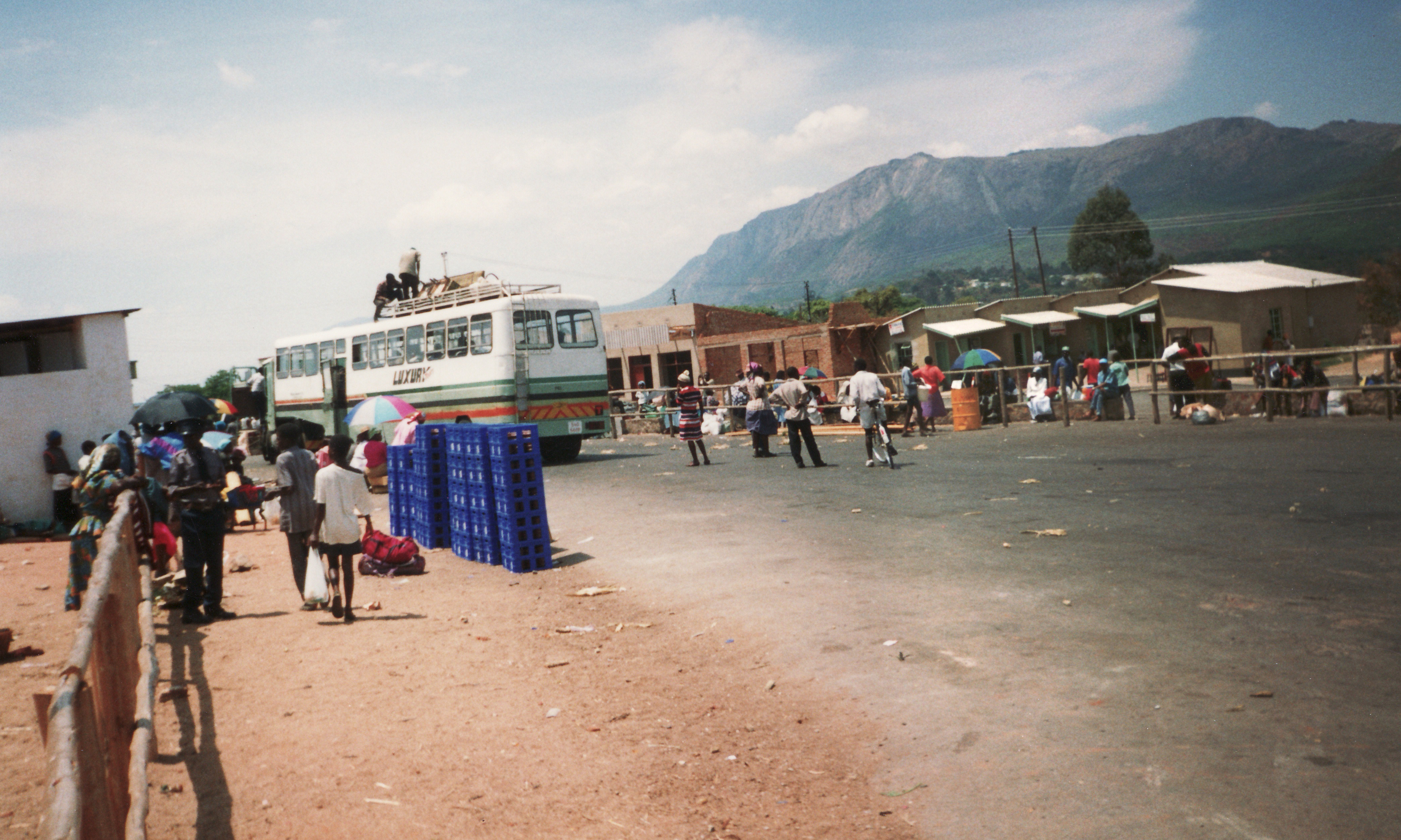
Nyanga is a mountainous district in the north of the Eastern Highlands, in Manicaland province, next to the border with Mozambique. At its heart is Nyanga National Park, one of the oldest in the country. It is a land of cool green mountains, rivers, waterfalls, pine plantations and trout lakes, dominated by Mount Nyangani (2.592 m), the highest peak in Zimbabwe. This is also home to Mutarazi, the country's highest waterfall (762 m). It is a destination for nature, hiking and fresh air, very different from the heat of the savannah.
📌Best time
Nyanga can be visited all year round, but each season has its own charm. The dry season (May to September) brings clear days, ideal for hikes and sharp views towards Mozambique, although the nights are cold (it can freeze in winter!). The rainy season (November to March) paints the mountains an intense green, with full-flowing waterfalls and mist, but also cloudy days and muddy trails. To climb Mount Nyangani you want a clear, settled day, as the weather at the summit changes quickly.
📌Suggested days
2 to 3 days are enough to enjoy Nyanga properly. One day for Nyanga National Park (Mount Nyangani, Nyangombe Falls, Mare and Rhodes dams, the trout), another for Mutarazi Falls and the Skywalk over the Honde Valley, and a third for history: the forts and pit structures of the 'Nyanga culture' and the Rhodes museum. It is a destination to take slowly, breathe fresh air and walk. Many people combine it with Bvumba and Mutare on a circuit through the Eastern Highlands.
📌Getting there
Nyanga is about 270 km east of Harare (around 3-3,5 hours by car) and about 100 km north of Mutare, the main city of the Eastern Highlands (1,5-2 hours). The most practical way to get there and move around is by your own or a rented car, because the attractions are scattered across the mountains. There are also buses and minibuses from Harare and Mutare to Nyanga town, but public transport within the area is limited. Nyanga town is the service base; many places to stay are in the surrounding mountains.
📌Language and currency
In Manicaland people speak Shona —especially the Manyika dialect— and English, which is the language of tourism. The main currency for travellers is the US dollar (USD), used in cash for park fees, activities, accommodation and shopping; since 2024 the ZiG (Zimbabwe Gold) has also been in circulation, but tourist prices are quoted in dollars. It is a good idea to carry cash in small dollar notes, because card payment is not always available in the mountains and the parks; stock up in Nyanga town or in Mutare.
💱 USD exchange rate
Loading rate…
🌤️ Weather in Nyanga
Loading weather…

Nyanga is the greenest, coolest face of Zimbabwe: a world of rolling mountains, forests, trout rivers and waterfalls at the northern end of the Eastern Highlands, right up against Mozambique. Here rises Mount Nyangani, at 2.592 metres the roof of the country, and here falls Mutarazi, Zimbabwe's highest waterfall with a 762-metre drop. It is a landscape that surprises anyone who links the country only with savannah and safaris: here it is cool, there is mist, pine trees and even frost in winter.

Nyanga National Park, one of the oldest in the country (it grew out of the estate Cecil Rhodes owned in these highlands), holds many of the highlights: the climb up Mount Nyangani, Nyangombe Falls, the Mare and Rhodes dams where you can fish for trout, and miles of trails. Around it there is much more: the vertigo of the Skywalk over Mutarazi Falls and the Honde Valley, the World's View lookouts, and a little-known archaeological treasure: the stone forts and 'pit structures' of the Nyanga farming culture, plus the nearby Ziwa ruins.

This guide covers Nyanga with a practical eye: what to walk and see, how much park fees and activities cost, how to get there and move around the mountains, where to sleep and eat, and how to combine nature, adventure and history. For travellers looking for highland air, hikes and otherworldly landscapes within Zimbabwe, Nyanga is one of the country's great surprises.

📖 History of Nyanga

The Nyanga mountains were inhabited for centuries by Manyika-speaking Shona communities, who between the 11th and 18th centuries built a remarkable farming civilisation: hundreds of kilometres of stone terraces, irrigation channels, hilltop stone forts and the distinctive 'pit structures' (sunken cattle pens), known today as the 'Nyanga culture'. In the 1890s, Cecil John Rhodes took over much of these highlands as his personal estate; that estate gave rise to the national park (created as Rhodes Inyanga National Park) and the area's tourism infrastructure. The full story —the terrace farmers, the forts, Rhodes and the park— is told on our history page.

Read the full history ↓

🏛️ Nyanga is in the Eastern Highlands

Green, cool Zimbabwe: misty mountains on the border with Mozambique, with the roof of the country at Nyanga, the cloud forests of Bvumba and the rugged trails of Chimanimani.

Read the history of The Eastern Highlands →

🗺️ What to see

1
Mount Nyangani (Zimbabwe's highest peak)
At 2.592 m, the highest mountain in the country: a high-altitude hike across mountain grassland to a rocky summit with immense views.
Leer más ↓
Mount Nyangani is the roof of Zimbabwe, at 2.592 metres above sea level. Climbing it is one of the country's most iconic hikes: the marked trail starts from a car park on the Scenic Road in Nyanga National Park and climbs through montane grassland to the rocky summit plateau. It is a demanding but accessible climb for fit walkers, about 2 to 3 hours one way (depending on your pace), with ever wider views of the Eastern Highlands. The mountain is considered sacred by local communities and is known for being unpredictable: the weather changes very quickly, mist can close in on the trail within minutes and some hikers have got lost, so it is recommended to set off early, on a clear day, with warm and waterproof clothing, and not to stray from the marked trail. Hiring a local guide is highly advisable, both for safety and for their knowledge of the terrain. Getting there: from the trailhead car park on the park's Scenic Road. Best time: dry, clear days (May-September). Tips: set off early, bring warm clothes, water and food; stick to the trail and consider going with a guide.
ℹ️ Distance: Trail from the Scenic Road in Nyanga National Park · Best time: Dry, clear days; set off early · Admission: Included in the Nyanga daily conservation fee (US$ 12 for international day visitors, US$ 5 for those staying inside) plus the vehicle fee, US$ 10 per day with foreign plates (ZimParks 2026 tariff) · Duration: 4 to 6 hours return
2
Mutarazi Falls and the Skywalk
Zimbabwe's highest waterfall (762 m) and a glass walkway and zip line suspended over the abyss of the Honde Valley.
Leer más ↓
Mutarazi Falls, in the south of Nyanga National Park, are Zimbabwe's highest waterfall with a drop of about 762 metres, where the river plunges over the edge of the escarpment towards the Honde Valley far below. The setting, on the rim of the Highlands, is dizzyingly beautiful, with views that on clear days reach all the way to Mozambique. The big modern attraction is the Mutarazi Skywalk & Skyline: a suspended walkway (skywalk) that juts out over the void with glass-floored sections, and a zip line (skyline / zipline) that crosses the gorge beside the waterfall, one of the highest of its kind in Africa. It is an adrenaline experience with a spectacular backdrop. For those not looking for thrills, the viewpoints offer the same views. Getting there: in the southern sector of the park, by car along the Scenic Road towards Mutarazi. Best time: clear days for the views; the waterfall is at its fullest in the rainy season. Tips: book the skywalk/skyline; bring warm clothes as it is often windy and misty on the edge.
ℹ️ Distance: Southern sector of Nyanga National Park (Mutarazi area) · Best time: Clear days; waterfall fullest in the rains · Admission: Skywalk around USD 40, Skyline (zipline) around USD 80, both around USD 100 per person (check 2026), plus park admission · Duration: 1 to 3 hours
3
Nyangombe Falls and the Mare and Rhodes dams
The Nyangombe River falls and the mountain lakes where you can fish for trout, in the heart of the national park.
Leer más ↓
Inside Nyanga National Park there is a string of water attractions. Nyangombe Falls are a series of cascades and rapids on the Nyangombe River among granite rocks, with pools and a forest setting; take care on the slippery rocks. The Mare and Rhodes dams (Mare Dam and Rhodes Dam) are two pretty mountain lakes, surrounded by pines and grassland, where people fish for trout —introduced into these cold waters— and you can row, picnic or simply enjoy the scenery. Nearby is the Nyanga Trout Hatchery, which you can visit to learn about the breeding of the fish that made the region famous among anglers. The whole area is ideal for easy walks, cycling and quiet nature days in a cool, green climate that looks very European. Getting there: inside Nyanga National Park, along its internal roads; by car. Best time: all year; green and full-flowing in the rains, peaceful in the dry season. Tips: if you like fishing, ask about trout permits; bring warm clothes for the cold mornings.
ℹ️ Distance: In Nyanga National Park (Nyangombe, Mare, Rhodes) · Best time: All year · Admission: Included in park admission; fishing with a separate permit · Duration: Half day to full day
4
World's View (Troutbeck)
A classic lookout at about 2.200 m above the village of Troutbeck, with immense panoramas of the Highlands.
Leer más ↓
World's View is one of Nyanga's most famous lookouts, high up near Troutbeck, at about 2.200 metres. From its natural balcony opens a vast panoramic view over the rolling mountains of the Eastern Highlands, the valleys, the plantations and, on clear days, the horizon towards the north and west of the country. It is the perfect place to grasp the scale of Nyanga's landscape. Access is easy (you drive almost to the lookout, then take a short walk) and there are often craft stalls. The name 'World's View' is no exaggeration when the day is clear. It is a must-stop, especially at sunset, and pairs well with a stay at the historic Troutbeck Resort, with its lake and golf course. Getting there: near Troutbeck, north of Nyanga; by car and a short walk. Best time: clear days, especially at sunset. Tips: bring warm clothes (it is cool and windy up high); ideal for panoramic photos.
ℹ️ Distance: Near Troutbeck, north of Nyanga district · Best time: Clear days; sunset · Admission: Small fee / ask at the entrance · Duration: 30 min to 1 hour
5
Stone forts and pit structures (Nyanga culture)
Hilltop stone forts and sunken pens of a 15th-17th century Shona farming civilisation, little known and fascinating.
Leer más ↓
Nyanga hides an extraordinary and rarely visited archaeological heritage: the remains of a sophisticated Shona farming civilisation which, between the 15th and 17th centuries (with roots going back to the year 1000), transformed these mountains with hundreds of kilometres of stone terraces, irrigation channels and stone structures. The most characteristic features are the 'pit structures': circular stone enclosures with a central pit, used as pens for cattle (protecting them from predators and thieves) with the dwellings around them. Several sites are accessible to visitors: Nyangwe Fort and Chawomera Fort, stone forts in commanding positions on the mountain, and a reconstructed pit structure that helps you understand how they worked. Exploring them, often with no one else around, is a glimpse into the lives of the highland farmers who tamed these slopes centuries before the Europeans arrived. A local guide or the information panels help you interpret what you see. Getting there: in and around Nyanga National Park; some sites require a walk. Best time: dry days for walking. Tips: combine them with a visit to the nearby Ziwa ruins and their museum for the full picture of the 'Nyanga culture'.
ℹ️ Distance: In Nyanga National Park (Nyangwe, Chawomera) and surroundings · Best time: Dry season for walking · Admission: Included in park admission; some sites have their own fee · Duration: Half day
6
Ziwa Ruins and Museum
A vast complex of terraces, walls and pit structures with an excellent site museum, at the foot of Ziwa mountain.
Leer más ↓
The Ziwa ruins (formerly called Van Niekerk Ruins), a National Monument, are the largest and most impressive site of the Nyanga farming culture. At the foot of Mount Ziwa stretch kilometres of stone farming terraces, walls, irrigation channels and pit structures, evidence of a dense farming population that worked these slopes for centuries. The site covers a huge area and gives a sense of the scale of that civilisation. The very well designed Ziwa Site Museum is one of the best introductions to the 'Nyanga culture': it explains terrace farming, irrigation systems, the sunken pens and the life of the Shona communities who built them. It is an essential visit for anyone who wants to understand the deep past of the Highlands, beyond the colonial narrative. Getting there: north of Nyanga, towards the Ziwa/Nyahokwe area; by car. Best time: dry season for exploring the terraces. Tips: start at the museum for context; wear comfortable shoes and bring water.
ℹ️ Distance: Ziwa/Nyahokwe area, north of Nyanga district · Best time: Dry season (May-September) · Admission: NMMZ fee: US$ 10 per non-resident adult and US$ 5 per child (US$ 4 and US$ 1 for locals), verified 10/08/2026 · Duration: Half day
7
Pungwe Gorge, Honde Valley and the Rhodes museum
The lookout over the Pungwe River gorge and the Honde Valley, plus the museum in Cecil Rhodes's former house.
Leer más ↓
On the southern edge of the Highlands, Pungwe Gorge and the lookout over the Honde Valley offer another of Nyanga's great landscapes: the escarpment drops away suddenly for hundreds of metres to the tropical Honde Valley, with its tea and banana plantations and, beyond, Mozambique. The Pungwe Falls and the area's viewpoints give spectacular views and are ideal for hikes. In town, the Rhodes Nyanga Hotel and its museum occupy the former country house of Cecil John Rhodes, who around 1896 bought these highlands as his personal estate. The small museum tells the story of the park and of the colonial presence in Nyanga. It is a good place to close the circle between African history (the terrace farmers) and colonial history (Rhodes and the birth of the park). Getting there: the Pungwe/Honde viewpoints are in the park; the museum is in the Rhodes Nyanga area. Best time: clear days for the valley views. Tips: check the museum's opening hours; combine with the waterfalls and the forts.
ℹ️ Distance: South of Nyanga National Park (Pungwe/Honde) and Rhodes Nyanga area · Best time: Clear days for the panoramas · Admission: Viewpoints included in the park; museum has its own fee · Duration: Half day
📶I have never landed without internet. I arrive and my phone connects to the strongest network in the country I am visiting: I can say I landed, sort out transport, book tours and keep posting, at a seriously good price. I always use the Maya eSIM — check their plans by clicking the banner.See plans →Maya Mobile eSIM — turn travel mode on
What nobody tells you

💵 Prices

Tickets

TypePrice
Parque Nacional Nyanga — entrada (visitante internacional)Daily conservation fee: US$ 12,00 per person per day for international visitors not staying overnight inside the park and US$ 5,00 if staying inside. Source: ZimParks «De-Gazetted Tariff 2026» (zimparks.org.zw/media/2026/02/De-Gazetted-Tariff-2026.pdf, verified 10/08/2026)
Entrada residente SADCUS$ 10,00 per person per day if not staying overnight inside the park and US$ 4,00 if staying inside. Source: ZimParks «De-Gazetted Tariff 2026» (zimparks.org.zw/media/2026/02/De-Gazetted-Tariff-2026.pdf, verified 10/08/2026)
Entrada residente / ciudadano de ZimbabweUS$ 5,00 per person per day if not staying overnight inside the park and US$ 2,00 if staying inside. Source: ZimParks «De-Gazetted Tariff 2026» (zimparks.org.zw/media/2026/02/De-Gazetted-Tariff-2026.pdf, verified 10/08/2026)
Entrada de vehículo (aparte de la tasa de conservación)Nyanga is in the large-parks table of the ZimParks tariff, which charges by number plate and not by the passenger's nationality: car, pickup or 4x4 US$ 10 per day with foreign plates for day visitors and US$ 3 if staying inside; with local plates, US$ 5 and US$ 2. Minibus of up to 25 seats US$ 30 / 10 (foreign) and US$ 15 / 5 (local). Source: ZimParks «De-Gazetted Tariff 2026» (zimparks.org.zw/media/2026/02/De-Gazetted-Tariff-2026.pdf, verified 10/08/2026)
Alojamiento de ZimParks en Nyanga (Rhodes, Udu, Mare, Mtarazi)Official tariff in two columns (local resident / international): at Rhodes Camp, 2-bedroom 4-bed lodge US$ 130 and US$ 150, 1-bedroom lodge (1A and 1B) US$ 100 and US$ 130, other 1-bedroom 2-bed lodges US$ 70 and US$ 90 and Executive Lodge 3 and 7 US$ 155 and US$ 170; at Udu, 4 beds US$ 95 and US$ 110 and 6 beds US$ 110 and US$ 125; at Mare, unrenovated 2-bedroom US$ 95 and US$ 115, renovated 1-bedroom Brook and Brown US$ 90 and US$ 120 and renovated 2-bedroom (Lakeview, Tiger, Rainbow, Riverview) US$ 130 and US$ 150, plus camping at the caravan site US$ 10 and US$ 15 per person per night; at Mtarazi, chalet for 2 people US$ 30 and US$ 50 and camping US$ 10 and US$ 15 per person per night. The daily conservation fee is charged separately. Source: ZimParks «De-Gazetted Tariff 2026» (zimparks.org.zw/media/2026/02/De-Gazetted-Tariff-2026.pdf, verified 10/08/2026). Bookings at https://book.zimparks.org.zw/
Mutarazi SkywalkAround USD 40 per person (check when visiting, 2026)
Mutarazi Skyline (tirolesa/zipline)Around USD 80 per person; Skywalk+Skyline combo around USD 100 (check when visiting, 2026)
Ruinas y Museo de ZiwaUS$ 10 per non-resident adult and US$ 5 per child; US$ 4 and US$ 1 for locals. It is a National Museums and Monuments of Zimbabwe (NMMZ) site, a body separate from ZimParks, and it is paid separately from the park fee (official shop nmmz.co.zw, verified 10/08/2026)
🔄 updated monthlyOfficial / reference values · double-check when buying

Activities and tours

ActivityPriceDurationOperator
Climbing Mount Nyangani (with or without a guide)Park admission (USD 15) + optional local guide, price to be agreed (verified 2026)4 to 6 hours returnLocal guides / on your own
Mutarazi Skywalk and Skyline (zipline)Skywalk USD 40, Skyline USD 80, combo USD 100 (verified 2026)1 to 3 hoursMutarazi Skywalk operator
Trout fishing at the Mare and Rhodes damsPark admission + fishing permit (verified 2026)Half dayZimParks / fishing lodges
Heritage tour: forts, pit structures and Ziwa ruinsPark/site admission; guide, price to be agreed (verified 2026)Half day to full dayLocal guides / NMMZ
Hiking and cycling through the park and the viewpointsPark admission (verified 2026)VariableOn your own / lodges
🔄 updated monthlyOfficial / reference values · double-check when buying

🚌 How to get there and distances

Getting around

Rental car
PriceFrom about USD 50-80 per day (verified 2026)
DurationVariable
Notes
The best way to get around Nyanga: the attractions are spread across the mountains and local public transport is scarce
Taxi / lodge transfers
PriceAgreed depending on distance (verified 2026)
DurationVariable
Notes
Some lodgings offer transfers and excursions; useful if you don't drive
Minibus (kombi) to Nyanga town
PriceAround USD 1-3 from nearby towns (verified 2026)
DurationVariable
Notes
Gets you to the town, but up in the mountains and inside the park there is almost no public transport
Local guides and operators
PriceDepending on excursion and group (verified 2026)
DurationVariable
Notes
Recommended for Mount Nyangani, the archaeological sites and for getting around without your own car
🔄 updated monthlyOfficial / reference values · double-check when buying

How to get there

RouteAirlines / operatorsAvg. priceDuration
Harare → Nyanga (via Rusape/Juliasdale)Own car / buses and minibusesFuel or fare depending on company (verified 2026)3 to 3.5 h (about 270 km)
Mutare → Nyanga (via Juliasdale)Own car / minibusesFuel or fare depending on company (verified 2026)1.5 to 2 h (about 100 km)
Nyanga ↔ Bvumba/Mutare (Eastern Highlands circuit)Own carFuel (verified 2026)Ideal for a multi-day circuit
Flight to Mutare (subject to availability) + car to NyangaDomestic flights depending on seasonDepending on route (verified 2026)Flight + 1.5-2 h by car
🔄 updated monthlyOfficial / reference values · double-check when buying

🏨 Where to stay

No exact prices: a scale from $ (budget) to $$$$$ (luxury), with 2-3 options per category.

Historic mountain resorts
Price$$$$$
Recommended options
From about USD 100-220 a night; classics such as Troutbeck Resort (with a lake and golf) and the historic Rhodes Nyanga Hotel, in mountain settings with fireplaces and gardens
Mountain lodges and hotels
Price$$$$$
Recommended options
Approx. USD 60-130 a night; lodges such as Inn on Rupurara, Pine Tree Inn and Montclair, comfortable and with good views
Self-catering and ZimParks cottages
Price$$$$$
Recommended options
From about USD 30-80 a night; ZimParks self-catering cottages and lodges inside the park (by the Mare and Rhodes dams), ideal for nature
Camping and budget
Price$$$$$
Recommended options
From about USD 10-30 per person; ZimParks campsites and budget options in Nyanga town, popular with backpackers and hikers

🍴 Where to eat

Restaurantes de resort y hotel
Price$$$$$
Options / signature dish
USD 15-35 per person; upmarket meals at Troutbeck and other resorts, with local trout, meat and international options in front of the fireplace
Trucha de Nyanga
Price$$$$$
Options / signature dish
USD 10-25 per person; the region's speciality, raised in its cold waters, served at mountain hotels and lodges
Cocina zimbabuense y comedores del pueblo
Price$$$$$
Options / signature dish
USD 5-12 per person; sadza with meat or chicken and local dishes at eateries in Nyanga town
Self-catering y provisiones
Price$$$$$
Options / signature dish
Buy supplies in Nyanga town or Mutare; many mountain lodgings are self-catering (you cook for yourself)

📖 History of Nyanga

Origins, formation and what the sources say.

The terrace farmers: the Nyanga civilisation

Long before Nyanga became a mountain destination, these highlands were home to one of the most remarkable and least-known farming civilisations in southern Africa. Manyika-speaking Shona communities lived on these slopes and reshaped them over centuries, roughly between AD 1000 and 1800. They built a human landscape on an astonishing scale: hundreds of kilometres of stone farming terraces stepping up the hills, plus irrigation channels, walls and defensive structures.

The most distinctive feature of what archaeologists call the 'Nyanga culture' is the 'pit structures': circular stone enclosures with a central pit, with the dwellings arranged around them. Their purpose was debated for a long time, but today it is generally accepted that they were sunken livestock pens, mostly for small stock, built to protect the animals from predators and thieves at night. Thousands of these structures dot the district. They point to a dense population and to a mixed economy of farming and herding adapted to high altitude.

Stone forts such as Nyangwe and Chawomera were also built on the hilltops, in commanding positions that controlled the valleys. Taken together, the terraces, irrigation, pens and forts reveal an organised society with advanced knowledge of how to manage soil and water on difficult mountain terrain. The great Ziwa complex, at the foot of the mountain of the same name, is the most impressive testimony to this civilisation, and today an excellent site museum explains it.

The Manyika and the Eastern Highlands

The Nyanga mountains are part of the historical territory of the Manyika, a subgroup of the Shona people who gave their name to the province of Manicaland. The Manyika developed a rich culture with its own music, dance and folklore. They organised chiefdoms and small states in the Eastern Highlands, a border region between the Shona plateau and the coastal world of Mozambique.

For centuries these highlands were a crossroads. Trade linked the interior with the Indian Ocean ports through the valleys that drop towards Mozambique, such as the Pungwe River valley and the Honde Valley. The region fell within the orbit of the great Shona kingdoms, such as Mutapa to the north. Through all those centuries it kept its Manyika identity, its own traditions and a strong attachment to the land and the mountains. Some of those mountains are considered sacred, Mount Nyangani among them.

That sacred side is still alive. Nyangani, the highest peak in the country, is respected by local communities, who believe it has a spiritual character and warn of the dangers of taking it lightly. Seeing Nyanga's landscapes is not enough to understand the place. You also have to recognise that this land carries a lot of history and meaning for the people who have lived here for a thousand years.

Cecil Rhodes and the birth of the national park

Nyanga's modern history is shaped by one unavoidable and controversial figure: Cecil John Rhodes. This British tycoon and politician drove the colonisation of the country that would carry his name, Rhodesia. Around 1896-1897, won over by the cool climate and the scenery of these mountains, Rhodes acquired a huge stretch of the Nyanga highlands as a private estate. His plan was to develop farms, plantations and a hill station there.

A country house was built on the estate. Today it is the Rhodes Nyanga Hotel and its museum. Crops, livestock and pine plantations were introduced, along with the trout that would make the area's rivers and dams famous among anglers. When Rhodes died in 1902, his Nyanga lands were left for public use. Over time that bequest became the national park, first created under the name Rhodes Inyanga National Park.

This story has two sides. On one hand, the colonial origin gave Nyanga early tourist infrastructure (hotels, roads, dams, plantations), and it became a very popular mountain destination, first for Rhodesians and later for Zimbabweans. On the other hand, it was part of the dispossession of African communities' land that marked colonisation. As in so many places in the country, Nyanga's 'European' landscape of pines and trout sits on top of a much older African land: the land of the terrace farmers.

Nyanga today: nature, adventure and history

After Zimbabwe's independence in 1980, the park was renamed simply Nyanga National Park, and the region became firmly established as one of the country's top nature and mountain destinations. Today Nyanga brings several worlds together within a few kilometres. There is the roof of Zimbabwe on Mount Nyangani (2.592 m) and the country's highest waterfall at Mutarazi (762 m). There are also trout lakes, forests, highland meadows and a cool climate that draws people looking to escape the heat.

In recent years, adventure has joined the classic nature offering. The Mutarazi Skywalk and its zipline over the Honde Valley have turned Nyanga into an adrenaline destination, with one of the highest skywalks and ziplines in Africa. And for anyone who knows where to look, there is always the deep layer of history: the stone forts, the pit structures and the Ziwa ruins. They are a reminder that African hands tamed these mountains centuries before Rhodes arrived.

Like much of Zimbabwe, Nyanga has been through the economic hardships of recent decades, with ups and downs in infrastructure and services. But its greatest treasure is still intact: a calm, green and magnificent mountain landscape. It is ideal for walking, fishing, breathing fresh air and losing yourself in the history and nature of the Eastern Highlands.

📚 Bibliography

  • Wikipedia (EN) — «Nyanga National Park»: https://en.wikipedia.org/wiki/Nyanga_National_Park
  • Wikipedia (EN) — «Mount Nyangani»: https://en.wikipedia.org/wiki/Mount_Nyangani
  • Wikipedia (EN) — «Nyanga culture / Ziwa»: https://en.wikipedia.org/wiki/Ziwa
  • Zimbabwe Parks and Wildlife Management Authority (ZimParks) — «Nyanga National Park»: https://www.zimparks.org.zw/nyanga-national-park/
  • Zimbabwe Field Guide — «Ziwa Ruins and Site Museum (formerly Van Niekerk Ruins)»: https://zimfieldguide.com/manicaland/ziwa-ruins-and-site-museum-formerly-van-niekerk-ruins
  • The Manica Post — «Nyanga: Bastion of archaeology»: https://www.manicapost.co.zw/nyanga-bastion-of-archaeology/
  • Wikipedia (EN) — «Manyika people»: https://en.wikipedia.org/wiki/Manyika_people
  • Wikipedia (EN) — «Cecil Rhodes»: https://en.wikipedia.org/wiki/Cecil_Rhodes

❓ Frequently asked questions

Can you climb Mount Nyangani without a guide?+
The trail is marked and many people do it on their own, but we recommend going with a local guide. Mount Nyangani has a reputation for being treacherous: mist can close in on the path within minutes, the weather changes fast and hikers have got lost after straying from the trail. Set off early on a clear day, bring warm layers, a waterproof, water and food, and don't venture off the marked route. A guide adds safety and knowledge of the terrain.
What is the Mutarazi Skywalk and how much does it cost?+
It's an adventure attraction at Mutarazi Falls (the highest in Zimbabwe, 762 m): a suspended walkway with glass-floored sections hanging over the edge of the escarpment (the skywalk, about USD 40) and a zip line that crosses the gorge beside the waterfall (the skyline/zipline, about USD 80; the combo of both, about USD 100). The views towards the Honde Valley and Mozambique are spectacular. Booking ahead is a good idea; prices are confirmed on the day of your visit.
When is the best time to go to Nyanga and what should I bring?+
All year round, but each season changes the experience. The dry season (May-September) brings clear days for hikes and views, with cold nights (it can freeze!). The rains (November-March) bring lush greenery, full-flowing waterfalls and mist, but also cloudy days and mud. Always bring warm layers (Nyanga is cool even in summer), a waterproof, hiking boots, sunscreen and cash in small dollar notes. For Nyangani, pick a day with settled weather.
How do I get around Nyanga?+
Ideally with your own or a rental car, because the attractions (the park, Mutarazi, World's View, the Ziwa ruins, the forts) are spread across the mountains and local public transport is very limited. There are buses and minibuses from Harare and Mutare to Nyanga town, but from there it's best to combine taxis, lodge transfers or excursions with local guides. Many lodgings offer activities and transfers.
Is the archaeological side (forts, pit structures, Ziwa) worth it?+
Very much so, and it gets very few visitors. Nyanga hides a Shona farming civilisation that covered these mountains with stone terraces, irrigation channels, hilltop forts and sunken livestock pens (pit structures) between the 11th and 18th centuries. Sites such as Nyangwe Fort, Chawomera Fort and, above all, the Ziwa ruins and their excellent museum help you understand that deep past. It's a fascinating historical counterpoint to the nature, and you'll almost always have it to yourself.

More places in Zimbabwe

Parque Nacional GonarezhouParque Nacional HwangeParque Nacional Mana PoolsParque Nacional MatoboRuinas de KhamiBulawayo
See every place in Zimbabwe →The history of Zimbabwe →
Sources consulted (6)
Still planning?
Explore more destinations in Zimbabwe
See all destinations →
Image credits
Photos from Wikimedia Commons, each under its own licence (CC BY, CC BY-SA or public domain). Open each file to see its author and licence.
Nyamhuka