Viajá con Gus
Home › Uganda › Mgahinga Gorilla National Park
Mgahinga Gorilla National Park
🇺🇬 Uganda · The southwest: gorillas and lakes

Mgahinga Gorilla National Park

🪪 What do I need to enter Uganda?Pick your citizenship and we tell you the visa, the days and the paperwork, with the official source.

By leaving your email and citizenship you agree to receive the documents you asked for and weekly travel news. You can unsubscribe whenever you want. How we handle your data.
Jump to what you need
📍Region
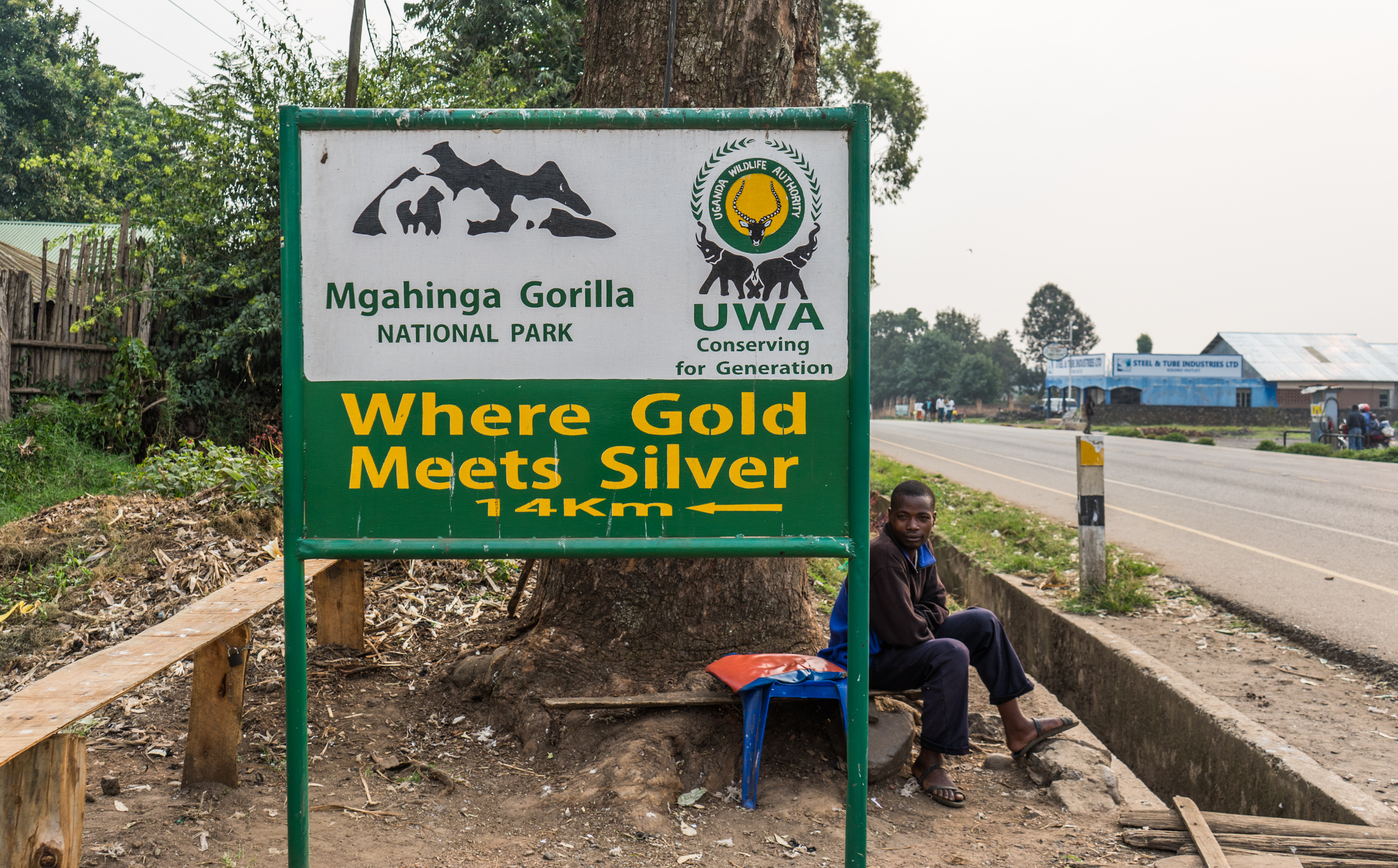
Mgahinga Gorilla National Park lies in the far southwest of Uganda, in Kisoro District, in the corner where the country meets Rwanda and the Democratic Republic of the Congo. At just 33,7 km² it is Uganda's smallest national park, but one of its most spectacular: it covers the Ugandan slopes of three volcanoes in the Virunga chain —Muhavura (4.127 m), Gahinga (3.474 m) and Sabyinyo (3.669 m)—, whose cones can be seen from half the country. It is part of the Virunga Conservation Area, a cross-border massif it shares with Rwanda's Volcanoes Park and Congo's Virunga National Park, and it is a refuge for rare mountain gorillas and golden monkeys.
📌Best time to visit
The best times to visit Mgahinga are the two dry seasons: June to September and December to February. In those months the forest and volcano trails are less muddy, climbing is safer and the chances of seeing the cones clear —rather than wrapped in mist— are higher. Like the whole Virunga region, this is humid mountain country: it can rain at any time of year and the climate at altitude is cool (it gets quite cold at night). The 'long' rains (March-May) and the 'short' rains (October-November) leave the forest lush but the paths slippery.
📌Suggested days
Two or three days are enough to make the most of the park: one day for gorilla trekking (the Nyakagezi family), another for golden monkey tracking or the Batwa cultural trail, and a third to climb one of the volcanoes (Gahinga or Muhavura are day hikes; Sabyinyo is more demanding). Many travellers combine Mgahinga with nearby Bwindi or Lake Bunyonyi, using the town of Kisoro as a base. You get there by road from Kabale or Kisoro.
📌Getting there
The park gate (Ntebeko) is about 14 km from Kisoro, the nearest town, half an hour by vehicle along a dirt track. Kisoro is connected by road to Kabale (1,5-2 h away) and to Kampala (8-10 h, about 510 km, mostly paved). There are also charter flights from Entebbe/Kajjansi to the Kisoro airstrip (about 1,5 h flying time). Most people arrive with a safari operator that includes 4x4 transport, guide and accommodation, and usually links Mgahinga with Bwindi. The border with Rwanda (Cyanika) is very close, so you can also arrive by flying into Kigali.
📌Getting around
Inside the park everything is done on foot, always accompanied by armed Uganda Wildlife Authority rangers: gorilla trekking, golden monkey tracking, the Batwa trail and the volcano climbs. There are no game drives or vehicle tracks: this is a mountain park for hiking. To reach the gate and get around the area you use your operator's 4x4 or transport hired in Kisoro. Wear good footwear and bring rain gear and warm layers, because you walk on slopes, through mud and bamboo, at more than 2.500 metres of altitude.
📌Language and currency
Uganda's official languages are English and Swahili; in this region people also speak Rufumbira/Kinyarwanda and other local languages, and rangers and guides get by in English. The currency is the Ugandan shilling (UGX); as of July 2026 the exchange rate is around 3.700-3.750 UGX per US dollar. Gorilla and golden monkey permits and Uganda Wildlife Authority fees are charged in dollars to non-residents. It is a good idea to bring US dollars in cash (notes in good condition, issued after 2013) for permits, tips and crafts, plus some shillings for small expenses.
💱 UGX exchange rate
Loading rate…
🌤️ Weather in Mgahinga Gorilla National Park
Loading weather…

Mgahinga Gorilla National Park is Uganda's smallest and, at the same time, one of its most impressive: it climbs the Ugandan slopes of three volcanoes in the Virunga chain, those perfect cones that mark the spot where Uganda, Rwanda and the Congo meet. Here, among bamboo forests and high-altitude heathland, live some of the last mountain gorillas on the planet and the elusive golden monkeys, in a mountain landscape that looks like something out of a storybook.

Mgahinga offers a quieter, more intimate experience than famous Bwindi: it gets far fewer visitors, and those who come can combine the great mountain gorilla trek —following the Nyakagezi family, the park's only habituated group— with tracking golden monkeys, endemic to the Virungas, and climbing one of the three volcanoes. From the summit of Sabyinyo you can literally stand in three countries at once.

This practical guide to Mgahinga explains how to get gorilla and golden monkey permits and what they cost, what the hikes up the Muhavura, Gahinga and Sabyinyo volcanoes are like, what the moving Batwa cultural trail is —the people who lived in these forests for millennia—, when to go, how to get there from Kisoro and how to link Mgahinga with Bwindi and Lake Bunyonyi to put together the great southwest Uganda circuit.

📖 History of Mgahinga Gorilla National Park

The name Mgahinga comes from 'gahinga', which in the local language refers to the small mounds of volcanic stone that farmers pile up when clearing their fields on the lower slopes of the volcanoes. For millennia these mountains were home to the Batwa, forest hunter-gatherers, until the area was protected as a gorilla sanctuary in 1930 and became a National Park in 1991, when the Batwa were evicted from the forest. Today Mgahinga is a key part of the Virunga Conservation Area, the cross-border effort that saved the mountain gorilla from extinction. That story, from the volcanoes and the Batwa to gorilla conservation, is told on our history page.

Read the full history ↓

🏛️ Mgahinga Gorilla National Park is in the southwest: gorillas and lakes

Uganda's most beautiful corner: almost half of the world's mountain gorillas live in Bwindi's World Heritage forest, surrounded by crater lakes, terraced farmland and the Virunga volcanoes.

Read the history of The southwest: gorillas and lakes →

🗺️ What to see

Tours nearby, in Kigali

A local guide tells you in half an hour what no sign at the site will ever explain. We look ours up on Civitatis: guided in Spanish and booked online with no fuss. They have 7 activities in Kigali. And there are free tours here: you book without paying and tip the guide whatever you think at the end, so trying one costs you nothing. Have a look below: tap any of them to see them all.

They depart from Kigali, 74 km away. If you book from this link we earn a commission and you pay no more.

1
Mountain gorilla trekking (Nyakagezi family)
The great encounter with mountain gorillas, following the Nyakagezi family through the bamboo forests of the volcanoes.
Leer más ↓
Gorilla trekking is Mgahinga's crown jewel. The park has a single group habituated for tourism, the Nyakagezi family, famous for its nomadic history: for years it crossed freely over the border into Rwanda and the Congo, which made its presence unpredictable; today it has become much more resident on the Ugandan side, with several silverbacks, females and young. Seeing these gentle giants up close —eating bamboo, looking after their young, watching you with disconcerting calm— is one of the most intense experiences Africa has to offer. The trek starts early at Ntebeko gate with a briefing from the rangers. It then heads into the bamboo forest and montane forest, climbing steep and sometimes muddy trails until you reach the family, which the trackers locate in the morning. Walking time varies a lot —from one to several hours— depending on where the gorillas are that day. Once with them, you have one magical hour to watch and photograph them, keeping the seven-metre health distance. To do the trek you need a Uganda Wildlife Authority gorilla permit, which is best booked well in advance (the number of daily permits is very limited). Getting there: Ntebeko gate, about 14 km from Kisoro. Best time: dry seasons (June-September, December-February). Tips: bring boots, gardening gloves, rain gear and water; hire a local porter (it supports the community and helps you on the climbs); minimum age 15.
ℹ️ Distance: Ntebeko gate, 14 km from Kisoro (half an hour) · Best time: Dry seasons: June-September and December-February · Admission: Non-resident gorilla permit USD 800, and USD 600 in low season (April, May and November); includes guide, rangers and park entry (UWA, circular Ref. TDO 93/04 of 26/02/2026; checked 08/2026) · Duration: Half day to full day; 1 hour with the gorillas
2
Golden monkey tracking
Tracking the rare golden monkeys, primates endemic to the Virungas that live only in this chain of volcanoes.
Leer más ↓
The golden monkey (Cercopithecus kandti) is one of Africa's most beautiful and least known primates: its bright orange fur on the back and flanks contrasts with the black of its legs and tail. It is endemic to the high-altitude forests of the Virunga chain —it lives only here and in Rwanda—, which makes Mgahinga one of the very few places in the world where you can track it. They live in large, noisy groups in the bamboo forest, whose tender shoots are one of their favourite foods. Tracking is quicker and less demanding than gorilla trekking: you walk through the bamboo following the trackers until you find the troop, which is usually busy leaping between the canes. Watching dozens of golden monkeys moving, feeding and playing among the greenery is a fun and very photogenic spectacle. For those with more time there is also the golden monkey 'habituation' experience, which is longer and lets you accompany researchers as they get the group used to human presence. It is an excellent and much cheaper alternative to the gorilla permit, ideal for wildlife and photography lovers. Getting there: from Ntebeko gate, with the rangers. Best time: dry seasons. Tips: bring a telephoto lens and patience; the bamboo is dense; standard tracking is usually shorter than gorilla trekking.
ℹ️ Distance: From Ntebeko gate, in the bamboo forest · Best time: Dry seasons; monkeys are active in the morning · Admission: Non-resident golden monkey tracking USD 60; habituation USD 100 (UWA, tariff Jul. 2024-Jun. 2026, expired on 30/06/2026 with no published replacement; checked 08/2026) · Duration: Half day (shorter than gorilla trekking)
3
Climbing Muhavura volcano (4.127 m)
The day hike to the summit of the park's highest volcano, with a small crater lake and views over the whole Virunga chain.
Leer más ↓
Muhavura ('the guide', because its cone can be seen from very far away and used to orient travellers) is, at 4.127 metres, Mgahinga's highest volcano and one of Uganda's great high-altitude hikes. The ascent is done in a single long, demanding day —you have to gain a lot of elevation on a steep trail that crosses forest, heathland and the high-mountain lichen zone—, but it requires no technical equipment. At the top a small crater lake awaits and, if the sky cooperates, a 360-degree view over the whole Virunga chain, Lake Bunyonyi and even the Congo and Rwanda. It is a tough day, 8 to 10 hours there and back, for fit hikers, with guides and rangers. The weather changes quickly and there can be mist, rain and cold at the top, so go prepared with warm layers, a waterproof jacket, water and food. The reward is huge: few mountains in Africa can be climbed in a day and offer such panoramas of lined-up volcanoes. Getting there: from Ntebeko gate, with a UWA guide. Best time: dry seasons, for clear skies. Tips: start very early; bring trekking poles, warm clothes and a waterproof; hire a porter; not suitable for anyone who isn't fit.
ℹ️ Distance: From Ntebeko gate; summit at 4.127 m · Best time: Dry seasons; set off before dawn · Admission: Non-resident volcano climbing fee (UWA); plus park entry (check when visiting, July 2026) · Duration: 1 day (8 to 10 hours there and back)
4
Gahinga and Sabyinyo volcanoes
The park's other two summits: Gahinga with its swampy crater and Sabyinyo, whose summit lies in three countries at once.
Leer más ↓
Besides Muhavura, Mgahinga offers climbs up two other volcanoes. Gahinga (3.474 m) is the most accessible of the three: the hike, about 6 hours there and back, crosses a beautiful bamboo forest and ends at a crater whose top has turned into a high-altitude swamp, an unusual and peaceful landscape. It is a good option for anyone who wants a volcano experience without the extreme toughness of Muhavura. Sabyinyo (3.669 m) is the most famous and challenging. Its name means 'old man's teeth', because its jagged silhouette looks like a gum with worn-down molars. The route covers its three stepped peaks along sharp ridges, with ladders and handrails on the most exposed sections, in a long, airy hike of about 8 hours. The most celebrated part is that at the highest point, the third peak, the borders of Uganda, Rwanda and the Democratic Republic of the Congo meet: you can literally stand with one foot in each country. Both climbs are done in a day, with guides and rangers, and need no technical equipment, but they do require good fitness. Getting there: from Ntebeko gate. Best time: dry seasons. Tips: Sabyinyo has exposed sections with chains, so take care if you are prone to vertigo; bring a waterproof and warm clothes.
ℹ️ Distance: From Ntebeko gate; Gahinga 3.474 m, Sabyinyo 3.669 m · Best time: Dry seasons · Admission: Volcano climbing fee (UWA) plus park entry (check when visiting, July 2026) · Duration: Gahinga ~6 h; Sabyinyo ~8 h (full day)
5
Batwa cultural trail and Garama Cave
A walk guided by the Batwa themselves, the indigenous people who lived in these forests, to the Garama refuge cave.
Leer más ↓
The Batwa Trail is one of Mgahinga's most human and moving experiences. The Batwa —sometimes called 'pygmies'— were for millennia the inhabitants of these mountain forests, hunter-gatherers who lived in harmony with the forest. When the forest became a national park in 1991 they were evicted and lost their ancestral way of life, ending up among the most marginalised peoples in the region. This trail, guided by the Batwa themselves, is a way of keeping their culture alive and generating income for the community. Along the way, the Batwa guides show how they lived in the forest: how they hunted with bows, lit fires, gathered medicinal plants and honey, and they share their myths and songs. The highlight is Garama Cave, a long underground lava tunnel that served the Batwa as a refuge and meeting hall, and from which they once launched raids. There, in the half-light, a group of Batwa women sings traditional songs that echo off the rock, an unforgettable moment. It is a visit full of meaning that helps you understand the human cost of conservation and directly supports the community. Getting there: from Ntebeko gate, with Batwa guides. Best time: all year round. Tips: bring cash for tips and Batwa crafts; it is a moderate walk of several hours; a torch helps in the cave.
ℹ️ Distance: From Ntebeko gate; Garama Cave · Best time: All year round · Admission: Batwa trail, separate fee of about USD 40-80 per person (UWA/community, check when visiting, July 2026) · Duration: Half day (about 3 to 4 hours)
6
Viewpoints, birds and the three-country border
Short walks along the edge of the park with views of the volcanoes, good high-altitude birding and the border marker.
Leer más ↓
Even without climbing a whole volcano, Mgahinga offers extraordinary scenery. From Ntebeko gate and its surroundings you can take in the three cones in a row —Muhavura, Gahinga and Sabyinyo— in one of Uganda's most beautiful views, especially at dawn, when the mist lifts off the slopes. There are short walks around the base of the park, ideal for anyone who wants to enjoy the surroundings without a big climb, and a trail that leads to the marker where the borders of Uganda, Rwanda and the Congo meet. The park is also an excellent destination for high-altitude and Albertine Rift birding: it is home to around 180 species, including several endemic to the region, such as the Rwenzori turaco, and bamboo and heathland birds that are hard to see elsewhere. Bird lovers can spend a morning exploring the forest edges with a specialist guide. These are relaxed activities, perfect for combining with gorilla or golden monkey tracking without wearing yourself out. Getting there: from Ntebeko gate. Best time: dry seasons, with clear skies to see the cones. Tips: bring binoculars and a camera; dawn gives the best light on the volcanoes; ask the rangers which short trails are available.
ℹ️ Distance: Around Ntebeko gate · Best time: Dry seasons; dawn for the volcanoes · Admission: Covered by park entry / birdwatching activity (UWA, check when visiting, July 2026) · Duration: Half day depending on the walk
📶I have never landed without internet. I arrive and my phone connects to the strongest network in the country I am visiting: I can say I landed, sort out transport, book tours and keep posting, at a seriously good price. I always use the Maya eSIM — check their plans by clicking the banner.See plans →Maya Mobile eSIM — turn travel mode on
What nobody tells you

💵 Prices

Tickets

TypePrice
Permiso de gorilas de montaña (no residente)USD 800 per person; USD 600 in low season (April, May and November), permit cannot be rescheduled. Foreign resident USD 700, rest of Africa USD 500, East Africa UGX 300.000. Includes park entry, guide and rangers (UWA, circular Ref. TDO 93/04 of 26/02/2026; checked 08/2026)
Rastreo de monos dorados (no residente)USD 60 non-resident (UWA, tariff Jul. 2024-Jun. 2026, expired on 30/06/2026 with no published replacement; checked 08/2026)
Habituación de monos dorados (no residente)USD 100 non-resident (UWA, tariff Jul. 2024-Jun. 2026, expired on 30/06/2026 with no published replacement; checked 08/2026)
Entrada al parque (no residente, por día)USD 40 per person/day non-resident (category A; foreign resident USD 30, rest of Africa USD 25, East Africa UGX 20.000) for activities without a primate permit (UWA, tariff Jul. 2024-Jun. 2026, expired on 30/06/2026 with no published replacement; checked 08/2026)
Escalada de volcán (Muhavura, Gahinga o Sabyinyo)Volcano climbing fee per person (UWA), in addition to park entry (check when visiting, July 2026)
Sendero de los batwa (Batwa Trail)About USD 40-80 per person (UWA/Batwa community, check when visiting, July 2026)
🔄 updated monthlyOfficial / reference values · double-check when buying

Activities and tours

ActivityPriceDurationOperator
Mountain gorilla trekking (Nyakagezi family)Permit USD 800 non-resident; USD 600 in low season (April, May and November)Half day to full day; 1 h with the gorillasUganda Wildlife Authority / safari operators
Golden monkey trackingUSD 60 non-resident (UWA, check when visiting)Half dayUganda Wildlife Authority
Climbing a volcano (Muhavura, Gahinga or Sabyinyo)UWA climbing fee + park entry (check when visiting)1 day (6 to 10 h depending on the volcano)Uganda Wildlife Authority (guides and rangers)
Batwa cultural trail and Garama CaveAbout USD 40-80 per person (check when visiting)3 to 4 hoursBatwa community / UWA
Albertine Rift birdwatchingWith a UWA guide, depending on the activity (check when visiting)Half dayUganda Wildlife Authority
Local porters for treks and climbsFrom about USD 15-20 per porter (tip extra, check when visiting)During the hikeKisoro communities
🔄 updated monthlyOfficial / reference values · double-check when buying

🚌 How to get there and distances

Getting around

4x4 with a safari operator
PriceIncluded in the safari package (check when visiting)
DurationKisoro-Ntebeko gate ~30 min
Notes
The usual way to get there and get around; the final track is dirt and a 4x4 is advisable, especially in the rainy season
Taxi or transport hired in Kisoro
PriceNegotiable in Kisoro (check when visiting)
Duration~30 min to the park gate
Notes
For those staying in Kisoro who want to get to the Ntebeko gate on their own
On foot inside the park
Included in the activity
DurationVariable
Notes
All activities (gorillas, golden monkeys, volcanoes, Batwa) are done on foot with rangers; there are no vehicles inside the park
Boda-boda (motorbike taxi) in Kisoro
PriceShort trips from around UGX 2.000-10.000 (check when visiting)
DurationVariable
Notes
Handy for getting around Kisoro; not recommended for the mountain track or at night
🔄 updated monthlyOfficial / reference values · double-check when buying

How to get there

RouteAirlines / operatorsAvg. priceDuration
Kampala/Entebbe → Kisoro by roadSafari operators, buses (e.g. Jaguar, Bismarkan)Bus from around UGX 40.000-60.000; safari depending on the package (check when visiting)8 to 10 h (about 510 km)
Kabale → Kisoro by roadOperators, minibuses and shared taxisMinibus from around UGX 10.000-15.000 (check when visiting)1,5 to 2 h on a mountain road
Entebbe/Kajjansi → Kisoro airstrip (charter flight)Aerolink Uganda and chartersDepending on the flight fare (check when visiting)~1,5 h flight
Kigali (Rwanda) → Kisoro via the Cyanika borderCross-border operatorsDepending on logistics and visas (check when visiting)3 to 4 h; requires border formalities
Kisoro → Ntebeko gate (Mgahinga)Operator's 4x4 or local transportDepending on transport (check when visiting)~30 min (14 km of dirt track)
🔄 updated monthlyOfficial / reference values · double-check when buying

🏨 Where to stay

No exact prices: a scale from $ (budget) to $$$$$ (luxury), with 2-3 options per category.

Luxury and boutique lodges
Price$$$$$
Recommended options
From around USD 200-500+ per person/night; options such as Mount Gahinga Lodge (Volcanoes Safaris), with views of the volcanic cones and programmes with the Batwa community
Mid-range lodges and hotels in Kisoro
Price$$$$$
Recommended options
Approx. USD 60-150 per person/night; comfortable options such as Kisoro Travellers Rest Hotel (historic, linked to Dian Fossey) or mid-range lodges near the park
Budget guesthouses and campsites
Price$$$$$
Recommended options
From around USD 20-60 a night; simple guesthouses and campsites in and around Kisoro, popular with backpackers and budget travellers

🍴 Where to eat

Comedores de lodge (media pensión / pensión completa)
Price$$$$$
Options / signature dish
Included in the lodge rate; menus with international and Ugandan cuisine, fireside dinners with views of the volcanoes
Restaurantes y hoteles de Kisoro
Price$$$$$
Options / signature dish
From around USD 5-15 per person; Ugandan cuisine (matoke, posho, beans, goat, tilapia) and simple international dishes
Comida local y mercados de Kisoro
Price$$$$$
Options / signature dish
From around USD 2-6; stalls and local eateries serving chapati, rolex (egg rolled in chapati), samosas and local fruit

📖 History of Mgahinga Gorilla National Park

Origins, formation and what the sources say.

Fire and forest: the birth of the Virunga volcanoes

Mgahinga's story begins long before humans arrived, deep inside the earth. The park covers the Ugandan slopes of three of the eight volcanoes that make up the Virunga (or Birunga) chain, a line of cones rising in the heart of the Albertine Rift, the western branch of Africa's Great Rift Valley. These volcanoes were born from the tectonic activity that, over millions of years, has been slowly pulling the African continent apart and has shaped some of the most spectacular landscapes in East Africa.

Mgahinga's three cones — Muhavura (4.127 m), Sabyinyo (3.669 m) and Gahinga (3.474 m) — are now extinct or dormant, but their shape gives away their igneous origin: Muhavura still holds a small lake in its crater, Gahinga has a swamp at its summit, and Sabyinyo, far older and more eroded, shows a jagged silhouette that earned it its name, 'old man's tooth'. The lava that once poured from them also created the area's underground caves, such as Garama, and the fertile volcanic soils that explain the dense farming population on the slopes.

Over time, a mosaic of ecosystems grew up those slopes, layered by altitude: montane forest, dense bamboo forest, giant heathland and high-altitude grassland dotted with lobelias and groundsels, those oddly shaped Afro-alpine plants that look like they come from another planet. This unique and fragile range of habitats is what supports the mountain gorillas, the golden monkeys and dozens of species found nowhere else on Earth.

en.wikipedia.org · Mgahinga Gorilla National Parken.wikipedia.org · Virunga Mountains

The Batwa: the forest's first inhabitants

For thousands of years, long before there were borders or national parks, these mountain forests were home to the Batwa, a hunter-gatherer people sometimes called 'pygmies'. Seen by many as the original inhabitants of the Great Lakes region, the Batwa lived in deep harmony with the forest: they hunted with bow and arrow, gathered honey, fruit and medicinal plants, and sheltered in temporary camps and in lava caves such as Garama. To them the forest was not a resource to exploit but their home, their larder and their temple.

As other farming and herding peoples — Bantu groups such as the Bafumbira — arrived over the last few centuries, the Batwa were pushed further and further into the forested heights. Even so, they kept their culture and their bond with the forest well into the 20th century. Garama Cave, a long underground gallery carved out by lava, was for generations a place of gathering, refuge and ceremony for them, and according to tradition it was from here that they launched raids to defend their territory.

The Batwa's story is also one of the great injustices tied to conservation. When the forest became a protected area, they were evicted from their ancestral lands with no compensation and no alternative, and became one of the poorest and most marginalised peoples in the region, with no land of their own and no access to the forest that gave their lives meaning. Today's Batwa Trail, led by the Batwa themselves, is an attempt to repair some of that damage: preserving their memory and generating income for the community by showing visitors what life in the forest was like.

en.wikipedia.org · Batwa peopleugandawildlife.org · Mgahinga gorilla national park

From gorilla sanctuary to national park

Official protection of these mountains began in the British colonial era. In 1930, the authorities of the Uganda Protectorate declared the area a gorilla sanctuary, aiming to protect mountain gorillas from hunting and from farmland creeping up the fertile volcanic slopes. It was one of the region's first conservation measures, at a time when science was only just beginning to understand these great apes and how rare they were.

For decades, though, the pressure on the forest was huge. The Kisoro region is one of the most densely populated in Uganda, and hunger for land kept pushing crops further up the slopes, shrinking the gorillas' habitat. Poaching, snares set for other animals and political instability across the Great Lakes region — with wars and refugees crossing the borders of Uganda, Rwanda and Congo — threatened the survival of the wildlife again and again.

Finally, in 1991, the old sanctuary was upgraded to Mgahinga Gorilla National Park, the same year neighbouring Bwindi Impenetrable National Park was created. At just 33,7 km², it became Uganda's smallest national park, but a strategic one: the Ugandan portion of a volcanic ecosystem that had to be protected together with the neighbouring countries. It was also during this process that the Batwa were finally evicted from the forest, a human cost that still marks the park's history.

en.wikipedia.org · Mgahinga Gorilla National Parkugandawildlife.org · Mgahinga gorilla national park

Saving the mountain gorilla: a cross-border story

The mountain gorilla (Gorilla beringei beringei) was on the brink of extinction for much of the 20th century. Only described by Western science in 1902, it suffered from hunting, the capture of infants for zoos and collectors, habitat loss and, above all, the deadly trap of political instability in the three countries that share the Virungas. In the 1970s and 1980s, when American researcher Dian Fossey was studying and defending gorillas on the Rwandan side of the chain, the total population had fallen to just a few hundred.

Rescue came from a simple, powerful idea: a gorilla was worth far more alive than dead. Carefully regulated gorilla-watching tourism made it possible to fund their protection and gave local communities an economic reason to conserve them rather than encroach on their forest. Since gorillas move freely across the invisible borders between Uganda, Rwanda and Congo, it became clear that no country could save them alone. That was the start of the cross-border cooperation that today shapes the Virunga Conservation Area and programmes such as the International Gorilla Conservation Programme.

That cooperation has produced historic results: the mountain gorilla is one of the very few great ape species whose population has grown, rising from a few hundred to more than a thousand across the Virungas and Bwindi. In Mgahinga, the Nyakagezi family embodies that story: a group that spent years roaming between the three countries and that today lets visitors witness, face to face, one of the greatest successes in African conservation.

en.wikipedia.org · Mountain gorillaigcp.org

Mgahinga today: conservation, community and responsible tourism

Today's Mgahinga is a small park of enormous value, managed by the Uganda Wildlife Authority as part of the great conservation corridor of south-western Uganda, alongside Bwindi and the region's lakes. Its challenge is the same as when it was created: protecting a fragile ecosystem and irreplaceable wildlife in one of Africa's most densely populated rural areas, where the forest runs almost straight into the potato, sorghum and pea fields on the slopes.

The balance is sought through responsible tourism and by sharing its benefits. Gorilla trekking and golden monkey tracking bring in income that funds conservation, and part of it goes to community projects — schools, healthcare, water — in neighbouring villages, so that local people see the park as an ally rather than an enemy. Initiatives such as the Batwa Trail, local porters and craft sales aim to get visitors' money straight into the hands of the people of Kisoro.

For travellers, Mgahinga offers a calmer, less crowded version of south-western Uganda's great experiences: the same mountain gorillas as Bwindi, but with far fewer tourists; the almost unique bonus of golden monkeys; and the privilege of climbing volcanoes whose summits are where three nations meet. In just a few square kilometres, it is a perfect summary of what makes this corner of Africa special: nature at its edge, deep human history and an exemplary fight to save one of the most extraordinary creatures on the planet.

ugandawildlife.org · Mgahinga gorilla national parken.wikipedia.org · Mgahinga Gorilla National Park

📚 Bibliography

  • Uganda Wildlife Authority — Mgahinga Gorilla National Park: https://ugandawildlife.org/national-parks/mgahinga-gorilla-national-park/
  • Wikipedia (ES) — «Parque nacional de los Gorilas de Mgahinga»: https://es.wikipedia.org/wiki/Parque_nacional_de_los_Gorilas_de_Mgahinga
  • Wikipedia (EN) — «Mgahinga Gorilla National Park»: https://en.wikipedia.org/wiki/Mgahinga_Gorilla_National_Park
  • Wikipedia (EN) — «Virunga Mountains»: https://en.wikipedia.org/wiki/Virunga_Mountains
  • Wikipedia (EN) — «Mountain gorilla»: https://en.wikipedia.org/wiki/Mountain_gorilla
  • Wikipedia (EN) — «Golden monkey»: https://en.wikipedia.org/wiki/Golden_monkey
  • Wikipedia (EN) — «Batwa people»: https://en.wikipedia.org/wiki/Batwa_people
  • International Gorilla Conservation Programme (IGCP): https://igcp.org/
  • Diary of a Muzungu — UWA conservation fees 2024 to 2026: https://www.muzungubloguganda.com/conservation/uwa-revises-conservation-fees-2024-to-2026/
  • Britannica — «Virunga Mountains»: https://www.britannica.com/place/Virunga-Mountains

❓ Frequently asked questions

What's the difference between seeing gorillas in Mgahinga and in Bwindi?+
Both have the same species, the mountain gorilla, and the permit costs the same (USD 800 for non-residents, and USD 600 in the low season of April, May and November). Bwindi has many more habituated families, so more permits and more certainty; Mgahinga has just one group, the Nyakagezi family, and gets far fewer visitors, which makes the experience more intimate and peaceful. Mgahinga's extra advantage is that in the same park you can add golden monkey tracking and a volcano climb. Many people combine both parks.
How much does the gorilla permit cost and how do I get one?+
The mountain gorilla permit for non-residents costs USD 800 and includes park entry, the guide and the rangers. In the low season (April, May and November) UWA charges USD 600, that is USD 200 less per person, although that permit cannot be rescheduled. Since 1 March 2026 the 7-day booking window has been suspended: the permit is only secured with full payment at the time of booking. Permits are limited and sell out, especially in high season, so it's best to book them months in advance through the Uganda Wildlife Authority or a safari operator. The minimum age for trekking is 15. (UWA, circular Ref. TDO 93/04 of 26/02/2026.)
What is golden monkey tracking and is it worth it?+
Golden monkeys are orange-furred primates endemic to the Virunga volcanoes: they live only here and in Rwanda. Tracking (USD 60 for non-residents) means walking through the bamboo forest until you find a large troop and watching it leap about and feed. It's shorter, easier and much cheaper than gorilla trekking, highly recommended for wildlife and photography lovers, and an experience found almost nowhere else in the world. You can do it on the same day as the gorillas or on a different day.
Can you climb the volcanoes, and do you need to be a mountaineer?+
Yes, you can climb the park's three volcanoes on day hikes, with guides and rangers, and no technical gear. Gahinga (3.474 m) is the gentlest (~6 h), Muhavura (4.127 m) the highest and toughest (8-10 h, with a crater lake at the summit), and Sabyinyo (3.669 m) the most exposed, with ridges and ladders and a summit at the point where three countries meet. You don't need to be a mountaineer, but you do need to be in good shape and bring warm and waterproof clothing, because the weather at altitude changes quickly.
What's the best time to visit Mgahinga?+
The dry seasons (June to September and December to February) are the best: less muddy trails, safer climbs and a better chance of seeing the cones clear of cloud. As it's a humid mountain area, it can rain at any time and nights are cold, so always bring warm layers and a rain jacket. Gorilla and golden monkey trekking run all year round; in the rainy season the forest is greener but the trails are more slippery.

More places in Uganda

Parque Nacional Impenetrable de BwindiParque Nacional KibaleParque Nacional Lago MburoParque Nacional Monte ElgonParque Nacional de los Montes RwenzoriParque Nacional Murchison Falls
See every place in Uganda →The history of Uganda →
Sources consulted (6)
Still planning?
Explore more destinations in Uganda
See all destinations →