Fakarava is the atoll of sharks. In its south pass, Tumakohua, hundreds of grey reef sharks —sometimes several hundred lined up in the current— form the famous 'wall of sharks', one of the most impressive underwater scenes on the planet. It is neither a coincidence nor a tourist feeding stunt: it is a whole protected ecosystem, which has turned this remote corner of the Tuamotus into a sanctuary for marine life, recognised by UNESCO as a Biosphere Reserve.
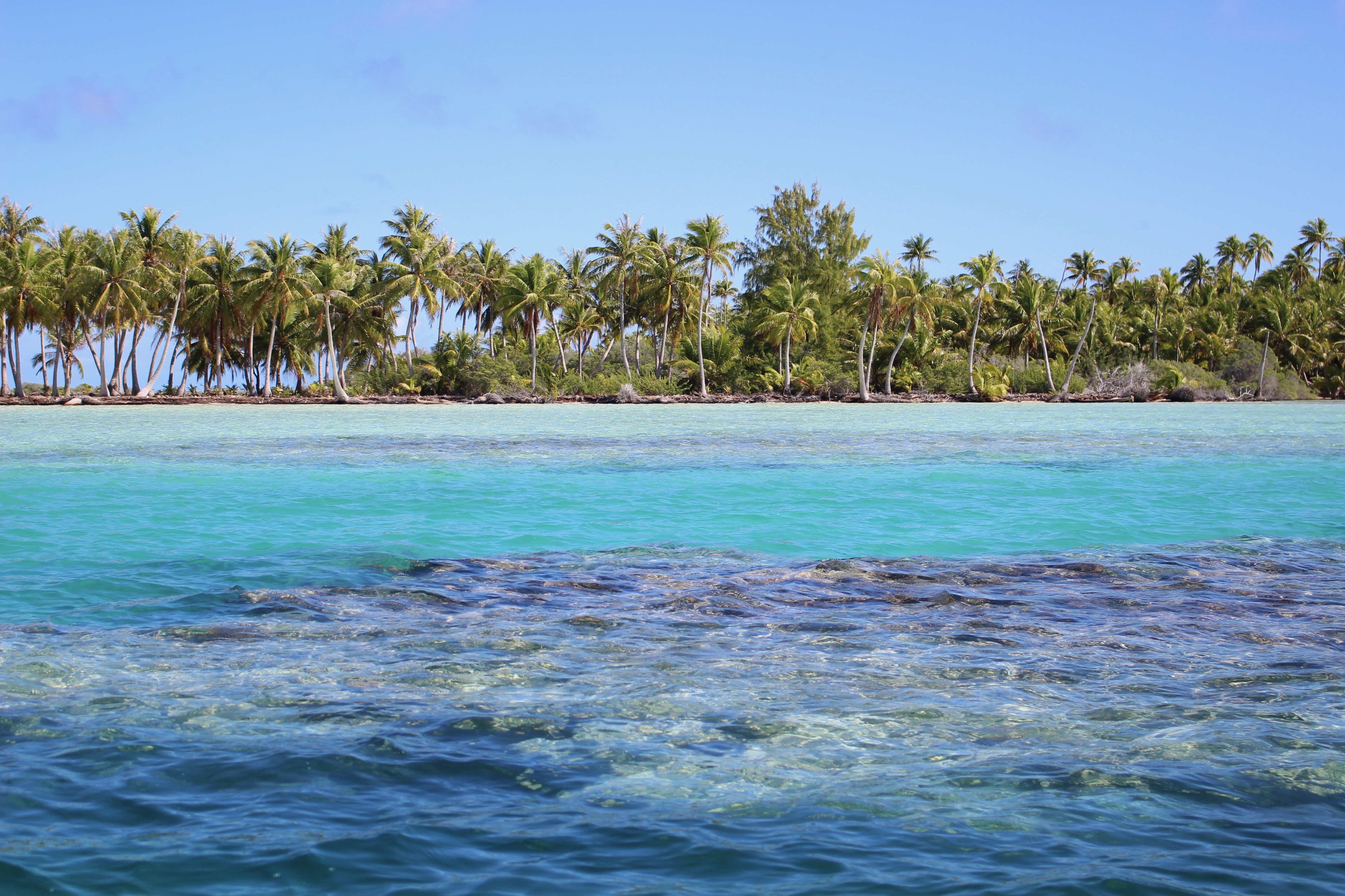
The second-largest atoll in French Polynesia, Fakarava is a 60 km-long coral rectangle with a vast lagoon and two passes linking it to the ocean: to the north, Garuae, the widest in all of Polynesia; to the south, Tumakohua, next to the old village of Tetamanu, with its coral church from 1874. Between them stretches a world of turquoise water, pink sand beaches, coconut palms and black pearl farms, with just one living village —Rotoava— and a pace of life that invites you to get around by bike and dive slowly.
This guide explores Fakarava with a practical, warm eye: how to get there (only on an Air Tahiti flight or by cargo ship), how to get around an atoll with no buses or taxis, what dives in the two passes really cost, the trip to the wall of sharks in the south, the pearl farms and the pink sands (all in CFP francs and verified in July 2026), and where to eat and sleep. Fakarava is not the postcard island of overwater bungalows: it is a wilder, quieter paradise, made for those looking for the ocean in an almost pristine state.
Fakarava was formed by the slow subsidence of an ancient volcano, whose reef kept growing as the mountain sank, leaving the coral ring described by Charles Darwin's theory. It was settled by Mā'ohi navigators, the Pa'umotu, who built villages and lived from the sea, fishing and diving for mother-of-pearl. The Russian explorer Bellingshausen sighted it in 1820; from 1849 Catholic missionaries arrived and Tetamanu, on the south pass, became the atoll's first administrative centre, with a coral church built in 1874. Under French rule, the atoll lived from mother-of-pearl, copra and later the black pearl. In the 20th century, the Tuamotus were marked by French nuclear testing on the nearby atolls of Moruroa and Fangataufa (1966-1996). In 1977 the commune of Fakarava was declared a UNESCO Biosphere Reserve. Its full story is told on the history page.
Read the full history ↓The largest group of coral atolls on the planet: 77 rings of sand and lagoon scattered across the Pacific, land of the Pa'umotu people, home of the black pearl and copra, and the setting for the French nuclear tests at Moruroa and Fangataufa.
Read the history of Tuamotu Archipelago →No exact prices: a scale from $ (budget) to $$$$$ (luxury), with 2-3 options per category.
Origins, formation and what the sources say.
Fakarava is, in fact, the outline of a mountain that no longer exists. Millions of years ago, an underwater volcano rose from a hotspot on the floor of the Pacific and pushed a high island up above the waves. Around it, in the warm, bright waters of the tropics, a coral reef grew and encircled it. Then the slow drift of the oceanic plate carried the island away from its heat source; the volcano went extinct and began to sink, millimetre by millimetre, while the coral, which only lives close to the light, kept growing towards the surface so it would not be buried in the gloom.
After countless generations of polyps, the volcanic summit vanished beneath the sea, and all that remained in its place was the ring of coral, enclosing a lagoon over what had once been the mountain's slope. That ring is Fakarava: a rectangle of coral about 60 km long and 21 wide, with a lagoon of more than a thousand square kilometres and only 24 km² of dry land, which nowhere rises very far above the water.
Charles Darwin explained this way islands are born and die in the 19th century with his subsidence theory, which he formulated after observing Pacific reefs during the voyage of the Beagle: first fringing reefs hugging the coast, then barrier reefs separated from it by a lagoon and, finally, atolls with no central island. Modern science has refined the model (the rise and fall of sea levels during the ice ages played a decisive part in shaping the lagoon), but Darwin's core idea holds up. Fakarava, with its two passes that let the lagoon breathe, is the coral skeleton of a volcano that sank and left no trace but its crown.
The first inhabitants of Fakarava arrived aboard double-hulled canoes, the va'a, as part of the greatest feat of navigation in human history: the Polynesian settlement of the Pacific. The Mā'ohi crossed thousands of kilometres of open ocean without instruments, reading the stars, the swells that bounce off islands, the clouds and the flight of birds. When they reached the Tuamotu, they faced a huge challenge: atolls with no rivers or mountains and no fertile soil, where fresh water has to be caught from the rain or drawn from fragile underground lenses.
The people of these low islands are known as the Pa'umotu, 'the people of the low islands', and they developed a remarkably well-adapted culture. Few people have lived off the sea the way they did: they fished the lagoon and the passes with stone traps and nets, free-dived for mother-of-pearl and pearls, and dug pits into the limestone to grow taro and other plants. They moved constantly between atolls to fish, trade and sometimes wage war, weaving a human network across the water.
As on every island in Polynesia, spiritual life was organised around the marae: ceremonial enclosures of coral and stone where gods and ancestors were honoured, rites of birth, war and death were held, and mana was affirmed, the sacred power that filled chiefs (ari'i) and places of power. Tatau, or tattooing, marked identity, lineage and rank on the skin. From that world before European contact, what survives today is the Pa'umotu language, the place names, the art of reading the sea and a relationship with the ocean that is still at the heart of life on Fakarava.
For Europeans, the Tuamotu were for centuries more of a hazard than a destination: they called them the 'Dangerous Archipelago' or the 'Dangerous Islands', a maze of coral rings barely visible above the waterline and passes with fierce currents where many sailing ships were wrecked. Fakarava entered European records relatively late: it was sighted on 17 July 1820 by the Russian navigator Fabian Gottlieb von Bellingshausen, during his famous expedition to Antarctica, which charted several Tuamotu atolls along the way.
The deep change, however, came with the missionaries. From 1849, the Catholic priest Honoré Laval and the Picpus mission (the same one that had completely reshaped society on the neighbouring Gambier Islands) extended their influence over Fakarava. Evangelisation brought with it the regrouping of the population around churches and the abandonment of many ancestral practices. In the north, the church at Rotoava was blessed around 1850. But the atoll's administrative and religious heart was set up in the south, in the village of Tetamanu, beside the Tumakohua pass: there, in 1874, a small church built from coral blocks was raised, and it still stands today, a witness to the era when the south was the centre of everything.
Over time, activity shifted north to Rotoava, which had better connections, and Tetamanu was left almost empty, frozen in time. That former capital of the southern pass, with its coral church and its handful of houses among the coconut palms, is today one of the most evocative historic spots in the Tuamotu, just a few metres from the wall of sharks that would make the island famous a century and a half later.
Like the rest of the Tuamotu, Fakarava spent the 19th and 20th centuries tied to whatever the outside world wanted to buy from its lagoons and coconut palms. First came mother-of-pearl: around the middle of the 19th century, harvesting black-lipped oysters enjoyed a golden age. Pa'umotu divers, reputed to be the best in the Pacific, free-dived to prise the shells off the seabed; their nacre was exported to make buttons and luxury goods, and their dark pearls were beginning to captivate Europe. Overharvesting exhausted the oyster beds, and by the 20th century mother-of-pearl had given way to copra (dried coconut flesh) as the atolls' main export; the coconut groves planted by the missionaries covered the low islands, and for decades copra kept the economy going.
At the same time, France tightened its grip on Polynesia. After the protectorate over the Kingdom of Tahiti in 1842 and the annexation of the Society Islands in 1880, the Tuamotu were absorbed into the French Establishments of Oceania, the colonial administration that in 1957 would become the Territory of French Polynesia. Fakarava, with its vast lagoon and scattered population, thus entered the 20th century as a French possession living off copra, fishing and mother-of-pearl, weeks of sailing away from Papeete.
In the last decades of the 20th century a new source of wealth arrived, one that linked back to the oldest: farming the Tahitian black pearl, the gem of the same black-lipped oyster that divers once sought on a single breath. The clean, calm lagoons of the Tuamotu proved ideal for pearl farming, and farms sprang up on Fakarava, such as Havaiki, which today shows visitors the whole process, from grafting to finished jewel, and which, together with tourism, supports much of the economy.
No history of the Tuamotu can leave out the most painful chapter of the 20th century. In 1963, having lost its test sites in the Sahara when Algeria became independent, France decided to move its nuclear tests to the Pacific and set up the Centre d'Expérimentation du Pacifique (CEP) on two uninhabited atolls in the southern Tuamotu: Moruroa and Fangataufa, part of the same Tuamotu archipelago as Fakarava. On 2 July 1966 the region's first bomb was detonated there, the 'Aldébaran' test.
Between 1966 and 1996, France carried out 193 nuclear tests at Moruroa and Fangataufa: 41 atmospheric tests (mushroom clouds over the ocean until international pressure forced a change in 1974) and more than 140 underground explosions in shafts drilled into the coral. The tests brought money and jobs to Tahiti and sped up emigration from the atolls, but they left a serious legacy that was kept quiet for decades: radioactive contamination, accidents such as the underwater landslide and wave triggered by a detonation at Moruroa in 1979, and a trail of illness that still fuels demands for truth and compensation today. It is a central wound in the identity of Ma'ohi Nui, the Mā'ohi nation, whose atolls were treated from Paris as 'empty' territory.
Fakarava, far from the test sites, took a very different and brighter path. In 1977, the commune of Fakarava, which groups seven atolls (Fakarava itself, Aratika, Kauehi, Niau, Raraka, Taiaro and Toau), was declared a UNESCO Biosphere Reserve in recognition of the exceptional health of its lagoon and reef ecosystems. That protection, strengthened over the years, is what has allowed the wall of sharks in the southern pass to remain what it is: hundreds of grey sharks hanging in the current, a symbol of a sea that is still intact.
Today's Fakarava is, above all, a sanctuary. Its status as a UNESCO Biosphere Reserve and the protection of its sharks (protected since 2008 in French Polynesia, which declared a huge shark sanctuary) have made the atoll one of the world's great diving destinations and a case study in what a healthy ecosystem can offer. In the southern Tumakohua pass, the 'wall of sharks' brings together hundreds of grey sharks; and every year, around June–July, on the full moons of the southern winter, thousands of marbled groupers gather to spawn and the sharks hunt in packs in a spectacular scene documented by National Geographic. In the north, the Garuae pass, the widest in all of Polynesia, offers drift dives through clouds of fish.
With around 850 inhabitants, almost all of them in Rotoava, Fakarava lives off that balance between nature and visitors: dive tourism fills the guesthouses and lodges, the farms grow black pearls in the lagoon, and daily life keeps the slow pace of the atoll, with the bicycle as the main way of getting around along a flat 15 km road. In the south, the old village of Tetamanu and its coral church from 1874 still recall the missionary past, while the sea in front of them pulses with the same abundance as ever.
Fakarava thus sums up, in a single ring of coral, the whole history of the Tuamotu: the sunken volcano and the coral that took its place, the Pa'umotu navigators and their sea culture, mother-of-pearl and copra, the nuclear shadow that marked the archipelago and, finally, the commitment to protecting one of the most alive oceans on the planet. This is not the Polynesia of overwater bungalows, but something deeper and rarer: a place where the sea is still in charge.