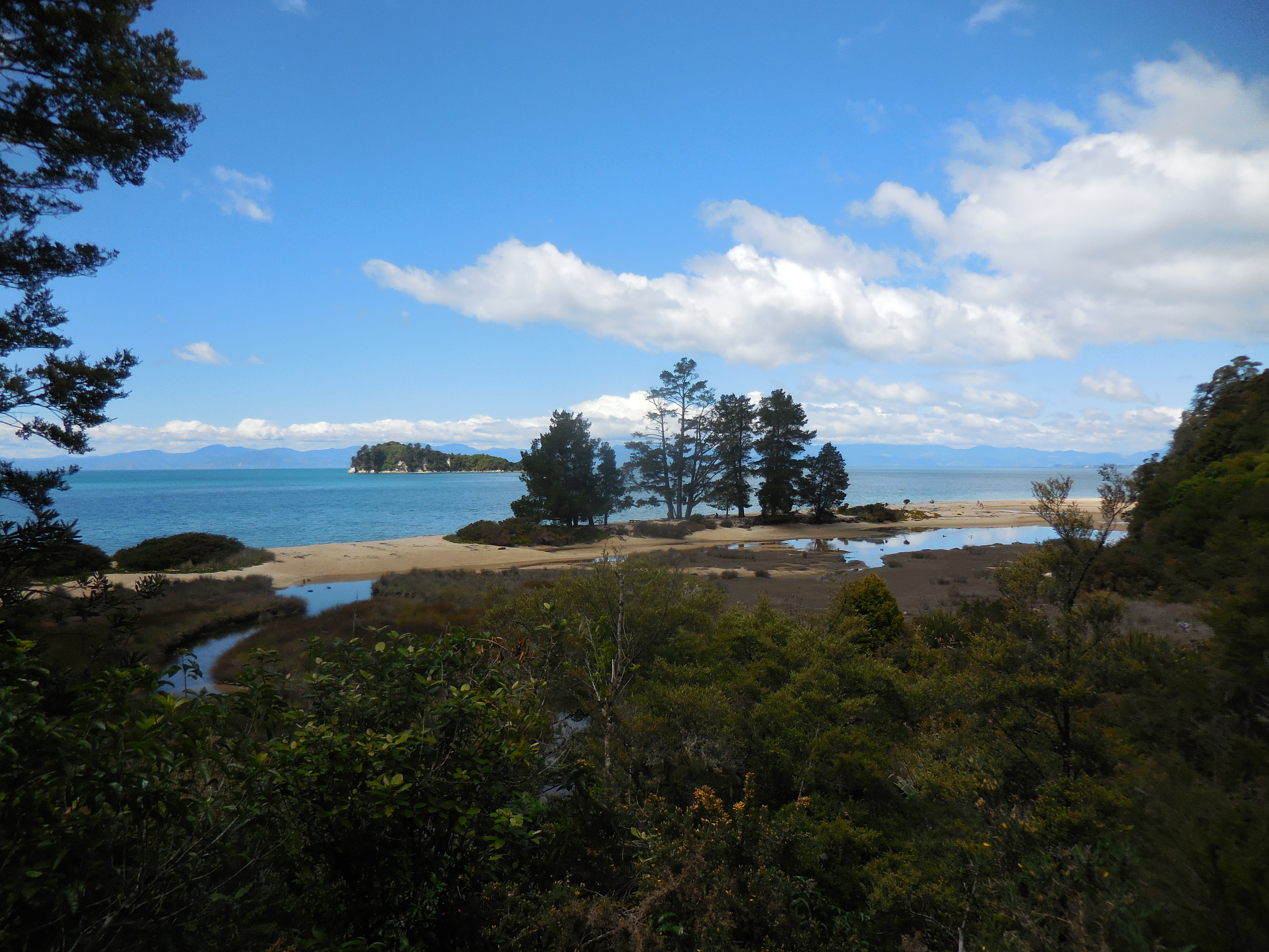
Abel Tasman National Park is the smallest in New Zealand and also one of the most loved: a coastline of golden-sand bays, turquoise water, lush native forest and sea-sculpted granite at the sunny northern tip of the South Island. Its jewel is the Abel Tasman Coast Track, one of the country's nine Great Walks, a coastal track of about 60 km that winds past dreamy beaches, crosses estuaries with the tide and serves up postcard views at every turn. You don't have to walk all of it: thanks to the water taxis, you can put together a day trip combining walking and boating.
The other great way to experience Abel Tasman is from the water, by sea kayak. The park's sheltered waters are ideal for paddling between the bays, getting close to New Zealand fur seal colonies at Tonga Island, slipping into hidden coves and camping on deserted beaches. Operators in Marahau and Kaiteriteri offer everything from half-day guided trips to multi-day expeditions combining kayaking, walking and water taxis. It's a perfect destination for every level: families, casual walkers and adventurers.
The park is named after the Dutch navigator Abel Tasman, the first European to sight New Zealand, who in December 1642 had a first, tragic encounter here -in Golden Bay/Mohua, just to the north- with the Māori of Ngāti Tūmatakōkiri. This is the land of iwi such as Ngāti Rārua, Te Ātiawa and Ngāti Tama, with centuries of history. Created in 1942 to mark 300 years since that arrival, Abel Tasman today combines spectacular nature, rich history and accessibility like few places in Oceania.
Abel Tasman National Park is named after the Dutch navigator who, in December 1642, became the first European to sight New Zealand and had, in nearby Golden Bay/Mohua, a first tragic encounter with the Māori of Ngāti Tūmatakōkiri, in which four of his men died; Tasman named the place 'Murderers Bay' and sailed on without landing. This coast is the ancestral territory of several iwi (Ngāti Rārua, Te Ātiawa, Ngāti Tama, among others). The park was created on 18 December 1942, on the 300th anniversary of that arrival, thanks to the drive of conservationist Pérrine Moncrieff. The full story is on the history page.
Read the full history ↓The sunny northern tip of the South Island, site of the first European contact (Tasman, 1642) and home to the New Zealand Company’s 1842 settlement, whose expansion sparked the bloody Wairau incident of 1843. Today it is a land of art, sunshine and the golden beaches of Abel Tasman National Park.
Read the history of Nelson-Tasman →They depart from Wellington, 139 km away. If you book from this link we earn a commission and you pay no more.
No exact prices: a scale from $ (budget) to $$$$$ (luxury), with 2-3 options per category.
Origins, formation and what the sources say.
Long before this coast bore the name of a Dutch navigator, its golden-sand bays and native forest were Māori territory, settled and known for centuries. The whole northern part of the South Island — what is now called Te Tau Ihu, 'the prow of the canoe' — was inhabited by successive waves of peoples. The Golden Bay/Mohua region, just north of today's park, and the bays along the Abel Tasman coast were rich in mahinga kai: fishing, shellfish, birds and forest resources.
Around the middle of the 16th century, the Ngāti Tūmatakōkiri iwi crossed over from the North Island and settled firmly in Golden Bay/Mohua and along this coast, spreading even towards Te Tai Poutini (the West Coast). By the end of that century, Ngāti Tūmatakōkiri were the dominant people in the area, with villages, pā and a dense network of sites and place names. When the first European ship appeared on the horizon in 1642, it did not arrive at an empty land but at a territory with its own owners, history and organisation.
That centuries-long Māori presence is the first — and deepest — layer of Abel Tasman's history. The estuaries that walkers on the Coast Track cross today, the beaches where kayakers camp, the granite rocks off the coast: all of them have names, stories and meaning in te reo Māori. The park we celebrate as a natural paradise is, before anything else, a Māori cultural landscape.
In December 1642, two ships of the Dutch East India Company, under the command of Abel Janszoon Tasman, became the first European vessels to sight New Zealand. Tasman was searching for the legendary southern continent and for trade routes; what he found was an unknown coast and a people with no intention of letting strangers in. The ships anchored off Wainui, in Golden Bay/Mohua, on 18 and 19 December 1642.
The encounter was a disaster of misunderstandings. For Ngāti Tūmatakōkiri, the arrival of strange ships and of men blowing trumpets — which they answered with their own conch shells, in what was probably a ritual challenge — was an intrusion. When a Dutch boat moved between the ships, a Māori waka rammed it, and four of Tasman's crew were killed in the clash. The Dutch fired their cannons; the Māori withdrew to the shore. Tasman, without ever having set foot on land, named the place 'Moordenaersbaay' — Murderers' Bay — and sailed away.
Tasman continued along the New Zealand coast without landing again, leaving the country to its own history for more than a century, until James Cook arrived in 1769. From the Māori perspective, that encounter was not a 'massacre' but the defence of their territory against an uninvited intrusion. Today, communities and historians reinterpret the 1642 episode not as a crime but as a first, tragic clash between two worlds that failed to understand each other. The navigator who gave the park its name, in fact, never set foot in it.
The Māori history of this coast did not stop in 1642. Over the following centuries, wars and migrations redrew the map of Te Tau Ihu. In the early 19th century, amid the Musket Wars and the great migrations led by Te Rauparaha from the north, several iwi — among them Ngāti Rārua, Te Ātiawa, Ngāti Tama and Ngāti Koata — moved into the northern South Island and displaced or absorbed the earlier peoples, including Ngāti Tūmatakōkiri. These iwi are today the main tangata whenua of the region.
European colonisation arrived in force in the 1840s, when the New Zealand Company founded Nelson (1842) and looked for land for its settlers across the region. The Abel Tasman coast, with its forest and granite, was exploited: trees were felled, granite was quarried at Tōtaranui and Tonga — the stone even ended up in buildings in Wellington — farming was attempted in the bays, and there were scattered settlements. Much of the original native forest was wiped out by fire and axe over decades of use.
By the early 20th century, much of the coast had been deforested and the land was degraded. Yet nature — helped by the warm, humid climate of the north — began to regenerate the forest, and a few voices started to see this coast not as a resource to exploit but as a treasure to protect. That idea, still a novel one, would find the right person to make it happen.
The conservation heroine of Abel Tasman was Pérrine Moncrieff, an English-born ornithologist, writer and activist who settled in Nelson and devoted her life to protecting the region's nature. Alarmed that the coast might be subdivided, sold off and exploited even further, Moncrieff led a campaign to have this land set aside as a national park. She moved heaven and earth, lobbied the authorities and managed to gather the support needed at a far from ideal moment: the middle of the Second World War.
The perfect occasion was an anniversary: 1942 marked 300 years since Abel Tasman sighted New Zealand. Taking advantage of that milestone, the park was created and opened on 18 December 1942, named after the Dutch navigator, at a ceremony in Tarakohe attended by Charles van der Plas as the personal representative of Queen Wilhelmina of the Netherlands. Thus Abel Tasman National Park was born, the smallest in New Zealand, in an event that brought together conservation, historical memory and a diplomatic nod to the Netherlands in the midst of war.
Moncrieff's vision proved prophetic. The protected native forest kept regenerating; the golden beaches and turquoise waters were preserved; and what had been an exploited, degraded coast became, over the decades, one of the most loved and visited landscapes in the country. Moncrieff remained watchful for years, even donating land to the park. Her figure — a woman ahead of her time in defending the environment — is today inseparable from the history of Abel Tasman.
Today's Abel Tasman is one of the great success stories of nature tourism in New Zealand: a small but spectacular park, explored every year by hundreds of thousands of people who walk its Coast Track — one of the country's nine Great Walks — paddle its bays by kayak and travel its waters by water taxi. The mix of golden beaches, regenerated forest, seals at Tonga Island and exceptional accessibility makes it unique: you can experience it in a day or in a week, with family or on your own.
That success brings challenges. Popularity puts pressure on the environment, and modern park management seeks to balance access with conservation: limited places in huts and campsites, rules on tides and keeping your distance from wildlife, forest restoration, pest control. A landmark moment came at Awaroa: in 2016, a stretch of private beach went up for sale and thousands of New Zealanders pooled their money in a crowdfunding campaign to buy it and donate it to the park, a collective gesture that showed how much this coast means to the country.
And historical memory keeps maturing. Reinterpreting the 1642 encounter — not as a massacre but as the tragic clash of two worlds — and recognising the iwi of Te Tau Ihu as tangata whenua give this coast back its Māori depth. The park bears the name of a Dutchman who never landed; but its real history starts much earlier, with the peoples who already knew every bay, and continues with those who — like Pérrine Moncrieff and the thousands who bought Awaroa — decided it was worth protecting. Walking Abel Tasman means walking through all those stories at once.