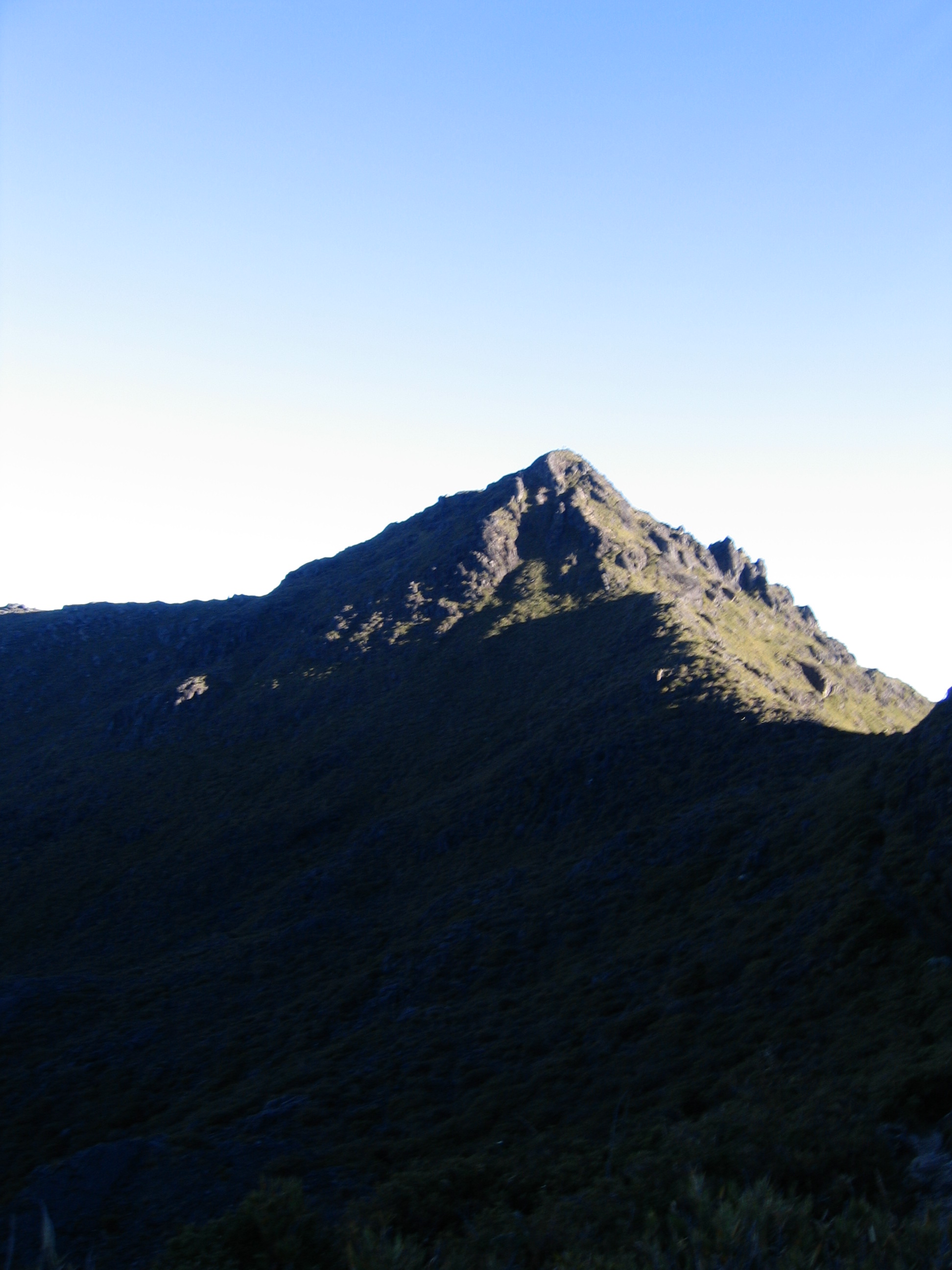
Cerro Chirripó, at some 3,820 meters above sea level, is the highest peak in Costa Rica and one of the highest in Central America. It stands in the heart of the Talamanca Range, inside Chirripó National Park, and climbing it is one of the country's great mountain challenges and experiences: a demanding hike that crosses jungle and cloud forest and ends in a high-mountain páramo landscape, unique in the region.
On clear days the summit offers a legendary reward: the chance to see the Pacific Ocean and the Caribbean Sea at the same time, something rare anywhere in the world. On the top and around it lie the Conejos and Morrenas valleys, lakes of glacial origin and formations that reveal this tropical high mountain was covered in ice during the ice ages, an exceptional geological feature.
This guide runs through the essentials of the climb to Cerro Chirripó with a practical eye: the route and the Crestones shelter, the booking and permit system (mandatory and in heavy demand), the base village of San Gerardo de Rivas, what to bring for the high-altitude cold, the best time to go and tips on getting in shape. A destination for hikers willing to put in a hard effort in exchange for a landscape you won't see twice.
Cerro Chirripó, the roof of Costa Rica, was the land of the Indigenous peoples of Talamanca, for whom the high mountains carried a strong spiritual meaning. Its páramo landscapes and its glacial lakes bear witness that the summit was covered in ice during the Pleistocene glaciations. The name 'Chirripó' is associated, in Indigenous languages, with 'land of eternal waters', for the many lakes and rivers in the area. Chirripó National Park was created in 1975 to protect this exceptional high-mountain ecosystem, part of the vast complex of protected areas in the Talamanca Range, declared a World Heritage Site by UNESCO (Talamanca Range-La Amistad Reserves). The full story is on our history page.
Read the full history ↓The capital province, political and economic heart of Costa Rica: born as a village among mountains, raised by coffee to become the seat of power, and able to leap from the bustle of the National Theater to the páramos of Chirripó —the roof of the country— and to the cloud forests where the quetzal reigns.
Read the history of San José →They depart from San Gerardo De Dota, 35 km away. If you book from this link we earn a commission and you pay no more.
No exact prices: a scale from $ (budget) to $$$$$ (luxury), with 2-3 options per category.
Origins, formation and what the sources say.
Cerro Chirripó, the roof of Costa Rica at some 3,820 meters, rises in the Talamanca Range, a territory historically inhabited by Indigenous peoples such as the Bribri and the Cabécar, whose communities still live on the slopes and in the valleys of this range. For these cultures the high mountains had a strong sacred and mythological weight, tied to their worldviews and to their relationship with nature.
The name 'Chirripó' itself is usually read, according to several traditions, with meanings linked to water and height, such as 'land of eternal waters' or expressions referring to the lakes and rivers that rise on these summits. The region's Indigenous place names reflect the deep connection of its peoples with a landscape of mountains, cloud forest and páramo.
The Talamanca Range, beyond its cultural value, is one of the areas of greatest biodiversity and endemism in Central America, and it holds one of the largest sets of protected areas in the region. For its exceptional natural value, the cross-border group of Talamanca reserves and La Amistad International Park (shared with Panama) was declared a World Heritage Site by UNESCO, a recognition that takes in the surroundings of Chirripó.
One of the most fascinating things about Cerro Chirripó is that its high country still carries the traces of a glacial past. During the Pleistocene glaciations the summits of the Talamanca Range, high and cold enough, were covered by glaciers. The advance and retreat of the ice carved the landscape, leaving U-shaped valleys, cirques and moraine deposits, as well as lakes of glacial origin in areas such as the Conejos and Morrenas valleys.
These lakes and formations make Chirripó one of the few places in Central America where the vestiges of tropical glaciation can be seen so clearly, a geological phenomenon of great scientific interest. Once the ice was gone, the cold climate and the altitude gave rise to the páramo, a high-mountain ecosystem with low vegetation adapted to extreme temperatures, frost and strong solar radiation, more typical of the Andes than of this latitude.
The Chirripó páramo is fragile and unique, with endemic species and a specially adapted flora. Its existence, together with the oak woods and cloud forests on the slopes, makes the high mountains of Talamanca an ecological mosaic of enormous value, which the trail to Chirripó crosses in spectacular fashion, climbing through several vegetation belts to the roof of the country.
Chirripó National Park was established in 1975 to protect this exceptional high-mountain ecosystem, part of the conservation effort Costa Rica mounted in that period and which turned the country into a world reference for protected areas. The park safeguards the páramo, the cloud forests, the oak woods and the basins of the many rivers that rise at these heights and supply water to wide regions of the country.
Chirripó belongs to a larger set of protected areas in the Talamanca Range which, together with La Amistad International Park —shared between Costa Rica and Panama—, forms one of the largest stretches of protected nature in Central America. This complex was inscribed as a World Heritage Site by UNESCO for its extraordinary biodiversity and its natural values.
Given the fragility of the high-mountain ecosystem and the growing popularity of the climb, access to Chirripó is strictly regulated by SINAC: entries and the stay at the Crestones shelter are booked in advance and places are limited. This management seeks to balance the chance for hikers from all over the world to live the experience of topping the country's highest peak with the long-term protection of a unique and irreplaceable landscape.
Although the summits of Talamanca were known to the Indigenous peoples, the scientific 'conquest' of Chirripó by explorers came relatively late, because of how remote and rugged the massif is. Through the 19th century and the early 20th, European and Costa Rican naturalists and geographers traveled the Talamanca Range documenting its flora, fauna and geology, and part of the early survey of the region in the late 19th century is credited to the bishop and explorer Bernardo Augusto Thiel, as well as to other travelers.
The exact height of Chirripó and its status as the country's highest point were pinned down as cartography and geodesy advanced over the 20th century. Scientific interest in its glacial lakes, its páramo and its biodiversity drew researchers who saw in these summits a natural laboratory unique in the tropics.
In time the climb stopped being a purely scientific or exploratory undertaking and opened up to mountaineers and hikers. The village of San Gerardo de Rivas, in the valley of the Chirripó river, established itself as the natural base for the route, and its inhabitants —farmers and muleteers— came to play a central role as guides, porters and hosts for anyone wanting to top the roof of Costa Rica.
Over the last few decades the climb up Chirripó became one of the most coveted mountain experiences in Costa Rica, for Costa Ricans and foreign visitors alike. Topping the summit at dawn, with the chance of seeing both oceans, turned into an almost initiatory goal for the country's trekking enthusiasts, and the classic route from San Gerardo de Rivas, with a night at the Crestones shelter, became the standard itinerary.
That growth in popularity forced a balance between access and conservation. SINAC brought in a system of capacity limits, reservations and permits —today managed online— that caps the number of people who can climb and sleep there each day, protecting the fragile páramo and the shelter. In parallel, the local community organized itself into the Consorcio Chirripó, which runs services such as lodging, meals and luggage portering with muleteers, bringing the families of San Gerardo into the tourism economy.
Today Chirripó is an example of the Costa Rican model of nature tourism: a demanding, memorable mountain experience, tightly regulated to keep it sustainable, in which the visitor not only climbs the country's highest peak but also supports the conservation of the protected area and the development of the mountain community that looks after it.