Viajá con Gus
HomeCanadaGros Morne National Park
Gros Morne National Park
🇨🇦 Canada · Atlantic Coast / Maritime Provinces

Gros Morne National Park

Jump to what you need
📌Province
Gros Morne National Park (Newfoundland and Labrador, Canada). It's on the west coast of the island of Newfoundland, on the Great Northern Peninsula, and it protects an extraordinary stretch of the Long Range Mountains, an extension of the Appalachians. It has been a UNESCO World Heritage Site since 1987 for its exceptional geological value: in its Tablelands the Earth's mantle is exposed, rock from deep inside the planet that is normally never seen at the surface. It combines fjords, mountains, coastline, boreal forest and a geology that helped confirm the theory of plate tectonics
📌Service town
The park is organized around two base villages. Rocky Harbour is the main one, in the north of the park, with the largest range of lodging and restaurants and the nearby Discovery Centre visitor center. Woody Point, in the south, gives access to the Tablelands and Bonne Bay fjord. The gateway by air is Deer Lake Airport (YDF), some 30-70 km from the park depending on the point, with flights from the big Canadian cities. From Deer Lake you rent a car, which is essential for getting around the park
📌Best time to go
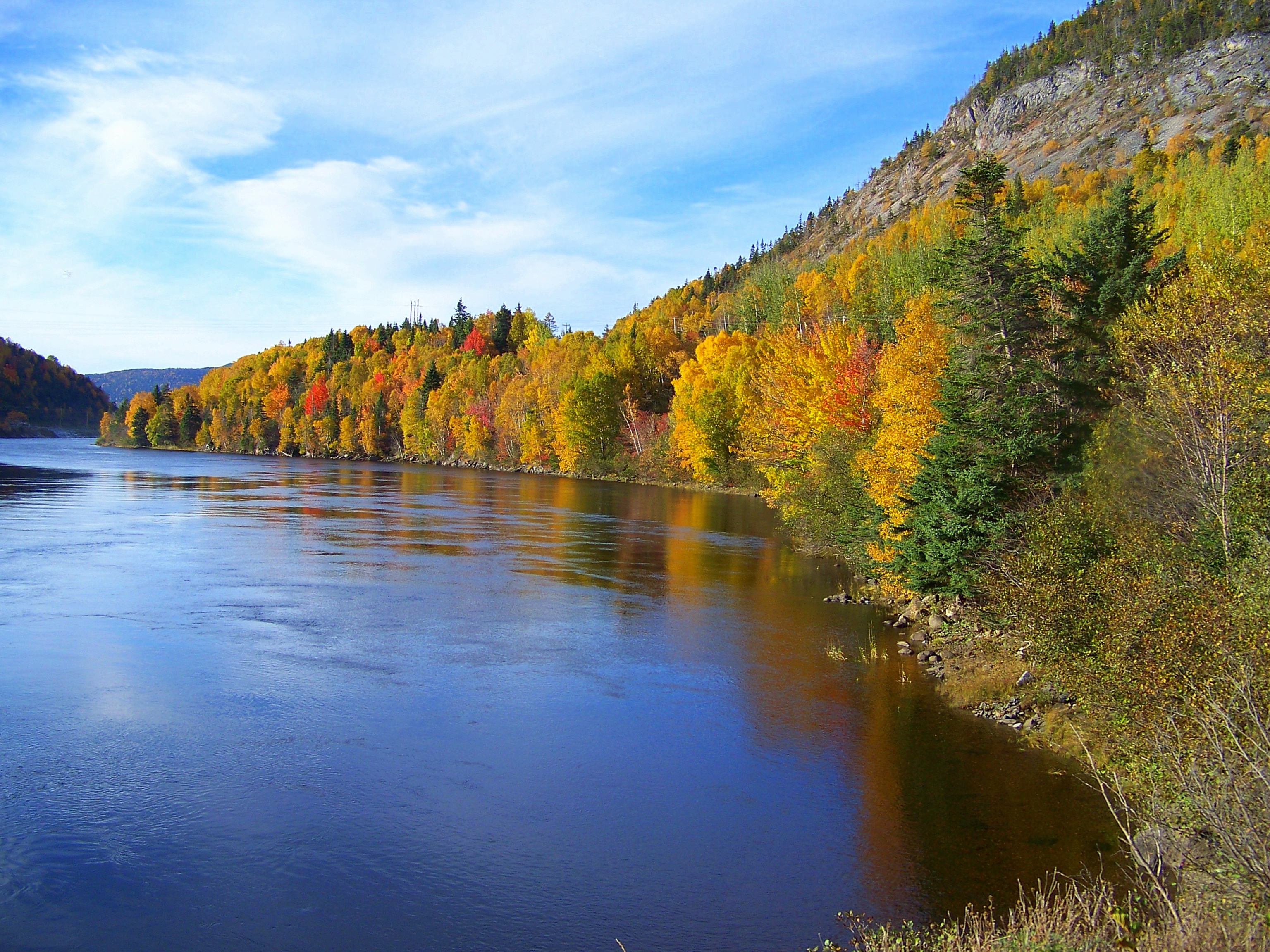
The best season is June to September (ideally July and August), when the trails, the visitor centers and, above all, the boat trips on the Western Brook Pond fjord are running, and the weather is kinder for the mountains and the coast. Early summer lets you see icebergs off the west coast; autumn brings the foliage of the boreal forest. Out of season (late autumn to spring) many services close and the weather is cold, windy and snowy at altitude. The mountains can bring fog and rain in any month, so it pays to be flexible
📌Suggested days
Two days covers the two unmissables: the boat trip on the Western Brook Pond fjord and the walk across the Tablelands (the Earth's mantle). Three or four days add the climb up Gros Morne Mountain, the beaches and lighthouses of the coast (Lobster Cove Head, Green Point), the visitor centers and another trail or two, like Green Gardens. With 5 to 7 days you can cover the park at an unhurried pace and combine it with other points on the Great Northern Peninsula, like L'Anse aux Meadows (the Vikings), further north
💱 CAD exchange rate
Loading rate…
🌤️ Weather in Gros Morne National Park
Loading weather…

Gros Morne National Park, on the west coast of the island of Newfoundland, is one of Canada's great natural treasures and a place where the landscape literally tells the story of the Earth. A UNESCO World Heritage Site, it protects deep fjords carved by glaciers, mountains of the ancient Appalachians, a wild Atlantic coast and, above all, an extraordinary geological phenomenon: the Tablelands, where the Earth's mantle is exposed, the rock from deep inside the planet that is almost never seen at the surface.

Its two great icons sum up that double soul of rock and water. On one side, the Western Brook Pond fjord, a canyon with vertical walls hundreds of meters high carved into the plateau, with waterfalls plunging from the top, which you travel on an unforgettable boat trip. On the other, the Tablelands, a plateau of orange, desolate rock —the exposed mantle— so different from the green around it that it looks like another planet. Add to that Gros Morne Mountain, which gives the park its name, with its bare summit and its views.

This guide covers Gros Morne with a practical, warm eye: how to sail the fjord, how to walk on the Earth's mantle, which other trails are worth it, where to stay (Rocky Harbour, Woody Point) and how to make the most of the season. It's a destination for anyone after grand nature, fascinating geology and the wildest coast in Newfoundland, far from the crowds, with landscapes that rank among the most impressive in the country as the reward.

📖 History of Gros Morne National Park

The Gros Morne region was Indigenous territory for millennia. There is archaeological evidence of very ancient human presence on the west coast of Newfoundland, including the Maritime Archaic people, whose remains were found at sites like Port au Choix, to the north, and later Palaeo-Eskimo and Indigenous peoples. In later times, the coast was frequented by European fishermen: the area was part of the so-called 'French Shore', the coastal strip where France kept fishing rights even after ceding Newfoundland to Britain. Small fishing communities of English, French and Irish roots settled along the coast. The name 'Gros Morne' is French and means, depending on the interpretation, 'great lone mountain' or 'great somber mountain', in reference to the peak that dominates the park. Gros Morne's real global significance, however, is geological: in the mid-20th century, geologists understood that the rocks of the Tablelands were oceanic mantle and deep crust pushed up over the continent during the closing of an ancient ocean (Iapetus) hundreds of millions of years ago, when the plates that formed the Appalachians collided. That evidence was key to confirming the theory of plate tectonics. For its geological value and its landscapes, Gros Morne was established as a national park (agreed in 1973 and formalized later) and declared a UNESCO World Heritage Site in 1987. The full story is on our history page.

Read the full history ↓

🏛️ Gros Morne National Park is in Newfoundland and Labrador

The easternmost province and the last to join Canada: land of the Beothuk and the Inuit, of the first Viking settlement in the Americas, of the epic of the cod and of the geological peaks of Gros Morne.

Read the history of Newfoundland and Labrador →

🗺️ What to see

1
Western Brook Pond (the fjord and the boat trip)
A spectacular canyon of vertical walls and waterfalls, carved by the glaciers, that you travel by boat.
The boat trip on Western Brook Pond is the star experience at Gros Morne and one of the most memorable Canada has to offer. Despite the name ('pond'), it's not a simple lake: it's a freshwater fjord, a deep canyon with almost vertical rock walls rising hundreds of meters (up to about 600 m) above the water, carved by the glaciers during the last ice age. When the ice retreated, the land rose and the fjord was cut off from the sea, filling with the purest fresh water. Sailing between those colossal walls, with waterfalls plunging from above (like Pissing Mare Falls, one of the highest in eastern North America), is an overwhelming experience: you feel tiny against the scale of the landscape. The water of the fjord is extremely pure, almost without nutrients. The tour boats run through the canyon with commentary on the geology and the nature of the place. One important detail: the dock isn't beside the road. To get there you first have to walk about 3 km (one way) along a boardwalk and trail across the coastal plain, which takes about 45 minutes. It's an easy walk but you have to factor it in to make the boat on time. How to get there: by car to the Western Brook Pond parking lot (north of the park), then the 3 km walk to the dock. Best time: June to September, when the boat runs (July-August, peak season). Tips: book the boat trip ahead (it's in high demand), arrive with plenty of time for the walk in, bring a warm layer (it's cool and windy in the fjord) and comfortable shoes. Check schedules and availability depending on the weather.
ℹ️ Distance: North of the park; parking lot + 3 km walk (45 min) to the dock · Best time: June to September (boat in season; July-August peak season) · Admission: Boat trip C$ 99 + HST adult, C$ 55 youth (BonTours; book ahead) + Parks Canada park entry C$ 12.25 adult/day (free from Jun 19 to Sep 7, 2026 with the Canada Strong Pass) (source: BonTours and Parks Canada, verified July 2026) · Duration: Half a day (walk + boat of about 2 h)
2
The Tablelands (the exposed Earth's mantle)
A plateau of orange, desolate rock that is the Earth's mantle surfacing, a landscape unique in the world.
The Tablelands are, along with the fjord, the great reason Gros Morne is a World Heritage Site, and one of the geologically most fascinating places on the planet. They are a plateau of rock in a distinctive orange-ochre color, almost without vegetation, that contrasts astonishingly with the green of the neighboring mountains: it looks, in fact, like a piece of Mars transplanted to Newfoundland. The reason for that oddity is extraordinary: the rock of the Tablelands is peridotite, rock from the Earth's mantle, that is, from deep inside the planet, which is normally tens of kilometers beneath our feet and almost never surfaces. About 500 million years ago, during the closing of an ancient ocean (Iapetus) and the collision of plates that formed the Appalachians, this piece of mantle and ocean floor was pushed up over the continent and left exposed. Its orange color comes from the oxidation of the iron in the rock, and its chemistry, toxic to most plants, explains why almost nothing grows there. The discovery of these rocks was one of the pieces of evidence that helped confirm the theory of plate tectonics. You cross it on the Tablelands Trail, a relatively easy path that heads into this lunar landscape, ideal for understanding the geology (there are guided walks by Parks Canada that are highly recommended). The difference with the green mountain across the valley is one of the most instructive contrasts there is. How to get there: by car, in the southern sector of the park, near Woody Point. Best time: June to September; summer for the guided walks. Tips: bring water, sunscreen (there's little shade) and sturdy shoes; join a Parks Canada interpretive walk to understand what you're looking at. Combine it with the Bonne Bay fjord and Woody Point.
ℹ️ Distance: Southern sector of the park, near Woody Point (by car) · Best time: June to September (guided walks in summer) · Admission: Included in park entry (Parks Canada C$ 12.25 adult/day; free from Jun 19 to Sep 7, 2026 with the Canada Strong Pass; verified July 2026) · Duration: 2 to 4 hours
3
Gros Morne Mountain (the climb to the summit)
The peak that gives the park its name, a demanding hike to a bare summit with views of fjords and sea.
Gros Morne Mountain is the peak that gives the park its name and its second highest summit, at about 800 meters, within the Long Range Mountains. Topping it is the park's great mountain hike and one of the most rewarding in Newfoundland, though also one of the most demanding. The Gros Morne Mountain Trail (also called the James Callaghan Trail) is a long, hard route of about 16 km round trip that takes between 6 and 8 hours. After a first section through the forest, the decisive stretch climbs a steep slope of loose rock (a gully) that tests the legs, before coming out onto the summit plateau, a landscape of bare alpine tundra. From the top, the reward is spectacular 360-degree views: the fjords, the Long Range Mountains, the coast and the Gulf of St. Lawrence. Arctic hares and caribou are often around on the summit. It's a hike only suitable for people in good physical shape and well prepared, with a lot of elevation gain. On top of that, the final climb is usually closed early in the season to protect wildlife during the breeding period, so you have to confirm it's open. How to get there: the trailhead is near Rocky Harbour, reachable by car. Best time: late June/July to September, in good weather (check that the summit is open). Tips: start early, bring plenty of water, food, a warm layer and a windbreaker (it's cold and windy up top), hiking boots, and register if the park asks you to. Don't attempt it in bad weather or fog. If you're not after that much effort, there are gentler trails in the park.
ℹ️ Distance: Near Rocky Harbour; trail of about 16 km round trip (by car to the trailhead) · Best time: July to September in good weather (check that the summit is open) · Admission: Included in park entry (Parks Canada C$ 12.25 adult/day; free from Jun 19 to Sep 7, 2026 with the Canada Strong Pass; verified July 2026) · Duration: Full day (6 to 8 hours of hiking)
4
Bonne Bay and Woody Point
The fjord that splits the park in two and the picturesque historic village that gives access to the Tablelands.
Bonne Bay is the great sea fjord that reaches into the heart of Gros Morne and divides the park into a northern and a southern half. Ringed by mountains, with its arms of water and its villages on the shore, it's one of the prettiest and most peaceful corners of the park, ideal for taking in the landscape, kayaking or catching an excursion boat. On its south shore is Woody Point, a charming historic village of wooden houses that was an important trading port in the past. Today it's the base for the southern sector of the park, the gateway to the Tablelands, and it keeps a quiet, artistic feel, with cafés, galleries, a bookshop and a theater that hosts a well-known literary festival in summer. Nearby is the Discovery Centre, the visitor center for the south of the park, with excellent exhibits on the geology and nature of Gros Morne (including the explanation of the Tablelands). The area also has Memorial University's marine research station (with a small aquarium in season) and coastal trails. Crossing from one side of Bonne Bay to the other (by car around it, or historically by ferry) is part of the experience. How to get there: by car; Woody Point and the south of the park are separated by road from the north (Rocky Harbour), going around Bonne Bay. Best time: June to September; summer for the festival and the activities. Tips: combine Woody Point with the Tablelands and the Discovery Centre in a single day in the south of the park. Enjoy the village atmosphere and its views over the fjord.
ℹ️ Distance: Center of the park; Woody Point on the south shore of Bonne Bay (by car) · Best time: June to September (festival and activities in summer) · Admission: Village free; Discovery Centre included in park entry (Parks Canada C$ 12.25 adult/day; free from Jun 19 to Sep 7, 2026 with the Canada Strong Pass; verified July 2026) · Duration: Half a day
5
Rocky Harbour and the Lobster Cove Head lighthouse
The park's main base village and a historic lighthouse with views of the coast and, in season, whales.
Rocky Harbour is the largest community inside Gros Morne National Park and its main service base: it holds most of the park's hotels, inns, restaurants and shops, which makes it the most convenient place to stay and organize trips in the northern sector. It's a welcoming coastal village, with its harbor and a relaxed feel. A few minutes away is the Lobster Cove Head lighthouse, a historic working lighthouse set on a rocky headland with views of the Gulf of St. Lawrence and the coast. The old keeper's house holds exhibits on the human and natural history of the area, and the lookouts and short trails around it are a lovely place to watch the sunset and, in season, spot whales and even icebergs offshore. Near Rocky Harbour there's also the Berry Hill area (with trails and a lookout), Shallow Bay beach (with dunes) at the northern end of the park, and a public heated saltwater pool to enjoy. It's the ideal base for combining the Western Brook Pond fjord, Gros Morne Mountain and the coast. How to get there: by car, in the northern sector of the park; it's the natural service crossroads. Best time: June to September; the summer sunsets at the lighthouse are magnificent. Tips: book lodging well ahead in high season (supply is limited and in high demand); use Rocky Harbour as base camp for your days in the north of the park.
ℹ️ Distance: Northern sector of the park; the lighthouse a few minutes from the village (by car) · Best time: June to September; sunsets and whales in summer · Admission: Village free; lighthouse and exhibits included in park entry (Parks Canada C$ 12.25 adult/day; free from Jun 19 to Sep 7, 2026 with the Canada Strong Pass; verified July 2026) · Duration: Park base; 1 to 2 hours for the lighthouse and the coast
6
Coastal trails (Green Gardens, Green Point, Coastal Trail)
Hikes along volcanic cliffs, beaches and the park's wild coast, with geology and wildlife.
Beyond its two great icons, Gros Morne offers a network of trails that show the park's other face: the coast of the Gulf of St. Lawrence, wild and full of geology and life. For many people, walking them is as memorable as the fjord and the Tablelands. The Green Gardens Trail is one of the most beautiful: it starts in the Tablelands area and drops toward a coast of cliffs of volcanic origin, with rock pinnacles, sea caves, green meadows above the cliffs and beaches where sheep sometimes graze. It's a trail of several hours and some effort, but the scenic payoff is enormous. Green Point, on the other hand, is famous among geologists: its rock layers exposed on the coast are a global reference point (a 'GSSP', a global standard) for defining a boundary between geological periods, as well as a lovely place for a walk on the beach. There are also gentler trails suitable for everyone, like the Coastal Trail and the Western Brook Pond Trail (the access walk to the fjord itself), Berry Hill, or strolls along the Shallow Bay beaches and the wetlands. Parks Canada offers interpretive programs that add a lot to the experience. How to get there: by car to the different trailheads spread around the park. Best time: June to September; summer for the coast and the beaches. Tips: pick the trail to match your level (Green Gardens is demanding; others are easy), check trail conditions at the visitor center, bring water, a windproof layer and proper footwear. Watch out for the coastal weather, changeable and windy.
ℹ️ Distance: Various points along the park's coast (by car to each trailhead) · Best time: June to September (coast and beaches in summer) · Admission: Included in park entry (Parks Canada C$ 12.25 adult/day; free from Jun 19 to Sep 7, 2026 with the Canada Strong Pass; verified July 2026) · Duration: From 1 hour to a full day depending on the trail
Advertisements
What nobody tells you

💵 Prices

Tickets

TypePrice
Entry to Gros Morne National Park (Parks Canada)C$ 12.25 adult/day in regular season (C$ 10 in winter); under 18 free; annual pass C$ 60.50 adult. Free admission from June 19 to September 7, 2026 with the Canada Strong Pass (source: Parks Canada, verified July 2026)
Boat trip on Western Brook Pond (BonTours)C$ 99 + HST adult, C$ 55 youth; book ahead (source: BonTours, verified July 2026)
Tablelands Trail and guided walksTrail included with park entry; Parks Canada interpretive walks free or low cost (verified July 2026)
Discovery Centre (Woody Point) and visitor centerIncluded in park entry (C$ 12.25 adult/day; free Jun 19–Sep 7, 2026 with the Canada Strong Pass; verified July 2026)
Lobster Cove Head lighthouse (exhibits)Included in park entry (C$ 12.25 adult/day; free Jun 19–Sep 7, 2026 with the Canada Strong Pass; verified July 2026)
Trails (Gros Morne Mountain, Green Gardens, coastal)Included with park entry
Camping in the park (Parks Canada campgrounds)Approx. C$ 26–30 a night (unserviced site); oTENTik (glamping) approx. C$ 100–130 a night (verified July 2026)
🔄 updated monthlyOfficial / reference values · double-check when buying

Activities and tours

ActivityPriceDurationOperator
Boat trip on the Western Brook Pond fjordC$ 99 + HST adult, C$ 55 youth (source: BonTours, verified July 2026)Half a day (walk + 2 h boat)BonTours (park-authorized operator)
Guided walk across the Tablelands (the Earth's mantle)Free or low cost, on top of park entry (verified July 2026)2-4 hParks Canada (interpretive programs)
Climb up Gros Morne MountainPark entry only (C$ 12.25 adult/day; verified July 2026)Full day (6-8 h)Self-guided (check that the summit is open)
Kayaking or a boat ride on Bonne BayApprox. C$ 50–90 per person depending on length (verified July 2026)Half a dayLocal operators from Norris Point / Rocky Harbour
Coastal hiking (Green Gardens, Coastal Trail)Park entry only (C$ 12.25 adult/day; verified July 2026)From 1 h to a full daySelf-guided / Parks Canada
Whale and iceberg watching from shore or by boatFree from shore; by boat approx. C$ 60–90 per person depending on season (verified July 2026)VariableLocal operators (depending on the iceberg/whale season)
Interpretive programs and wildlife watchingMany free with park entry; some low cost (verified July 2026)VariableParks Canada
🔄 updated monthlyOfficial / reference values · double-check when buying
Advertisements

🚌 How to get there and distances

Getting around

ModePriceDurationNotes
Car / car rentalRental approx. C$ 60–110 per day from Deer Lake; fuel approx. C$ 1.70–2/liter (verified July 2026)VariableEssential. The park is very large, its attractions are spread out (north and south, separated by Bonne Bay) and there's no internal public transport. The usual approach is to rent a car at Deer Lake airport. Watch out for moose and caribou on the roads
Organized trips and toursApprox. C$ 60–150 per person depending on the trip (verified July 2026)Variable
On foot along the park trailsIncluded with park entryVariableInside the park, the attractions are covered on foot along signposted trails of varying difficulty. The access walk to Western Brook Pond is unavoidable if you want to take the boat
Boats (fjord boat, kayak, Bonne Bay)Western Brook Pond C$ 99 + HST adult; kayaking/rides on Bonne Bay approx. C$ 50–90 (source: BonTours, verified July 2026)VariableThe Western Brook Pond boat and the Bonne Bay rides are an essential part of the park experience
🔄 updated monthlyOfficial / reference values · double-check when buying

How to get there

RouteAirlines / operatorsAvg. priceDuration
Deer Lake Airport (YDF) → Rocky Harbour / the parkCar rental at the airport; some shuttles/toursRental car approx. C$ 60–110/day; taxi/shuttle approx. C$ 80–150 (verified July 2026)Approx. 45 min to 1.5 h depending on the point in the park
Flights to Deer Lake from Toronto, Montreal, Halifax, St. John'sAir Canada, WestJet, PAL Airlines and othersApprox. C$ 250–600 one way depending on origin and season (verified July 2026)Depending on origin
By road from St. John's or other parts of Newfoundland (Trans-Canada Highway)Own or rental carFuel approx. C$ 90–140 from St. John's (about 700 km; verified July 2026)Long (approx. 7-8 h from St. John's)
Ferry to Newfoundland (Marine Atlantic) + drive to the parkMarine Atlantic (to Port aux Basques) + carFerry approx. C$ 22 per adult passenger + C$ 57 per standard vehicle, one way (fares cut 50% by the government since Aug 2025, with a fuel surcharge) (source: Marine Atlantic, verified July 2026)Crossing of about 7 h + drive to Gros Morne (approx. 3 h)
Combining with the Great Northern Peninsula (L'Anse aux Meadows)Own carFuel approx. C$ 50–80 one way (about 430 km; verified July 2026)Approx. 5 h north from the park
🔄 updated monthlyOfficial / reference values · double-check when buying

🏨 Where to stay

No exact prices: a scale from $ (budget) to $$$$$ (luxury), with 2-3 options per category.

CategoryPriceRecommended options
Hotels and inns in Rocky Harbour (main base)$$$$$The largest range in the park: mid-range hotels and inns in Rocky Harbour (e.g. Ocean View Hotel, Gros Morne Cabins): approx. C$ 140–230 a night in high season (verified July 2026). Book well ahead (limited supply)
Charming inns and B&Bs (Woody Point and the coast)$$$$$Historic inns and charming bed & breakfasts in Woody Point and along the coast (e.g. The Old Loft, Aunt Jane's Place): approx. C$ 130–220 a night (verified July 2026), with a quiet feel and views over the fjord
Cabins, chalets and rentals$$$$$Cabins, chalets and rental houses in the park's villages: approx. C$ 130–250 a night (verified July 2026), handy for families or longer stays, with your own kitchen
Camping and budget options (Parks Canada)$$$$$Parks Canada campgrounds (Berry Hill, Lomond, Trout River, Green Point): approx. C$ 26–30 a site; oTENTik glamping approx. C$ 100–130 a night; hostels from C$ 35–60 (verified July 2026). Book ahead

🍴 Where to eat

TypePriceOptions / signature dish
Seafood and Newfoundland cooking$$$$$Fresh fish, seafood, north coast shrimp and traditional Newfoundland dishes in Rocky Harbour and Woody Point (e.g. Fishermans Landing, Java Jack's): mains approx. C$ 22–40 (verified July 2026)
Restaurants and cafés in the base villages$$$$$Family restaurants, gastropubs and cafés in Rocky Harbour and Woody Point, with Canadian and local cooking: approx. C$ 16–30 per dish (verified July 2026). Limited supply, worth booking in season
Home cooking, bakeries and markets$$$$$Bakeries, home cooking and small shops to stock up before the hikes: sandwiches, soups and baked goods approx. C$ 6–16 (verified July 2026). Useful if you're staying in a cabin with a kitchen
Local chef-driven cooking and food experiences$$$$$Places working with local products (seafood, game, wild berries), sometimes tied to charming inns: set menu or dishes approx. C$ 30–55 (verified July 2026). For a special meal in the park
Advertisements

📖 History of Gros Morne National Park

Origins, formation and what the sources say.

The first inhabitants: Maritime Archaic, Palaeo-Eskimo and Indigenous peoples

Thousands of years before a geologist set foot on the Tablelands, this coast already held human stories. The west coast of the island of Newfoundland, where Gros Morne National Park now stretches, has been inhabited for millennia, and archaeology has revealed in the region a succession of peoples who adapted to a coast rich in marine resources but harsh in climate. The oldest and best known is the so-called Maritime Archaic tradition, hunters and fishers who worked the shoreline several thousand years ago; one of their most important burial grounds was found at Port au Choix, further north on the same peninsula, with graves that have yielded valuable knowledge about their culture.

Those peoples were followed, in different waves, by Palaeo-Eskimo groups (such as the Dorset) and, later, by Indigenous peoples. All of them lived by hunting marine mammals, fishing, hunting caribou and gathering, drawing on the seasonal abundance of the Gulf of St. Lawrence coast. Their camps, stone tools and remains are scattered across the region and testify to a long human presence well before the Europeans arrived.

That depth of time is part of the value of Gros Morne: the park protects not only an extraordinary geological landscape but also the traces of thousands of years of human adaptation to a challenging environment at one of the edges of the continent.

The succession of cultures on the west coast of Newfoundland
Archaeology documents on the west coast of Newfoundland a sequence of peoples (Maritime Archaic, Palaeo-Eskimo groups like the Dorset, and later Indigenous peoples), well evidenced at sites like Port au Choix. The chronology and the relationships between these cultures are still being researched and refined, so they should be taken as a general picture still evolving.
Source: https://www.thecanadianencyclopedia.ca/en/article/port-au-choix

The 'French Shore' and the European fishing communities

Like all of Newfoundland, the Gros Morne region entered the European orbit through the cod fishery in the Gulf of St. Lawrence and the waters of the northwest Atlantic. But the west coast of the island had a particularity: for a long time it was part of the so-called 'French Shore'. After the wars and treaties that between the 17th and 18th centuries handed Newfoundland over to Britain, France nonetheless kept the right to fish and dry cod on certain stretches of the coast, including much of the west.

This created a peculiar situation: during the fishing season, French fishermen occupied the coast seasonally, while permanent settlement was limited or discouraged so as not to conflict with those rights. Over time the French rights faded away (definitively in the early 20th century) and the coast opened fully to settlement.

Over the centuries, small fishing communities of English, Irish, French and mixed roots formed in the villages of the area —Rocky Harbour, Woody Point, Trout River, Cow Head and others—, living off the fishery and the resources of the coast and the mountains. Woody Point, in particular, became a trading port of some importance. Those communities, with their seafaring culture and their traditional way of life, are part of the living heritage that today sits alongside the national park.

The 'French Shore' and its effects on settlement
Sources agree that the west coast of Newfoundland was part of the 'French Shore', where France kept seasonal fishing rights even after ceding the island to Britain, which for a long time limited permanent settlement. The exact extent and duration of those rights varied under successive treaties.
Source: https://en.wikipedia.org/wiki/French_Shore

The name 'Gros Morne' and the Long Range Mountains

The park's name comes from its most emblematic mountain, Gros Morne, a French place name that betrays the legacy of the 'French Shore'. 'Gros Morne' is usually translated as 'great lone mountain' or 'great somber mountain': 'gros' means 'big', and 'morne' is a word used in colonial French for an isolated, rounded hill (and which also evokes something 'somber' or 'gloomy'). The name describes well this bare-topped peak that rises, solitary and massive, above the landscape.

Gros Morne Mountain is part of the Long Range Mountains, a range that runs along western Newfoundland and forms the northeastern end of the Appalachians, the very ancient chain that stretches across eastern North America. Although they are modest in height today, worn down by hundreds of millions of years of erosion, they were originally part of a far more imposing system, raised by the great continental collisions of the geological past.

These mountains, their alpine tundra plateaus, their glacier-carved valleys and their fjords form the backbone of the park. Walking them —whether to the summit of Gros Morne or across the plateaus— means covering a fragment of the Appalachians at one of their most spectacular and best preserved ends.

The meaning of 'Gros Morne'
The most widespread interpretation translates 'Gros Morne' from French as 'great lone mountain' or 'great somber mountain', from 'gros' (big) and 'morne' (isolated hill / somber). It's an accepted etymology, though the precise translations can vary slightly from source to source.
Source: https://www.thecanadianencyclopedia.ca/en/article/gros-morne-national-park

The Tablelands, the Earth's mantle and plate tectonics

Gros Morne's real global significance is geological, and its heart is the Tablelands, one of the wonders of the planet's geology. There, in the middle of Newfoundland's green landscape, stretches a plateau of orange, desolate rock where almost nothing grows: a setting so alien it looks Martian. The explanation is astonishing: that rock, called peridotite, does not belong to the Earth's surface but to its mantle, the layer tens of kilometers deep, beneath the crust. In the Tablelands, that deep mantle is, incredibly, in plain sight.

How did it get here? The answer is a journey of hundreds of millions of years. About 500 million years ago there was an ancient ocean, the Iapetus, separating continental masses. As that ocean closed and the plates collided —the process that would end up forming the Appalachians and, much later, the supercontinent Pangaea—, fragments of the ocean floor and the mantle beneath it were pushed and mounted onto the edge of the continent instead of sinking. Geologists call those fragments of oceanic crust and mantle emplaced on dry land 'ophiolites', and the Tablelands are one of the most complete and accessible examples in the world.

Studying these rocks was of enormous scientific importance: it provided decisive evidence for confirming the theory of plate tectonics, the revolutionary idea that the Earth's surface is made of plates that move, collide and pull apart. That's why Gros Morne is a place of pilgrimage for geologists from around the world, and why UNESCO recognized it. The orange color of the Tablelands comes from the oxidation of the iron in the peridotite, and its chemistry, poor in nutrients and rich in metals toxic to plants, explains its bare, lunar look.

The Tablelands as an ophiolite and as evidence for plate tectonics
There is scientific consensus that the Tablelands are an ophiolite: a fragment of mantle and oceanic crust from the ancient Iapetus Ocean, emplaced on the continent during the formation of the Appalachians hundreds of millions of years ago. Studying it helped confirm the theory of plate tectonics. The dates and the details of the process are still being pinned down by geological research.
Source: https://whc.unesco.org/en/list/419/

The glacial fjords and the puzzle of Western Brook Pond

If the Tablelands tell the deep story of the Earth's interior, the fjords of Gros Morne tell the story of ice. During the great ice ages, enormous masses of ice covered Newfoundland and, as they pushed through the valleys of the Long Range Mountains, they carved and deepened them, turning river valleys into spectacular gorges with almost vertical walls. When the ice retreated, about 10,000 years ago, the fjords were left behind, some of them still connected to the sea and others locked inland.

The most famous is Western Brook Pond. Its modest name ('pond', a very Newfoundland usage) doesn't do it justice: it's a freshwater fjord, a canyon more than 15 km long with rock walls up to about 600 meters high, cut by waterfalls that plunge from the top. Its geological story is curious: it was originally a sea fjord, connected to the ocean, but after the glaciers retreated the land, freed from the weight of the ice, rose (a phenomenon called isostatic rebound) and left the fjord cut off from the sea. Over time its waters turned fresh and extraordinarily pure, with very few nutrients and minerals.

Sailing that canyon today —after the roughly 3 km access walk across the coastal plain— is one of the park's great experiences and a direct way to grasp the power of the glaciers that sculpted this landscape. Western Brook Pond is the most reproduced image of Gros Morne and one of Canada's natural icons.

The origin of Western Brook Pond as a former sea fjord
Geological sources agree that Western Brook Pond is a former fjord carved by the glaciers that was cut off from the sea after the last ice age by the rising of the land (isostatic rebound), turning into a lake of very pure fresh water. That's the standard explanation of what makes it unusual.
Source: https://parks.canada.ca/pn-np/nl/grosmorne/nature

The creation of the park and UNESCO World Heritage status (1987)

Recognition of this region's exceptional value —its unique geology, its fjords, its biodiversity— led the government of Canada to protect it as a national park. The establishment of Gros Morne was agreed in the 1970s (a federal-provincial agreement in 1973) and was formalized over the following years, with Parks Canada created as the manager of the area. As in many parks, setting it up meant reconciling conservation with the presence of the fishing communities living in the area, some of which remain inside or beside the park (the so-called 'enclaves').

The great international milestone came in 1987, when UNESCO inscribed Gros Morne on the World Heritage List. The designation recognized two kinds of outstanding universal value. On one side, the geological: the Tablelands, with their exposed Earth's mantle and their status as an ophiolite, offer a superb illustration of the process of plate tectonics and of the history of the Earth. On the other, the scenic and natural: the glacial fjords, the Appalachian mountains, the coastal cliffs, the alpine tundra and the boreal forest make up an ensemble of outstanding beauty.

Since then, Gros Morne has established itself as one of Canada's most admired national parks and an essential destination in Newfoundland, combining science, wilderness and the seafaring culture of the west coast. Walking on its Earth's mantle, sailing its fjords or topping its mountain means looking into some of the deepest chapters of the planet's history, in one of the most spectacular corners of Atlantic Canada.

What UNESCO recognizes in Gros Morne (1987)
The inscription of Gros Morne as a World Heritage Site in 1987 rests both on its geological value (the Tablelands as an ophiolite illustrating plate tectonics and the history of the Earth) and on its scenic and natural value (glacial fjords, mountains, coast and ecosystems). That's the dual criterion usually cited for the site.
Source: https://whc.unesco.org/en/list/419/

📚 Bibliography

  • Wikipedia (ES) — «Parque nacional Gros Morne»: https://es.wikipedia.org/wiki/Parque_nacional_Gros_Morne
  • Wikipedia (EN) — «Gros Morne National Park»: https://en.wikipedia.org/wiki/Gros_Morne_National_Park
  • Parks Canada — «Gros Morne National Park»: https://parks.canada.ca/pn-np/nl/grosmorne
  • UNESCO — «Gros Morne National Park»: https://whc.unesco.org/en/list/419/
  • The Canadian Encyclopedia — «Gros Morne National Park»: https://www.thecanadianencyclopedia.ca/en/article/gros-morne-national-park
  • Wikipedia (EN) — «Tablelands (Newfoundland)»: https://en.wikipedia.org/wiki/Tablelands_(Newfoundland)
  • Wikipedia (EN) — «Western Brook Pond»: https://en.wikipedia.org/wiki/Western_Brook_Pond
  • Wikipedia (EN) — «Long Range Mountains»: https://en.wikipedia.org/wiki/Long_Range_Mountains
  • Wikipedia (EN) — «Ophiolite»: https://en.wikipedia.org/wiki/Ophiolite
  • The Canadian Encyclopedia — «Port au Choix»: https://www.thecanadianencyclopedia.ca/en/article/port-au-choix

❓ Frequently asked questions

Why is Gros Morne a World Heritage Site?+
Mainly for its exceptional geological value. In the Tablelands the Earth's mantle (peridotite) is exposed, rock from deep inside the planet that is almost never seen at the surface: it was pushed up over the continent hundreds of millions of years ago during the plate collision that formed the Appalachians, and studying it helped confirm the theory of plate tectonics. Add to that glacial fjords like Western Brook Pond and some spectacular landscapes. UNESCO inscribed it in 1987.
How much is the Western Brook Pond boat and what are the two unmissable things in the park?+
The boat trip on the Western Brook Pond fjord (a canyon of vertical walls and waterfalls, reached after a 3 km walk) costs C$ 99 + HST per adult and C$ 55 per youth in 2026 (BonTours), and it's worth booking ahead. The other unmissable experience is the walk across the Tablelands, the exposed Earth's mantle, an orange landscape that looks like another planet and that you can walk free with park entry. If you only have two days, those are the two plans you can't miss.
How much is entry to Gros Morne National Park?+
In regular season daily entry costs C$ 12.25 per adult (C$ 10.75 seniors; under 18 free), and there's a Parks Canada annual pass for C$ 60.50. A key point for 2026: thanks to the Canada Strong Pass, admission to Parks Canada sites is free from June 19 to September 7, 2026, right in the middle of high season. Park entry covers the Tablelands, the trails, the Lobster Cove Head lighthouse and the Discovery Centre; the Western Brook Pond boat (BonTours) is paid separately.
Do I need a car to visit Gros Morne?+
Yes, it's practically essential. The park is enormous, its attractions are widely spread (the north and the south are separated by the Bonne Bay fjord) and there's no internal public transport. The usual approach is to fly to Deer Lake and rent a car there. When driving the roads, take real care with moose and caribou, above all at dawn and dusk.
When is the best time to go?+
June to September, ideally July and August, when the trails, the visitor centers and, above all, the Western Brook Pond boat are running and the weather is kinder. Early summer lets you see icebergs offshore; autumn brings the foliage of the boreal forest. Out of season many services close and it's cold, with snow at altitude. The mountains can bring fog and rain in any month.
Do you have to be very fit for the trails?+
It depends on the trail. The climb up Gros Morne Mountain is long (about 16 km) and hard, only for people in good shape and well prepared, with a very steep climbing section. Green Gardens also takes some effort. But there are plenty of easy trails for everyone: the access walk to the Western Brook Pond fjord, the Tablelands Trail, the coastal and beach walks. Pick according to your level and check trail conditions at the visitor center.
Where should you stay?+
Rocky Harbour, in the north, is the main base and holds the largest range of lodging, restaurants and services; it's the most convenient for the fjord and the mountain. Woody Point, in the south, is a charming village, an ideal base for the Tablelands and Bonne Bay. Supply is limited and in high demand, so you have to book quite far ahead in high season (summer).
Can I combine Gros Morne with the Vikings at L'Anse aux Meadows?+
Yes, it's a classic combination. L'Anse aux Meadows, the Viking World Heritage site and the oldest confirmed European settlement in the Americas, is further north on the same peninsula (the Great Northern Peninsula). It means several hours of driving north from Gros Morne, so it's worth adding days to the itinerary. It's a spectacular trip along the west coast of Newfoundland.
Sources consulted (15)
Still planning?
Explore more destinations in Canada
See all destinations →
Advertisements
Image credits
Photos from Wikimedia Commons, each under its own licence (CC BY, CC BY-SA or public domain). Open each file to see its author and licence.
Nature's Autumn Palette on Newfoundland's Humber River in