Viajá con Gus
HomeArgentinaMina Clavero
Mina Clavero
🇦🇷 Argentina · Córdoba and the Center

Mina Clavero

Jump to what you need
📌Province
Córdoba — Traslasierra Valley, at the foot of the Sierras Grandes (San Alberto department)
📌Service city
The city of Córdoba (~150-170 km to the northeast via the Camino de las Altas Cumbres / RP34, around 2.5 to 3 hours) or Villa Dolores (~45 km to the south, the largest town in Traslasierra)
📌Best time to go
Summer (December to March) for rivers, swimming spots and beaches; spring and autumn for pleasant weather, trekking and fewer people
📌Suggested days
3 to 5 days (a couple of days for the river and the swimming spots; the Camino de los Túneles, the Rocsen Museum in Nono and the Altas Cumbres for the rest)
💱 ARS exchange rate
Loading rate…
🌤️ Weather in Mina Clavero
Loading weather…

Mina Clavero is the tourist heart of the Traslasierra Valley, on the far side of the Sierras Grandes of Córdoba, and probably the destination with the most water in the whole province. Three rivers run through town — the Mina Clavero, the Panaholma and the Los Sauces — along with countless streams that carve natural pools, slides and waterfalls into the rock. It's no accident that the Mina Clavero River was voted one of the Seven Natural Wonders of Argentina: here, water is the star of the summer.

The town is small and easy to walk. From the central bridge you can reach famous swimming spots in a few minutes, such as El Nido del Águila, where rock walls up to 22 meters high box in the river and form deep pools, or quieter stretches like Los Elefantes (also called Los Cajones) and La Toma, a genuine natural water park of stone potholes and slides. It's a destination built for family downtime, with sandy beaches, cold sierra water and a long tradition of Argentine summer holidays.

But Mina Clavero is much more than the river. It's the ideal base for exploring Traslasierra: a few kilometers away is Nono, with the astonishing Rocsen Museum; the legendary Camino de los Túneles, a 1930s feat of engineering that crosses the Pampa de Pocho between extinct volcanoes and palm groves; the Camino de las Altas Cumbres, which climbs to the Pampa de Achala and Quebrada del Condorito National Park; and the approaches to Cerro Champaquí, the highest peak in Córdoba. River by day, sierras and scenic roads the rest of the time: that mix is what keeps Mina Clavero a classic that never goes out of style.

📖 History of Mina Clavero

The Traslasierra Valley was home to the Comechingones (their local groups, the tinquinas), who farmed the land with irrigation channels and left their mark on the name of the place. Tradition says the area was called Milac Navira, after a local chief, and that the present name derived from it; another version holds that it comes from an old 'Mina de Clavero', a mining operation linked to the Clavero family, a common surname in the district. As a settlement, Mina Clavero has existed for more than four centuries, but with no firm founding date. In 1887 Cura Brochero persuaded Doña Anastasia Fabre de Merlo to open the first guesthouse, the founding gesture of local tourism; the municipality was created in 1928 and October 11 — the day Doña Anastasia died, in 1946 — was adopted as the date of the town's spiritual and symbolic founding. The full story is on our history page.

Read the full history ↓

🏛️ Mina Clavero is in Córdoba

The landlocked province of sierras and rivers: Comechingón land founded by Cabrera in 1573, seat of the oldest university in the country and of the great Jesuit legacy, cradle of the University Reform and of the Cordobazo, capital of sierra tourism and of cuarteto.

Read the history of Córdoba →

🗺️ What to see

1
El Nido del Águila
The most famous swimming spot in Mina Clavero, about 1.5 km from the center (reached along calle Urquiza, by car or on foot). Rock walls up to 22 meters high box in the river and form deep pools of crystal-clear water. There's a trail and a viewpoint. Unmissable and heavily photographed.
El Nido del Águila is the postcard image of Mina Clavero and the first place almost everyone heads for on arriving in town. Here the Mina Clavero River is squeezed between granite walls shaped by the erosion of water and wind, forming a natural bowl of greenish, crystal-clear water that in some stretches is several meters deep. It's a spectacular landscape: polished rock, cold sierra water and a trail with a viewpoint that lets you take in the canyon from above before heading down to the beach. What made the place famous is cliff diving. From the highest stone ledges, daring jumpers throw themselves into the pool in front of an audience; it's a spectacle that draws visitors from all over the country and even from abroad. Important: the jump is only done by people with experience and full knowledge of the depth; for most visitors, the sensible thing is to swim in the safe areas, sunbathe on the rocks and walk the trail to the viewpoint. Getting there is very easy. It's about 1.5 km from the center of Mina Clavero, barely eleven blocks following the signs along calle Urquiza. You can walk it as a pleasant stroll, cycle or drive; there are also remises that get you there in a few minutes. Access to the public area is free, though in high season it's worth arriving early because it fills up and parking is limited. The best time is summer, from December to March, when the heat makes you want to get in the water and the river is at its best flow for swimming. The water is cold all year, so you get in a bit at a time. Out of season the place is still worth it for the scenery and the quiet, ideal for photos and walks without the summer crowds. As at every sierra swimming spot, bring rubber shoes or water sandals (the stones are slippery), sunscreen and drinking water, and always respect the signs about deep areas and currents. After rain in the Altas Cumbres the river can rise suddenly: if the sky is heavy upstream, the prudent thing is to move away from the channel.
ℹ️ Distance from the center: ~1.5 km (about 11 blocks along calle Urquiza) · Height of the rock walls: Up to about 22 meters of granite · Access: Free and open in the public area; on foot, by bike or by car · Best time to go: Summer (December to March) for swimming
2
The Mina Clavero River and its confluence
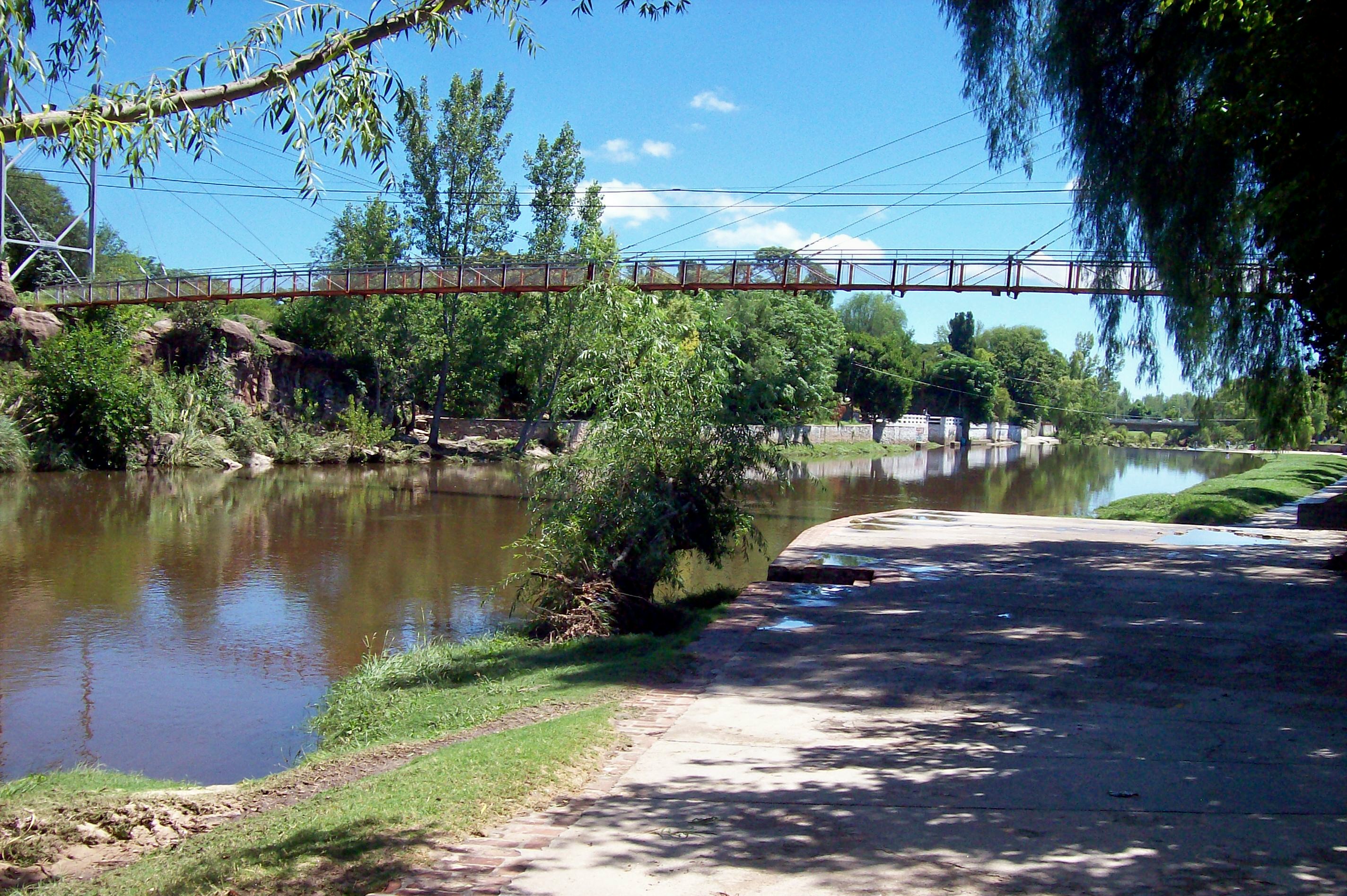
The river that runs through the center, voted one of the Seven Natural Wonders of Argentina. It rises in the Altas Cumbres with cold water that, at the level of the town, merges with the warmer water of the Panaholma River to form the Los Sauces River. Its beaches and walkways are the heart of summer life.
The Mina Clavero River is, literally, the backbone of the destination: it gives the town its name, runs through it end to end and concentrates the summer life of everyone who comes to the valley. Its recognition as one of the Seven Natural Wonders of Argentina is no accident: along its course it carves pools, potholes, slides and sandy beaches into the rock, one after another, forming a genuine system of natural swimming spots. The river rises high in the Altas Cumbres, comes down cold and clear and, at the level of the town, meets the Panaholma River, whose water is somewhat milder; that confluence gives rise to the Los Sauces River, which carries on down the valley. That mix of temperatures is part of the charm: there are freezing stretches, ideal for a bracing dip, and gentler, warmer pools where you can stay for hours. The best thing about the Mina Clavero River is that it's within easy reach. From the central bridge and the town center you can walk to beaches, walkways and swimming spots. You don't need a car to enjoy it: you go with the deck chair, the umbrella and the mate, and pick your stretch according to the plan, from the busiest ones with services to quieter corners upstream or downstream. The star season is summer, from December to March, when the water is inviting and the whole town revolves around the river. In those months there are more people and services run at full tilt. In spring and autumn the flow and the scenery are still lovely for walking the banks, though the water is too cold for many. In winter the river is pure landscape and silence. As a practical note, keep in mind that this is a mountain river: the water is cold, floods after sierra storms can be sudden and the stones on the bed are slippery. Water shoes, attention to the signs, keeping an eye on the kids and moving away from the channel when the weather turns bad upstream are the basic precautions for enjoying it without a scare.
ℹ️ Distinction: One of the Seven Natural Wonders of Argentina · Confluence: Joins the Panaholma River to form the Los Sauces River · Access: From the center and the bridge, on foot · Best time for swimming: Summer (December to March)
3
La Toma swimming spot
A stunner on the river: its stone bowl and natural slides turn it into a water park made by nature. A big favorite with families for a day out.
La Toma is one of the best-loved corners of Mina Clavero for a family day out. Its great draw is a stone bowl ringed by natural slides that the water has polished over centuries: the result is a genuine water park built by nature, where adults and kids slide down the rocks and plunge into pools of freezing, transparent water. The setting adds to the charm: the spot sits in a pocket of sierra vegetation, with beaches to lay out the deck chair, natural shade and room to spend the whole day. It's one of those places you arrive at early, settle into with mate and food, alternating swims with rests in the sun, and stay until late afternoon. Many sectors have services such as a shop, toilets and areas for an asado, though it's worth checking availability on the day. La Toma is a few kilometers from the center of Mina Clavero, on the road that connects with the craftspeople's area and Cura Brochero. It's an easy drive of a few minutes, and in high season there are usually transport and remises. Being a little further out than El Nido del Águila, it tends to have a slightly more relaxed feel, though at the height of summer it also gets plenty of visitors. The best time to make the most of it is summer, when the heat makes the slides and the stone bowl irresistible. The water, as at every swimming spot in the valley, is cold all year. In spring and autumn the place is ideal for a walk or a quiet picnic, with the river as a backdrop and far fewer people. Among the practical tips: non-slip footwear for moving over the wet stones, care with children on the slides and in the deeper pools, sunscreen and a hat. And, as always on sierra rivers, watch the weather at the headwaters: a storm upstream can raise the flow quickly.
ℹ️ Draw: Stone bowl and natural slides (a natural water park) · Distance from the center: A few km, on the road to the craftspeople's area / Cura Brochero · Ideal for: A full family day · Best time to go: Summer (December to March)
4
Los Elefantes (Los Cajones)
A swimming spot of boxed-in water and great calm. At the end of the narrows, where the channel opens out, the rock formations on either side look like elephants and gave the place its name. Ideal for a more peaceful day.
Los Cajones and Los Elefantes are really two adjoining stretches of the same walk along the Los Sauces River, and together they make up one of the most photogenic corners of Mina Clavero. In the Los Cajones section, the river runs boxed in between vertical rock walls that form rapids and pools of varying depth; the water moves between narrow walls, creating a closed-in, spectacular landscape. Where the narrows open out, Los Elefantes appear: on either side of the channel, two great masses of granite sculpted by erosion recall the silhouette of elephants, and between them the water slips down in a small waterfall before spreading into wide beaches of golden sand. That contrast — the dramatic narrows followed by broad, gentle beaches — is what makes the place so special and perfect for combining a swim, photos and a rest. The spot is very close to the center of Mina Clavero, a few minutes away, and easy to reach by car or even on foot depending on where you set out from. Because of its layout it usually offers quieter sectors than the central swimming spots, perfect if you're after a peaceful day, with the sandy beaches as a big plus for resting in the sun. The ideal season is summer, from December to March, when the river is at its best flow and the heat invites a swim. Outside those months, the main draw is the landscape: the rock formations and the contrast between narrows and beaches are worth the trip even without getting in the water, especially in spring and autumn with good light for photography. As everywhere in the valley, take extra care in the boxed-in sections: currents in the rapids can be stronger than they look and the rocks are slippery. Water shoes, attention to deep areas, care with children and moving away from the channel during storms at the headwaters are the standard recommendations.
ℹ️ River: Los Sauces River (boxed in between rock walls) · Origin of the name: Elephant-shaped rock formations on both banks · Distance from the center: A few minutes; reachable by car or on foot · Best time to go: Summer (December to March)
5
Source and waterfall of the Mina Clavero River
About 30 km from town, in the Altas Cumbres, an imposing drop of some 100 meters marks the source of the river. You take it in from a natural viewpoint after an easy walk. A high-country highlight.
The source of the Mina Clavero River is one of the most striking outings in the Altas Cumbres and the perfect complement to enjoying the river in town: here you see where it all begins. High in the sierra, an imposing waterfall of a little over 100 meters marks the origin of the watercourse that later runs down to the valley. It's one of the tallest falls in Córdoba and a first-rate natural spectacle. The waterfall is seen from a natural viewpoint known as 'El Balcón', reached after a walk along a mountain trail of about 600 meters, with steps, that takes around half an hour. From that balcony you take in the drop in all its scale and, downstream, the view opens towards the Quebrada del Sobrado, home to condors that can often be seen gliding over the gorge. The trail is of medium difficulty, but the scenic payoff more than justifies it. The place is some 27 to 30 km from Mina Clavero, on the Camino de las Altas Cumbres (RP34). It's about half an hour by car, climbing a very scenic mountain road. Access to the trail is usually through a roadside stop or property where you pay an entry fee; there you can also usually find crafts and regional food, from chivito to sandwiches with homemade bread, which have earned a good name among visitors. The best time to visit is after the sierra rainy season, when the waterfall comes down with more force and is seen at its finest; summer and early autumn usually offer good flow. It's worth going early to make the most of the light and avoid the midday heat on the climb, and always with clear skies to enjoy the views. Practical details: comfortable footwear with good grip for the stepped trail, water, sunscreen and a hat, since some stretches have no shade. Being high in the mountains, the weather can change fast; it's worth checking the state of the road and the property before setting out, and driving carefully on the winding Altas Cumbres route.
ℹ️ Height of the waterfall: A little over 100 meters (among the tallest in Córdoba) · Distance from Mina Clavero: ~27 to 30 km via RP34 (Altas Cumbres) · Trail to the 'El Balcón' viewpoint: ~600 m with steps; around 30 minutes, medium difficulty · Access: Through a property/roadside stop with a paid entry (check)
6
Camino de los Túneles (Pampa de Pocho)
A 1930s feat of engineering with five tunnels dug into the mountain to connect Córdoba with La Rioja. Leaving Mina Clavero towards Taninga on RP28, it crosses palm groves, the extinct volcanoes of the Pampa de Pocho and cliffside views. One of the most impressive scenic roads in the province.
The Camino de los Túneles, also called the Taninga Tunnels, is one of the most impressive scenic roads in Córdoba and a near-obligatory outing from Mina Clavero. It's a feat of engineering from the 1930s, with five tunnels dug by hand into the mountain, designed to connect Córdoba with La Rioja across the Pampa de Pocho. More than a shortcut, today it's a tourist route of unique landscapes: cliff roads, drop-offs, palm groves and extinct volcanoes. The most fascinating part of the road is the change of scenery. After leaving the valley towns behind and climbing towards the Pampa de Pocho, the surroundings turn almost otherworldly: caranday palms stand out against the hills, the cones of old extinct volcanoes appear, along with cattle and windmills, and finally the tunnels, one after another between cliffside views that take your breath away. It's also common to spot condors gliding over the crags, which adds to the magic of the drive. From Mina Clavero you head north up the valley, through Cura Brochero and Panaholma to Taninga; from there the tunnel section starts on RP28 heading towards the Las Palmas and Chancaní area. The full run from Mina Clavero is around 60 km to the start of the tunnels. The stretch from Taninga to the tunnels is paved, but beyond that, dropping down towards the Chancaní Nature Reserve, the road turns to gravel: so it's best to go with the car in good shape and a full tank. The best time to do it is autumn, winter and spring, on clear days with pleasant temperatures: the low light brings out the palm groves and the volcanoes, and clear skies improve the views and the chances of seeing condors. In summer it can get very hot on the Pampa de Pocho and afternoon storms can complicate the gravel, so an early start is recommended. Practical details: fill the tank before setting out (there are no service stations on the scenic stretch), take water and food, drive carefully on the cliff sections and the gravel, and check the state of the road, especially after rain. You can do it on your own by car or book a tour with local Traslasierra agencies, a good option if you'd rather not drive in the mountains.
ℹ️ Tunnels: Five tunnels dug into the mountain in the 1930s · Distance from Mina Clavero: ~60 km to the start of the tunnels (via Cura Brochero, Panaholma and Taninga) · Road surface: Paved from Taninga to the tunnels; gravel towards Chancaní · Recommendation: Car in good shape, full tank and a clear day
7
Rocsen Museum (Nono)
About 12-15 km away, in the neighboring town of Nono, this many-sided museum brings together more than 65,000 of the most varied pieces: vintage motorbikes, butterflies, sculptures, a mummy and objects from all over the world. Its statue-lined facade is famous. One of the most curious museums in the country.
The Museo Polifacético Rocsen, on the outskirts of Nono, is one of the most original and best-loved museums in Argentina, and an unmissable trip from Mina Clavero. It was founded by the French collector Juan Santiago Bouchon, born in Nice, who settled in the Traslasierra Valley in the mid-20th century and poured into it the objects he had gathered over a lifetime. The result is an encyclopedic museum with no single theme: anything humans have made or nature has produced can have its place at Rocsen. The collection is astonishing for its variety and sheer volume: tens of thousands of pieces spread across more than a hundred themes, among them vintage cars and motorbikes, musical instruments, minerals, butterflies and insects, sculptures, religious objects, weapons, clocks and curiosities from around the world. The stars include a Nazca mummy more than a thousand years old and a huge mineral collection. Outside, the facade is unmistakable: a wall of nearly fifty statues, sculpted by Bouchon himself, representing figures from world history and culture. The museum is about 12 km from Mina Clavero and a few kilometers from the center of Nono, so it's a matter of minutes by car; there are also regional services and tours that include it. The usual plan is to combine the visit with a wander around Nono, a quiet Traslasierra town with its own rivers and swimming spots. It's open all year, with generous hours that stretch a little further in January and February for the high season. The visit works in any season: it's an ideal plan for a cloudy day, a rainy one or one too hot for the river, since much of the route is indoors. Allow between an hour and a half and two hours to take it in without rushing, because every room invites you to linger. Practical details: there is an entry fee, with different rates for adults, retirees, students and children (it's worth checking the current price, which is subject to inflation). There is parking and, on site, somewhere to grab a bite. Because of its location on the outskirts of Nono, the easiest way is to arrive in your own vehicle or on an organized tour.
ℹ️ Distance from Mina Clavero: ~12 km (a few km from the center of Nono) · Collection: Tens of thousands of pieces across more than a hundred themes · Highlights: Thousand-year-old Nazca mummy, the mineral collection and the facade with Bouchon's statues · Hours: Open all year; extended hours in January and February (check)
8
Camino de las Altas Cumbres
The scenic road (RP34) that links Mina Clavero with the rest of Córdoba by climbing to the Pampa de Achala. Winding, with imposing scenery, it gives access to viewpoints, the source of the river and Quebrada del Condorito National Park.
The Camino de las Altas Cumbres (Provincial Route 34) is much more than the access road to Mina Clavero: it is, in itself, one of the most beautiful scenic routes in Argentina. It crosses the central spine of the Córdoba sierras, between the Sierras Grandes and the Sierras de los Comechingones, climbing up to the Pampa de Achala, a high plateau of around 2,000 meters. Anyone arriving in Traslasierra this way gets, right away, a taste of the mountain landscape that defines the region. The drive is pure spectacle. The road climbs between gorges and rock walls, with stretches where the mountain seems to form walls on either side and viewpoints that open onto immense panoramas of the valley, the reservoirs and the peaks. Along the way there are roadside stops, the entrance to Quebrada del Condorito National Park, the turnoff to the source of the Mina Clavero River and various natural attractions that invite you to pull over and get out. The road connects Mina Clavero with the Córdoba city and Villa Carlos Paz area: around 150 to 170 km which, by car, take about 2.5 to 3 hours. It's a winding route, with tight bends, gradients and cliffside sections, plus speed cameras and checkpoints. It's not one to rush: the ideal is to take your time, drive calmly and stop at the viewpoints. You don't need a tour to do it, since you drive it on the way in or out of the destination. The best time to enjoy it is in good weather with clear skies, which is more common in autumn, winter and spring. In winter, though, there can be fog, ice or intense cold at the top of Achala, and in any season the high-country weather changes fast. It's best to avoid the foggy hours and the night, when the combination of bends and poor visibility makes driving harder. Practical details: fill the tank before going up, take warm clothes even if it's hot below (temperatures drop several degrees on the tops), keep to the speed limit because of the cameras and for safety, and watch out for wildlife on the road. If you have time, it's worth planning stops at the source of the river and at the Condorito to get the most out of the drive.
ℹ️ Route: RP34, over the Pampa de Achala (~2,000 m altitude) · Mina Clavero – Córdoba distance: ~150 to 170 km; 2.5 to 3 hours by car · Gives access to: The source of the river, Quebrada del Condorito and viewpoints · Worth knowing: Winding route with speed cameras; warm clothes and a full tank
9
Quebrada del Condorito National Park
Up on the Altas Cumbres, it protects the headwaters of river basins, the biodiversity of the Pampa de Achala and, above all, the Andean condors that glide over the gorge. Reached from RP34, with guided walks.
Quebrada del Condorito National Park protects a unique piece of the Pampa de Achala, the high plateau of the Sierras Grandes of Córdoba, and is the great sanctuary of the Andean condor in the central region of the country. Here these enormous birds nest on the walls of the gorge and use the thermals rising between the rocks to take flight: watching them glide over the abyss is one of the most thrilling nature experiences Córdoba has to offer. Beyond the condors, the park preserves a singular high-country ecosystem: grasslands, small tabaquillo woods, springs that are the headwaters of important river basins, and flora and fauna adapted to the harsh climate of the high pampa. The star route is the walk to the Balcón Norte, a trail of about four hours there and back that doesn't require a guide and ends at a viewpoint over the gorge, ideal for spotting condors. The Balcón Sur, more demanding (about eight hours), is only done with a licensed guide. There are also short interpretive trails of low difficulty near the visitor center. The main entrance is on the Camino de las Altas Cumbres (RP34), at roughly km 59.5, on a tight bend; from there a couple of kilometers of gravel lead to the parking area and the visitor center. Coming from Mina Clavero on RP34 it's a natural detour on the way to Córdoba. If you're not driving, you can take the buses linking Villa Dolores–Mina Clavero–Carlos Paz, which stop at La Pampilla on the road. The best time to visit is spring, summer and autumn, with mild days and good visibility; the first hours of the morning are usually best for seeing condors in flight. Winter is very cold at that altitude, with the chance of frost and fog. In any season the Achala weather is changeable, so it's best to set out early and check the forecast. Practical details: entry to the park is usually free, but it's worth checking hours and conditions, since the gate and the trails close at a set time. Take plenty of water, food, sunscreen, a hat and warm clothes (the wind and the cold catch people out even in summer), and hiking footwear. There are no services on the long trails, so being self-sufficient is key.
ℹ️ Access: RP34 (Altas Cumbres), around km 59.5; 2 km of gravel to the visitor center · Balcón Norte trail: ~4 hours there and back, no guide required · Main draw: Andean condor watching over the gorge · Entry: Usually free; check hours and closing times
10
Cerro Champaquí (approaches)
The highest point in Córdoba (2,790 m). Although the summit is usually climbed from San Javier/Yacanto or Villa Alpina, Traslasierra is a base for organizing the crossing, which takes between 8 and 10 hours on foot or on horseback, always with specialist guides.
Cerro Champaquí, at 2,790 meters above sea level, is the roof of Córdoba and one of the most coveted mountain objectives in central Argentina. Climbing to its summit, which commands a 360-degree view over the sierras and, on clear days, as far as the distant Andes, is an unforgettable experience. It isn't an improvised outing but a mountain crossing that takes preparation, though it's within reach of walkers in good shape who are up for the effort. The summit can be reached by several routes. From the Traslasierra side, San Javier is the classic base: it's about 49 km from Mina Clavero, and from there you climb on RP14 towards places like the La Constancia estancia or Los Molles, with options such as the demanding Cuesta de las Cabras (which can be done in a day with a huge amount of ascent) or the Los Molles trail, which takes two or three days. On the Calamuchita side, Villa Alpina is the other most-used starting point, with a circuit of several days. Mina Clavero and Traslasierra work as a logistical base for organizing the crossing: hiring licensed guides, arranging transport to the trailheads and coordinating accommodation in mountain refuges or estancias. From any point in the valley, the climb to the summit takes on average between 8 and 10 hours of walking (or riding), so many people choose to spend the night in a high refuge and split the effort over two days. The best time for the climb is spring and autumn, when the weather is more stable and temperatures kinder; summer allows the ascent but often brings strong afternoon storms, and winter can mean snow, ice and extreme cold at the summit. In any season, high-country weather is very changeable and can deteriorate in minutes, which makes an early start and close attention to the forecast essential. Practical details: never go up without a licensed mountain guide, who knows the trails and the conditions. Take hiking footwear, warm and waterproof clothing (even in summer), plenty of water and food, sun protection and, if the crossing lasts several days, overnight gear. Preparing physically beforehand is the difference between enjoying the summit and suffering it.
ℹ️ Altitude: 2,790 m above sea level (highest point in Córdoba) · Bases for the climb: San Javier (~49 km from Mina Clavero) or Villa Alpina · Length of the climb: ~8 to 10 hours on foot or on horseback (often over 2 days) · Requirement: Licensed mountain guide and good physical preparation
11
Panaholma and its river
A nearby village with natural pools on the Panaholma River, a craft market and a colonial chapel from the late 18th century. A quiet getaway with historical roots in the valley.
Panaholma is one of those small, peaceful Traslasierra villages that keep the slow rhythm of the deep valley. It sits on the banks of the river of the same name, a few kilometers north of Villa Cura Brochero, and offers a getaway with historical roots and contact with nature, far from the bustle of the busier swimming spots. Its name, of Quechua origin, is usually translated as 'river of taciturn waters', and it describes well the gentle, serene character of the place. The great natural draw is the Panaholma River, which is born from the meeting of cold and milder watercourses and, along its quiet run, forms waterfalls, shallow stretches and natural pools ideal for a relaxed swim. Its swimming spots are less crowded than those of Mina Clavero, perfect for a calm day. The village's other great heritage is its historic chapel, linked to the work of Cura Brochero and the local settlers, a testimony to the faith and rural life of the district across the centuries. Panaholma also has a fine craft tradition: the area has well-known ceramicists' and artisans' workshops, and you'll often come across fairs and stalls selling handmade pieces. Walking the village, its chapel and its rural surroundings, and taking a dip in the river, makes for a complete half-day or quiet full day. It's easy to reach from Mina Clavero along the valley road, passing through Cura Brochero; it's a few kilometers away and a matter of minutes by car. It is, in fact, a natural stop if you're heading for the Camino de los Túneles or Taninga, which lets you combine the visit with other outings in the northern part of the valley. The best time to enjoy the river is summer, when the water invites a swim, though the village and its chapel are worth the visit all year. In spring and autumn it's ideal for a quiet walk and for browsing the craft fairs in pleasant weather. As everywhere in the valley, bring water shoes for the river, sun protection and some cash for craft purchases.
ℹ️ Location: Traslasierra Valley, on the banks of the Panaholma River, north of Cura Brochero · Distance from Mina Clavero: A few km via Cura Brochero (minutes by car) · Attractions: The river's natural pools, the historic chapel and craft fairs · Best time to go: Summer for the river; all year for the village
Advertisements
What nobody tells you

💵 Prices

Tickets

TypePrice
Public river swimming spots (El Nido del Águila, La Toma, Los Elefantes, etc.)Free and open access in the public sectors; some private swimming spots or water parks charge admission, US$ 2–5 approx. per person (range according to traveler forums, verified July 2026)
Camino de los Túneles / Camino de las Altas CumbresFree access by road (no charge); fuel is on you
Rocsen Museum (Nono)$29,000 ARS adults; $23,000 ARS university students and retirees; $10,000 ARS young people 11–17; under-10s free (source: Fundación M. Rocsen, verified July 2026)
Quebrada del Condorito National ParkFree, open entry (source: Parques Nacionales, verified July 2026); check hours and trail closures
Source of the river / 'El Balcón' waterfall viewpointAccess through a property/roadside stop with a charge, US$ 2–4 approx. per person (range according to traveler forums, verified July 2026)
🔄 updated monthlyOfficial / reference values · double-check when buying

Activities and tours

ActivityPriceDurationOperator
Spending the day at the swimming spots and bathing in the river's natural poolsFree in the public sectorsAs long as you like / full day
Driving the Camino de los Túneles and the Pampa de Pocho (volcanoes and palm groves)Guided tour US$ 30–55 per person (range according to local Traslasierra agencies, verified July 2026); free on your own by car (fuel only)Half a day to a full dayTours from local agencies in Mina Clavero and Traslasierra, or on your own by car (gravel stretches; check the state of the road and your fuel)
Visiting the Rocsen Museum in Nono$29,000 ARS general admission (source: Fundación M. Rocsen, verified July 2026); reduced rates for children, retirees and students~1.5 to 2 hrsMuseo Polifacético Rocsen (Nono); combines well with a wander around the town
Trekking and guided walks in the sierras (including the climb up the Champaquí)Half-day walks US$ 20–45 per person; guided Champaquí crossing (2 days with a guide) US$ 90–180 per person (range according to Traslasierra mountain guides, verified July 2026)From a few hours to 2 days (Champaquí)Mountain guides and licensed operators in Traslasierra
Condor watching at the Quebrada del Condorito (Altas Cumbres)Park entry free; guided tour from Mina Clavero US$ 30–55 per person (range according to local agencies, verified July 2026)Half a day to a full dayGuides and agencies; can be combined with the Camino de las Altas Cumbres
Horseback riding, mountain biking, quad bikes and paraglidingHorseback rides and MTB US$ 20–45; quad bike trips US$ 40–80; paragliding flight US$ 50–90 per person (range according to active tourism operators in Mina Clavero, verified July 2026)Variable (by the hour / by the day)Active tourism operators in Mina Clavero and around
🔄 updated monthlyOfficial / reference values · double-check when buying
Advertisements

🚌 How to get there and distances

Getting around

ModePriceDurationNotes
On foot around town and the nearby swimming spotsFreeThe center, the bridge and swimming spots such as El Nido del Águila are within walking distance; the town is small and easy to get around.
Taxi / remísIn-town trips $2,500–6,000 ARS; to the swimming spots or Nono, return with waiting time, $12,000–25,000 ARS (range according to local forums, verified July 2026)Handy for reaching swimming spots further out or moving with luggage; there are ranks in the center and at the terminal.
Regional / intertown busShort hops within the valley from $800–2,500 ARS (range according to local forums, verified July 2026)Companies such as Sarmiento and Panaholma connect Mina Clavero with Nono, Villa Dolores and other valley towns.
Bicycle (rental)$4,000–8,000 ARS per day (range according to local shops, verified July 2026)By the hour or by the dayA nice option for exploring the riverside area and the surroundings.
Own or rented carUS$ 45–80 per day, mid-range category (range according to rental aggregators, verified July 2026); fuel extraThe most convenient way to combine the town with the Camino de los Túneles, Nono, the Altas Cumbres and the Condorito. Some stretches (the Túneles) are gravel.
🔄 updated monthlyOfficial / reference values · double-check when buying

How to get there

RouteAirlines / operatorsAvg. priceDuration
City of Córdoba → Mina Clavero via the Camino de las Altas Cumbres (RN20 / RP34)Own or rented vehicleFuel only (no tolls on the scenic stretch)~2.5 to 3 hrs (about 150-170 km); winding route, with speed cameras and checkpoints, drive carefully
City of Córdoba → Mina Clavero by busEmpresa Sarmiento, Córdoba-Coata and other medium-distance services from the Córdoba terminalUS$ 8–23 / from $19,800 ARS depending on the service (source: CheckMyBus, verified July 2026)~3 hrs depending on the service and the stops
Buenos Aires → Mina Clavero (long distance)Chevallier, 20 de Junio and other long-distance companiesUS$ 51–84 / from $60,000 ARS depending on the service and how far ahead you book (source: Busbud and CheckMyBus, verified July 2026)~13 h 40 min approx.
Córdoba airport (Ambrosio Taravella) → Mina ClaveroTransfer, rental car or a combination with a bus from the Córdoba terminalPrivate transfer US$ 90–150 per vehicle; by car, fuel only (range according to local operators, verified July 2026)~3 hrs by car
Mina Clavero ↔ valley towns (Nono, Villa Dolores, Cura Brochero, San Javier)Regional services (Sarmiento, Panaholma and others in the valley)$800–3,000 ARS depending on the destination (range according to local forums, verified July 2026)Varies with the destination (from 15 min to more than 1 h)
🔄 updated monthlyOfficial / reference values · double-check when buying

🏨 Where to stay

No exact prices: a scale from $ (budget) to $$$$$ (luxury), with 2-3 options per category.

CategoryPriceRecommended options
Budget / backpacker$$$$$US$ 25–45 a night in hostels, one- and two-star hotels, family guesthouses, apartments and campsites near the river (range according to booking aggregators, verified July 2026). Simple options for tight budgets.
Cabins and aparthotels$$$$$US$ 50–90 a night for 2–4 people across the huge range of cabins and complexes with pools spread through the neighborhoods and along the river (range according to Booking.com, verified July 2026). It's one of the most typical formats in Mina Clavero and Traslasierra, ideal for families and groups.
Mid-range / classic hotel$$$$$US$ 60–110 a night in traditional three-star hotels, many with a pool, garden and restaurant (range according to booking aggregators, verified July 2026). A good central base for getting around on foot.
Upscale / country hotel with river views$$$$$US$ 110–200 a night in country hotels and upmarket cabins with pool, spa and views of the sierras and the river, with gourmet and wellness services (range according to Booking.com and Tripadvisor, verified July 2026).

🍴 Where to eat

TypePriceOptions / signature dish
Pizzerias, tearooms and ice cream shops$$$$$US$ 5–12 per person in pizzerias, cafés, tearooms and ice cream shops in the center, ideal for an afternoon snack or a casual outing after the river (range according to travel blogs, verified July 2026). Traslasierra has a good tradition of homemade sweets and baking.
Bars and breweries$$$$$US$ 8–16 per person in bars and craft breweries for the late afternoon and evening, with the valley's relaxed vibe (range according to Tripadvisor, verified July 2026). Some add live music in season.
Grill and regional sierra cooking$$$$$US$ 12–25 per person in grills and restaurants serving Córdoba cooking (asado, kid goat, locro, empanadas, pasta), the town's most typical family option (range according to Tripadvisor, verified July 2026), many of them on the central avenues.
Restaurants with river / sierra views and chef-driven cooking$$$$$US$ 22–40 per person for starter, main and dessert, at places with a gallery or terrace overlooking the river and the sierras, with regional and chef-driven cooking at country hotels (range according to booking aggregators, verified July 2026), ideal for lunch or for watching the sunset.
Advertisements

📖 History of Mina Clavero

Origins, formation and what the sources say.

The Traslasierra Valley, the Comechingones and the origin of the name

Long before the town existed, the Traslasierra Valley — the one that lies 'on the far side' of the Sierras Grandes, seen from Córdoba — was inhabited by the Comechingones, the most widespread native people of the Córdoba sierras. Their local groups, known as tinquinas, lived in this district and settled in what are now Mina Clavero, Cañada Larga, Niña Paula and La Gloria. They were farmers: they worked the land in the damp spots, dug channels and irrigation ditches, and sowed maize, squash, beans, quinoa and sweet potato. They also raised animals, made pottery and, by tradition, worshipped the sun and the moon. Their bond with water and with the sierra rivers shaped the character of this place forever.

Much of the mystery around the name comes from that indigenous root. The area is said to have once been called Milac Navira, after a powerful local chief, and the translation of that name evoked 'turbulent waters' or the 'rock of the rising water' — a description anyone who has seen the river squeezed between the rock walls recognizes at once. Over the centuries, according to one version, 'Milac Navira' was gradually worn down into 'Mina Clavero'. The town's name, then, holds the echo of its first inhabitants and of the water that defines it.

Derived from the indigenous name Milac Navira
One school of thought holds that 'Mina Clavero' is the centuries-long corruption of the Comechingón place name Milac Navira, the name of a local chief, whose meaning was associated with 'turbulent waters' or 'rock of the rising water'. It would thus be a name of indigenous root, hispanicized through use.
Source: https://www.posadadonangel.com.ar/mina-clavero-/historia/
From a 'Mina de Clavero'
Another version, defended by several historians, states that the name comes from 'Mina de Clavero': there is said to have been a substantial mining operation in the area belonging to the Clavero family, a common surname in the district. From 'Mina de Clavero' would have come, simply, 'Mina Clavero'.
Source: https://www.turismocordoba.com.ar/minaclavero/historia.php
posadadonangel.com.ar · Historiaturismocordoba.com.ar · Historiawelcomeargentina.com · History

The founding: Cura Brochero and Doña Anastasia

Around 1573, when the Traslasierra Valley was still inhabited by the Comechingones, the first Spanish expeditions arrived to explore the settlements and look for minerals and treasure. But unlike so many Argentine towns that have a founding deed and a date, Mina Clavero has existed as a settlement for more than four centuries without a firm birthday. For a long time it was barely a handful of scattered houses in a valley of rivers, far from the main roads.

The great push came from a much-loved figure in Córdoba: Father José Gabriel del Rosario Brochero, the famous 'Gaucho Priest' of Traslasierra. Born on March 16, 1840 near Santa Rosa de Río Primero, he was ordained in 1866 and in 1869 was appointed vicar of the whole San Alberto department, a territory of some 10,000 inhabitants that took in all of Traslasierra. He settled in Villa del Tránsito — today Villa Cura Brochero, a few kilometers from Mina Clavero — and with his own hands and the work of his parishioners built churches and chapels, raised schools and opened roads through the sierras. In old age he caught leprosy through his contact with the sick, whom he visited and with whom he even shared mate, which left him deaf and blind before he died in 1914. Rome recognized that devotion: he was declared venerable in 2004, beatified in 2013 and canonized by Pope Francis on October 16, 2016, becoming the first saint born, raised and deceased in Argentina.

It was this same priest who, in 1887, persuaded Doña Anastasia Fabre de Merlo to open a guesthouse in Mina Clavero, the first in town, sowing the seed of its tourist vocation. Decades later, on May 1, 1928, the municipality was created, giving the community an institutional shape. And when Doña Anastasia died, on October 11, 1946, that day was adopted as the date of Mina Clavero's spiritual and symbolic founding, in tribute to the woman who opened the town's doors to the first travelers.

posadadonangel.com.ar · Historiaturismocordoba.com.ar · Historiaelmanifiesto.com.ar · Los origenes de mina claveroes.wikipedia.org · José Gabriel Brocherovillacurabrochero.gov.ar · Nuestro santo

The rivers and the birth of tourism

If anything defines Mina Clavero, it's water. The town is crossed by three rivers and countless streams, which over time made it the destination with the most watercourses in the whole province of Córdoba. The Mina Clavero River rises in the Altas Cumbres with cold, crystal-clear water that comes down the mountain; at the level of the town it merges with the milder water of the Panaholma River, which drops from the Pampa de Achala, and together they give rise to a third arm, the Los Sauces River. That network of channels carved pools, potholes, natural slides and waterfalls into the rock, which are today the famous swimming spots of the area.

Starting from Doña Anastasia's first guesthouse, the summer trade kept growing. Argentine families discovered the sandy beaches, the sierra water and the coolness of the valley, and Mina Clavero became one of the country's great classics of river tourism. Swimming spots such as El Nido del Águila — with its walls up to 22 meters high —, La Toma and Los Elefantes became famous. The greatest recognition came when the Mina Clavero River was voted one of the Seven Natural Wonders of Argentina, a seal that confirmed what summer visitors already knew: that water is, here, the real treasure.

cordobaturismo.gov.ar · Rio mina claveroprensa.cba.gov.ar · El rio mina clavero es una de las 7…minaclavero.gov.ar · Turismoregional

The Camino de los Túneles and the Altas Cumbres

The geography of Traslasierra — a valley closed in by the imposing wall of the Sierras Grandes — always made getting in and out of Mina Clavero a challenge. Out of that came two of the most impressive road works in Córdoba. The first is the Camino de los Túneles: a feat of engineering undertaken in the 1930s to connect the province of Córdoba with La Rioja, crossing the mountain through five tunnels dug into the rock. Leaving Mina Clavero towards Taninga, the road (today RP28) crosses the Pampa de Pocho, a startling region of palm groves and extinct volcanoes whose eroded cones rise from the plain, and offers cliffside views that take your breath away. Around it survives a patch of Córdoba's native woodland, with algarrobo, quebracho and caranday palms, and wildlife including pumas, guanacos and more than a hundred and fifty bird species.

The second great route is the Camino de las Altas Cumbres, the scenic road (RP34) that links Mina Clavero with the rest of Córdoba by climbing to the Pampa de Achala, the roof of the sierras. Winding and grand in scenery, it gives access to the source of the Mina Clavero River — with its waterfall of some hundred meters — and to Quebrada del Condorito National Park, where Andean condors glide. These routes are not just roads: they are attractions in their own right, and they turned Mina Clavero from a remote village into one of the most visited sierra destinations in Argentina, telling in every bend and every tunnel the story of the effort to beat the mountain.

A few kilometers away, in the neighboring town of Nono, another personal story completed the map of local attractions. The Frenchman Juan Santiago Bouchon, born in Nice in 1928 and trained in anthropology and fine arts in Paris, came to Argentina in 1950 and settled in Nono in 1959. Ten years later, on January 6, 1969, he opened the Rocsen Museum in barely 100 square meters — Rocsen means 'holy rock' in Celtic, the name of a family property lost during the Second World War — and began pouring into it the objects from his travels around the world. The museum never closed for a single day until Bouchon's death on February 1, 2019, just weeks after marking, on January 6, its first 50 years of uninterrupted life. Now run by the Fundación M. Rocsen that Bouchon himself created, it brings together more than 65,000 pieces across more than a hundred different themes, and remains, alongside the water of Mina Clavero, one of the great reasons to visit this corner of Traslasierra.

cordobaturismo.gov.ar · El camino de los tunelesturismocordoba.com.ar · Lostunelesguiadecabanias.com · Camino de las altas cumbresmuseorocsen.org · Informaciónes.wikipedia.org · Museo Polifacético Rocsen

📚 Bibliography

  • Posada Don Ángel — «Breve historia de Mina Clavero»: https://www.posadadonangel.com.ar/mina-clavero-/historia/
  • Turismo Córdoba — «Historia de Mina Clavero, Traslasierra»: https://www.turismocordoba.com.ar/minaclavero/historia.php
  • Welcome Argentina — «Historia de Mina Clavero»: https://www.welcomeargentina.com/minaclavero/history.html
  • El Manifiesto (Traslasierra) — «Los orígenes de Mina Clavero»: https://elmanifiesto.com.ar/los-origenes-de-mina-clavero/
  • Córdoba Turismo (Gobierno de Córdoba) — «Río Mina Clavero»: https://cordobaturismo.gov.ar/experiencias/rio-mina-clavero/
  • Prensa Gobierno de Córdoba — «El río Mina Clavero es una de las 7 maravillas naturales de Argentina»: https://prensa.cba.gov.ar/turismo/el-rio-mina-clavero-es-una-de-las-7-maravillas-naturales-de-argentina/
  • Córdoba Turismo (Gobierno de Córdoba) — «El Camino de los Túneles»: https://cordobaturismo.gov.ar/experiencias/el-camino-de-los-tuneles/
  • Turismo Córdoba — «Camino de los Túneles y Volcanes»: https://www.turismocordoba.com.ar/lostuneles/
  • Municipalidad de Mina Clavero — «Turismo Regional»: https://minaclavero.gov.ar/turismoregional.html
  • Wikipedia (ES) — «José Gabriel Brochero»: https://es.wikipedia.org/wiki/Jos%C3%A9_Gabriel_Brochero
  • Fundación M. Rocsen — Información: https://www.museorocsen.org/informaci%C3%B3n
  • Wikipedia (ES) — «Museo Polifacético Rocsen»: https://es.wikipedia.org/wiki/Museo_Polifac%C3%A9tico_Rocsen

❓ Frequently asked questions

How do I get to Mina Clavero from the city of Córdoba?+
The classic route is the Camino de las Altas Cumbres: you take RN20 west and join RP34, which climbs to the Pampa de Achala and drops into Traslasierra. It's about 150-170 km and, by car, around 2.5 to 3 hours on a very scenic but winding road (there are speed cameras and checkpoints, so drive carefully). There are also medium-distance buses from the Córdoba terminal (companies such as Sarmiento, Panaholma or Sierra Bus), with a journey of about 3.5 to 4 hours.
When is the best time to visit Mina Clavero?+
Summer (December to March) is the star season: that's when the rivers and swimming spots are at their best for bathing, sunbathing and spending the day as a family, though it's also when there are the most people and everything is more expensive. Spring and autumn are ideal for trekking, the scenic roads and enjoying the valley in pleasant weather with fewer tourists. Winter is quiet, with mild days and cold sierra nights.
Which are the best swimming spots on the river?+
The most famous is El Nido del Águila, 1.5 km from the center, with walls up to 22 meters high and deep pools. La Toma is a natural water park of stone potholes and slides, a big favorite with families. Los Elefantes (or Los Cajones) offer boxed-in water and plenty of quiet. Almost all of them have free public sectors; some private swimming spots charge admission.
What is the Camino de los Túneles and is it worth it?+
Yes, it's one of the most impressive outings in the area. It's a 1930s feat of engineering with five tunnels dug into the mountain to connect Córdoba with La Rioja. Leaving Mina Clavero towards Taninga (RP28), the road crosses the Pampa de Pocho with its palm groves and extinct volcanoes, and offers spectacular cliffside views. The stretch as far as the tunnels is paved, but beyond that it's gravel: go with the car in good shape, a full tank, and check the state of the road.
Can I climb the Champaquí from Mina Clavero?+
Mina Clavero and Traslasierra are a good base for organizing the crossing, though the summit of the Champaquí — the highest peak in Córdoba, at 2,790 meters — is usually climbed from San Javier/Yacanto or Villa Alpina. The ascent takes between 8 and 10 hours and is done on foot or on horseback, always with specialist guides. It isn't an improvised outing: it requires physical preparation and professional support.
What is there to do besides the river?+
Quite a lot. A few kilometers away is Nono, with the astonishing Rocsen Museum and its more than 65,000 pieces. The Camino de los Túneles crosses the Pampa de Pocho between volcanoes and palm groves. The Camino de las Altas Cumbres climbs to the Pampa de Achala and Quebrada del Condorito National Park, where condors are spotted. And the area offers trekking, horseback riding, mountain biking, quad bikes and paragliding.
How many days should I stay?+
With 3 to 5 days you're comfortable: a couple of days for the swimming spots and the river, one for the Camino de los Túneles and the Pampa de Pocho, one for Nono and the Rocsen Museum, and another for the Altas Cumbres and the Condorito. If you want to add the Champaquí, allow one or two days more. It's a destination to take slowly, at the pace of the valley.
Sources consulted (21)
Still planning?
Explore more destinations in Argentina
See all destinations →
Advertisements
Image credits
Photos from Wikimedia Commons, each under its own licence (CC BY, CC BY-SA or public domain). Open each file to see its author and licence.
Río Mina Clavero pasarela