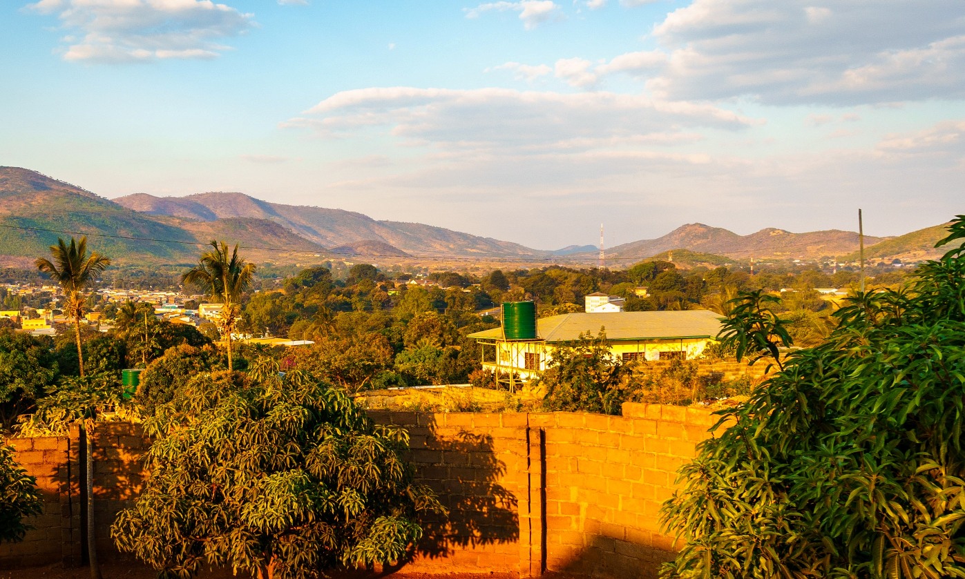
Chipata is not a tourist destination in itself, but almost everyone heading to South Luangwa — one of the best safari parks in Africa — passes through here. It is the capital of Zambia's Eastern Province, a fast-growing commercial town tucked into a fertile valley surrounded by hills, a stone's throw from the Malawi border. For travellers it is the last 'real' stop before the park: the one with banks, ATMs, supermarkets, petrol stations and a hospital.
But Chipata is also a place with its own history and personality. It began as Fort Jameson, a colonial fort from the late 19th century, and became the capital of North-Eastern Rhodesia before Zambia even existed. It is the heartland of the Ngoni people, warriors of Zulu origin who migrated here in the 19th century and who every February celebrate the Ncwala, one of the most spectacular traditional ceremonies in the country, with dancing, drums and the ritual sacrifice of a black bull.
This guide takes Chipata for what it is: a strategic stopover and a crossroads between Zambia and Malawi, but also a lively town worth stopping in, to wander its bustling market, see its great mosque and colonial buildings, stock up on supplies and — with luck and the right timing — get a glimpse of Ngoni culture before continuing on towards the leopards of the Luangwa.
Chipata was founded around 1899 as Fort Jameson, a military and administrative post of the British South Africa Company named after Leander Starr Jameson, of the famous 'Jameson Raid'. It was the capital of North-Eastern Rhodesia in the early 20th century, right in the heart of the territory of the Ngoni people, warriors of Zulu roots who had arrived decades earlier after crossing the Zambezi. With Zambia's independence in 1964, the old Fort Jameson took back an African name: Chipata, from the Ngoni term 'chimpata', 'the wide space' or open valley between the hills. Its full story — from the Ngoni migration to the colonial fort and the modern town — is told on our history page.
Read the full history ↓The wild jewel of eastern Zambia: a fault in the Great Rift Valley where the Luangwa River winds through the country's greatest concentrations of wildlife, and where the walking safari was born.
Read the history of The Luangwa Valley →No exact prices: a scale from $ (budget) to $$$$$ (luxury), with 2-3 options per category.
Origins, formation and what the sources say.
More than any other people, the Ngoni shaped the human history of the Chipata region. They came from far away, in southern Africa: Nguni-speaking clans related to the Zulus who, in the 1820s, fled the 'Mfecane', the great period of wars and upheaval set off by the expansion of Shaka's Zulu kingdom. Led by chiefs such as Zwangendaba, thousands of people set out on a long migration north that would last for decades.
Around 1835, Zwangendaba's Ngoni crossed the Zambezi River (according to tradition, during a solar eclipse) and pushed on through the highlands of what is now eastern Zambia and southern Tanzania. When Zwangendaba died, the group split into several branches. One of them, later led by Chief Mpezeni, settled for good on the fertile eastern plateaus, the region where Chipata stands today, and imposed its rule over the Chewa and other local groups.
The Ngoni brought with them the military organisation and customs of the Nguni south: the warrior regiment (impi), cowhide shields, war dances and the first-fruits ceremony, known here as Ncwala, which is still held every February. That South African heritage, transplanted more than two thousand kilometres from its birthplace, makes Zambia's Eastern Province a unique cultural place, and it explains why the people of Chipata see a warrior tradition with Zulu roots as their own.
In the late 19th century, British colonial expansion in southern Africa, driven by Cecil Rhodes and his British South Africa Company (BSAC), reached these lands. The rich Ngoni region, with its good farmland, soon caught the colonisers' attention. In 1897-1898, Company forces conquered Mpezeni's Ngoni kingdom by force of arms, in a campaign that ended with the warriors' defeat, the capture of the heir Nsingu (who was executed by firing squad) and the confiscation of thousands of head of cattle.
On this newly conquered territory, around 1899 the Company set up a military and administrative post that it named Fort Jameson, after Leander Starr Jameson, the British adventurer famous for the failed 'Jameson Raid' of 1895 against the Boer republic of the Transvaal. Its founding is usually credited to Robert Codrington, the BSAC administrator in the area. The fort soon became the region's centre of power.
In 1900, Fort Jameson was made the capital of North-Eastern Rhodesia, one of the two territories into which the Company divided its lands north of the Zambezi. For little more than a decade, this small savannah town was the administrative seat of a vast territory. In 1911, when North-Eastern and North-Western Rhodesia merged to form Northern Rhodesia, the capital moved to Livingstone, and Fort Jameson remained the seat of the Eastern Province, a role it still holds under another name.
During the first half of the 20th century, Fort Jameson grew as the centre of a farming region. The plateau's mild climate and fertile soils drew European settlers who set up plantations, above all of tobacco, which became the area's main cash crop. Alongside the farmers came a community of traders of Indian and East African origin who controlled much of the local trade: the large mosque that still marks the skyline of the town centre is a reminder of that presence.
Life in Fort Jameson revolved around the 'boma', the cluster of colonial offices, and the services that kept the town going: the station, the hospital, the religious missions and the schools. Cut off from the major centres of Northern Rhodesia (the mining Copperbelt lay far away, at the other end of the country), the Eastern Province always kept a rural, somewhat peripheral character, more closely tied by roads and trade to neighbouring Nyasaland (today's Malawi) than to the rest of the territory.
That link with Nyasaland was decisive. The region always served as a place of transit and exchange with the east, and many local workers migrated to the mines in the south. Close cultural ties with the Chewa and Ngoni peoples on both sides of the border gave this corner of Zambia a strong identity of its own, distinct from that of the copper heartland and the capital.
The nationalist movement that led Zambia to independence also found an echo in the Eastern Province. In 1964, Northern Rhodesia became the Republic of Zambia, under the leadership of Kenneth Kaunda and his UNIP party. Independence brought a wave of renaming: colonial names honouring British administrators and adventurers were replaced with African place names.
And so the old Fort Jameson became Chipata. The new name comes from the local word 'chimpata', usually translated as 'the open space' or 'the wide place', a reference to the town's position in a valley between hills. The change was much more than a formality: it symbolised the end of an era and the recovery of an identity of its own, tied to the land and to the peoples who had lived there long before the Company arrived.
As capital of the Eastern Province of the new Zambia, Chipata kept growing as an administrative and farming centre. Tobacco, cotton and maize remained the backbone of its economy, and the town established itself as the main market and service hub for the whole eastern region, both for Zambian farmers and for cross-border trade with Malawi.
In recent decades, Chipata has become one of Zambia's fastest-growing cities. In 2017 it was officially granted city status, the fifth in the country to receive it, in recognition of its growth and its role as provincial capital. Today it has more than 120,000 inhabitants and is home to banks, universities, hospitals, markets and shopping centres that make it the economic heart of the entire Eastern Province.
A recent milestone changed Chipata's relationship with tourism: the paving of the road to Mfuwe, the gateway to South Luangwa National Park. What used to be a slow, difficult dirt road became a tarmac drive of just over two hours, making one of Africa's great safari parks far more accessible. For thousands of travellers, Chipata became the essential stop to stock up before heading into the Luangwa Valley.
So today the city combines its two historic roles: farming and trading centre of a fertile region, and crossroads between Zambia and Malawi. Now it adds a third: springboard for safaris. And once a year, when the Ncwala drums sound at Mtenguleni and the Ngoni warriors dance with their shields, Chipata remembers that beneath its modern face as a growing city still beats the old heritage of those warriors who crossed the Zambezi almost two centuries ago.