Few places on the planet let you literally stand on the equator, with one foot in the northern hemisphere and the other in the southern, and Ilhéu das Rolas is one of them. This two-square-kilometre islet, off the southern tip of the island of São Tomé, is crossed by latitude 0°, marked since 1936 by a monument with an armillary sphere and a map of the world engraved in the ground: the famous Marco do Equador.
But Ilhéu das Rolas is much more than a geographical curiosity. It is a small tropical paradise of sandy beaches, clear waters and reefs that make it one of the best snorkelling and diving spots in the country, with a quiet resort as its only infrastructure and trails that climb through the forest to viewpoints overlooking the whole southern coast of São Tomé and the striking Pico Cão Grande in the distance.
This guide explains how to reach the islet by crossing the Canal das Rolas from Porto Alegre, how to visit the equator monument, where to dive and swim, and how to combine Rolas with the gems of the São Tomé south. It's the perfect trip to round off a journey to one of Africa's least visited and most surprising island nations, right where the world splits exactly into two halves.
Ilhéu das Rolas owes its fame to a unique geographical fact: the equator runs across it. Between 1915 and 1918, the renowned Portuguese navigator and historian Gago Coutinho —a pioneer of transatlantic aviation— mapped São Tomé and confirmed that the 0° parallel passed through this islet. In 1936, the colonial government erected the Marco do Equador there, a monument with an armillary sphere on top of a world map, to mark where the equator passes. The islet also shares the history of São Tomé and Príncipe: uninhabited islands discovered around 1470, colonised for sugar and cocoa through slave labour on the roças, and independent since 1975. The full story is told on our history page.
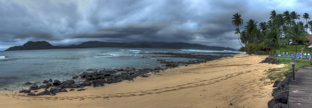
Read the full history ↓Latitude zero: an islet crossed by the equator, with its 1936 monument and natural pools of crystal-clear water among the rocks of southern São Tomé.
Read the history of The far south and the equator →No exact prices: a scale from $ (budget) to $$$$$ (luxury), with 2-3 options per category.
Origins, formation and what the sources say.
Ilhéu das Rolas is a small volcanic islet of barely two square kilometres that rises off the southern tip of the island of São Tomé, separated from it by the narrow Canal das Rolas. Like the rest of the São Tomé and Príncipe archipelago, it is volcanic in origin: it belongs to a chain of volcanoes that rises from the floor of the Gulf of Guinea, along a fracture line in the Earth's crust that runs from Mount Cameroon, on the mainland, to the island of Annobón.
What makes the islet unique is a purely geographical accident: the equator, the 0° parallel that divides the Earth into the northern and southern hemispheres, crosses it almost through the middle. It is one of the very few points of dry land on the planet where the equator passes exactly, and the only one in the country. That cartographic coincidence would turn this remote corner of the Atlantic into a symbolic place and a tourist attraction.
Like almost all of São Tomé and Príncipe, the islet was uninhabited when the Portuguese reached the archipelago around 1470-1471. For centuries it was just a dot on the map off the southern tip, covered in vegetation and visited by fishermen. Its story as a geographical landmark would only begin to be written in the early 20th century, thanks to one of the great Portuguese navigators of the time.
Between 1915 and 1918, the Portuguese officer, navigator and historian Carlos Viegas Gago Coutinho carried out mapping work on the island of São Tomé. Gago Coutinho is a famous figure in Portugal: in 1922, together with Sacadura Cabral, he made the first aerial crossing of the South Atlantic, from Lisbon to Rio de Janeiro, and he was a pioneer of celestial navigation. During his surveys in São Tomé he determined precisely that the equator passed through Ilhéu das Rolas.
To commemorate that finding and honour the scientific work, in 1936 the Portuguese colonial government erected the 'Marco do Equador' on the islet, a monument marking where the 0° parallel passes. The landmark is topped by an armillary sphere —the old astronomical instrument that also appears on the Portuguese flag— and at its foot a world map was laid into the ground with the equator running across it, so visitors can literally stand with one foot in each hemisphere.
The monument, restored over the years, became the great symbol of the islet and a must-stop for every traveller who reaches the south of the country. Walking up the trail through the forest to the Marco do Equador, with views of São Tomé and Pico Cão Grande in the background, and taking a photo on the middle of the world, is today one of the most sought-after experiences in São Tomé and Príncipe.
Ilhéu das Rolas shares the history of the archipelago it belongs to. After the Portuguese discovery around 1470, the island of São Tomé was settled from 1493 with colonists and thousands of enslaved Africans, and in the 16th century it became one of the first great sugar centres of the Atlantic world, an early trial of the slave plantation system that would later spread to the Americas.
Once sugar declined, the second great cycle came with cocoa in the 19th century. By the early 20th century São Tomé and Príncipe had become the world's largest cocoa producer, grown on the 'roças', huge plantation-villages worked by 'serviçais' recruited in Angola, Cape Verde and Mozambique under conditions so close to slavery that they sparked an international scandal. The far south, facing the islet, also filled up with roças and with villages of fishermen and workers.
Ilhéu das Rolas and neighbouring Porto Alegre, the southernmost town on the island, always remained the last frontier of that colonisation: the most remote, humid and forested area, sparsely populated and hard to reach. That isolation, an obstacle for centuries, is now its greatest asset: it kept the beaches, reefs and forest of the south exceptionally well preserved.
São Tomé and Príncipe gained independence from Portugal on 12 July 1975, after centuries of colonial rule and episodes such as the 1953 Batepá Massacre, a symbol of the national awakening. The young country, with a fragile economy heavily dependent on cocoa, went through a one-party period and in 1990 adopted multiparty democracy, looking to nature tourism as a new source of development.
Ilhéu das Rolas found its tourist calling in that transition. Building on its position on the equator, its beaches and its clear-water reefs, a resort was set up on the islet; it is now its only infrastructure and has made it one of the most attractive destinations in the south, especially for diving and snorkelling. The small fishing community living on the ilhéu shares the island with this tourist activity.
Today the islet sums up the charm of the whole country: untouched nature, superb waters, a colonial history shaped by sugar and cocoa, and that irresistible geographical quirk of sitting exactly on the line that splits the world in two. Visiting Ilhéu das Rolas is at once a swim in the equatorial Atlantic and a short journey through the history of São Tomé and Príncipe.