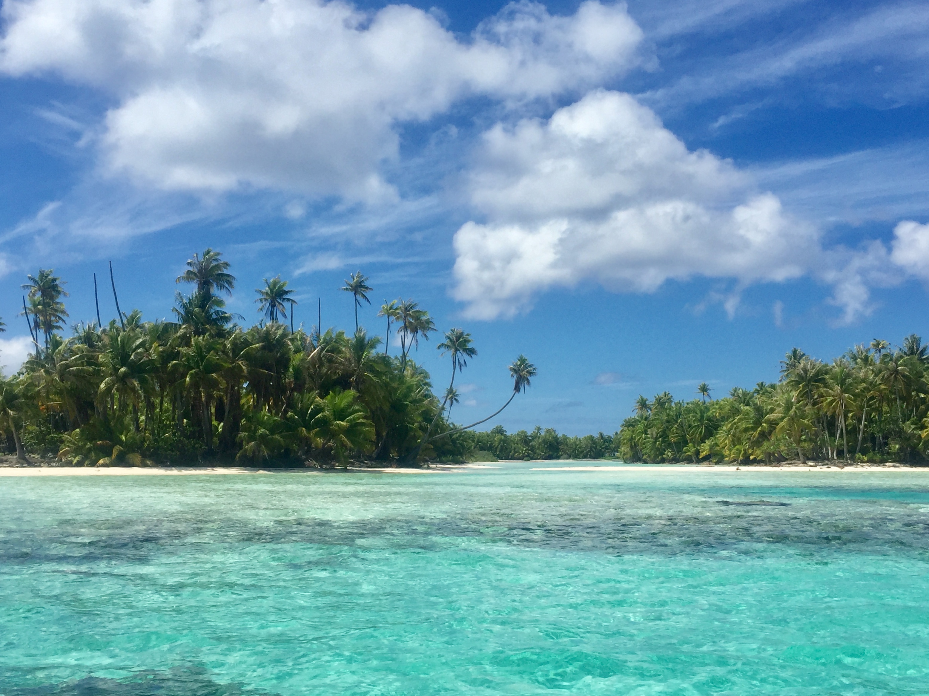
Rangiroa is the largest atoll in French Polynesia and one of the largest on the planet: a slender ring of coral more than 200 km around, enclosing a lagoon so vast that it's hard to take in from the air and the far shore disappears over the horizon. Its name in the Pa'umotu language, Ra'iroa, means 'immense sky', and that's exactly what strikes you first: the imbalance between the land (a ribbon of sand and coconut palms just a few metres high) and the water, which dominates everything.
Above all, it is one of the world's great diving destinations. In the Tiputa and Avatoru passes, where the lagoon breathes with the tide, the current carries divers along on a 'drift dive' past walls of grey sharks, schools of barracuda and jacks, manta rays and Napoleon wrasse. The Tiputa Pass is also home to bottlenose dolphins that play in the waves and with the divers, and between January and March they're joined by great hammerhead sharks. You don't need to dive to see them: from the point by the village, at sunset, you can watch the dolphins leaping in the current.
This guide covers Rangiroa with a practical, friendly eye: how to get there (only by Air Tahiti plane or by cargo ship), how to get around an atoll with no buses or taxis, what dives really cost, the excursions to the Lagon Bleu and the Sables Roses, and a visit to the world's only vineyard planted on coral, Vin de Tahiti (all prices in CFP francs and checked in July 2026), plus where to eat and sleep. Rangiroa isn't the turquoise-lagoon-and-mountain postcard of Bora Bora: it's something rarer and wilder, a world made almost entirely of water and horizon.
Rangiroa formed through the slow subsidence of an ancient volcano: its reef kept growing towards the light while the mountain sank, leaving the ring of coral described by Charles Darwin's theory. It was settled by Mā'ohi navigators around the 10th century, who built marae and villages at Avatoru, Tiputa and on other motu. Europeans sighted it in 1616 (the Dutch explorers Le Maire and Schouten, who called it 'Island of Flies'), and in the 19th century came the missionaries, pearl diving and copra. France established a protectorate and later annexed the islands, and in the 20th century the Tuamotu Archipelago was marked by French nuclear testing on the nearby atolls of Moruroa and Fangataufa (1966-1996). Today Rangiroa lives from dive tourism, black pearls and its famous vineyard. Its full story is told on the history page.
Read the full history ↓The largest group of coral atolls on the planet: 77 rings of sand and lagoon scattered across the Pacific, land of the Pa'umotu people, home of the black pearl and copra, and the setting for the French nuclear tests at Moruroa and Fangataufa.
Read the history of Tuamotu Archipelago →No exact prices: a scale from $ (budget) to $$$$$ (luxury), with 2-3 options per category.
Origins, formation and what the sources say.
It is hard to believe that Rangiroa, that ribbon of sand and coconut palms no more than twelve metres high at its highest point, is the ghost of a mountain. And yet it is. Millions of years ago, an undersea volcano rose over a hotspot on the floor of the Pacific and formed a high island. Along its warm, sunlit shores a coral reef grew and circled it like a necklace. Over time, the oceanic plate carried the island away from the hotspot, the volcano went extinct and the mountain began to sink slowly under its own weight as the crust cooled.
As the land sank, the coral, which needs light and shallow water, kept growing upwards, generation after generation of polyps, to stay close to the surface. After thousands of years, the volcanic summit disappeared completely beneath the water. All that remained was the ring of coral that had fringed it, enclosing a lagoon over what had once been the mountain's slopes. That ring is Rangiroa today: an atoll.
This explanation, the subsidence theory, was put forward by Charles Darwin in the 19th century, based on what he observed during the voyage of the Beagle. It described with remarkable accuracy what you can see in the Tuamotus: high islands with fringing reefs, islands surrounded by barrier reefs and, finally, atolls with no central island. Modern science has refined and added to the model, and changes in sea level during the ice ages played a huge part, but Darwin's core insight still holds. Rangiroa is living proof of a volcano that sank while the coral wove its crown. Its name in the Pa'umotu language, Ra'iroa, 'immense sky', seems to name exactly that vastness: 1,446 km² of lagoon, some 415 motu and a horizon of water where you cannot see the opposite shore.
Long before any European dreamed of the Pacific, the Mā'ohi had already done the unthinkable: they settled the largest ocean on the planet aboard double-hulled canoes, the va'a, guided by the stars, the swell, the flight of birds and the colour of the sky and the water. Rangiroa was probably inhabited from the 10th century, when those navigators reached this remote ring of coral and decided to stay. They chose to live in one of the most demanding environments there is: an atoll with no rivers, no mountains and hardly any fertile soil, where fresh water has to be wrung from the rain and from underground lenses.
The people of the Tuamotus are known as the Pa'umotu (or Pā'umotu), 'the people of the low islands', and they developed a culture extraordinarily well adapted to coral and sea. They dug cultivation pits into the limestone to grow taro and other root crops. They were masters of fishing in the lagoon and the passes like few other Pacific peoples. And, according to later accounts, they were the finest divers in the region, able to free-dive to the bottom in search of mother-of-pearl and pearls. Rangiroa had several villages, among them Avatoru, Tiputa, Tivaru and Otepipi. In these villages and on various motu, people built marae: ceremonial enclosures of stone and coral where the community honoured the gods and the ancestors, held its rites and affirmed mana, the sacred power that flowed from the chiefs (ari'i) and from certain places.
Life on the atoll was also a life of voyaging: the Pa'umotu constantly travelled between atolls to fish, trade and wage war. Around the 15th century, Rangiroa was drawn into conflicts with warriors from the neighbouring atolls of Anaa and Kaukura. To protect themselves from attack, people tended to gather in the villages of Tivaru, Avatoru and Tiputa. That web of navigation, kinship and war wove a whole world on the water. What survives of it today are the names, the language, the marae and the art of reading the sea.
The first Europeans to record Rangiroa were the Dutchmen Jacob Le Maire and Willem Schouten. In 1615-1616 they were looking for a new route to the Pacific around the southern tip of South America, via Cape Horn, which they named themselves, and on their way through the Tuamotus they sighted the atoll. They gave it a rather unpoetic name: Vlieghen Eylandt, 'Island of Flies', after the insects that greeted them. For the Pa'umotu, of course, the island had already had a name for centuries.
The 18th century brought a parade of great navigators. The Briton John Byron passed through the Tuamotus in 1765 and renamed several atolls, giving Rangiroa and its neighbour Tikehau English names in honour of the Crown. James Cook sailed these waters in 1769, on the same voyage on which he observed the transit of Venus from Tahiti. The Tuamotus, with reefs barely visible at water level and passes with ferocious currents, were known as a deathtrap for sailing ships. For centuries Europeans called them the 'Dangerous Islands' or the 'Dangerous Archipelago', a maze of coral rings where many ships were lost. Later, in 1839, the American expedition led by Charles Wilkes charted them in greater detail.
That contact, sporadic at first, gradually changed the Pa'umotu world. The ships brought diseases the population had no defences against, metal tools, firearms and, above all, a new economy built on what the outside world wanted to buy: mother-of-pearl from the lagoon's oysters, pearls and, later, copra. Nothing would ever be the same again.
In the 19th century, two forces transformed the Tuamotus for good: Christianity and the world market. Missionaries, first Protestants from the London Missionary Society and later Catholics, travelled from atoll to atoll converting the population, reorganising villages around churches and discouraging many ancestral practices. On Rangiroa, as on so many other atolls, the marae were abandoned and daily life came to revolve around the church and the pastor. Today the coral churches of Avatoru and Tiputa are part of the landscape.
At the same time, the atoll's economy became hooked into the wider world. Around the mid-19th century, the harvesting of mother-of-pearl and pearls enjoyed a golden age. Pa'umotu divers, the best in the Pacific, free-dived to prise black-lip oysters from the seabed. Their shells were exported to make buttons and luxury goods, and their rare, dark pearls were beginning to fascinate jewellers. Overharvesting soon exhausted the oyster beds, and by the 20th century mother-of-pearl had given way to copra, the dried flesh of the coconut from which oil is extracted. Copra became the atolls' great export.
During the same period, France extended its rule over Polynesia. It imposed a protectorate over Queen Pomare IV's Kingdom of Tahiti in 1842 and annexed the Society Islands in 1880. The colonial power then gradually took in the Tuamotus as well, which until then had been tied to the Tahitian chiefs. The atolls became part of the French Establishments in Oceania, the colonial administration that in 1957 became the Territory of French Polynesia. So Rangiroa, with its two villages and its immense lagoon, entered the 20th century as a French possession. It lived on copra, fishing and barter, and was still weeks away from Papeete.
No history of the Tuamotus can skip the most painful chapter of the 20th century. In 1963, after losing its nuclear test sites in the Sahara when Algeria became independent, France decided to set up its atomic testing centre in the Pacific: the Centre d'Expérimentation du Pacifique (CEP). It chose two uninhabited atolls in the southern Tuamotus, Moruroa and Fangataufa, part of the same Tuamotus as Rangiroa. There, on 2 July 1966, it set off its first bomb in the region, the 'Aldébaran' test, a plutonium fission device detonated over the lagoon.
Between 1966 and 1996, France carried out 193 nuclear tests at Moruroa and Fangataufa. The first 41 were atmospheric tests, mushroom clouds over the ocean, until international pressure forced a change in 1974. They were followed by more than 140 underground explosions in shafts drilled into the coral. The tests turned French Polynesia into the heart of a nuclear power and brought money, jobs and rapid urbanisation to Tahiti, where many people from the atolls moved. But the cost was enormous and was hushed up for decades. It included radioactive contamination of the air, water and soil, accidents such as the one in July 1979, when a detonation set off an underwater landslide and a wave at Moruroa, and a legacy of illness. Today hundreds of cancer cases a year are recognised as attributable to the tests, and the debate over compensation and historical truth is still open.
Rangiroa, in the north of the archipelago and far from the test sites, was never a testing zone. But it shares the Pa'umotu memory of that time: the memory of a people whose atolls, seen as 'empty' from Paris, were used to test weapons of destruction without anyone asking them. That wound, in what in Tahitian is called Ma'ohi Nui, the Mā'ohi nation, is now central to Polynesian identity and politics.
Modern Rangiroa was born, to a large extent, on the day the first plane landed. The opening of the airport in 1965 ended centuries of isolation. What had been a weeks-long journey by goélette became an hour's flight from Papeete, and the atoll opened up to tourism. The first to arrive were divers, drawn by the reputation of the Tiputa and Avatoru passes. There the tide puts on one of the most intense underwater shows on the planet: grey sharks by the dozen, manta rays, Napoleon wrasse, schools of barracuda and the resident dolphins playing in the current. Rangiroa established itself as one of the world's great diving destinations.
Meanwhile, the lagoon found a new treasure. From the last decades of the 20th century, farming the Tahitian black pearl, the gem of the black-lip oyster that divers once searched for on a single breath, became an economic mainstay of many atolls in the Tuamotus, with farms dotted across the lagoons. Rangiroa also produced a world first: the vineyard of businessman Dominique Auroy. From 1991 he experimented with growing vines on coral soil, planted his first vines on a motu in 1997, and in 2000 made the first wine ever produced in Polynesia. Vin de Tahiti, with its whites and its rosé ripened under the Pacific sun, is today the only wine in the world made on an atoll.
Today Rangiroa lives where the ancient meets the unlikely: the Pa'umotu culture of sea and canoe, the pearl with its roots in ancestral diving, the dive tourism that fills the guesthouses and the impossible vineyard on the coral. With some 2,500 inhabitants split between Avatoru and Tiputa, the 'immense sky' is still what it has always been: a thin ring of life over a sunken volcano, surrounded on every side by ocean.