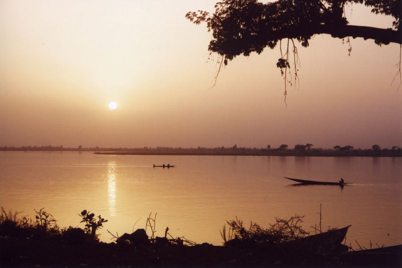
W National Park is Niger's natural jewel and one of the most important protected areas in West Africa. It takes its name from the double meander the Niger River traces downstream of Niamey, a zigzag that forms the letter W on the map, and it spreads across three countries: Niger, Benin and Burkina Faso. The Nigerien part covers about 220,000 hectares and was declared a World Heritage Site in 1996; in 2017 UNESCO extended the inscription to the components in the other two countries and created the W-Arly-Pendjari Complex.
What it protects is exceptional: the largest continuous stretch of intact Sudano-Sahelian savanna in the region, with grasslands, scrub, gallery forest along the rivers, and wetlands. It is home to West Africa's largest elephant population, hippos, West African lions (a genetically distinct and critically endangered population), leopards, buffalo, roan antelope, kob, warthogs, crocodiles and more than 350 bird species, which earned it Important Bird Area status from BirdLife International. 454 plant species have been recorded, including two orchids endemic to Niger.
And now the hard part. The park sits at the heart of the tri-border area, the epicentre of jihadist violence in the Sahel. There were armed attacks in and around the complex in 2022, in July 2024 (with twelve rangers and soldiers killed) and in April 2025. The whole area is rated red by Western foreign ministries. This page documents what the park is and what it holds, with the practical information that existed when it could be visited, but it does not suggest going: today it is not a tourist destination.
For millennia the double bend of the Niger River was a crossroads for wildlife, and the area's low human density (shaped by the tsetse fly and river blindness, which discouraged settlement) kept it relatively untouched. The French colonial administration formally created the park by decree on 4 August 1954, bringing together in a single protected unit territory from the colonies of Niger, Dahomey (now Benin) and Upper Volta (now Burkina Faso). After independence in 1960, each country managed its portion separately, until regional cooperation brought them back together under the label of “W Regional Park”. The Ramsar Convention recognised the Nigerien part as a wetland of international importance in 1987; UNESCO declared it a Biosphere Reserve and added it to the World Heritage List in 1996, and in 2017 extended the inscription to the Beninese and Burkinabe components under the name W-Arly-Pendjari Complex. Since the early 2020s, the spread of armed groups in the Sahel has turned the park into a sanctuary for the insurgents themselves and a battleground.
Read the full history ↓The country's fertile strip: the capital that grew up beside the river, the Zarma lands of Dosso and the last wild giraffes of West Africa, at Kouré.
Read the history of Niamey and the Niger River (south-west) →No exact prices: a scale from $ (budget) to $$$$$ (luxury), with 2-3 options per category.
Origins, formation and what the sources say.
The Niger is Africa's third-longest river, and for centuries its course baffled geographers: it rises in the mountains of Guinea, barely 250 kilometres from the Atlantic Ocean, and instead of flowing towards the sea it heads northeast to the edge of the Sahara. There it traces a huge arc in Mali, the famous Boucle du Niger, and only then turns southeast to reach the Gulf of Guinea four thousand kilometres later.
On the stretch through Niger, downstream from Niamey, the river makes two consecutive, sharply defined meanders that on a map draw the letter W with precision. That, and nothing else, is where the park's name comes from: in French it reads «double v».
That zigzag is no whim. It follows the geological structure of the Precambrian basement and of the sedimentary formations the river winds around, and it creates a highly varied mosaic of habitats in a small area: permanent channels, sandbanks, islands, river terraces, laterite plateaus and rocky outcrops. The Tapoa, Mékrou and Alibori tributaries complete the river network.
The result is what UNESCO describes as the largest continuum of terrestrial, semi-aquatic and aquatic ecosystems in the West African savanna belt: grasslands, scrub, wooded savanna and extensive gallery forests along the watercourses. 454 plant species have been recorded here, including two orchids endemic to Niger, and the area marks the southern limit of the brousse tigrée, or tiger bush, the banded scrub typical of the Sahelian plateaus.
The West African savanna has been inhabited for thousands of years, and across most of the region human pressure transformed the landscape completely. The strip along the Niger's double bend, by contrast, stayed relatively empty, and that is the underlying reason there is still something left to protect today.
The decisive factor was disease. The river valleys in the area were long-standing hotspots for two insect-borne diseases: trypanosomiasis, or sleeping sickness, spread by the tsetse fly, which also kills livestock; and onchocerciasis, or river blindness, spread by blackflies of the genus Simulium. In an economy of farmers and herders, nobody settles an area where cattle can't survive and people go blind.
History added to this. The region lay on the margins of the great states that dominated the Sahel, from the Songhai Empire to the Gourmantché and Borgu kingdoms and the Hausa emirates, and for centuries it was a frontier zone, a corridor for raids and a no man's land, hardly suited to permanent settlement.
The result was an island of savanna with few people and intact wildlife in the middle of an increasingly populated region. By the time effective health campaigns against both diseases got under way in the 20th century, that island already had legal protection, which stopped farming from wiping it out as it wiped out almost everything else.
Formal protection came by decree on 4 August 1954, at the height of the French colonial period. The administration of French West Africa created W National Park across the territories of three different colonies that met at the river's double bend: Niger, Dahomey and Upper Volta.
It was a remarkable decision for its time and place: a cross-border protected area, conceived as a single ecological unit before the modern idea of transnational conservation existed. The logic was simple (elephants don't read maps), and it anticipated by several decades practices that are standard today.
Independence in 1960 broke up that administrative unit. Niger, Dahomey (renamed Benin in 1975) and Upper Volta (Burkina Faso since 1984) each inherited their own section and managed it separately, with unequal resources and different priorities. For decades the park worked as three parks.
It came back together as a concept through regional cooperation and international organisations, which began to speak of the “W Regional Park” and to fund joint programmes for patrols, wildlife surveys and development in surrounding communities. In June 2020, management of the Benin section passed to the NGO African Parks under a delegated management agreement with the State of Benin.
International recognition came in three stages, each broader than the last.
The first was in 1987, when the Niger section, some 220,000 hectares, was listed as a Wetland of International Importance under the Ramsar Convention, in recognition of the role of the Niger River and its floodplains as habitat for waterbirds and other water-dependent wildlife.
The second was in 1996, a double milestone for the park: UNESCO designated it a Biosphere Reserve under the Man and the Biosphere (MAB) Programme, also covering 220,000 hectares, and inscribed it on the World Heritage List as “W National Park of Niger” for its outstanding natural values.
The third was in 2017, when the World Heritage Committee approved a transnational extension that added the Benin and Burkina Faso sections to the inscription, including the Arly reserves and Pendjari National Park. The property was renamed the W-Arly-Pendjari Complex and became one of Africa's largest cross-border natural sites, with more than a million hectares of core zones.
UNESCO's case is compelling: this is the largest and most important continuum of terrestrial, semi-aquatic and aquatic ecosystems left in the West African savanna belt, and the last refuge for species that have disappeared from the rest of the region.
What makes the W-Arly-Pendjari complex irreplaceable isn't abundance but exclusivity: much of what lives here no longer lives anywhere else in West Africa.
The clearest case is the elephant. Over the 20th century the region lost almost all its populations, broken up and wiped out by ivory hunting and the spread of farming. Today the WAP complex holds the largest population of African savanna elephants in all of West Africa, and their survival depends directly on the corridor between the three countries continuing to work.
The second case is the West African lion. Genetic studies over the past two decades have shown that lions in the west of the continent form a distinct lineage, more closely related to Asiatic lions than to those of eastern and southern Africa, and that they are critically endangered: only a few hundred remain in total. The WAP complex is their main stronghold. Alongside them are some twenty-five cheetahs spread across the whole area, plus leopards, spotted hyenas and a full community of herbivores: buffalo, roan antelope, Buffon's kob, korrigum, duikers, reedbuck and warthogs.
In the water, the river and its tributaries support herds of hippos and populations of Nile crocodile. In the air, more than 350 bird species, which earned it Important Bird Area status from BirdLife International, ranging from savanna residents to the huge contingent of Palearctic migrants that come down to winter in the Sahel between November and March.
And then there are the absences. The western black rhino, which once lived in the savannas of the region, was officially declared extinct in 2011, without a single individual left anywhere in the world. It is the starkest reminder of what is at stake in these parks: the gap between a small, protected population and a species that ceases to exist can be a matter of a couple of decades.
From the mid-2010s, the tri-border area between Niger, Mali and Burkina Faso, and by extension the corridor running down towards Benin, became the epicentre of the jihadist insurgency in the Sahel. Islamic State in the Greater Sahara and JNIM, the al-Qaeda-linked coalition, fight over the territory with each other and with the armies of the three countries.
For these groups, a huge protected area that is unpopulated, covered in vegetation and crossed by porous international borders is a strategic asset: a hideout, a supply corridor and a sanctuary. W Park and the rest of the WAP complex thus went from being a conservation problem to a national security problem for three states.
The timeline of decline is stark. There were attacks in and around the park in 2022. In July 2024, an attack killed twelve rangers and soldiers. In April 2025, a large-scale attack attributed to JNIM left dozens of soldiers dead. Rangers, who in most of the world's park systems are civilian conservation staff, became military targets.
The coup of 26 July 2023 in Niger and the subsequent break with ECOWAS, France and the United States reshaped the entire framework of regional cooperation that had supported joint management of the park, just when it was needed most.
Today the US Department of State keeps Niger at Level 4, “Do Not Travel”, and European foreign ministries rate the entire tri-border area red, formally advising against all travel. The Nigerien authorities require foreigners leaving Niamey to travel with a military escort. W National Park is still a World Heritage Site and is still home to West Africa's largest elephant population. It's just that nobody can go and see them.