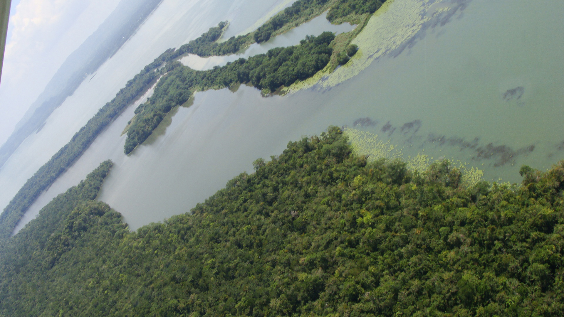
Punta de Manabique is one of the wildest and least visited corners of the Guatemalan Caribbean: a long peninsula of mangrove, untouched beaches and jungle that separates the Bay of Amatique from the Gulf of Honduras, in the department of Izabal. Declared a Wildlife Refuge, it was Guatemala's first marine-coastal protected area and is a Ramsar site of international importance for its wetlands.
It's a destination of deep nature, home to one of the most diverse coastal ecosystems in Central America: tropical rainforest, mangrove swamp, flooded savanna, freshwater lagoons and the country's only glimpses of coral reef. Its waters and estuaries shelter the manatee, a vulnerable marine mammal, along with crocodiles, waterbirds, sea turtles and a rich Caribbean coastal fauna. Fishing communities live in harmony with this fragile setting.
This guide gathers the essentials for approaching Punta de Manabique realistically and respectfully: what the refuge is and which ecosystems it protects, what wildlife and landscapes to expect (mangroves, manatees, beaches, estuaries), what the logistics involve —a remote destination visited by boat from Puerto Barrios and arranged with operators or the managing foundation—, the best time to go, where to sleep and eat, and tips for enjoying this natural, little-travelled Caribbean.
Punta de Manabique is a peninsula on Guatemala's Caribbean coast, in Izabal, separating the Bay of Amatique from the Gulf of Honduras. Inhabited by fishing communities with a long relationship with the Caribbean Sea, it was declared a Wildlife Refuge in 1999, becoming the first marine-coastal protected area in the Guatemalan Protected Areas System (SIGAP), managed by CONAP. Shortly afterwards, in 2000, its wetlands were listed under the Ramsar Convention as wetlands of international importance (some 132,900 ha). It protects one of the most diverse coastal ecosystems in Central America and is a refuge for the manatee. The history and formation of the area are on our history page.
Read the full history ↓The only department with a Caribbean coast: Garífuna and Q'eqchi' country, home to the country's largest lake, to the Río Dulce and its colonial pirate castle, to United Fruit's bananas and Puerto Barrios, to jungle, to the giant stelae of Quiriguá and to the gateway to Copán.
Read the history of Izabal →They depart from San Pedro Sula, 75 km away. If you book from this link we earn a commission and you pay no more.
No exact prices: a scale from $ (budget) to $$$$$ (luxury), with 2-3 options per category.
Origins, formation and what the sources say.
In a country almost everyone associates with volcanoes, highlands and Maya ruins, there is a Guatemala very few know: a tongue of mangrove and sand sinking into the Caribbean, where the manatee still swims and no road reaches. That secret Guatemala is called Punta de Manabique. It's a low, sandy peninsula jutting into the sea at the country's northeastern tip, in the department of Izabal. Its geography is strategic: it separates the Bay of Amatique —the great inner bay on which Puerto Barrios and Lívingston sit— from the Gulf of Honduras, the broad arm of sea Guatemala shares with Belize and Honduras. The point lies about 20 kilometres north of Puerto Barrios and can only be reached by boat.
The peninsula is a product of the Caribbean's coastal dynamics: the action of the rivers running down from the mountains of Izabal, the sea currents and sedimentation gradually shaped a territory of lowlands, sands, lagoons and, above all, extensive mangroves. These mangrove forests, growing on the boundary between land and sea, are the defining feature of the place and the basis of its extraordinary biological richness.
The result is an uncommon mosaic of coastal ecosystems: tropical rainforest, mangrove swamp, seasonally flooded savanna, freshwater lagoons and Guatemala's only glimpses of coral reef. That combination, in the transition between the continent and the Caribbean Sea, makes Punta de Manabique one of the most valuable and singular natural enclaves in the country.
Punta de Manabique's great wealth lies in its biodiversity. The refuge takes in one of the most diverse coastal ecosystems in Central America, where tropical forest, mangroves, flooded savannas, freshwater lagoons and coral reefs sit side by side. That variety of habitats sustains an abundant fauna that is, in many cases, vulnerable or threatened.
The most emblematic species is the Caribbean manatee (Trichechus manatus), a large, gentle and vulnerable herbivorous marine mammal that finds in the refuge's marshes, estuaries and lagoons a key habitat for feeding and shelter. Punta de Manabique is one of the most important places in Guatemala for the conservation of this species, a symbol of the Caribbean wetlands.
Alongside the manatee, the refuge's waters and forests are home to crocodiles, sea turtles, iguanas, fish of commercial and ecological importance, and spectacular birdlife: herons, pelicans, frigatebirds, kingfishers and numerous migratory birds that use these wetlands to rest and feed. The mangroves, moreover, act as a fish nursery and as a natural barrier protecting the coast, an ecological service essential to the whole region.
Punta de Manabique is not an uninhabited territory: inside and around the refuge live communities with a close and ancient relationship to the Caribbean Sea, the mangroves and the rivers. Small-scale fishing is the basis of their economy and their way of life, and their knowledge of the environment is part of the region's cultural heritage.
The Caribbean coast of Izabal is also an area of great cultural blending. Nearby, in Lívingston, lives one of Guatemala's main Garifuna communities —descendants of Africans and Caribbean peoples, with a language, music and cuisine of their own— and the whole region combines Afro-Caribbean, Maya, mestizo and seafaring influences. That human diversity enriches the experience of the Guatemalan Caribbean of which Punta de Manabique forms part.
The life of the refuge's communities depends directly on the health of the ecosystems: on the mangroves as fish nurseries, on clean water and on the wildlife. That is why the conservation of the area and the development of respectful tourism go hand in hand with the well-being of its people. Many initiatives aim to make ecotourism generate income for the communities while protecting the setting, in a delicate but fundamental balance.
Formal recognition of Punta de Manabique's natural value came at the end of the 20th century. In 1999, the peninsula was declared a Wildlife Refuge, joining the Guatemalan Protected Areas System (SIGAP). The milestone was twofold: not only was an exceptional territory being protected, but this was the country's first marine-coastal protected area, a decisive step for the conservation of Guatemala's seas and coasts. Management of the refuge falls to the National Council of Protected Areas (CONAP).
Very shortly afterwards, in 2000, the wetlands of Punta de Manabique were listed under the Ramsar Convention as Wetlands of International Importance, covering some 132,900 hectares that take in land, inland waters and coastal waters. The Ramsar Convention thus recognised the refuge as one of Guatemala's most important wetlands, for its biodiversity and for its role in stabilising the coast and controlling flooding.
These designations established Punta de Manabique as a protected area of national and international significance, and as a laboratory of marine-coastal conservation involving the state, foundations and communities. The great challenge, to this day, is to protect a fragile ecosystem —threatened by pressure on resources, pollution and climate change— while promoting low-impact tourism that benefits local people. Visiting Punta de Manabique respectfully is, in that sense, a way of supporting the conservation of one of the last great natural refuges of the Guatemalan Caribbean.
Being Guatemala's only large marine-coastal protected area has not spared Punta de Manabique from pressure. The refuge lives with concrete threats: overfishing and destructive fishing gear, mangrove deforestation, the pollution the rivers carry down from the interior of Izabal —including what comes down the Motagua river, one of the most polluted in the region— and, increasingly, the effects of climate change on a low, fragile coast. Add to that the pressure of drug trafficking and smuggling, which have historically used these remote shores and their proximity to Belize and Honduras as a corridor.
The peninsula's strategic position, between the Bay of Amatique and the Gulf of Honduras, also places it at the heart of an old territorial dispute: Guatemala maintains a historic claim over Belizean territory, and the waters of the gulf are a shared and sensitive space between Guatemala, Belize and Honduras. That geopolitical context makes Manabique not only a wildlife refuge but also a point of sovereignty and coastal surveillance for the country.
Against all of this, the bet is on a model of conservation with people inside it, not outside. CONAP, together with the managing foundation Fundary/FUNDAECO and the fishing communities, promotes surveillance of the area, mangrove restoration, manatee monitoring and low-impact ecotourism that generates local income without degrading the setting. The balance is delicate —there is more ambition than resources— but it defines the future of the place: either responsible tourism and sustainable fishing sustain the refuge, or the pressure on its resources ends up emptying it. Visiting Punta de Manabique respectfully, hiring local guides and services, is a direct way of tipping the scales towards its conservation.