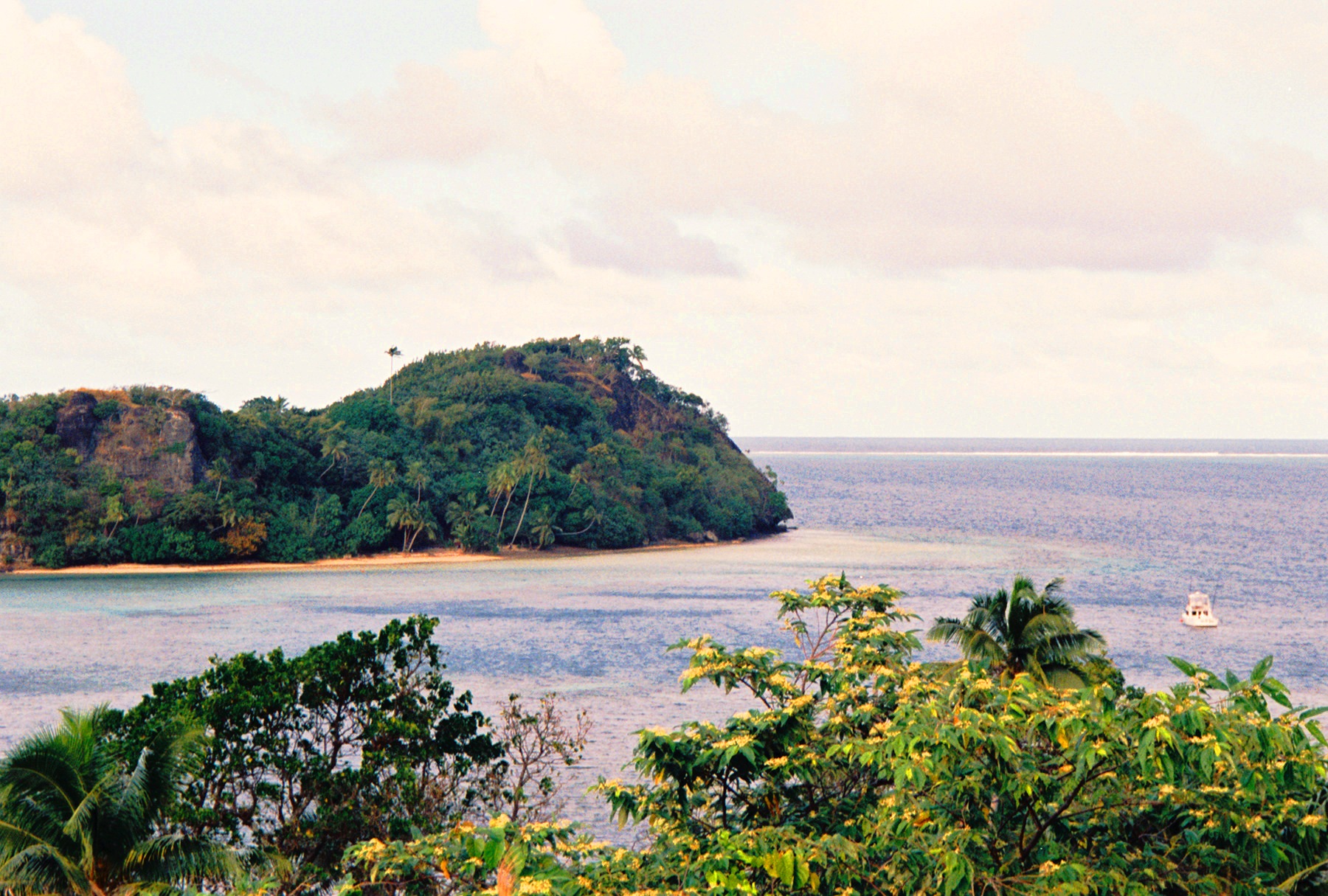
Kadavu is the Fiji almost nobody sees: a long, green, mountainous island about 90 km south of Viti Levu, so remote and with so little infrastructure that it feels like stepping back fifty years. There are no paved roads, no tourist towns and no hotel chains: there's rainforest covering three quarters of the island, iTaukei villages where people still live off the land and the sea, and a handful of dive eco-resorts tucked away in its bays. Getting there takes a flight or an overnight ferry followed by a boat transfer. And that is exactly what makes it special.
Underwater, Kadavu is a legend. It is surrounded by the Great Astrolabe Reef, one of the largest barrier reefs on the planet, with more than 60 dive sites, soft-coral walls, current-swept passages where sharks and big fish gather, and the famous manta ray cleaning stations in the south, where you can swim with these giants almost all year round. It's a world-class diving and snorkelling destination, but also a place for kayaking, fishing, spotting endemic birds and genuine encounters with Fijian culture.
This guide covers Kadavu with a practical eye: how to get there (Fiji Link flight or Goundar ferry), the best spots on the Astrolabe, where to stay among the dive eco-resorts, how much diving costs and what to expect from a village visit with a kava ceremony. It also honours its history: an island inhabited since Lapita times, with its own dialect, its four endemic birds and a volcano, Nabukelevu, whose eruption 2,500 years ago is preserved in iTaukei oral tradition.
Kadavu has been inhabited for millennia: it was part of the Lapita expansion that settled Fiji around 1000 BC, and the oral memory of its villages preserves the story of the eruption of the Nabukelevu volcano (Mount Washington) some 2,500 years ago, passed down over a hundred generations. The first European to sight it was William Bligh in 1792, and the great reef surrounding it was named Astrolabe after the ship of French navigator Dumont d'Urville, who nearly ran aground there in 1827. Kadavu stayed out of Cakobau's wars and the cession of Fiji to Britain in 1874, and to this day it is one of the country's least developed provinces, with some 75 iTaukei villages living on yaqona (kava), copra and, increasingly, eco-tourism. The full story is on our history page.
Read the full history ↓The other Fiji, wilder and more remote. It takes in Vanua Levu, the second-largest island, with laid-back, bohemian Savusavu; lush Taveuni, the "garden island", which the 180th meridian crosses; the reefs of Kadavu; and Levuka, the old capital and the country's only World Heritage Site.
Read the history of Vanua Levu, Taveuni and the outer islands →They depart from Suva, 102 km away. If you book from this link we earn a commission and you pay no more.
No exact prices: a scale from $ (budget) to $$$$$ (luxury), with 2-3 options per category.
Origins, formation and what the sources say.
At the western tip of Kadavu rises Nabukelevu, an 805-metre volcano that modern maps also call Mount Washington. It is extinct and covered in rainforest, but around 2,500 years ago it erupted, and that event, far from being lost, became part of the oral tradition of the iTaukei of Kadavu. It was handed down by word of mouth for about a hundred generations.
The story is told as a myth. It says that Tanovo, a deity (vu) from the neighbouring island of Ono, flew into a rage when a new volcanic dome grew on Nabukelevu and blocked his view of the sunset. He flew to the mountain and began the driva qele, "stealing earth", tearing off chunks of the mountain to bring it down. Tautaumolau, the deity who lived on Nabukelevu, came out to defend it, and the two vu locked in an aerial battle. As they fought and spun across the sky, the earth Tanovo was carrying fell into the sea and "created" the islands that now dot the coast.
The remarkable thing is that a study published in 2023 in the journal Oral Tradition found striking geological accuracy in that legend. The order in which the islands are "born" matches the direction in which the eruption's ash column spread. The mentions of the sea pulling back before the impact fit the way a tsunami behaves. The great crater, still visible today, reflects the "stealing earth" motif. By dating the volcanic deposits, modern science confirmed what the villages had been saying since before writing existed: their sacred mountain had exploded, and it had to be remembered.
For the kai Kadavu, Nabukelevu isn't just geography. It is the home of ancestral deities and a place heavy with tabu (sacred). It also proves that a people's memory, well looked after, can outlast any document. It's the best starting point for understanding this island, a place where the deep past is still alive.
Long before that eruption, Kadavu was already inhabited. The island is part of the great Lapita dispersal. The Lapita were Austronesian seafarers who set out from Island Melanesia and settled Fiji around 1000 BC (Fiji's Lapita sites date roughly from 1100 to 550 BC). Those pioneers arrived in double-hulled canoes, finding their way by the stars, the swell and the flight of birds. They brought finely made pottery decorated with stamped geometric patterns, the archaeological signature of their whole expansion across the Pacific.
In Kadavu, as in the rest of Fiji, those first settlers lived from fishing, from growing root crops such as dalo (taro) and yam, and from trade networks between islands. Over the centuries, new waves of people of mainly Melanesian origin arrived. From that mix came traditional iTaukei society, made up of villages organised by mataqali (patrilineal clans) and yavusa (groups of clans sharing a common ancestor). What held it together was the vanua, the idea that ties the people, their chief, their land and their sea into a single web of belonging and mutual obligation.
Kadavu developed an identity of its own within Fiji. Cut off by the sea and protected by its great reef, it kept its own dialect (Kadavu Fijian differs in several ways from standard Bauan) and a strong sea-going culture. According to some interpretations, its name evokes this sense of a long land reaching out into the ocean. When the Europeans arrived, Kadavu was a patchwork of villages and chiefdoms with centuries of history behind them. They had no idea yet of the world that was about to reach their shores.
The first European on record to sight Kadavu was William Bligh, in 1792. Bligh, the same captain from the famous mutiny on the Bounty, had already crossed Fijian waters in an open boat after the 1789 mutiny, on his way to Timor, and he came back through the area on a later voyage. His charts were among the first to record these islands for Europeans. For decades, Europeans called Fiji the "Bligh Islands", and its reefs had a name for being dangerous to shipping.
No reef proved that better than Kadavu's. In 1827, the French navigator and explorer Jules Dumont d'Urville was crossing the Pacific in command of the corvette Astrolabe. As he sailed past Kadavu, his ship nearly ran aground on the huge barrier reef that surrounds the island. The ship survived, and the reef took its name: ever since, it has been called the Great Astrolabe Reef, in honour of the ship that nearly sank there and as a warning to others. It is one of the largest barrier reefs in the world, and today it is the main reason travellers come to Kadavu.
Throughout the 19th century, traders, whalers and people hunting for bêche-de-mer (sea cucumber) and sandalwood worked these waters. Whalers stopped at the islands to restock, and they brought goods, diseases and firearms that would upset the fragile balance of power between Fijian chiefdoms. With its location and its anchorages, Kadavu had its moment in the spotlight. For a while, its port at Galoa was even considered as a possible centre for European activity in Fiji, before Levuka, on Ovalau, became the first colonial port.
While Kadavu was going through its own changes, the rest of Fiji was in turmoil. In the first half of the 19th century, the chiefdoms of the west and east of the archipelago fought for supremacy, Bau above all as Ratu Seru Epenisa Cakobau rose to power. New European firearms fuelled those wars. Cakobau went as far as proclaiming himself Tui Viti (King of Fiji) in 1871, but his kingdom was fragile. He owed money to American traders, he couldn't keep order among a growing number of European settlers, and other chiefs challenged his power.
On 10 October 1874, Cakobau and twelve other high chiefs signed the Deed of Cession, handing sovereignty over Fiji to Queen Victoria and the British Crown. Fiji became a colony. Kadavu had stayed out of the big wars in the centre of the archipelago, and it joined the new colonial administration without having been the setting of any of those conflicts. It became a province within the system of indirect rule the British set up, which partly respected iTaukei chiefly structures.
The change that mattered most for the country's future didn't come to Kadavu. It came to the sugar-cane plains of Viti Levu and Vanua Levu. To work the sugar plantations without uprooting Fijians from their land, the colonial government brought in about 60,500 indentured labourers from India between 1879 and 1916. They called their contract girmit, from the English "agreement", and called themselves girmitiyas, "the people of the girmit". They endured extremely harsh conditions, but many stayed on once their contracts ended and put down roots. They are the ancestors of the large Indo-Fijian community, which together with the iTaukei shapes modern Fiji: two peoples, two religions and two languages living side by side in one country, sometimes uneasily.
Fiji remained a British colony until 10 October 1970, almost exactly a century after the cession, when it became independent. But the coexistence between iTaukei and Indo-Fijians, inherited from the colonial era, would become the central issue of the country's politics. In 1987, an election brought to power a coalition with strong Indo-Fijian support. Lieutenant Colonel Sitiveni Rabuka then led two coups in the same year, claiming political supremacy for native Fijians and declaring a republic. More coups followed in 2000 and 2006, along with constitutional crises and periods of military rule.
All that turbulent history played out far from Kadavu. The island is remote and turned towards the sea, and it kept to its own rhythm. Life went on in the villages, along with the cycle of yaqona (kava), its main cash crop, and of copra, fishing and the traditional organisation of the vanua. Kadavu remained one of Fiji's least developed provinces, with just two dirt roads, no bus network and most of its original rainforest intact. Seen from today, that lack of infrastructure is its greatest treasure: it kept a natural world and a culture that have already been lost elsewhere in Fiji.
From the late 20th century, eco-tourism began to offer another way to make a living. The dive eco-resorts of the Great Astrolabe Reef brought jobs and income without wrecking the environment. Many of them are partnered with nearby villages and committed to conservation. The kai Kadavu learned to share their world while staying its owners: the reef, the four endemic birds, the sevusevu ceremony and the bilo of kava passed round at sunset.
That is Kadavu today. On this island, the eruption of a volcano is still told the way it was told 2,500 years ago, and the sea matters more than the roads. Travellers who make the effort to get there find Fiji at its deepest and most alive. Almost without meaning to, the island chose the best possible future: staying true to itself.