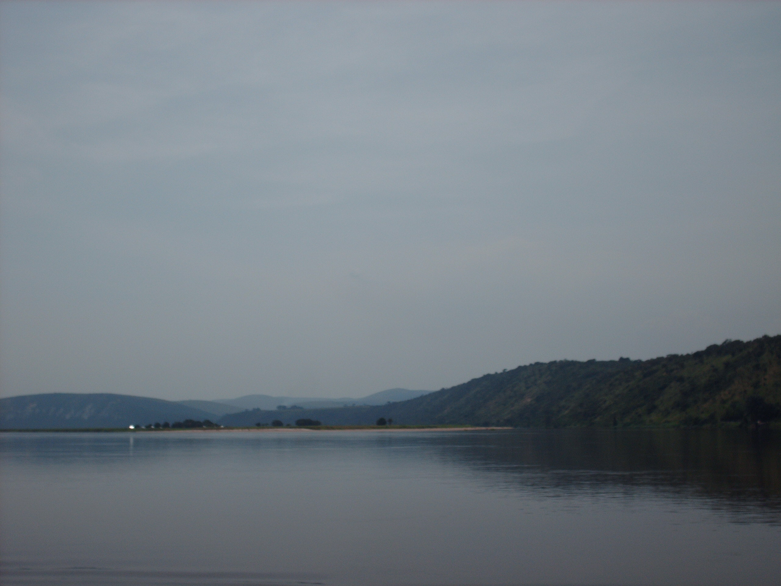
Les Rapides is one of Brazzaville residents' favourite outings: the point where the mighty Congo River, after flowing wide and calm past the city, begins to narrow and break into foaming rapids. From here, and for more than 300 kilometres towards the Atlantic, the river tumbles down an endless succession of rapids and falls —the Livingstone Falls— that make it completely unnavigable all the way to the sea. That geographical feature explains much of the region's history.
The place is both a natural spectacle and a leisure spot. From the terraces of its bars and restaurants, perched over the bank, you can see the wild water crashing against the rocks, the fishermen's canoes skilfully manoeuvring in the current and, across the river, the skyline of Kinshasa. It is the ideal spot to understand why the Congo River, despite its enormous flow, never served as a direct route from the interior to the ocean.
This guide explains how to visit Les Rapides from Brazzaville: how to get there, what to see, where to eat good river fish by the water and why this stretch of the Congo is so special. It is a short, cheap and very local trip, perfect for rounding off a visit to the capital with an afternoon on the banks of the great river.
The rapids that give this spot its name are the start of the Livingstone Falls, the gigantic staircase of rapids down which the Congo River loses height before reaching the Atlantic. It was precisely this impassable barrier that, for centuries, kept the vast interior of the Congo Basin cut off from the sea, shaped European exploration of the river in the 19th century and, in colonial times, forced the construction of the Congo-Ocean Railway to bypass the rapids and carry goods to the port of Pointe-Noire. Its story is told on our history page.
Read the full history ↓The laid-back capital born of Brazza's treaty with the Makoko, on the banks of the world's deepest river: birthplace of rumba, the sapeurs and the Poto-Poto school, facing the lights of Kinshasa.
Read the history of Brazzaville and the Congo River →No exact prices: a scale from $ (budget) to $$$$$ (luxury), with 2-3 options per category.
Origins, formation and what the sources say.
The Congo River rises in the highlands of the south-east of the continent and runs for some 4,700 kilometres in a great arc that crosses the equator twice, gathering the waters of an immense basin (home to the world's second-largest tropical rainforest) until it becomes the second-largest river on the planet by discharge, after the Amazon. For most of its course, the river flows wide and navigable across the great central depression of the basin. But as it nears the ocean, the African plateau drops sharply towards the narrow coastal plain, and the river has to overcome that difference in height in a very short distance.
That clash between plateau and coast is what creates the rapids you see at Les Rapides, on the doorstep of Brazzaville. Just upstream, the river widens into a large river lake called Pool Malebo (formerly Stanley Pool), facing Brazzaville and Kinshasa. Just downstream, that enormous flow is squeezed and plunges into the series of rapids known as the Livingstone Falls: 32 rapids and drops that take the river down some 270 metres over about 350 kilometres, as far as the port of Matadi, close to the sea.
This geological feature has an astonishing consequence: because of the force and depth with which the water carves out its bed along this stretch, the Congo is the deepest river in the world, with soundings of more than 220 metres at some points of the Livingstone Falls. You can sense all that power from the terraces of Les Rapides, where the great river starts to show its fury.
The historical consequence of these rapids is enormous: although the Congo River is a navigable waterway for thousands of kilometres inside the continent, you cannot sail it continuously from the interior to the Atlantic. The barrier of the Livingstone Falls cuts off the route just before the sea. For centuries, this kept the heart of Central Africa cut off from direct maritime trade, despite the presence of powerful kingdoms and very busy trade routes.
Portuguese navigators had reached the mouth of the Congo River as early as 1482, with Diogo Cão, and made contact with the Kingdom of Kongo, near the coast. But neither they nor the Europeans who came after them could travel up the river beyond the rapids: the interior remained a geographical mystery for almost four centuries. Trade (including the tragic slave trade) went overland and along the navigable stretches, with long detours to get around the barrier of water.
And so a natural feature like the rapids you see at Les Rapides shaped the history of an entire region: it was the reason the interior of the Congo Basin stayed out of the direct reach of the maritime powers for so long, and the reason European exploration of it came so late, well into the 19th century.
Europeans did not travel through the interior of the Congo River until the second half of the 19th century. The British explorer and missionary David Livingstone spent his last years searching for the sources of Africa's great rivers, and his name ended up being given to the Livingstone Falls, although he never travelled their full length. It was the journalist and explorer Henry Morton Stanley who, on his famous crossing of Africa from 1874 to 1877, came down the Congo River from the interior and faced the terrible series of rapids on its final stretch, losing men and boats in the attempt.
Stanley understood the strategic value of the great river lake that opens out in front of present-day Brazzaville, which for a long time bore his name (Stanley Pool, now Pool Malebo). Shortly afterwards, working for King Leopold II of Belgium, he founded the post of Léopoldville, the future Kinshasa, on the left bank. On the right bank, at almost the same time, the Italian-French explorer Pierre Savorgnan de Brazza founded the post of Brazzaville in 1880, after signing a treaty with the Téké king.
So the spot where the river widens into the Pool and then breaks into the rapids of Les Rapides became the stage for the Franco-Belgian rivalry for control of the Congo, one of the great chessboards of the 'Scramble for Africa'. Two twin cities were born facing each other across the water, right where the river stops being navigable to the sea.
The obstacle of the rapids called for a solution so that the riches of the interior could be shipped out to sea. The colonial answer was to build railways that went around the barrier of water. On the Belgian side, the Matadi–Léopoldville railway was built; on the French side, the Congo-Ocean Railway (CFCO), built between 1921 and 1934 to link Brazzaville (the end of inland navigation on the Pool) with the Atlantic port of Pointe-Noire, bypassing the falls and rapids overland.
The CFCO was a titanic and tragic undertaking: it was built with the forced labour of tens of thousands of Africans recruited from all over French Equatorial Africa, and disease, accidents and brutal conditions caused a huge death toll, especially on the mountain sections of the Mayombe. Thanks to the railway, Brazzaville became established as the hub between the river and the sea, and Pointe-Noire was born and grew as its port.
In this way, the rapids you now see as a picturesque landscape at Les Rapides were actually a decisive factor in the economy and political geography of the region: they forced the construction of railways, gave whole cities their reason to exist and set the route along which goods still travel today between the interior and the coast of the Congo.
Today, what was once a barrier feared by explorers and traders has become a place to relax. Les Rapides is where Brazzaville's residents head at weekends and in the late afternoon: a green, cool spot on the riverbank, with bars and restaurants where you can watch the wild water, eat fresh fish and enjoy the breeze. The geography that once isolated the region is now an attraction that makes it unique.
The area keeps its local, authentic character, far from mass tourism. Fishermen's pirogues still take on the current as they have for centuries, the river still breaks into foam and, on the other side, Kinshasa is a reminder that here, at this exact spot, two countries and two capitals look at each other across the water. It's a simple place but full of meaning: much of the natural and human history of the Congo River comes together here.
So visiting Les Rapides is much more than sitting in front of some rapids: it's a glimpse of the power of the world's second-largest river, a way to understand why the interior of Africa stayed isolated for so long and how a geographical feature shaped entire cities, railways and histories. All with a cold beer in your hand and the sunset turning the water gold.