Viajá con Gus
HomeCanadaCharlevoix
Charlevoix
🇨🇦 Canada · Quebec

Charlevoix

Jump to what you need
📌Province
Charlevoix (Quebec, Canada). It's a region of the province of Quebec on the shores of the St. Lawrence River, northeast of Quebec City, famous for its landscape of hills, valleys, farms and picturesque villages where the mountains plunge into the river. It's one of the most beautiful and most artistic regions of Quebec, recognised as a Biosphere Reserve by UNESCO. Its unique geography comes from a gigantic meteorite impact crater about 350 million years old, one of the largest inhabited craters in the world. Its main towns are Baie-Saint-Paul and La Malbaie
📌Gateway town
Charlevoix is toured by car along the St. Lawrence. Its two hubs are Baie-Saint-Paul, an artists' town with galleries, restaurants and inns, the gateway to the region; and La Malbaie, with the historic resort of Pointe-au-Pic and the luxurious Fairmont Le Manoir Richelieu. The gateway by air is Quebec City and its airport (YQB), a little over an hour's drive from Baie-Saint-Paul. From Charlevoix you can reach Tadoussac and the mouth of the Saguenay (whale watching) and Île aux Coudres
📌Best time to go
Charlevoix is enjoyable all year, but summer and autumn are the most rewarding. Summer (June to September) is ideal for touring the villages, the farms and the food route, hiking and enjoying the green landscapes. Autumn (late September to October) puts on one of the finest foliage displays in Quebec, with the hills turning red and orange. Winter brings skiing (at Le Massif de Charlevoix, one of the best resorts in the east) and snowy landscapes. Spring is quieter. The whale season in nearby Tadoussac runs from May/June to October
📌Currency
Canadian dollar (CAD). You can pay by card almost everywhere, though it's worth carrying some cash for farms, producers and small villages. In Quebec two taxes are added to most prices: the federal GST (5%) and the provincial QST (9.975%), close to 15% in total. The predominant language is French
📌Suggested days
Two days cover the essential towns: Baie-Saint-Paul (art and food) and La Malbaie, along the scenic St. Lawrence route with a few stops at farms and viewpoints. Three or four days add Le Massif de Charlevoix (views or skiing), Île aux Coudres, Parc national des Grands-Jardins or Parc national des Hautes-Gorges-de-la-Rivière-Malbaie, and the food route (the 'Route des Saveurs'). With five to seven days, Charlevoix pairs perfectly with a getaway to Tadoussac and the Saguenay fjord for whale watching
💱 CAD exchange rate
Loading rate…
🌤️ Weather in Charlevoix
Loading weather…

Charlevoix is one of the most beautiful and best-loved regions of Quebec: a succession of hills, valleys and picturesque villages on the shores of the St. Lawrence River, northeast of Quebec City, where the mountains seem to plunge into the water. It's a land of artists and good food, of farms and charming inns, declared a Biosphere Reserve by UNESCO, and it holds an astonishing geological secret: all its rolling relief sits on an enormous meteorite impact crater from about 350 million years ago.

Its two hearts are Baie-Saint-Paul, a charming artists' town full of galleries, restaurants and colourful houses (and, as it happens, the birthplace of Cirque du Soleil), and La Malbaie, with its elegant spa-resort tradition and the imposing Fairmont Le Manoir Richelieu looking out over the river. Between them unfolds one of the most beautiful scenic routes in Canada, dotted with farms, cheese dairies, vineyards, viewpoints and small villages like Saint-Irénée or Les Éboulements.

This guide covers Charlevoix with a practical, warm eye: which villages to visit, how to follow the food and art route, where the viewpoints and national parks are, how to go up Le Massif for the views or the skiing, and how to combine the region with Tadoussac and the whales of the Saguenay. It's a destination for anyone after landscapes, art, food of the land and the deep francophone soul of Quebec, far from the big cities.

📖 History of Charlevoix

The Charlevoix region was the territory of Indigenous peoples, especially the Innu (Montagnais) and other Algonquian peoples who travelled the north shore of the St. Lawrence. The European presence came early: Jacques Cartier himself sailed these waters in the 16th century, and under the French regime the first seigneuries and parishes were established along the river. The region owes its name to François-Xavier de Charlevoix, an 18th-century Jesuit priest and historian of New France. For centuries Charlevoix lived off farming, fishing, forestry and shipbuilding (the celebrated wooden 'goélettes'). In the 19th and early 20th centuries the beauty of its landscapes made it one of Quebec's first tourist and summer destinations: La Malbaie and Pointe-au-Pic drew the high society of Montreal, Quebec and the United States, who built summer villas and the grand Manoir Richelieu hotel. That same beauty made Charlevoix a land of artists: 19th- and 20th-century painters immortalised it in their canvases, and Baie-Saint-Paul established itself as an artists' colony. The region's geological secret is one of its greatest: about 350 million years ago a giant meteorite struck here and formed the Charlevoix crater, tens of kilometres across, whose semicircular depression explains much of the present-day relief and the layout of the villages. In 1988 UNESCO recognised Charlevoix as a Biosphere Reserve. The full story is on our history page.

Read the full history ↓

🏛️ Charlevoix is in Quebec

Canada's great French-speaking province: cradle of New France, founded by Champlain in 1608, land of the St. Lawrence River, of the nationalist fervor of the Quiet Revolution and of a Latin, European culture unique in North America.

Read the history of Quebec →

🗺️ What to see

1
Baie-Saint-Paul (the artists' town)
The charming artists' town that is the gateway to Charlevoix, with galleries, colourful houses and good food.
Baie-Saint-Paul is the most charming village in Charlevoix and its natural gateway: a town set in a valley opening onto the St. Lawrence River, ringed by hills, with a main street (rue Saint-Jean-Baptiste) full of life. Above all it's an artists' town: for more than a century the beauty of its landscapes drew painters who immortalised it, and today its streets hold a remarkable number of art galleries, studios, boutiques and cafés. Walking around Baie-Saint-Paul is a pleasure: its colourful wooden houses, its restaurants cooking from the land, its shops of local products (cheeses, chocolates, craft beer) and its relaxed, creative atmosphere make you want to stay. It also has a notable contemporary art centre (the Musée d'art contemporain de Baie-Saint-Paul) and hosts cultural events through the year. A curious fact: Baie-Saint-Paul is the birthplace of Cirque du Soleil, which started here from a group of street performers. From the town and its surroundings there are viewpoints with magnificent views over the valley, the river and Île aux Coudres, especially lovely at sunset and in autumn. It's the ideal place to start discovering Charlevoix and to base yourself. Getting there: by car, a little over an hour from Quebec City along the St. Lawrence route (Highway 138). Best time: summer and autumn (foliage); any time for art and food. Tips: give yourself time to walk the main street and step into the galleries; check the cultural events calendar; take the chance to buy local products from the 'Route des Saveurs'. A good launching point for the rest of the region.
ℹ️ Distance: The gateway to Charlevoix, a little over 1 h from Quebec City (by car) · Best time to go: Summer and autumn (foliage); all year for art and food · Admission: Walking around the town is free; most galleries are free to enter; the Musée d'art contemporain roughly CAD 12/adult (source: MACBSP, verified July 2026) · Duration: Half a day to a full day (and a base to stay)
2
La Malbaie and the Manoir Richelieu
Charlevoix's historic resort town, with its grand château-hotel looking out over the St. Lawrence.
La Malbaie is Charlevoix's other main hub and the historic heart of its tourist tradition. In the late 19th and early 20th centuries its Pointe-au-Pic sector became one of North America's fashionable resorts, where the high society of Montreal, Quebec and the United States spent the summer in elegant villas overlooking the river. That grand past can still be felt in its mansions and its distinguished air. The symbol of that era is the Fairmont Le Manoir Richelieu, an imposing hotel built to look like a French château, on a promontory with spectacular views of the St. Lawrence. It's one of Canada's great historic hotels, surrounded by gardens and with a casino next door, and even if you're not staying it's worth going over to admire the building and the views. The nearby Musée de Charlevoix tells the history and art of the region (adult admission roughly CAD 10). La Malbaie and its surroundings (Cap-à-l'Aigle, with its lilac gardens; Pointe-au-Pic) offer coastal walks, viewpoints and access to the spectacular Parc national des Hautes-Gorges. It's the ideal base for the eastern part of Charlevoix. Getting there: by car, following the St. Lawrence route from Baie-Saint-Paul (about 45 minutes along the coast). Best time: summer and autumn; the foliage sharpens the views from the Manoir. Tips: go over to the Manoir Richelieu for the views and, if it interests you, to the museum; take the coastal route between Baie-Saint-Paul and La Malbaie slowly, stopping at the villages and viewpoints along the way.
ℹ️ Distance: Eastern Charlevoix, about 45 min from Baie-Saint-Paul along the coast (by car) · Best time to go: Summer and autumn (foliage and views) · Admission: Walking around the town is free; Musée de Charlevoix roughly CAD 10/adult; the Casino de Charlevoix is free to enter (18 and over) (source: Musée de Charlevoix, verified July 2026) · Duration: Half a day to a full day
3
Le Massif de Charlevoix
The mountain with the greatest skiable vertical in eastern Canada and unique views of the St. Lawrence, all year round.
Le Massif de Charlevoix is the region's great mountain and one of its most spectacular attractions, in winter and in every other season. Its most distinctive feature is that it offers the greatest skiable vertical in eastern Canada, with the twist that its runs face straight onto the St. Lawrence River: skiing here means descending 'towards the river', with a view of the estuary few resorts in the world can match. In winter, Le Massif is one of the best ski and snowboard resorts in eastern North America, known for its heavy snow, its views and a less crowded feel than other big resorts. The adult day pass runs around CAD 135–166 depending on the date (source: official Le Massif site, 2025-26 season, verified July 2026). In the other seasons the mountain offers hiking, mountain biking and activities like the mountain luge descent, plus the chance to go up simply for the panoramic views over the St. Lawrence, Île aux Coudres and the Charlevoix landscape. Le Massif is also known for an ambitious tourism project driven by the founder of Cirque du Soleil, which includes a design hotel (Club Med Québec Charlevoix) and a scenic tourist train that runs along the riverbank between Quebec and Charlevoix (the 'Train de Charlevoix'), a lovely way to arrive. After years of uncertainty, the train ran successfully again in 2025 and confirmed its return for the 2026 season (it started in June), with summer and autumn departures (source: Train de Charlevoix / Groupe Voyages Québec, verified July 2026). Getting there: by car, near Petite-Rivière-Saint-François, between Quebec City and Baie-Saint-Paul. Best time: winter for skiing; summer and autumn for the views and the activities. Tips: in winter, check the snow report and book the pass online (cheaper); in other seasons, go up on a clear day for the views; look into the scenic tourist train as an alternative way to get there.
ℹ️ Distance: Near Petite-Rivière-Saint-François, between Quebec and Baie-Saint-Paul (by car) · Best time to go: Winter (skiing); summer and autumn (views and activities) · Admission: Adult ski pass roughly CAD 135–166/day (source: official Le Massif site, 2025-26 season, verified July 2026; dynamic pricing, cheaper online); summer activities priced by option · Duration: Half a day to a full day
4
Île aux Coudres
A peaceful island in the St. Lawrence, with historic mills, cycling and a traditional pace of life.
Île aux Coudres is a small, peaceful island in the middle of the St. Lawrence River, off the Charlevoix coast, reached on a short, free ferry crossing. Its name ('island of the hazel trees') was given by Jacques Cartier himself in the 16th century, when he found hazel trees on it. It's a place to slow down and enjoy a traditional pace of life, with its fields, its houses and its views of the river and the Charlevoix mountains on the far shore. The island is ideal to tour by bicycle: a loop of about 23 km follows its shores, and you can rent bikes (roughly CAD 30–45/day) to ride the full circuit at a gentle pace, stopping at its viewpoints and corners. Among its attractions are the historic mills (Les Moulins de l'Isle-aux-Coudres, a restored windmill and watermill that show how flour used to be ground; adult admission roughly CAD 13), small chapels, local artisan products (the island is famous for its apple products, such as 'pâte de fruits' and liqueurs) and the memory of the old traditions of schooner building and beluga hunting. It's a perfect half-day or full-day excursion from Baie-Saint-Paul, adding a touch of island calm to a Charlevoix visit. Getting there: by car to the landing (near Saint-Joseph-de-la-Rive) and then the free ferry to the island. Best time: spring to autumn (summer for cycling; autumn for the foliage). Tips: the ferry is free (even with a car); bring or rent a bike to tour the island; try the local apple products; check the ferry and mill timetables. An ideal plan to combine with Baie-Saint-Paul.
ℹ️ Distance: An island in the St. Lawrence; ferry from Saint-Joseph-de-la-Rive (drive to the landing) · Best time to go: Spring to autumn (cycling in summer, foliage in autumn) · Admission: Ferry free (cars included); Moulins de l'Isle-aux-Coudres roughly CAD 13/adult; bike rental CAD 30–45/day (source: Moulins de l'Isle-aux-Coudres and local operators, verified July 2026) · Duration: Half a day to a full day
5
National parks (Hautes-Gorges and Grands-Jardins)
Two spectacular mountain parks: canyons and rivers in Hautes-Gorges, tundra and caribou in Grands-Jardins.
The mountainous interior of Charlevoix hides two Quebec national parks (managed by the Sépaq) that show the region's wildest, grandest face, both framed by the ancient meteorite crater. Parc national des Hautes-Gorges-de-la-Rivière-Malbaie is one of the most impressive landscapes in eastern Canada: a deep river canyon hemmed in by some of the highest mountains east of the Rockies, with the rivière Malbaie winding through it. You can explore it on spectacular trails (like L'Acropole des Draveurs, a demanding hike with vertiginous views) and, above all, on a relaxing boat trip (croisière en bateau-mouche, roughly CAD 50/adult, park access included; verified July 2026) that sails between the canyon walls. It's a must for nature lovers. Parc national des Grands-Jardins, further inland, is a surprise for its landscape: in the middle of southern Quebec it holds an almost subarctic setting, with taiga, tundra and coniferous forest, home to a caribou population and to lakes and mountains. It's a unique place for hiking (with summits like Mont du Lac des Cygnes), wildlife watching and, in winter, snow activities. Getting there: by car, in the interior of Charlevoix (Hautes-Gorges is reached from the La Malbaie/Saint-Aimé-des-Lacs area; Grands-Jardins from the road inland). Best time: June to October for hiking and cruises (autumn for the foliage); winter for snow. Tips: you pay the Sépaq admission (roughly CAD 9.55–10.25/adult/day; verified July 2026); book the Hautes-Gorges cruise and the activities ahead; bring hiking boots, water and warm layers; check the distances and access roads.
ℹ️ Distance: Inland Charlevoix (Hautes-Gorges near La Malbaie; Grands-Jardins further inland) (by car) · Best time to go: June to October (hiking, cruises, foliage); winter for snow · Admission: Sépaq admission roughly CAD 9.55–10.25/adult/day (under-18s free); the Hautes-Gorges bateau-mouche cruise roughly CAD 50/adult (access included) (source: Sépaq, verified July 2026) · Duration: Half a day to several days
6
The scenic and food route (Route des Saveurs)
The drive along the St. Lawrence coast among farms, cheese dairies, vineyards and charming villages.
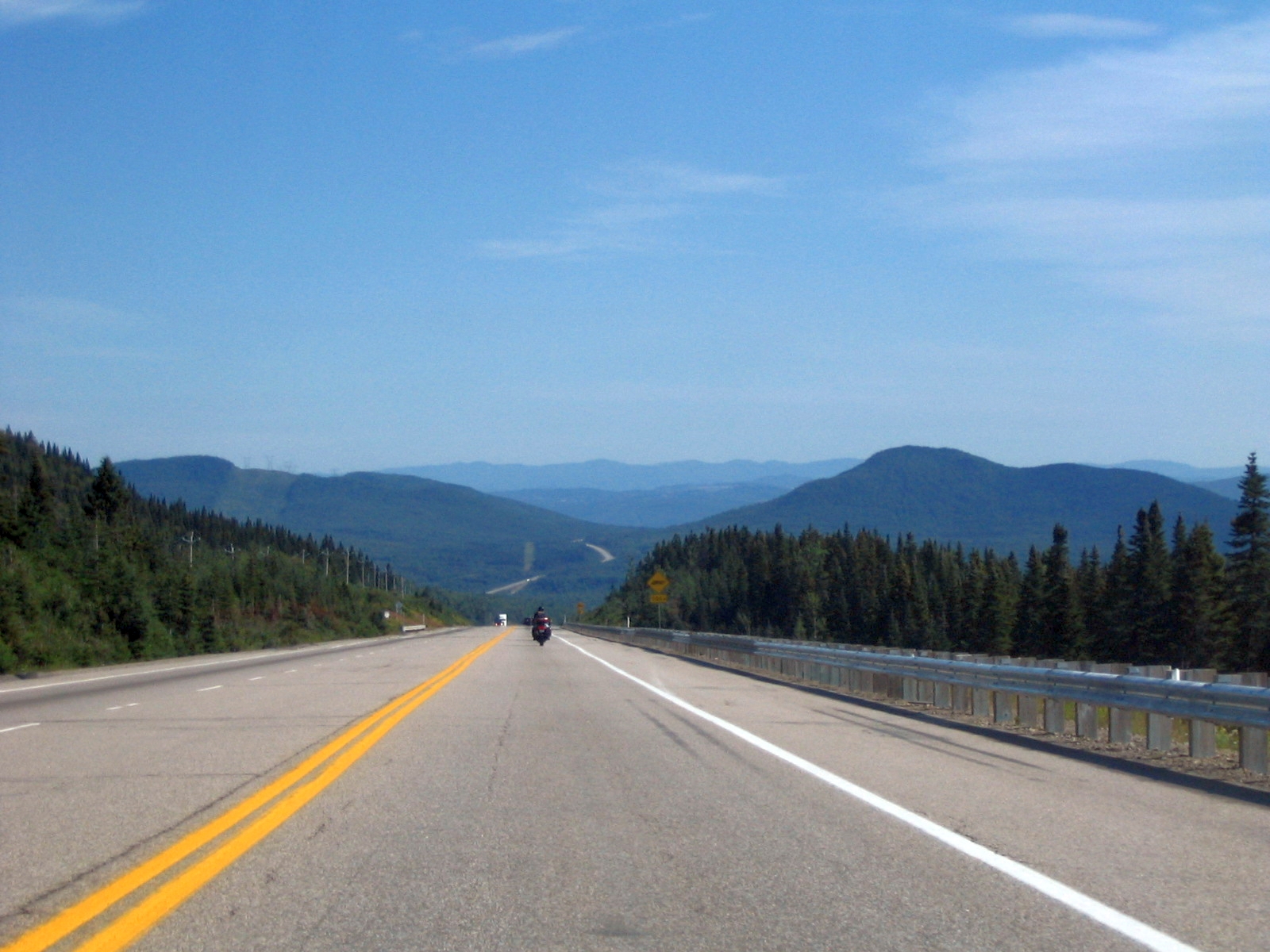
One of the best ways to experience Charlevoix is simply to drive it slowly along the scenic route that follows the St. Lawrence shore and winds through the hills. The road between Baie-Saint-Paul and La Malbaie (Highway 362 along the coast, prettier than the 138) is one of the most beautiful in Canada: it climbs and drops among farms, passes through charming villages like Les Éboulements, Saint-Irénée or Saint-Joseph-de-la-Rive, and hands you constant viewpoints over the river, Île aux Coudres and the mountains. To that scenic pleasure, Charlevoix adds its culinary reputation. The region is one of Quebec's great destinations for food of the land, with a well-known food route (the 'Route des Saveurs de Charlevoix') that brings together producers and restaurants: artisan cheese dairies (with award-winning cheeses, like Maison Maurice Dufour), farms, bakeries, chocolate makers, craft breweries (Microbrasserie Charlevoix), cider houses, vineyards and even one of Quebec's first protected designations of origin for a food product (Charlevoix lamb). Visiting the producers, tasting their cheeses, charcuterie, breads and drinks (tastings roughly CAD 5–15, verified July 2026), and eating in restaurants that work with these local products is an essential part of the experience. It's the ideal destination to combine landscape, art and good food in a single trip, stopping at every village and every farm that catches your eye. Getting there: by car, following the coastal route (362) between Baie-Saint-Paul and La Malbaie and the roads out to the producers. Best time: summer and autumn (seasonal produce and foliage). Tips: take the day slowly so you can stop at farms, cheese dairies and viewpoints; check the 'Route des Saveurs' map; book at the most sought-after restaurants; bring a cooler for the food shopping.
ℹ️ Distance: The St. Lawrence coast between Baie-Saint-Paul and La Malbaie (Highway 362) (by car) · Best time to go: Summer and autumn (seasonal produce and foliage) · Admission: Driving the route is free; producer visits and tastings roughly CAD 5–15; restaurant meals depend on what you order (verified July 2026) · Duration: Half a day to a full day
Advertisements
What nobody tells you

💵 Prices

Tickets

TypePrice
Villages (Baie-Saint-Paul, La Malbaie) and the scenic routeFree (open access) (verified July 2026)
Art galleries, Musée d'art contemporain (Baie-Saint-Paul) and Musée de CharlevoixMany galleries are free to enter; Musée d'art contemporain roughly CAD 12; Musée de Charlevoix roughly CAD 10/adult (source: the museums' official sites, verified July 2026)
Le Massif de Charlevoix (skiing)Adult day pass roughly CAD 135–166 (source: official Le Massif site, 2025-26 season, verified July 2026; dynamic pricing, cheaper online)
Ferry to Île aux CoudresFree (the ferry is free, cars included) (source: Société des traversiers du Québec, verified July 2026)
Moulins de l'Isle-aux-Coudres and the island's attractionsMoulins roughly CAD 13/adult; bike rental on the island CAD 30–45/day (source: Moulins de l'Isle-aux-Coudres, verified July 2026)
Parc national des Hautes-Gorges (admission and cruise)Sépaq admission roughly CAD 9.55–10.25/adult/day; bateau-mouche cruise roughly CAD 50/adult (access included) (source: Sépaq, verified July 2026)
Parc national des Grands-Jardins (Sépaq admission)Roughly CAD 9.55–10.25/adult/day; under-18s free (source: Sépaq, verified July 2026)
Producer visits (Route des Saveurs)Tastings roughly CAD 5–15 depending on the producer (source: Route des Saveurs producers, verified July 2026)
🔄 updated monthlyOfficial / reference values · double-check when buying

Activities and tours

ActivityPriceDurationOperator
Touring the galleries and art of Baie-Saint-PaulMany galleries free; Musée d'art contemporain roughly CAD 12/adult (verified July 2026)Half a dayLocal galleries and art centres
Food route (Route des Saveurs): farms, cheese dairies, vineyardsTastings roughly CAD 5–15; meals depend on what you order (verified July 2026)Half a day to a full dayCharlevoix producers (Route des Saveurs)
Skiing at Le Massif de CharlevoixAdult day pass roughly CAD 135–166 (source: official Le Massif site, 2025-26 season, verified July 2026)Half a day to a full dayLe Massif de Charlevoix
Cruise through the canyon of Parc national des Hautes-GorgesRoughly CAD 50/adult (park access included) (source: Sépaq, verified July 2026)1-2 hSépaq (bateau-mouche)
Hiking (L'Acropole des Draveurs, Mont du Lac des Cygnes)Sépaq admission roughly CAD 9.55–10.25/adult/day (source: Sépaq, verified July 2026)Half a day to a full daySépaq
Cycling and wandering on Île aux CoudresFerry free; bike rental CAD 30–45/day (verified July 2026)Half a dayBike rental on the island (Vélo-Coudres)
Charlevoix scenic tourist train (summer–autumn season)Scenic ride roughly CAD 50–100/person depending on the route (source: Train de Charlevoix; running in 2026, verified July 2026)VariesTrain de Charlevoix
Whale-watching trip at Tadoussac/Baie-Sainte-CatherineBoat roughly CAD 100–130/adult; zodiac from CAD 99.99 (source: Croisières AML, verified July 2026, + taxes)2-3 hCroisières AML and Saguenay operators
🔄 updated monthlyOfficial / reference values · double-check when buying
Advertisements

🚌 How to get there and distances

Getting around

ModePriceDurationNotes
Car / car rentalRental roughly CAD 50–90/day from Quebec; fuel roughly CAD 1.55/litre (verified July 2026)VariesEssential. Charlevoix is a large region toured along the St. Lawrence route, with villages, farms and parks spread out. A car lets you stop at viewpoints and producers whenever you like. Highway 362 along the coast is the most scenic
Ferry to Île aux CoudresFree (cars included) (source: Société des traversiers du Québec, verified July 2026)Short crossing (~15 min)Free ferry from Saint-Joseph-de-la-Rive to the island. On the island, a bike is the ideal way around
Scenic tourist train (Train de Charlevoix)Roughly CAD 50–100/person depending on the route (source: Train de Charlevoix, verified July 2026)VariesA scenic train running along the St. Lawrence shore between the Quebec area and Charlevoix; a scenic transport option. It runs from June to autumn (confirmed for 2026); check timetables and departures
Organised excursionsDay tour from Quebec roughly CAD 100–180/personVariesAgencies run excursions to Charlevoix from Quebec City for those who don't drive (check ahead)
🔄 updated monthlyOfficial / reference values · double-check when buying

How to get there

RouteAirlines / operatorsAvg. priceDuration
Quebec City (YQB) → Baie-Saint-Paul (by car)Your own car or a rentalRental CAD 50–90/day + fuel (about 95 km)A little over 1 h (via Highway 138)
Quebec City → Charlevoix (scenic train)Train de Charlevoix (runs summer–autumn; confirmed for 2026)Roughly CAD 50–100/person depending on the route (verified July 2026)A scenic ride along the riverbank
International flights to Quebec (YQB) or Montreal (YUL) + carAirlines to Quebec/Montreal (Air Canada, WestJet, Porter)Depends on origin and airline; then a car from CAD 50/dayFlight + road transfer
Charlevoix → Tadoussac/Saguenay (whales) via Highway 138 + ferryCar + free ferry at the mouth of the Saguenay (Baie-Sainte-Catherine ↔ Tadoussac)Ferry free; fuel onlyRoughly 1.5-2 h from La Malbaie + the ferry
Driving the north shore of the St. Lawrence from other regionsYour own car or a rentalFuel onlyDepends where you start
🔄 updated monthlyOfficial / reference values · double-check when buying

🏨 Where to stay

No exact prices: a scale from $ (budget) to $$$$$ (luxury), with 2-3 options per category.

CategoryPriceRecommended options
Historic and luxury hotels (Manoir Richelieu, inns)$$$$$CAD 250–500 a night. The emblematic Fairmont Le Manoir Richelieu in La Malbaie, château-like and with river views, tops the luxury offering, alongside high-end relais with standout dining (Auberge des Falaises, Hôtel & Spa Le Germain Charlevoix)
Charming inns and gastronomic auberges$$$$$CAD 180–350 a night. Charlevoix is famous for its charming 'auberges' (inns), many with excellent cooking from the land (La Pinsonnière, Auberge des Peupliers), spread across Baie-Saint-Paul, La Malbaie and the coastal villages. The essence of staying in the region
Mid-range hotels, B&Bs and chalets$$$$$CAD 120–220 a night. Mid-range hotels, bed and breakfasts and rental chalets in the villages and along the river, good value for the charm, ideal as a base for touring the region by car
Budget / camping and simple options$$$$$Camping in the national parks (Hautes-Gorges, Grands-Jardins) CAD 30–45 a night; the Sépaq's prêt-à-camper ready-pitched tents roughly CAD 100–140; motels and simple options from CAD 90. For travellers on a tight budget or after nature

🍴 Where to eat

TypePriceOptions / signature dish
Charlevoix cooking from the land (Route des Saveurs)$$$$$Tasting menu CAD 70–130; a dish CAD 30–50. Charlevoix is one of Quebec's great food destinations: restaurants and auberges working with local products (Charlevoix lamb with a designation of origin, artisan cheeses, charcuterie, cider and wine), many tied to the 'Route des Saveurs'
Bistros and creative kitchens in Baie-Saint-Paul$$$$$A dish CAD 25–42. The artists' town is full of bistros and creative kitchens combining market cooking with the region's artistic spirit, plus the Microbrasserie Charlevoix and cafés (Le Mouton Noir, Joe Smoked Meat)
Cheese dairies, farms and producers to taste at$$$$$Tasting CAD 5–15; purchases depend on the product. Visits and tastings straight at artisan cheese dairies (Maison Maurice Dufour, with award-winning cheeses), farms, chocolate makers, bakeries and cider houses across the region, where you can buy and try the products of the land
Cafés, bakeries and home cooking$$$$$Coffee or a light meal CAD 6–18. Cafés, bakeries and home cooking in the villages, handy for breakfast, a coffee or a light bite between stops on the scenic route
Advertisements

📖 History of Charlevoix

Origins, formation and what the sources say.

The Innu and the first inhabitants of the north shore of the St. Lawrence

Long before the villages and the charming inns existed, the north shore of the St. Lawrence River, where Charlevoix stretches today, was travelled by Indigenous peoples. The region and its surroundings were part of the territory of Algonquian peoples, especially the Innu (historically also known as the Montagnais, the 'mountain people'), hunter-gatherers who moved with the resources of the season: they hunted, fished in the river and its tributaries and travelled by canoe along a network of waterways connecting the St. Lawrence with the interior.

The great river — which the Indigenous peoples and later the French would see as a natural highway — was the axis of life in the region. The mouth of the nearby Saguenay River, a little further northeast, was also an important meeting and trading point between different peoples, where the richness of the waters (which draws the whales today) also drew hunters of marine mammals.

This millennia-old Indigenous presence is the deepest layer of Charlevoix's history. Although the later French colonisation radically transformed the region, the landscape that would captivate artists and summer visitors — the river, the mountains, the valleys — was the same one these peoples had lived in and travelled for thousands of years.

The Indigenous peoples of the north shore
The sources place Algonquian peoples, in particular the Innu/Montagnais, as the traditional inhabitants and users of the north shore of the St. Lawrence in the Charlevoix and Saguenay area. Territorial boundaries and patterns of use were fluid and seasonal, as is typical of hunter-gatherer peoples, so they're described in general terms.
Source: https://www.thecanadianencyclopedia.ca/en/article/innu-montagnais-naskapi

Jacques Cartier, New France and the origin of the name

The European presence in Charlevoix goes back to the earliest days of French exploration of America. The navigator Jacques Cartier, on his voyages up the St. Lawrence in the 1530s, sailed these waters; he's credited, for example, with the name of Île aux Coudres ('island of the hazel trees'), which he is said to have given on finding hazel trees there. Later, under the French regime of New France (17th and 18th centuries), the region began to be settled: seigneuries and parishes were established along the riverbank, and the first villages were founded, such as Baie-Saint-Paul, one of the oldest in the region.

The region owes its name to an 18th-century figure: Father François-Xavier de Charlevoix, a Jesuit priest, explorer and historian of New France. Charlevoix travelled through America and wrote an influential history of New France, and his surname ended up naming this region of Quebec in his honour.

Under the French regime and, after the British conquest of 1759-1760, under British rule, Charlevoix developed a francophone, Catholic rural society organised around its parishes, its fields and the river. Its people lived off farming on land won from the slopes, off fishing, off the forest and off a trade that would become emblematic: building wooden schooners, the 'goélettes', which for generations plied the St. Lawrence carrying goods.

The origin of the name 'Charlevoix'
There's consensus that the region takes its name from the French Jesuit, explorer and historian François-Xavier de Charlevoix (18th century), author of a history of New France. The name was applied to the region in his honour; the administrative details of when it was fixed as the official designation can vary between sources.
Source: https://www.thecanadianencyclopedia.ca/en/article/charlevoix

The secret underfoot: the Charlevoix meteorite crater

Beneath the villages, the farms and the rolling valleys of Charlevoix lies one of Quebec's most astonishing geological secrets: the region sits on a gigantic meteorite impact crater. About 350 million years ago a meteorite several kilometres across struck the Earth at this point, releasing colossal energy and gouging out a crater tens of kilometres in diameter (estimates put it at around 54 km), one of the largest known impact craters in the world and, remarkably, one of the few that is densely inhabited.

Over hundreds of millions of years, erosion, glaciers and geological processes transformed and softened the crater, but its mark still deeply shapes today's landscape. The region's characteristic semicircular layout — that sort of great arc of low, fertile land ringed by mountains — corresponds in large part to the structure of the ancient crater. In fact, many of Charlevoix's villages line up precisely along the most fertile depression left by the impact, while the crater rim forms mountainous relief. At the centre of the structure rises a massif (Mont des Éboulements), corresponding to the 'central peak' that usually forms in large impact craters.

So the landscape that visitors fall in love with, and that inspired generations of artists, has a literally cosmic origin. Charlevoix is a place where people live, farm and holiday on the scar of one of the greatest catastrophes this part of the planet ever suffered, a geological eternity ago.

The Charlevoix crater and its age
The scientific community recognises Charlevoix as a large meteorite impact crater, dated to around 350-450 million years ago (estimates vary between studies) and with an estimated diameter of about 54 km. It's considered one of the largest densely inhabited impact craters in the world. The exact figures for age and size are still being refined by research.
Source: https://en.wikipedia.org/wiki/Charlevoix_crater

The high-society resort and the Manoir Richelieu (19th-20th centuries)

Through the 19th century and into the early 20th, Charlevoix's extraordinary beauty made it one of the earliest and most prestigious summer holiday destinations in North America. The arrival of steamships along the St. Lawrence (the 'bateaux blancs', the white boats) made it easy for the high society of Montreal, Quebec City and, above all, the big cities of the eastern United States to discover the region and adopt it as a fashionable summer retreat.

The epicentre of that aristocratic tourism was La Malbaie, and particularly its Pointe-au-Pic sector, where wealthy summer visitors built elegant summer villas overlooking the river, many of which still stand. The region filled with hotels and grand houses, and earned a reputation as a distinguished resort. The symbol of that golden age is the Manoir Richelieu (today the Fairmont Le Manoir Richelieu), a grand hotel built to look like a French château on a promontory with views of the St. Lawrence, which hosted the elite of the period and remains, rebuilt, one of Canada's great historic hotels.

That tourist tradition, one of the oldest in the country, left a deep mark on Charlevoix's identity: the region grew used early on to receiving visitors and to caring for its landscape as its greatest treasure, laying the foundations of the tourist and food destination it is today.

Charlevoix as a pioneering tourist destination
The sources agree that Charlevoix, and especially La Malbaie/Pointe-au-Pic, was one of the earliest and most prestigious summer destinations in North America from the 19th century onward, driven by the steamships and the influx of high society, with the Manoir Richelieu as its emblem. It's a widely accepted characterisation of its tourist history.
Source: https://www.thecanadianencyclopedia.ca/en/article/charlevoix

A land of artists: Baie-Saint-Paul and the painting of Charlevoix

The same beauty that drew the summer visitors also captivated artists, and Charlevoix became one of the great sources of inspiration for Quebec and Canadian painting. From the end of the 19th century and through the 20th, many painters went to Charlevoix — and very particularly to Baie-Saint-Paul — to capture its landscapes of hills, valleys, farms, the river and the region's very particular light. The colourful houses, the sloping fields, the St. Lawrence and the mountains became recurring motifs in countless canvases.

Baie-Saint-Paul, at the heart of a valley opening onto the river, established itself as a genuine artists' colony. That vocation is fully alive: today the town is full of art galleries, studios and cultural centres, and it holds events devoted to the visual arts. But Charlevoix's creative legacy goes beyond painting: Baie-Saint-Paul is also the birthplace of Cirque du Soleil, the famous circus company that began in the early 1980s from a group of street performers from the region, before becoming a worldwide phenomenon.

This double identity — a land of landscapes and a land of artists — is one of Charlevoix's distinguishing marks and an essential part of its charm: touring the region means, to a large extent, walking through the settings that inspired so many works and through villages where art is still part of everyday life.

Baie-Saint-Paul as an artists' colony and the birthplace of Cirque du Soleil
The sources recognise Charlevoix, and especially Baie-Saint-Paul, as an important centre of Quebec landscape painting from the end of the 19th century, and Baie-Saint-Paul as the birthplace of Cirque du Soleil (in the 1980s). The details of the company's exact beginnings can vary from account to account, but the link with the region is well documented.
Source: https://en.wikipedia.org/wiki/Baie-Saint-Paul

Biosphere Reserve and today's Charlevoix (1988)

International recognition of Charlevoix's exceptional value — its landscape, its biodiversity, its geology and the harmonious relationship between its people and nature — came in 1988, when UNESCO designated the region a World Biosphere Reserve under its Man and the Biosphere (MAB) programme. The distinction recognises Charlevoix as a territory where nature conservation coexists sustainably with human activity (farming, tourism, village life), and it stretches from the shore of the St. Lawrence to the almost subarctic settings of the interior, like those of Parc national des Grands-Jardins.

Protected too through its national parks (Hautes-Gorges-de-la-Rivière-Malbaie, Grands-Jardins) managed by Quebec's parks network, Charlevoix has managed to preserve what made it famous: its landscapes, its rural heritage and its character. On those foundations, the region has reinvented itself over recent decades as a destination combining nature, art and, very prominently, cooking of the land, with a producers' route ('Route des Saveurs') and a recognised food identity that place it among Quebec's great destinations for eating well.

Today's Charlevoix gathers all its layers of history: the millennia-old territory of the Indigenous peoples, the legacy of New France, the cosmic secret of its meteorite crater, the elegance of its resort past, its soul as a land of artists and its commitment to caring for nature. Travelling through it means, at the same time, taking in one of the most beautiful landscapes in Canada and reading in it, layer by layer, a fascinating story that runs from the stars to the table.

The Biosphere Reserve designation (1988)
UNESCO designated Charlevoix a World Biosphere Reserve in 1988, under the MAB programme, recognising the coexistence of nature conservation and sustainable human activity in the region. It's a recognised milestone in its identity as a natural and cultural destination.
Source: https://en.unesco.org/biosphere/eu-na/charlevoix

📚 Bibliography

  • Wikipedia (ES) — «Charlevoix (Quebec)»: https://es.wikipedia.org/wiki/Charlevoix_(Quebec)
  • Wikipedia (EN) — «Charlevoix (region)»: https://en.wikipedia.org/wiki/Charlevoix_(region)
  • The Canadian Encyclopedia — «Charlevoix»: https://www.thecanadianencyclopedia.ca/en/article/charlevoix
  • Wikipedia (EN) — «Charlevoix crater»: https://en.wikipedia.org/wiki/Charlevoix_crater
  • Wikipedia (EN) — «Pierre François Xavier de Charlevoix»: https://en.wikipedia.org/wiki/Pierre_Fran%C3%A7ois_Xavier_de_Charlevoix
  • Wikipedia (EN) — «Baie-Saint-Paul»: https://en.wikipedia.org/wiki/Baie-Saint-Paul
  • Wikipedia (EN) — «La Malbaie»: https://en.wikipedia.org/wiki/La_Malbaie
  • Wikipedia (EN) — «Fairmont Le Manoir Richelieu»: https://en.wikipedia.org/wiki/Fairmont_Le_Manoir_Richelieu
  • UNESCO — «Charlevoix Biosphere Reserve» (MAB): https://en.unesco.org/biosphere/eu-na/charlevoix
  • The Canadian Encyclopedia — «Cirque du Soleil»: https://www.thecanadianencyclopedia.ca/en/article/cirque-du-soleil

❓ Frequently asked questions

What is the Charlevoix crater?+
It's one of the region's most astonishing geological secrets: about 350 million years ago a giant meteorite (several kilometres across) struck here and formed an enormous impact crater tens of kilometres in diameter, one of the largest inhabited craters in the world. That semicircular depression explains much of Charlevoix's rolling relief and the layout of its villages and valleys. Today people live on the crater almost without noticing, but it's at the root of the region's unique landscape.
Which two villages are unmissable?+
Baie-Saint-Paul, the gateway to Charlevoix, a charming artists' town with galleries, colourful houses, good food and the birthplace of Cirque du Soleil; and La Malbaie, the historic resort town with the imposing Fairmont Le Manoir Richelieu overlooking the river. Between them runs the prettiest scenic route in the region. It's worth doing both, plus the small villages along the way (Les Éboulements, Saint-Irénée).
Do I need a car to visit Charlevoix?+
Yes, it's practically essential. Charlevoix is a large region best enjoyed by driving the St. Lawrence coast (rental roughly CAD 50–90/day), stopping at villages, farms, cheese dairies and viewpoints as you please. Highway 362 along the coast is the most scenic. Public transport is limited. A scenic alternative for part of the journey is the tourist train, but for getting around the region a car is the best option.
How much does it cost to ski at Le Massif?+
The adult day pass at Le Massif de Charlevoix runs around CAD 135–166 for the 2025-26 season (verified July 2026), with dynamic pricing depending on the date (weekdays and buying ahead online tend to be cheaper; with accommodation on the mountain it drops to around CAD 110). Le Massif has the greatest skiable vertical in eastern Canada and unique views of the St. Lawrence River. In summer and autumn the mountain offers other activities and panoramic views.
Can I combine Charlevoix with whale watching?+
Yes, it's a classic and highly recommended combination. At the northeastern end of Charlevoix, Highway 138 takes you (across a free ferry at the mouth of the Saguenay River) to Tadoussac and Baie-Sainte-Catherine, one of the best places in the world for whale watching. The trip (Croisières AML and others) runs around CAD 100–130 per adult by boat, or from CAD 99.99 by zodiac (verified July 2026). From La Malbaie it's roughly 1.5 to 2 hours. The whale season runs from May/June to October.
Why do they say Charlevoix is a land of artists and good food?+
Because of its history and its present. The beauty of its landscapes drew painters from the 19th century onward who immortalised it, and Baie-Saint-Paul established itself as an artists' colony, today full of galleries. On the food side, Charlevoix is one of Quebec's great destinations for cooking of the land, with a food route (the 'Route des Saveurs') bringing together cheese dairies, farms, vineyards, cider houses and restaurants that work with award-winning local products, like Charlevoix lamb. Art and good food go hand in hand.
Is it worth going even if I don't ski?+
Absolutely. Le Massif may be a great ski resort, but Charlevoix shines in every season for its villages, its art, its food, its landscapes and its national parks (Hautes-Gorges, Grands-Jardins). Summer and autumn are, for many, the best times, with no skiing involved: driving the scenic route, visiting Baie-Saint-Paul and La Malbaie, sailing the Hautes-Gorges canyon (cruise roughly CAD 50, verified July 2026) or wandering Île aux Coudres are plans that don't depend on snow.
Sources consulted (19)
Still planning?
Explore more destinations in Canada
See all destinations →
Advertisements
Image credits
Photos from Wikimedia Commons, each under its own licence (CC BY, CC BY-SA or public domain). Open each file to see its author and licence.
060821-02