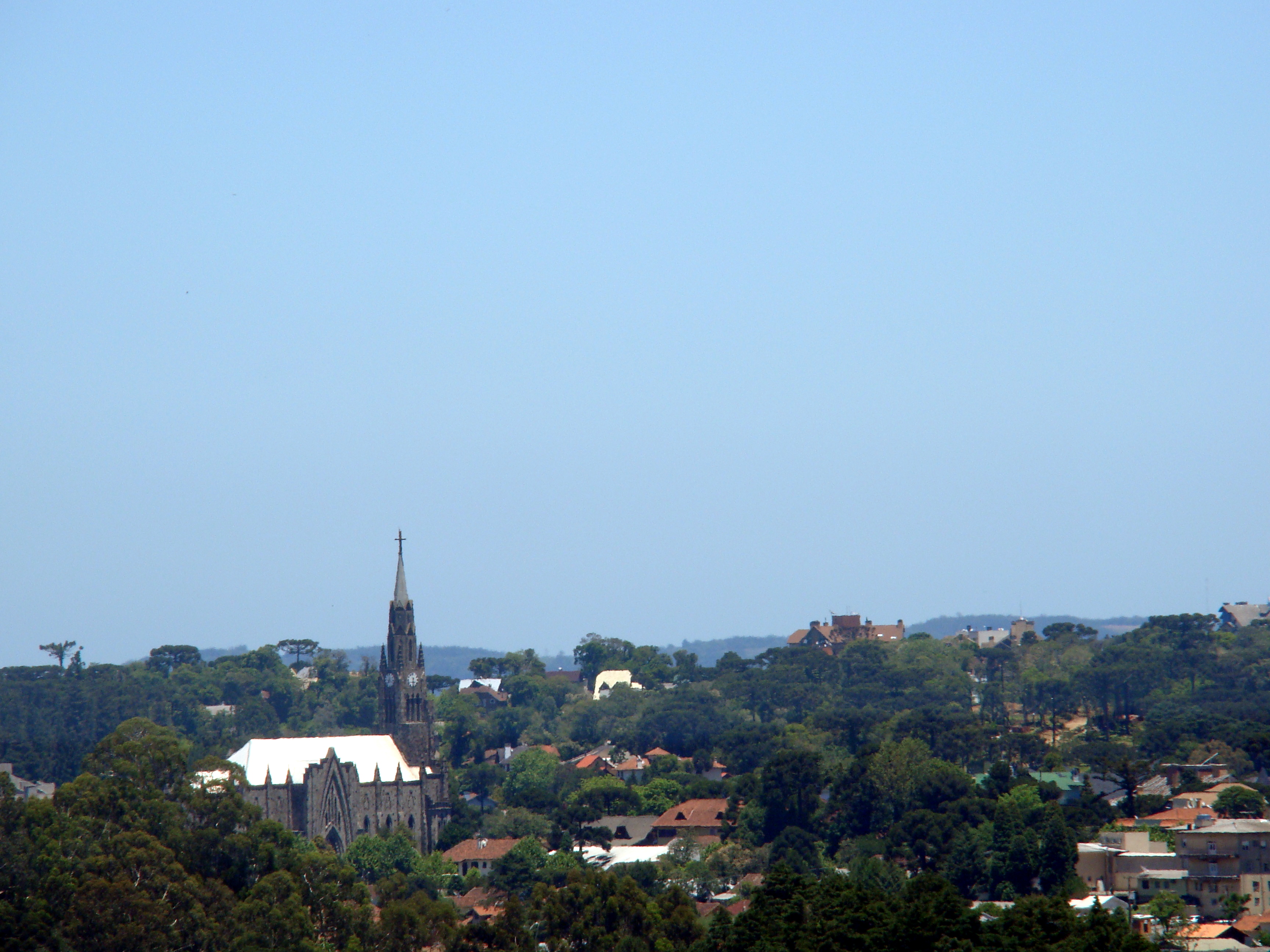
Canela is a mountain town in the Serra Gaúcha, in the northeast of Rio Grande do Sul, the inseparable sibling and neighbor of Gramado: barely 8 km separate the two town centers, and many travelers take them in as a single destination. But Canela has a character of its own and, for many, a more authentic and less commercial charm than its famous neighbor. Here nature is what rules: waterfalls, state parks, araucaria pines and cool highland air that makes you want to walk.
Its great icon is the Cascata do Caracol, an imposing waterfall of some 130 meters that drops through the araucaria forest inside the Parque do Caracol, one of the most photographed postcards in southern Brazil. Add to that the Catedral de Pedra (Catedral de Nossa Senhora de Lourdes), a neo-Gothic church built in basalt stone that dominates the center, and an endless run of adventure and viewpoint attractions nearby, such as the Parque da Ferradura and the canyon of the Caí River.
This guide covers the essentials of Canela with a practical eye and real prices: how to get there and get around, what to see among waterfalls, parks and churches, where to sleep and eat in the Serra Gaúcha, and how to combine the visit with Gramado, Bento Gonçalves and the canyons of the highlands. Canela is nature, mountain cold, chocolate, fondue and paths through araucarias: the greener, more adventurous side of the most touristy region in southern Brazil.
Canela was born in the early 20th century as a stop on the tropeiro route and as part of the logging of the Serra Gaúcha's araucaria forests, in a region settled by German and Italian immigrants. For a long time it was part of Gramado, until it became a municipality of its own in 1944. Local tradition traces its name to an old canela tree (several species of the laurel family) that served as a landmark. Over time, mountain tourism, the waterfalls and the cool climate turned it, alongside Gramado, into one of Brazil's great highland destinations. The full story is on our history page.
Read the full history ↓Brazil's southernmost state: a disputed frontier of the Pampa and of the Guaraní Jesuit missions, cradle of the gaúcho of mate and churrasco. Land of the Farroupilha Revolution and of Garibaldi, of the German and Italian immigration of the Serra Gaúcha, of wine and of the spectacular canyons of Cambará do Sul.
Read the history of Rio Grande do Sul →If you book from here we earn a commission and you pay no more. Prices and availability come from Civitatis.
No exact prices: a scale from $ (budget) to $$$$$ (luxury), with 2-3 options per category.
Origins, formation and what the sources say.
Local tradition says it all started with a tree. At a crossroads in the mountains, where the drovers stopped to rest their mule trains after exhausting days on the road, there grew a leafy canela tree that gave shade and served as a landmark. 'Let's stop at the canela', they would say, and that simple gesture —naming a place after the tree that marked it— ended up christening a whole town that, a century later, would be one of the most visited mountain destinations in Brazil.
The history of Canela is tied to the roads of the Serra Gaúcha and to the immense araucaria forest (the pinheirais) that covered the highlands of northeastern Rio Grande do Sul. Before the town existed, the region was a corridor for the tropeiros, the drovers who led trains of mules and cattle between the south of the country and the fairs of the interior. At those crossings of tracks, more than 800 meters up, the cool climate and the woods defined the landscape.
The town's name, according to the most widespread tradition, comes precisely from that old, leafy canela tree (a Portuguese name for several species of the laurel family, not for the spice) that grew beside the road and served as a landmark and a resting point for travelers; the repeated use of the expression among drovers ended up fixing the place name.
Through the 19th century and the beginning of the 20th, European settlement —above all German and Italian immigrants arriving in Rio Grande do Sul— gradually populated these lands. Logging araucaria timber, farming and ranching gave the first economic push to a region that, decades later, would find its true calling in tourism.
For much of their history, Canela and Gramado grew together, as part of a single territory in the Serra region. Canela was for a long time a district tied to the administration of the Taquara area and, later, to Gramado, with which it shares its origin, its landscape and its immigrant culture. The close relationship between the two towns —barely 8 kilometers apart— holds to this day and explains why they are usually visited as a single destination.
Population growth, driven by European settlement and by the timber and farming economy, led to a push for administrative autonomy. Canela broke away and was established as a municipality in 1944, separating from Gramado and taking on an identity of its own. From then on, the two towns followed parallel but distinct paths.
The strong mark left by German and Italian immigrants shows in the architecture, the food (the café colonial, fondue, the cured meats and sweets) and the traditions of the region, which in time became part of the tourist appeal of the Serra Gaúcha.
Canela's identity, like that of the whole Serra Gaúcha, is deeply marked by 19th-century European immigration. From 1824 the Brazilian imperial government encouraged German settlers to come to Rio Grande do Sul, and from 1875 it added a large wave of Italian immigrants. These families settled in the valleys and highlands of the mountains, where they were given small plots of land (the 'colônias') to clear the forest and take up family farming, animal raising and trades.
The Germans settled first in the Gramado-Canela region and neighboring areas, while the Italians predominated somewhat further north, around Bento Gonçalves and Caxias do Sul, where they developed winegrowing. In Canela's case, that German and Italian inheritance translated into a particular culture: houses of wood and stone, vegetable gardens, grapevines, cured meats and preserves, baking, homemade sweets and a strong religious tradition, along with araucaria woodworking.
That cultural matrix is, today, one of the region's great tourist draws. The café colonial —a generous afternoon spread of German and Italian origin—, fondue, the craft breweries, the chocolate shops and the European-inspired architecture are not a recent invention for tourists, but the development, adapted to tourism, of a real immigrant inheritance. Understanding that settlement helps you read Canela's landscape and its table beyond the cold weather and the waterfalls.
From the middle of the 20th century, Canela found its great engine of development in mountain tourism. The cool climate, the araucarias, the waterfalls and the canyons of the region drew visitors from all over Brazil, especially from the hot cities of the south and southeast, who came looking for the mountain cold, above all in winter.
Two milestones shaped the town's tourist identity. On one side, the Cascata do Caracol, the roughly 130-meter waterfall in what is today the Parque Estadual do Caracol, became one of the natural icons of southern Brazil. On the other, the building of the Catedral de Pedra (Catedral de Nossa Senhora de Lourdes), begun around the middle of the century and raised in basalt stone in a neo-Gothic style, gave the center a monument with a European air that became the symbol of the town.
Over the years, adventure parks, viewpoints such as the Parque da Ferradura, theme parks on the road toward Gramado and a full range of pousadas, fondue restaurants, colonial cafés and chocolate shops were added to those attractions. Today Canela, together with Gramado, forms the heart of gaúcho mountain tourism, one of the most visited destinations in Brazil.
Few buildings sum up Canela's character as well as its Catedral de Pedra, formally the Catedral de Nossa Senhora de Lourdes. Its history was not that of a quick job: the neo-Gothic project went up in stages across several decades of the 20th century, with local basalt stone as the main material, quarried and worked by stonemasons from the mountain region itself. That unhurried pace of construction, financed in good part by contributions from the local Catholic community —many of them descendants of the German and Italian settlers who had arrived decades earlier— explains why the main tower, today more than 60 meters high, took so long to finish.
The choice of neo-Gothic style was no accident: it set out to evoke the stone cathedrals of central Europe, an architectural nod to the roots of much of the Serra Gaúcha's immigrant population. The result —a slender tower, stained glass, pointed arches, all in dark stone— gave Canela a symbolic center that set it apart from other rural towns in the region, many of which kept more modest churches of wood or plain masonry.
Over the years the cathedral became far more than a church: it is the geographical and emotional heart of the town, ringed by the Praça da Matriz with its gardens and fountains, the stage for the main religious and civic celebrations, and the star of the Christmas and winter postcards that today identify Canela in any tourist brochure. Its carillon, which rings at certain hours, marks the everyday pulse of downtown.
The Cascata do Caracol, today Canela's most photographed icon, was not always protected. For much of the first half of the 20th century, the araucaria forest around the waterfall met the same fate as much of the woodland of the Serra Gaúcha: logging. Araucaria trunks, prized for their soft, versatile timber, fed sawmills across the region, and the landscape that looks untouched today was, at some point, at risk of disappearing along with the rest of the native forest.
The creation of the Parque Estadual do Caracol, which surrounds and protects the waterfall and its araucaria setting, was the institutional answer to that degradation, in line with a wider conservation movement that, in the middle and late 20th century, led to the creation of several parks and reserves in the Serra Gaúcha and in the neighboring canyon region (Aparados da Serra, Serra Geral). Protecting the area not only saved the waterfall's landscape but also allowed the orderly development of the tourist infrastructure that surrounds it today: the main viewpoint, the staircase of more than 900 steps down to the base of the falls, and more recently the Observatório Ecológico, the panoramic tower with an elevator that offers privileged views of the whole scene.
Today the park runs on a management model that combines conservation and tourism, with paid admission that funds the upkeep of the trails and the infrastructure, and special benefits (the 'Bilhete Gaúcho' and free entry for local residents) meant to keep the bond between the park and the community around it. For any visitor, understanding this story of exploitation and later protection adds a layer of meaning to the walk down to the base of the waterfall: what you see today might not have survived.