Viajá con Gus
Home › Benin › W National Park
W National Park
🇧🇯 Benin · The north: Atacora, Borgou and the parks

W National Park

🪪 What do I need to enter Benin?Pick your citizenship and we tell you the visa, the days and the paperwork, with the official source.

By leaving your email and citizenship you agree to receive the documents you asked for and weekly travel news. You can unsubscribe whenever you want. How we handle your data.
Jump to what you need
📌Safety warning
IMPORTANT: W National Park, in the far north of Benin (on the border with Niger and Burkina Faso), is today one of the MOST DANGEROUS areas in the country. Jihadist groups have settled in the park since 2020 and turned it into a base of operations; there have been deadly attacks and armed groups have a strong presence. Tourism is completely closed. Foreign ministries strongly advise against all travel to this region. This page describes the park's natural value and the reality of the situation, but tourist visits are NOT possible under current conditions. Always check your country's official travel advice.
📍Region
W National Park (or Park W, named after the double bend the Niger River traces in the area) is a vast cross-border savanna park shared by Benin, Niger and Burkina Faso, covering more than 10,000 km² across the three countries. The Beninese section lies in the far north-east of the country, in the Alibori and Borgou departments, along the border with Niger (marked by the Niger River) and with Burkina Faso. Together with Arly and Pendjari, it forms part of the large W-Arly-Pendjari (WAP) protected complex.
📌Recognition
Park W was the first park in the region to be inscribed by UNESCO as a World Heritage Site (the Nigerien section in 1996), and the recognition was later extended to cover the cross-border W-Arly-Pendjari (WAP) complex. It is also a Biosphere Reserve. Together with its neighbouring parks, it forms the largest expanse of protected savanna in West Africa and an essential refuge for the region's wildlife.
📌Wildlife
The complex that Park W belongs to is home to some of the last viable populations of large mammals in West Africa: elephants, lions (the West African subspecies, critically endangered), cheetahs, buffalo, hippos, and a wide variety of antelopes and birds. In natural terms, it is one of the most valuable areas in the region.
📌Tourism status
Tourism in Park W is closed. The occupation of the park by armed jihadist groups makes any tourist activity impossible in the Beninese section (and across large areas on the Nigerien and Burkinabe sides). There are currently no operating safaris, guides or accommodation in the Beninese part of the park.
📌Currency
The region's currency is the West African CFA franc (XOF), pegged to the euro (1 EUR = 655,957 XOF) and at around 600 XOF to the dollar (2024). In practice, this information is for reference only: the park is not accessible to tourists under current conditions.
💱 XOF exchange rate
Loading rate…
🌤️ Weather in W National Park
Loading weather…

In natural terms, W National Park is one of the great treasures of West Africa: a huge savanna park of more than 10,000 km² shared by Benin, Niger and Burkina Faso, named after the double bend (a 'W') that the Niger River traces as it passes through the area. Together with the neighbouring Arly and Pendjari parks, it forms the cross-border W-Arly-Pendjari (WAP) complex, the largest expanse of protected savanna in the region and an essential refuge for elephants, lions, cheetahs and extraordinary wildlife.

It was also a conservation pioneer: the Nigerien section of Park W was the first site in the region inscribed by UNESCO as a World Heritage Site, in 1996, and the recognition was later extended to the whole WAP complex. A Biosphere Reserve and a symbol of three countries working together to protect a shared ecosystem, Park W was one of the great hopes for nature-based ecotourism in West Africa.

However, this guide has to be blunt: today Park W is one of the most dangerous areas in Benin. Since 2020, jihadist groups have settled in the park and turned it into a base of operations, with deadly attacks and a strong armed presence. Tourism is completely closed and foreign ministries strongly advise against travelling to the region. Here we present the park's natural and historical value and the reality of the situation, but we want to be clear that tourist visits are neither possible nor advisable under current conditions. Safety comes first.

📖 History of W National Park

Protected since the colonial era and established as a park in the mid-20th century, W National Park is named after the double bend the Niger River traces in the area. Shared by Benin, Niger and Burkina Faso, it became a symbol of cross-border conservation: the Nigerien section was inscribed by UNESCO as a World Heritage Site in 1996, and the recognition was later extended to the W-Arly-Pendjari (WAP) complex, a Biosphere Reserve and the largest protected savanna in West Africa. But since 2020, the spread of the jihadist insurgency in the Sahel has turned the park into a refuge and base for armed groups, with deadly attacks that have made it one of the most insecure areas in the country and shut down tourism completely.

Read the full history ↓

🏛️ W National Park is in the north: Atacora, Borgou and the parks

The other Benin: the Bariba kingdom of Borgou, the earthen fortress-houses of Somba country (a World Heritage Site) and the great Pendjari and W parks, the last wildlife sanctuaries of West Africa.

Read the history of The north: Atacora, Borgou and the parks →

🗺️ What to see

1
The Niger River and the 'W' shape
The distinctive double bend of the Niger River that gives the park its name and marks the region's natural border.
Leer más ↓
Park W owes its unusual name to the double bend (a 'W') that the Niger River traces as it flows through this part of West Africa. The great river, one of the most important on the continent, marks the border between Benin and Niger here and shapes the park's landscape, with its riverside gallery vegetation, its floodplains and its role as a source of life for all the wildlife. This geographical feature is more than a curiosity: the river and its tributaries structure the park's ecosystem, concentrate animal life and partly explain the area's natural wealth. The Niger's 'W' is one of the most recognisable geographical features on the map of Africa. Current status: the area is currently inaccessible to tourists because of the occupation by armed groups; this description is a natural and geographical reference.
ℹ️ Location: Benin-Niger border, marked by the Niger River · Interest: Geography, hydrology, riverside habitat · Status: Area inaccessible for safety reasons (2024) · Note: Reference description; visit not possible
2
The large mammals of the WAP complex
Elephants, West African lions, cheetahs and buffalo, among the last viable populations in the region.
Leer más ↓
As part of the W-Arly-Pendjari complex, Park W is home to some of the last viable populations of large mammals in West Africa. Savanna elephants, the West African lion (a genetically distinct, critically endangered subspecies), the cheetah, the buffalo and other large herbivores survive here. The conservation of these species depends on vast, connected protected areas like this one. Park W's conservation value is immense: it is part of the most important natural corridor for megafauna in the whole region. Before the security crisis, it was also a potential ecotourism destination, although always less developed for tourism than neighbouring Pendjari. Current status: the occupation of the park by armed groups not only prevents tourism but also seriously threatens the conservation of these species and the work of the rangers. Reference description.
ℹ️ Species: Elephant, West African lion, cheetah, buffalo, antelopes · Importance: Last viable populations in the region (WAP complex) · Status: Conservation under threat; tourism closed for safety reasons (2024) · Note: Reference description; visit not possible
3
World Heritage Site and Biosphere Reserve
Park W was a pioneer: the first site in the region inscribed by UNESCO (Nigerien section, 1996), now part of the cross-border WAP complex.
Leer más ↓
Park W holds a prominent place in the history of conservation in West Africa. Its Nigerien section was the first site in the region inscribed by UNESCO on the World Heritage List, in 1996, in recognition of its outstanding natural value. The recognition was later extended to cover the cross-border W-Arly-Pendjari (WAP) complex, which brings the parks of the three countries together into a single World Heritage Site. The park is also a UNESCO Biosphere Reserve and an example of cross-border management, with Benin, Niger and Burkina Faso working together to protect an ecosystem that knows no borders. It is the largest expanse of protected savanna in West Africa and a natural heritage of global value. Current status: this conservation value coexists with a security crisis that has turned much of the complex into a conflict zone, putting at risk both the natural heritage and the lives of those who protect it. Reference description.
ℹ️ Recognition: World Heritage Site (Nigerien section 1996; extended WAP complex); Biosphere Reserve · Management: Cross-border cooperation between Benin, Niger and Burkina Faso · Importance: Largest protected savanna in West Africa · Status: Complex seriously affected by insecurity (2024)
4
A birdwatching paradise
The WAP complex, which includes Park W, is a top destination for birds, with hundreds of savanna and wetland species.
Leer más ↓
Beyond the large mammals, Park W and the wider W-Arly-Pendjari complex are a major birdwatching destination, with hundreds of bird species linked to the variety of habitats: wooded savanna, gallery forests, the banks of the Niger and wetlands. Raptors, storks, herons, hornbills, bee-eaters and many waterbirds and savanna birds find refuge in the park, especially around the watercourses. This birdlife is part of the complex's enormous natural value and, before the crisis, was one of the potential draws for specialist ecotourism. As with the mammals, the conservation of these bird populations depends on the ecosystem remaining protected. Current status: the park is inaccessible because of the security situation; this description is a natural reference.
ℹ️ Diversity: Hundreds of bird species (WAP complex) · Habitats: Savanna, gallery forest, wetlands, banks of the Niger · Status: Inaccessible for safety reasons (2024) · Note: Reference description; visit not possible
5
Cross-border cooperation and the rangers
Park W is a symbol of joint management between Benin, Niger and Burkina Faso, and of the difficult work of the rangers who protect the WAP complex.
Leer más ↓
One of Park W's most notable features is its cross-border nature: for decades, protecting this shared ecosystem has required cooperation between Benin, Niger and Burkina Faso, in a joint effort to conserve the largest protected savanna in West Africa. This coordinated management, supported by international organisations, made the W-Arly-Pendjari complex a model of regional conservation. Behind this protection are the rangers, whose patrols and fight against poaching are essential for the survival of the wildlife. With the outbreak of conflict, their work has become extremely dangerous, and many have ended up on the front line of the insecurity. Recognising their role means understanding that conservation is not just about nature, but also about the people who sustain it. Current status: cooperation and conservation are seriously compromised by the armed occupation of much of the complex; this description is a reference and a tribute to that work.
ℹ️ Management: Cross-border cooperation between Benin, Niger and Burkina Faso · Key players: Rangers and conservation organisations · Status: Work seriously compromised by insecurity (2024) · Note: Reference description; visit not possible
6
The savanna landscape and wetlands
Vast savannas, gallery forests, floodplains and waterholes that support great biodiversity.
Leer más ↓
Park W protects a mosaic of landscapes typical of the Sudano-Sahelian savanna: grassy plains with scattered trees, gallery forests along the rivers, floodplains, hills and numerous waterholes. This variety of habitats supports enormous biodiversity, including large mammals, birds (the WAP complex is a top birdwatching destination) and other forms of life. The wetlands and the banks of the Niger and its tributaries are especially important, serving as a refuge for wildlife in the dry season and as breeding and feeding grounds for countless species. It is a complete, functioning ecosystem, one of the few preserved on this scale in West Africa. Current status: the park's natural wealth remains, but it is currently inaccessible and its conservation is threatened by the conflict. Natural reference description.
ℹ️ Habitats: Savanna, gallery forest, wetlands, banks of the Niger · Biodiversity: Great richness of mammals, birds and other species · Status: Inaccessible for safety reasons; conservation under threat (2024) · Note: Reference description; visit not possible
📶I have never landed without internet. I arrive and my phone connects to the strongest network in the country I am visiting: I can say I landed, sort out transport, book tours and keep posting, at a seriously good price. I always use the Maya eSIM — check their plans by clicking the banner.See plans →Maya Mobile eSIM — connect before you land
What nobody tells you

💵 Prices

Tickets

TypePrice
Acceso al parque (parte beninesa)Not applicable: tourism is closed because of the occupation by armed groups and the security situation (2024)
Referencia históricaBefore the crisis, access to the Beninese section required an entry fee, a 4x4 vehicle and a guide, with rates comparable to those elsewhere in the region; today there are no tourism operations
🔄 updated monthlyOfficial / reference values · double-check when buying

Activities and tours

ActivityPriceDurationOperator
Safari / wildlife viewingNot available: tourism closed for safety reasons (2024)--
Any tourist activity in the parkNot possible under current conditions; check official advice--
🔄 updated monthlyOfficial / reference values · double-check when buying

🚌 How to get there and distances

Getting around

Park access
Not applicable
Notes
The Park W area (north-eastern Alibori/Borgou, on the border with Niger and Burkina Faso) is advised against by foreign ministries and occupied by armed groups; do not attempt to enter
Reference towns (Kandi, Banikoara)
Notes
Kandi and Banikoara used to be gateway towns to the region; today the entire northern border strip calls for extreme caution and checking official advice
🔄 updated monthlyOfficial / reference values · double-check when buying

How to get there

Access to Park W (Beninese section)
Not applicable
DurationArea advised against; tourism closed for safety reasons (2024)
Regional reference
Duration
The far north of Benin (border with Niger and Burkina Faso) is under a do-not-travel advisory; always check the latest official recommendations
🔄 updated monthlyOfficial / reference values · double-check when buying

🏨 Where to stay

No exact prices: a scale from $ (budget) to $$$$$ (luxury), with 2-3 options per category.

Accommodation in the park
Price$$$$$
Recommended options
There are no tourism operations or operating accommodation in the Beninese section of Park W under current security conditions
General note
Price$$$$$
Recommended options
The entire northern border strip is advised against for tourism; there is no safe base from which to visit the park today

🍴 Where to eat

TypePriceOptions / signature dish
Servicios en el parque$$$$$Not available: the area is closed to tourism because of the security situation

📖 History of W National Park

Origins, formation and what the sources say.

The Niger River and the geography of a 'W'

W National Park takes its unusual name from the double bend, a 'W', that the Niger River traces as it flows through this part of West Africa, where the borders of Benin, Niger and Burkina Faso meet. The great river is one of the continent's main waterways, and together with its tributaries it shapes the park's whole ecosystem. It creates gallery forests along the riverbanks, floodplains and waterholes that sustain animal life in the middle of the Sudano-Sahelian savannah.

Across the three countries, the park covers more than 10,000 km² of savannah, gallery forest, hills and wetlands. The Beninese section lies in the far northeast of the country, in the Alibori and Borgou departments, along the border with Niger (marked by the river) and with Burkina Faso. Few people live here and nature dominates. It sits at the heart of one of the most ecologically valuable regions of West Africa.

You can't understand the park without its cross-border character. Ecosystems and wildlife know no borders, and protecting an area this vast only makes sense on a regional scale. That is why Park W was born, and grew, around the idea of countries working together to conserve a shared natural heritage.

fr.wikipedia.org · Parc national du Wen.wikipedia.org · W National Park

A conservation pioneer in West Africa

Protection of the W region began in the French colonial era, with wildlife reserves set up to preserve the abundant wildlife of this savannah. In the mid-20th century, the area was organised as a national park in each of the territories that are now Benin, Niger and Burkina Faso, which secured its status as a protected area. Park W became one of the region's best-known natural areas.

International recognition came in 1996, when UNESCO added the Niger section of Park W to the World Heritage List. It was the first site in West Africa to earn that status for its natural value, a milestone for conservation in the region. The park was also declared a Biosphere Reserve under the UNESCO programme that aims to balance nature protection with the development of local communities.

Over time, that recognition grew to cover the entire W-Arly-Pendjari (WAP) cross-border complex, bringing the parks of the three countries together as a single large World Heritage Site. The WAP became the largest expanse of protected savannah in West Africa and a model of cross-border management, with Benin, Niger and Burkina Faso cooperating to protect a shared ecosystem and its iconic wildlife.

whc.unesco.orgfr.wikipedia.org · Parc national du W

A refuge for West Africa's megafauna

The natural value of Park W and the WAP complex is immense. Wildlife has disappeared from much of its historical range in this region, and these protected savannahs have become one of the last refuges for West Africa's megafauna. Populations of savannah elephant, cheetah, buffalo and a wide variety of antelope survive here. So does the West African lion, a genetically distinct subspecies that is critically endangered, with only a few hundred animals left.

The W-Arly-Pendjari complex is estimated to hold a very significant share of the large mammals still surviving anywhere in West Africa. That makes its conservation a priority not only for the country but for the continent: the future of iconic species across the whole region depends to a large extent on this area surviving. The park is also a first-class birdwatching destination, with a huge variety of birds drawn to its wetlands and savannahs.

For decades, this natural value fed hopes for ecotourism that would benefit both conservation and local communities. Park W was always less developed for tourism than neighbouring Pendjari, but it was part of a vision of northern Benin finding pride and progress in its natural heritage. That vision, however, would be cut short when the conflict arrived.

whc.unesco.orgen.wikipedia.org · W National Park

Jihadist occupation: from sanctuary to armed base

From 2020 onwards, the spread of the jihadist insurgency in the Sahel changed the reality of Park W dramatically. Armed groups began moving into the region from eastern Burkina Faso and south-western Niger. They were linked to organisations such as JNIM (tied to Al-Qaeda) and the Islamic State in the Greater Sahara. At first they used the park as a transit and smuggling route. Later they took advantage of its size, its small population and how hard it is to control, settled inside it and turned it into a base and a hideout.

In time, Park W came to be described as a kind of 'headquarters' for these groups. From there they organised their expansion southwards, eastwards and westwards, and launched attacks on other areas. Vast, rugged terrain, a presence across borders and weak state control in a remote region made the park especially hard to win back. Wildlife and rangers were caught in the middle of a conflict.

The years that followed brought repeated, very deadly attacks. Beninese military positions came under deadly assault inside the park and in the 'Point Triple' area, where Benin, Burkina Faso and Niger meet. Jihadist groups claimed some of these attacks, which rank among the most serious Benin has ever suffered. Sources cited in the press put the number of Beninese soldiers killed in the region at more than a hundred between 2021 and the end of 2024. Tourism was shut down completely.

adf-magazine.com · Benins w national park becomes headquarters…crisisgroup.org · 310 containing militancy west africas park w

Today: nature caught in a conflict

Today W National Park is one of the most dangerous areas of Benin. It is a tragic example of how the Sahel security crisis has reached and transformed an exceptional natural area. Tourism is completely closed and conservation is under serious threat. Protecting wildlife has become extremely difficult and dangerous in a territory occupied by armed groups. Foreign ministries firmly advise against all travel to the region.

Analysts such as those at International Crisis Group have stressed the close link between biodiversity and security here. The very things that make the park a refuge for wildlife, its size, its isolation and its cross-border character, have also made it a refuge for armed groups. Containing the insurgency while saving the natural heritage calls for complex responses that combine security, development for local communities and conservation, in a very unstable regional context.

The future of Park W, like that of the whole region, depends on stability returning. Its natural value is still intact in potential. It is part of the largest protected savannah in West Africa, a refuge for elephants and lions and a World Heritage Site. But it remains inaccessible and at risk. For travellers, Park W is not a destination today. It is a reminder of what is at stake on this border: a natural heritage of global value caught in a conflict. Any approach to the region must start, without exception, from the official travel advice and the utmost caution. Safety comes first.

crisisgroup.org · 310 containing militancy west africas park wtheconversation.com · Benin pourquoi les djihadistes ciblent les…

📚 Bibliography

  • UNESCO — W-Arly-Pendjari Complex (World Heritage Site): https://whc.unesco.org/en/list/749/
  • Wikipedia (FR) — «Parc national du W»: https://fr.wikipedia.org/wiki/Parc_national_du_W
  • Wikipedia (EN) — «W National Park»: https://en.wikipedia.org/wiki/W_National_Park
  • International Crisis Group — Containing the jihadist insurgency in Park W: https://www.crisisgroup.org/fr/africa/sahel/burkina-faso-niger-benin/310-containing-militancy-west-africas-park-w
  • Africa Defense Forum — Park W becomes a 'headquarters' for terrorists: https://adf-magazine.com/2024/05/benins-w-national-park-becomes-headquarters-for-terrorists/
  • The Conversation — Why jihadists target Benin's parks: https://theconversation.com/benin-pourquoi-les-djihadistes-ciblent-les-parcs-nationaux-253605
  • Wikipedia (EN) — «W National Park massacre»: https://en.wikipedia.org/wiki/W_National_Park_massacre
  • Wikipedia (EN) — «2025 Point Triple attack»: https://en.wikipedia.org/wiki/2025_Point_Triple_attack
  • OSAC — Benin Country Security Report: https://www.osac.gov/Country/Benin/Content/Detail/Report/14e7534b-2c90-415f-8d8b-1d3f9fbe8a25
  • Jeune Afrique — The terrorist attack in Park W: https://www.jeuneafrique.com/1311934/politique/benin-l-attaque-terroriste-dans-le-parc-du-w-signe-du-risque-de-propagation-du-jihadisme/

❓ Frequently asked questions

Can you visit W National Park in Benin?+
No. Tourism in Park W is completely closed. Since 2020, jihadist groups have settled in the park and turned it into a base of operations, with deadly attacks and a strong armed presence. It is now one of the most dangerous areas in Benin, and foreign ministries strongly advise against travelling to the region. Do not attempt to enter under any circumstances. If you are interested in West African nature, plan your trip around other parts of the country and always check the latest official travel advice.
Why is Park W important from a natural point of view?+
Because it is part of the W-Arly-Pendjari (WAP) complex, the largest expanse of protected savanna in West Africa and an essential refuge for the region's megafauna: elephants, West African lions (a critically endangered subspecies), cheetahs, buffalo and a wide variety of antelopes and birds. It was a conservation pioneer (its Nigerien section was the first site in the region inscribed by UNESCO as a World Heritage Site, in 1996) and it is a Biosphere Reserve. Its natural value is enormous, even though it is inaccessible today.
Why is it called Park 'W'?+
The name comes from the double bend — a 'W' — that the Niger River traces as it flows through this region, on the border between Benin and Niger. It is one of the most recognisable geographical quirks on the map of Africa. The Niger River and its tributaries shape the park's ecosystem and are home to much of its wildlife.
What has happened to security in W National Park?+
Since around 2020, armed groups linked to the Sahel's jihadist insurgency, operating from eastern Burkina Faso and south-western Niger, have moved into W National Park. They first used it as a transit and smuggling route, then as a base and refuge, until it became a kind of 'headquarters'. There have been deadly attacks on Beninese military positions in the area, some of the worst the country has suffered. Tourism has been shut down, and the region is now one of the most dangerous in Benin.
Is there any other way to see wildlife in Benin?+
Under current conditions, safari options in the north (Pendjari and W) are closed or heavily restricted for security reasons. If nature is what draws you, the sensible thing is to research the situation thoroughly before making any plans and to focus on experiences in the centre and south of the country, which don't face this problem (landscapes, culture, wetland wildlife and birds in safe areas). Whatever your plans for any part of the north, always check your country's latest official travel advice. Safety must come before any sightseeing goal.

More places in Benin

Parque Nacional de la PendjariPorto-NovoPossotoméSavalouAbomeyBoukoumbé
See every place in Benin →The history of Benin →
Sources consulted (7)
Still planning?
Explore more destinations in Benin
See all destinations →
Image credits
Photos from Wikimedia Commons, each under its own licence (CC BY, CC BY-SA or public domain). Open each file to see its author and licence.
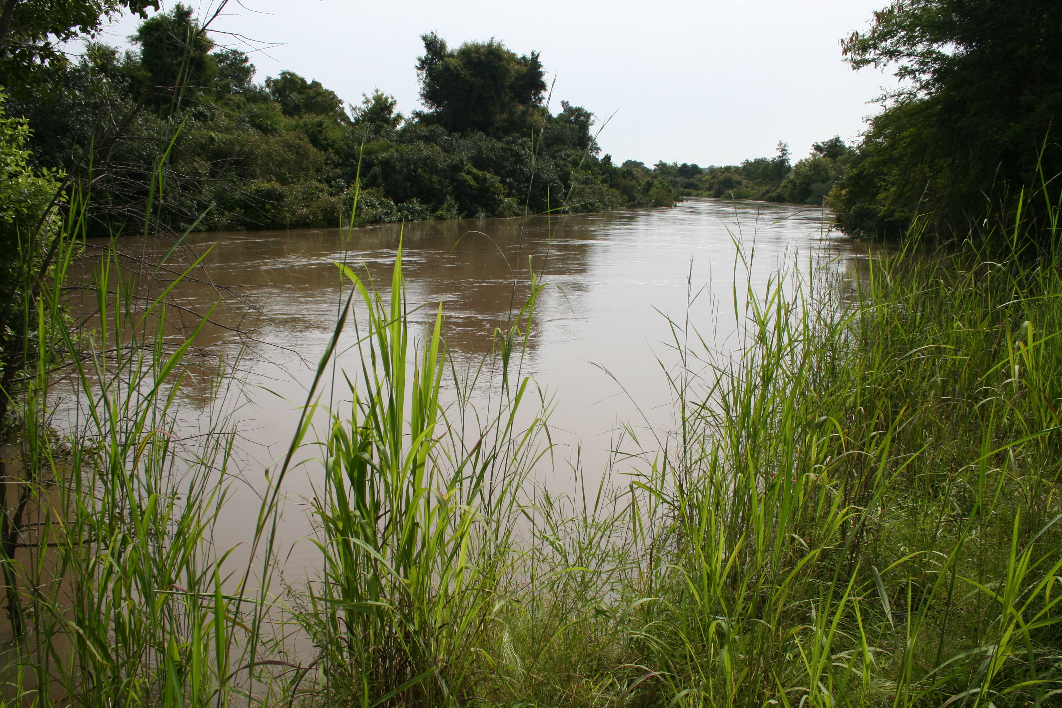
Mekrou river in W-National Park MS 6380