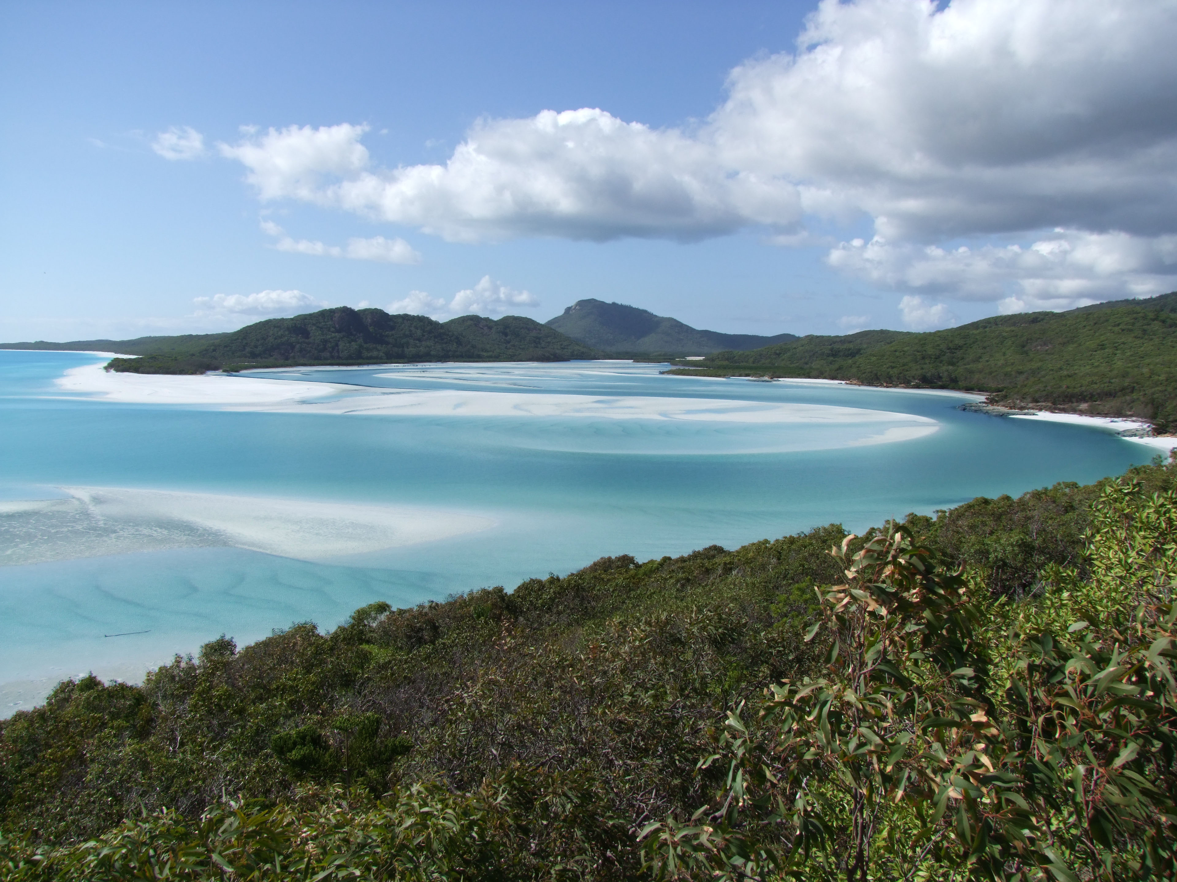
For many, the Whitsunday Islands are Australia's dream postcard: 74 granite islands covered in tropical forest rising out of a turquoise sea, right in the heart of the Great Barrier Reef. The jewel is Whitehaven Beach, seven kilometres of brilliant white silica sand —some of the purest in the world— that barely holds the heat and that, at the Hill Inlet lookout, swirls into the pale blue water in patterns of colour that shift with the tide. It's one of those landscapes that look retouched and aren't.
You explore the archipelago from Airlie Beach, a laid-back beach town that serves as the base of operations: from its harbour leave the fast catamarans to Whitehaven, the snorkel boats to the reefs, the yachts for two- or three-day sailing trips between islands, and the ferries to resort islands such as Hamilton and Daydream. Underwater lies the other half of the show: corals, turtles, rays, colourful fish and, in winter, humpback whales passing through to calve.
This guide takes you through the best of the Whitsundays with a practical eye: how to get to Whitehaven and Hill Inlet, where to snorkel on the Great Barrier Reef, which sailing tours and scenic flights are worth it, how much everything costs in Australian dollars, how to get around and when to go to avoid stinger season. Everything verified, so you can plan your trip to this World Heritage destination with no surprises.
Long before the Europeans arrived, the islands were the Country of the Ngaro people, one of Australia's oldest Aboriginal seafaring peoples, with more than 9,000 years of continuous occupation and a culture built on navigating between the islands in bark canoes. British navigator James Cook sailed through the passage on Whit Sunday (Pentecost) in 1770, hence the name. Nineteenth-century colonisation brought frontier violence and disease that devastated the Ngaro, whose descendants today keep their connection to these waters alive. The full story —the Ngaro, Cook, the timber and pearling industries, and the birth of tourism— is on our history page.
Read the full history ↓The state of sunshine and the tropics: land of dozens of Aboriginal nations, born as the Moreton Bay penal settlement in 1824, separated from New South Wales in 1859 and shaped by sugar cane, wool and mining. It is home to the Great Barrier Reef and the Daintree Rainforest, two World Heritage Sites.
Read the history of Queensland →If you book from here we earn a commission and you pay no more. Prices and availability come from Civitatis.
No exact prices: a scale from $ (budget) to $$$$$ (luxury), with 2-3 options per category.
Origins, formation and what the sources say.
Long before a single tourist sailing boat existed, someone was already crossing these waters by canoe. For at least nine thousand years, the 74 islands we now call the Whitsundays were the Country of the Ngaro people, one of the oldest seafaring Aboriginal peoples in Australia. They didn't just live beside the sea: they lived from the sea and on the sea, and their story is that of one of the most remarkable seafaring cultures on the continent.
Ngaro territory stretched for more than a hundred kilometres, from St. Bees Island to Hayman Island, and reached the mainland at Cape Conway and the mountains east of present-day Proserpine: some 520 square kilometres of islands, reefs and coastline. To get around this world of water, the Ngaro built unique canoes called 'winta', made from three pieces of ironbark bark sewn together. In them they made seasonal voyages of up to a hundred kilometres out to sea, even reaching the outer reefs of the Great Barrier Reef, tens of kilometres off the coast. They knew the currents, tides, winds and stars with a precision that astonished the first Europeans.
On South Molle Island stood one of the largest stone quarries in Australia before European contact. There the Ngaro extracted rock to make their 'juan knives', specialised stone knives that they then traded along the coast and inland. This trade shows that the islands were not an isolated corner but a hub in exchange networks connecting many peoples.
Ngaro life left hundreds of archaeological sites across the islands: cave shelters, rock paintings, shell mounds (middens) marking thousands of years of meals, and engravings. Today the Ngaro Sea Trail, on South Molle, Whitsunday and Hook islands, lets visitors walk through part of this cultural landscape and glimpse, respectfully, the depth of this history. The Ngaro language is now considered extinct, and its exact relationship with the neighbouring Wiri and Giya languages is still being studied.
The name 'Whitsunday' — Pentecost Sunday in old English — arrived suddenly, with a ship, in 1770. On 3 June that year, Lieutenant James Cook was sailing HMB Endeavour north along Australia's east coast when he found a wide, sheltered passage between islands that let him continue unhindered. Cook named it 'Whitsunday's Passage' because, according to his journal, it was Whit Sunday.
There's a curious detail, often quoted by local guides: Cook actually got the date wrong. Sailing west around the world without correcting for the change of day, his calendar was running ahead. The day he recorded as Whit Sunday was in fact a Monday. Which means the archipelago should technically be called 'Whitmonday'. The mistake was stamped on the map forever, and today it's an anecdote repeated on every boat.
Cook passed through quickly: just a few days later, further north, the Endeavour ran aground on the Great Barrier Reef and nearly sank. The crew managed to bring it to the mouth of a river — today's Endeavour River, next to present-day Cooktown — where they spent almost seven weeks repairing it on the beach. For the Ngaro, that ship crossing their sea in 1770 was barely a shadow on the horizon. The real impact of the Europeans would take almost a century to arrive, and when it did, it was devastating.
For decades after Cook, the islands remained, in practice, Ngaro territory. Imperial maps claimed them in London, but life on the water carried on as it had for millennia. That would change from the 1860s.
From the 1860s, European colonial expansion reached the central Queensland coast in full force, and for the Ngaro it was a catastrophe. Colonisation brought three combined blows: frontier violence, disease and the dispossession of their land.
Settlers came looking for pasture for cattle, timber (red cedar and other valuable coastal species) and, later, land for sugar cane. The clash was brutal. Frontier violence — confrontations, reprisal massacres, the actions of the feared Native Police — decimated Aboriginal communities across the region. On top of this came introduced diseases against which the Ngaro had no defences: smallpox and measles caused enormous loss of life.
In 1870, the surviving Ngaro were forcibly moved to penal settlements and subjected to forced labour, torn from the islands that had been their home for thousands of years. It was one of many 'removals' that colonial authorities imposed on Aboriginal peoples in Australia, separating them from their Country, their language and their culture. By the 1930s, the Ngaro population had fallen to around a hundred people.
Meanwhile, the colonial economy was taking hold on the mainland opposite the islands. In 1882 the Crystal Brook Sugar Company was formed and the following year the local sugar industry got under way; in 1897 the Proserpine mill was established, which in time would become one of the most modern in the world. Cane, timber and cattle shaped the mainland, while the islands were left practically emptied of their original inhabitants. It's a hard story, worth keeping in mind behind the turquoise postcard: the paradise visited today was, for its original people, the scene of dispossession.
Tourism came to the Whitsundays almost by chance, through families who set up modest cabins on the islands in the early decades of the 20th century. What began as fishing camps and small guesthouses gradually grew, especially after the Second World War, when cars, planes and free time put these remote beaches within reach of more people.
The big leap came in the second half of the 20th century. Islands such as Daydream, Hayman, South Molle and Long Island developed resorts, and in the 1980s businessman Keith Williams turned Hamilton Island into a destination with its own airport, marina, hotels and all the infrastructure of a town, something unprecedented in the archipelago. Airlie Beach, on the mainland, went from a hamlet to the logistics base for all tourism in the region: from its harbour began to depart the catamarans to Whitehaven, the dive boats and the huge fleet of sailing boats that made the 'sailing trips' famous.
At the same time, awareness grew that this was a natural treasure that needed protecting. Most of the islands were declared national park (Whitsunday Islands National Park), left uninhabited and protected, and the whole area became part of the Great Barrier Reef Marine Park, inscribed as a UNESCO World Heritage Site in 1981. Whitehaven Beach, with its almost pure silica sand, became a global icon, and Hill Inlet the most reproduced postcard view in Australia.
Today the challenge is to balance tourism that welcomes hundreds of thousands of visitors a year with the conservation of the corals — threatened by bleaching and climate change — and with recognition of the people who were here first. In 2024, the Gia and Ngaro peoples lodged a native title claim with the National Native Title Tribunal, another step on the long road to restoring their legal and cultural connection to these waters. The Ngaro Sea Trail and the operators who weave Ngaro culture into their tours are signs that the islands' oldest story is, little by little, being heard again beneath the murmur of the waves.