Viajá con Gus
HomeVenezuelaPico El Águila
Pico El Águila
🇻🇪 Venezuela · The Andes

Pico El Águila

Jump to what you need
📌State
Pico El Águila is a high-mountain páramo pass in Mérida state, in the Venezuelan Andes, on the border with Barinas state. It sits at around 4,118 meters on the Trans-Andean highway, which makes it one of the highest road passes in Venezuela. It's famous for the condor monument (a bronze eagle/condor commemorating the Liberator Simón Bolívar's crossing of these páramos in 1813) and for its overwhelming views of the range. It belongs to the páramo zone of Mérida state, near the villages of Apartaderos and Mucuchíes.
📌Service city
The city of Mérida is the usual base for visiting Pico El Águila, though it's also reachable from the Barinas side along the Trans-Andean highway. Mérida has a bus terminal, hotels, hospitals, ATMs and travel agencies. The nearby villages of Apartaderos and Mucuchíes offer posadas, restaurants and basic services, and are much-used stopping points. At Pico El Águila itself there's usually a roadside stop with food and hot-drink stands, craft stalls and shelter, plus the condor monument. Bring cash and plenty of warm clothing for the extreme cold at that altitude.
📌Best time to go
The best time to visit Pico El Águila is the Andean dry season, from December to March (and part of April), when the skies are clearer, there's less rain and visibility across the range is better. The rainy season (May to November) brings more fog, damp cold and, at times, difficult driving conditions on the mountain road. In any season the cold is intense because of the altitude (over 4,000 m): there can be sub-zero temperatures, strong wind and, occasionally, frost or snow. The weather changes very fast. Always go well wrapped up and with sun protection, because the sun at altitude is fierce.
📌Suggested days
Pico El Águila is normally visited as a stop of a few hours within a tour of the páramo and the Trans-Andean highway, together with Mucubají, Apartaderos and Mucuchíes. In half a day (or a few hours) you can take in the landscape, see the condor monument, have something hot and walk a little on the páramo. Travelers driving the Trans-Andean highway between Mérida and Barinas usually cross the pass as one of the landmarks of the route. To go deeper into the páramo and combine it with walks and lagoons, set aside a full day for the area, based in Mérida or in the páramo villages.
💱 VES exchange rate
Loading rate…
🌤️ Weather in Pico El Águila
Loading weather…

Reaching Pico El Águila means reaching one of Venezuela's highest roads: a páramo pass at around 4,118 meters, where the Trans-Andean highway crosses the Andes in the middle of a landscape of mountain, cold and silence. The air is thin, the wind cuts, and on clear days the view over the summits and valleys is simply overwhelming.

The place is marked by its famous monument: a large bronze sculpture of a condor (popularly called 'the eagle') with its wings spread, commemorating the Liberator Simón Bolívar's crossing of these frozen páramos in 1813, during the Admirable Campaign. Battered by the wind and often wrapped in fog, the monument has become a symbol of the Andean crossing and an obligatory stop for anyone driving the Trans-Andean highway.

This guide gathers the essentials for enjoying Pico El Águila with a practical eye: how to get there from Mérida or from Barinas, what to see and do at the stop, how to handle the extreme cold and the altitude safely, and where to eat and sleep in the nearby páramo villages. It's an unmissable point for anyone traveling the Venezuelan Andes who wants to feel, literally, the top of the road.

📖 History of Pico El Águila

Pico El Águila is a páramo pass on the Trans-Andean highway in Mérida state, at around 4,118 meters, on the border with Barinas. Its historical fame comes from the fact that the Liberator Simón Bolívar crossed these frozen páramos in 1813, during the Admirable Campaign, taking his army over the range in extreme conditions of cold and altitude; the area was formerly known as the Páramo de Mucuñuque or de la Cordillera, and Bolívar's crossing was etched into the region's historical memory. To commemorate that feat, a monument was erected on the site with a large bronze sculpture of a condor (popularly called 'the eagle') with its wings spread, which gave the peak the name it carries today. The area, inhabited in pre-Hispanic times by Timoto-Cuica peoples —high-altitude farmers whose trace survives in place names such as Mucuchíes and Mucubají— passed under Spanish control after the founding of Mérida in 1558, and the páramo became a mountain route between Mérida and the llanos of Barinas. The construction of the Trans-Andean highway in the first decades of the 20th century turned this páramo pass into a driveable road and, in time, into a tourist landmark. Pico El Águila also fell within the protected setting of the Mérida Andean páramo. Today it's one of the most emblematic stops on a journey through the range. The full story is on our history page.

Read the full history ↓

🏛️ Pico El Águila is in Mérida

The Andean state par excellence: snow-capped peaks, moorlands of frailejón plants and mountain villages, home of the Timoto-Cuica people, with Pico Bolívar (Venezuela's highest point), the world's highest cable car and the lively university city of Los Andes.

Read the history of Mérida →

🗺️ What to see

1
The condor monument (Bolívar's 'Eagle')
The great bronze sculpture commemorating Simón Bolívar's crossing of the páramo in 1813, which gave the peak its name.
The monument at Pico El Águila is the symbolic heart of the place: an imposing bronze sculpture of a condor (popularly called 'the eagle') with its wings spread, set on a pedestal in the middle of the páramo above 4,000 meters. It was sculpted by the Colombian artist Marcos León Mariño in 1925 —the same year this stretch of the Trans-Andean highway was inaugurated under the government of Juan Vicente Gómez— to commemorate the Liberator Simón Bolívar's crossing of these frozen páramos in 1813, during the Admirable Campaign, when his army crossed the range in extreme cold and altitude (the exact route Bolívar took across the Mérida páramos is historically debated, but the monument fixed his memory here). Often battered by wind and wrapped in fog, the monument has an epic, solitary air that leaves an impression. It's the photo point par excellence and a physical reminder of the independence epic that crossed these mountains. Beside the monument there's usually a plaque and historical references to Bolívar's feat. Stopping here, feeling the cold and the páramo wind and taking in the range, helps you grasp what crossing these Andes on foot and on horseback two centuries ago must have meant. It's both a historical landmark and a natural viewpoint. Getting there: on the Trans-Andean highway, at the top of the pass, from Mérida or Barinas. Best time: clear dry-season days for good views of the range. Tips: wrap up seriously (it's bitterly cold and windy), don't linger if you feel altitude sickness, and take advantage of the gaps in the fog for photos.
ℹ️ Distance: At the top of the pass, on the Trans-Andean highway, at around 4,118 m · Best time: Clear dry-season days (December to March) · Admission: Free (open access) · Duration: A stop of 30 min to 1 hour
2
The páramo pass and its views over the range
One of the highest road passes in Venezuela, with overwhelming panoramas of the Andes.
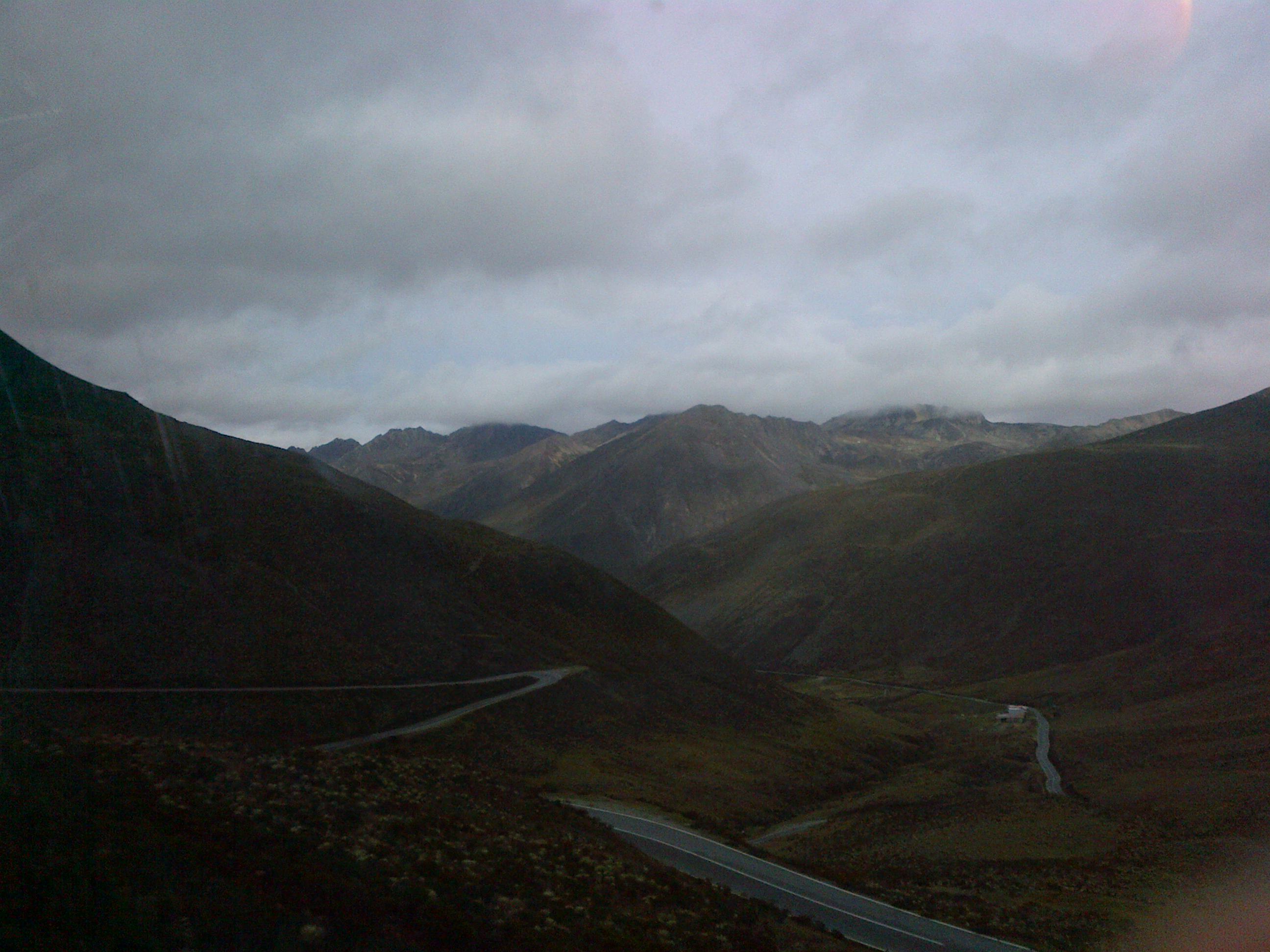
Beyond the monument, the great draw of Pico El Águila is the place itself: one of the highest points on any road in Venezuela, at around 4,118 meters, where the Trans-Andean highway crowns the range. From here, on clear days, the view opens over a sea of mountains, páramo valleys and Andean summits, a high-mountain landscape you can rarely take in so comfortably from a road. It's a high páramo environment: low vegetation, frailejones that withstand the cold and the radiation, bare rock and enormous skies. The weather is very changeable: it can go from blazing sun to thick fog and freezing wind in a matter of minutes, which adds drama to the place. When the clouds clear, the feeling of standing at the top of the Andean world is unforgettable. It's an ideal spot to stop, look, take photos and feel the scale of the range, always with care because of the altitude. For many travelers, crossing Pico El Águila is one of the peak moments of a trip through the Venezuelan Andes. Getting there: on the Trans-Andean highway, at the top of the pass. Best time: dry season and clear mornings. Tips: stop only in safe places beside the road, wrap up, drink water and make the most of the clear spells for the panorama.
ℹ️ Distance: The top of the Trans-Andean highway, on the Mérida-Barinas border, at around 4,118 m · Best time: Dry season; clear mornings (the fog rises later) · Admission: Free (open access from the road) · Duration: A stop of 30 min to 1 hour
3
The páramo stop: hot food and crafts
The roadside stop with hot-drink stands, traditional food and local crafts.
Pico El Águila is a classic stop on the Trans-Andean highway, and around the monument there's usually a small cluster of stands and shops designed to warm travelers up. It's traditional to stop here for something hot —coffee, chocolate, herbal infusions or the classic Andean 'calentaíto'— and to eat something warming after crossing the páramo. It's also common to find craft stalls and local produce: wool weavings, hats, scarves and cold-weather clothing, sweets, honey and other Andean products. It's a chance to buy a souvenir that's genuinely useful in this weather, and to support the people of the páramo. The stop also lets you warm up, use a bathroom and rest from the altitude before carrying on. Check which services are available, since that can change with the season and current conditions. Getting there: right at the top of Pico El Águila, on the road. Best time: any time, especially welcome given the cold. Tips: bring cash and warm layers, and take the chance to have something hot.
ℹ️ Distance: At the top of Pico El Águila, next to the monument · Best time: Any time (very welcome given the cold) · Admission: Free access; US$ 1-4 for a hot drink or dish; crafts from US$ 3 (verified July 2026, indicative) · Duration: 30 min to 1 hour
4
The Trans-Andean highway and páramo route
The Andean crossing landscape that links Pico El Águila with Mucubají, Apartaderos and Mucuchíes.
Pico El Águila doesn't stand alone: it's part of the great Trans-Andean highway route, one of the most spectacular mountain drives in Venezuela, crossing the Mérida páramo and connecting Mérida with the llanos of Barinas. The Águila pass is the highest and most dramatic point of that journey. The road runs through a chain of unmissable landscapes and villages: the Mucubají páramo with its glacial lagoon, the village of Apartaderos (the páramo crossroads) and Mucuchíes, a traditional Andean village. Along the route come fields of frailejones, lookouts, lagoons, high-altitude crops and hamlets of adobe and tile, on a journey combining nature, history and Andean culture. Driving this stretch —whether as a day trip (the classic 'Páramo Tour') or as part of the crossing between Mérida and Barinas— is the Venezuelan Andes at their fullest, and Pico El Águila is the symbolic summit of the route. Getting there: on the Trans-Andean highway, by vehicle or organized trip, from Mérida or Barinas. Best time: dry season. Tips: combine Pico El Águila with Mucubají, Apartaderos and Mucuchíes; drive carefully in the mountains and consider a driver or an organized trip given road conditions.
ℹ️ Distance: A stretch of the Trans-Andean highway (Mérida–Barinas), with Mucubají, Apartaderos and Mucuchíes nearby · Best time: Dry season (December to March) · Admission: Free (driving the road); Páramo Tour with an agency US$ 25-40 per person (verified July 2026) · Duration: Half a day to a full day (the páramo route)
5
Mucubají Lagoon (nearby)
The most famous glacial lagoon of the Mérida páramo, a few minutes from Pico El Águila.
Very close to Pico El Águila, inside Sierra Nevada National Park, lies Mucubají Lagoon, the best-known and most accessible glacial lagoon in the Venezuelan Andes, at around 3,550 meters. Ringed by frailejones and mountains, it's a place of remarkable serenity and beauty, with a level path following much of the shore that allows short walks without any technical effort. Longer routes to other high lagoons, such as Laguna Negra, also start from the lagoon, for anyone wanting more demanding walks. It's an obligatory stop for anyone driving the Trans-Andean highway and the perfect complement to a visit to Pico El Águila, since the two are only minutes apart. Getting there: on the Trans-Andean highway, a few kilometers from Pico El Águila, with signposted access inside Sierra Nevada National Park. Best time: dry season, clear mornings. Tips: bring warm layers and water, and sign in at the Inparques post if you're walking beyond the main shoreline.
ℹ️ Distance: A few kilometers from Pico El Águila, on the Trans-Andean highway · Best time: Dry season; clear mornings · Admission: Inparques registration US$ 3-5 per person (verified July 2026; confirm at the post) · Duration: 1 to 2 hours (shoreline path); half a day for the longer routes
6
The village of Apartaderos and the páramo crossroads
The small high-altitude village where the roads to Mérida, Barinas and Valera meet, with posadas and crafts.
A few minutes from Pico El Águila sits Apartaderos, a small páramo village at the junction of the roads connecting Mérida with Barinas and with Valera (Trujillo state), which gives it both its name and its historic role as a meeting point of Andean routes. Despite its size, it concentrates posadas, restaurants, wool craft stalls and stands selling the sweets and preserves typical of the páramo. The village, high up and as cold as Pico El Águila itself, is a practical stop for a night, a hot meal or souvenirs before or after crossing the pass. Its strategic position makes it an ideal base for exploring the whole páramo area: El Águila, Mucubají, Mucuchíes and the Llano del Hato Astronomical Observatory are all a short distance away. Getting there: on the Trans-Andean highway, a few minutes from Pico El Águila. Best time: year-round, busier in the dry season. Tips: it's a good place to stay the night and set off early into the páramo; bring cash and plenty of warm clothing.
ℹ️ Distance: A few kilometers from Pico El Águila, on the Trans-Andean highway · Best time: Year-round; dry season for better weather · Admission: Free to walk around the village · Duration: 1 to 2 hours; ideal for an overnight stay
Advertisements
What nobody tells you

💵 Prices

Tickets

TypePrice
Access to Pico El Águila and the monumentFree (open access from the road)
Views from the páramo passFree (open access)
Hot food and drinks at the stopUS$ 1-4 for a hot drink or dish (verified July 2026, indicative)
Local crafts and produceUS$ 3-15 depending on the item (weavings, hats, sweets; verified July 2026, indicative)
Páramo Tour (Mucubají, Apartaderos, Pico El Águila, Mucuchíes)US$ 25-40 per person, full day (verified July 2026)
Inparques registration at Mucubají LagoonUS$ 3-5 per person (verified July 2026)
🔄 updated monthlyOfficial / reference values · double-check when buying

Activities and tours

ActivityPriceDurationOperator
Páramo and Trans-Andean highway tour (includes Pico El Águila)US$ 25-40 per person (verified July 2026)Full dayMérida agencies
Photo stop at the condor monument and the passFree (open access)30 min to 1 hOn your own or as part of the tour
Short walk on the páramo and around Mucubají LagoonUS$ 3-5 (Inparques registration); US$ 15-25 with a guide (verified July 2026)VariableLocal páramo guides
Crossing the range on the Trans-Andean highway (Mérida–Barinas)US$ 5-15 on shared transport (verified July 2026)Depends on the routeLocal transport and drivers
🔄 updated monthlyOfficial / reference values · double-check when buying
Advertisements

🚌 How to get there and distances

Getting around

ModePriceDurationNotes
'Páramo Tour' trip or taxi with driver (the tourist 'shuttle' to the pass)Páramo Tour US$ 25-40 per person for a full day; private taxi return from Mérida US$ 40-60 (source: Mérida agencies and taxi drivers, verified July 2026)Full dayThere's no urban bus up to the pass (4,118 m): the standard way to get there is the jeep/van trip leaving Mérida and running the Trans-Andean highway with stops at Mucubají, Apartaderos, Pico El Águila and Mucuchíes, or a taxi hired with an experienced driver. Booked at the agencies in central Mérida
How to pay for the bus and for transport (payment methods)Cash (bolívares and dollars) and pago móvilIn the city of Mérida, the Trolmérida/TROMERCA mass transit system and the minibuses charge the fare —indexed to the dollar, around US$ 0.25— in CASH in bolívares or by pago móvil. The Andean shared cars toward Apartaderos and Mucuchíes, the organized trips, the food and the crafts at the pass are paid in cash (bolívares or dollars in small bills) or by pago móvil. Up on the páramo there are NO ATMs and no card terminals: go up with cash in small bills (verified July 2026)
Route and real-time tracking appsFreeFor getting around the city of Mérida, people use Google Maps; Moovit partially covers the urban lines and the Trolmérida. For the climb to the páramo there is NO transport tracking app (the shared cars are informal and the trips are arranged with the agency): plan distances on the Trans-Andean highway with Google Maps and confirm road conditions and the weather before heading up (verified July 2026)
Andean shared cars from Mérida / from BarinasUS$ 0.25-15 per leg depending on distance (source: dollar-indexed Andean fare, INTT, verified July 2026)Depends on the route (mountain road)Andean shared transport connects Mérida with Apartaderos and Mucuchíes, and comes up from Barinas on the Trans-Andean highway; useful for reaching the base villages, though for the top of the pass itself a tour or a taxi is better. Get off at Apartaderos and arrange the climb from there
On foot around the pass (with care)FreeVariableFor walking around the monument and the páramo; with great care given the altitude (over 4,000 m) and the cold. Don't wander off without a guide or beyond the safe area beside the road (verified July 2026)
🔄 updated monthlyOfficial / reference values · double-check when buying

How to get there

RouteAirlines / operatorsAvg. priceDuration
Mérida → Pico El Águila (Trans-Andean highway via Apartaderos)Private vehicle, taxi or organized trip from MéridaUS$ 25-40 on an organized trip; private taxi return US$ 40-60 (verified July 2026)About 2 to 3 h depending on the route and stops
Barinas → Pico El Águila (climbing the Trans-Andean highway from the llanos)Private vehicle or transport along the Trans-Andean highwayUS$ 5-15 on shared transport (verified July 2026)Depends on the starting point (mountain road)
As a landmark on the Páramo Tour from MéridaMérida travel agenciesUS$ 25-40 per person (verified July 2026)Within a full-day trip
🔄 updated monthlyOfficial / reference values · double-check when buying

🏨 Where to stay

No exact prices: a scale from $ (budget) to $$$$$ (luxury), with 2-3 options per category.

CategoryPriceRecommended options
Páramo posadas in Apartaderos / Mucuchíes$$$$$US$ 25-45 a night; mountain posadas and hotels with heating or a fireplace and Andean cooking. The most practical option for staying near Pico El Águila
Charming Andean posadas$$$$$US$ 45-80 a night; characterful posadas in traditional houses of the Mérida páramo, with good food and a welcoming atmosphere for standing up to the cold
Budget (family-run posadas)$$$$$US$ 15-25 a night; simple, cheap lodgings in the páramo villages. Check for hot water and heating given the cold
Base in the city of Mérida$$$$$US$ 25-45 a night; travelers who want more services can stay in Mérida and visit Pico El Águila on a day trip. Mérida has the widest choice of hotels in the region

🍴 Where to eat

TypePriceOptions / signature dish
Hot drinks and traditional páramo food (the Pico El Águila stands)$$$$$US$ 1-4 for a drink or dish; coffee, chocolate, herbal infusions, the classic 'calentaíto', soups and snacks to fight the cold at the top of the pass
Andean páramo cooking in Apartaderos / Mucuchíes$$$$$US$ 6-15 a dish; trout, pisca andina, hot soups and traditional páramo dishes in the nearby villages
Trout, sweets and honey from the Mérida region$$$$$US$ 2-8 per item or dish; trout, sweets, dulce de leche and honey are typical of the páramo and are sold in the villages and at roadside stands
Advertisements

📖 History of Pico El Águila

Origins, formation and what the sources say.

The high páramo and the Timoto-Cuica peoples

At 4,118 meters, where the air thins and the cold bites even in sunshine, there's a point in the Venezuelan range now crossed by a paved road —one of the highest in all of South America— and where, more than five centuries ago, only those with no choice ventured. It's the pass now called Pico El Águila, in the Andean páramo of Mérida state, a tropical high-mountain ecosystem of frailejones, lagoons and silence. Long before there was any road, these frozen lands were part of the territory of the Timoto-Cuica peoples, the Indigenous communities of the Venezuelan Andes.

The Timoto-Cuicas were high-altitude farmers: they cultivated terraces, managed water and lived in villages scattered through the páramo valleys. Their trace survives in the names of nearby villages —Mucuchíes, Mucubají, Apartaderos— and in the traditional farming techniques still practiced in the region. For them, the páramo, with its cold, its lagoons and its summits, carried a strong sacred meaning.

The páramo passes in this area were known and feared routes, crossed with great effort because of the altitude and the extreme climate. That ancestral knowledge of the terrain and the mountain paths was the basis on which, centuries later, the colonial and republican routes across the range would be laid out.

Indigenous legacy in the páramo
Sources link the place names with the 'mucu' prefix and the region's high-altitude farming to the Timoto-Cuica peoples who lived in the Mérida Andes before colonization. The precise ethnic boundaries and the meaning of the names vary between authors and are presented as approximations.
Source: https://es.wikipedia.org/wiki/Timoto-cuicas

Colonization and the páramo as the route between Mérida and the llanos

After the founding of Mérida in 1558 by Juan Rodríguez Suárez, the Venezuelan Andes came under Spanish rule, and the páramo region was absorbed into colonial life. Andean villages such as Mucuchíes and Apartaderos emerged and consolidated, devoted to high-altitude farming and livestock.

The páramo where Pico El Águila now stands was part of the mountain routes linking the city of Mérida with the llanos of Barinas and the rest of the country. These were punishing paths, traveled on foot and by mule, carrying people, livestock and goods between the range and the lowlands. Crossing these high passes, exposed to cold, wind and fog, was a genuine ordeal for muleteers and travelers.

For centuries this pass was above all an obligatory point of transit and the territory of shepherds and muleteers. That role as a corridor between mountain and plain defined its history and explains why it was precisely here that, in the middle of the war of independence, one of the most remembered feats in Venezuelan history would take place.

The pass as an Andean corridor
Sources describe the Mérida páramo passes as part of the historic routes between Mérida and the llanos of Barinas. The detail about the old colonial paths is offered as a general reconstruction of traditional Andean travel.
Source: https://es.wikipedia.org/wiki/M%C3%A9rida_(estado)

Bolívar's crossing and the Admirable Campaign (1813)

The event that gave this páramo pass its place in history came in 1813, during the war of independence. That year the Liberator Simón Bolívar launched the so-called Admirable Campaign, a rapid military offensive setting out from New Granada (present-day Colombia) into Venezuela to free the territory. To advance toward the center of the country, the patriot army had to cross the Venezuelan Andes.

Historical tradition remembers Bolívar and his troops crossing these frozen páramos, an extreme mountain passage given the altitude, the cold and the difficult terrain. Taking an army over the range, in the middle of the páramo with scant shelter, was a logistical and human feat that stayed in the region's memory.

That episode turned the pass into a place loaded with patriotic symbolism. In time the area —previously known by names tied to the páramo (such as Páramo de Mucuñuque or de la Cordillera)— came to be associated with Bolívar's feat, and the crossing of the Andes through this country was written into the heroic narrative of Venezuelan independence.

Bolívar and the Admirable Campaign
Historical sources place Bolívar's Admirable Campaign in 1813, with the crossing of the Venezuelan Andes as part of the offensive from New Granada toward the center of the country. The precise details of the itinerary across each páramo vary between sources and local tradition, so they are best taken as general historical reference.
Source: https://es.wikipedia.org/wiki/Campa%C3%B1a_Admirable

The condor monument and the name 'Pico El Águila'

To commemorate the Liberator's crossing of these páramos, a monument was erected at the top of the road that would become the symbol of the place: a large bronze sculpture of a condor with its wings spread, set on a pedestal in the middle of the páramo. The work was made by the Colombian sculptor Marcos León Mariño in 1925, the same year Juan Vicente Gómez's government inaugurated this stretch of the Trans-Andean highway. Although the figure is a condor —the emblematic bird of the Andes— it became popularly known as 'the eagle', and that name ended up sticking to the whole pass: 'Pico El Águila'. The spot is also called Collado del Cóndor, in reference to the sculpture.

The monument, battered by wind and often wrapped in páramo fog, has an epic, solitary air. Beside it, the crossing of the Andes by Bolívar and his army is remembered, tying the place to the memory of independence. Over time the sculpture became the main landmark and photo point of the pass, and it isn't unusual to find it covered in frost or even snow on cold late-July and August mornings, when the páramo occasionally wakes up white.

So a curious slip of naming —calling a condor an 'eagle'— was fixed forever in the place names. Today 'Pico El Águila' refers to this high point on the Trans-Andean highway, and its monument is one of the icons of a journey through the Mérida páramo, a crossroads where the history of independence, the epic of road engineering and the extreme beauty of the high mountains come together.

A condor called an 'eagle' (Marcos León Mariño, 1925)
Sources note that the monument at Pico El Águila / Collado del Cóndor is a sculpture of an Andean condor made by the Colombian artist Marcos León Mariño in 1925, the year this stretch of the Trans-Andean highway was inaugurated under Gómez. It is popularly called an 'eagle', a name that spread to the pass itself. The exact route Bolívar took across the Mérida páramos in 1813 is historically debated.
Source: https://es.wikipedia.org/wiki/Collado_del_C%C3%B3ndor

The Trans-Andean highway and the rise of a tourist landmark

The Pico El Águila páramo pass was transformed for good by the construction of the Trans-Andean highway, one of the great road projects of the Venezuelan Andes, driven forward in the first decades of the 20th century. This road crossed the range, connecting the Andes with the rest of the country, and its route ran precisely over this high point, making it one of the highest road passes in Venezuela.

What had been a mountain crossing made with enormous effort on foot and by mule became driveable. Pico El Águila went from a remote and feared point to an accessible and celebrated landmark of the journey across the range. Along the Trans-Andean highway, the villages and posadas that serve páramo tourism flourished, among them Apartaderos and Mucuchíes.

With the growth of mountain tourism in Mérida, Pico El Águila established itself as an obligatory stop on the páramo route, alongside Mucubají Lagoon and the Andean villages. Today it combines its historical value —the monument and the memory of Bolívar's crossing— with its scenic value, as one of the highest and most emblematic viewpoints in the Venezuelan Andes. Traveling it is at once a journey through the history and through the nature of the range.

The Trans-Andean highway as a transforming route
Sources agree in identifying the Trans-Andean highway, built in the first decades of the 20th century, as the project that opened the Mérida páramo passes —Pico El Águila included— to modern transport and to tourism. The exact dates of the various sections should be checked in specialist sources.
Source: https://es.wikipedia.org/wiki/Carretera_Trasandina

📚 Bibliography

  • Wikipedia (ES) — «Pico El Águila»: https://es.wikipedia.org/wiki/Pico_El_%C3%81guila
  • Wikipedia (ES) — «Campaña Admirable»: https://es.wikipedia.org/wiki/Campa%C3%B1a_Admirable
  • Wikipedia (ES) — «Carretera Trasandina (Venezuela)»: https://es.wikipedia.org/wiki/Carretera_Trasandina
  • Wikipedia (ES) — «Mérida (estado)»: https://es.wikipedia.org/wiki/M%C3%A9rida_(estado)
  • Wikipedia (ES) — «Timoto-cuicas»: https://es.wikipedia.org/wiki/Timoto-cuicas
  • Wikipedia (ES) — «Cóndor andino»: https://es.wikipedia.org/wiki/Vultur_gryphus
  • Wikipedia (ES) — «Laguna de Mucubají»: https://es.wikipedia.org/wiki/Laguna_de_Mucubaj%C3%AD
  • Wikipedia (ES) — «Collado del Cóndor»: https://es.wikipedia.org/wiki/Collado_del_C%C3%B3ndor
  • Wikipedia (ES) — «Mérida (Venezuela)»: https://es.wikipedia.org/wiki/M%C3%A9rida_(Venezuela)

❓ Frequently asked questions

Where is Pico El Águila and how do I get there?+
It's in Mérida state, on the border with Barinas, at the top of the Trans-Andean highway, at around 4,118 m. You get there by vehicle or organized trip from Mérida (via Apartaderos, about 2-3 h), or by climbing from Barinas on the Trans-Andean highway. It's usually included in the 'Páramo Tour' (US$ 25-40 per person, verified July 2026).
Why is it called 'El Águila' and what is the monument?+
The name and the monument come from a large bronze sculpture of a condor with its wings spread (popularly called an 'eagle'), erected to commemorate the Liberator Simón Bolívar's crossing of these páramos in 1813, during the Admirable Campaign. Seeing it is free.
Is it very cold?+
Yes, bitterly. Above 4,000 m the cold is extreme, with strong wind and, at times, sub-zero temperatures, frost or a little snow. The weather changes very fast. Go well wrapped up, in layers, even if it's sunny when you leave Mérida.
Is the altitude dangerous?+
The altitude (over 4,000 m) can cause altitude sickness: headache, dizziness or shortness of breath. It helps to be acclimatized (spend a few days in Mérida first), avoid sudden exertion, drink water and not linger if symptoms appear. Going down brings quick relief.
How much time do you need?+
Pico El Águila is usually visited as a stop of 30 minutes to an hour within a páramo tour. To enjoy the whole Trans-Andean route, with Mucubají, Apartaderos and Mucuchíes, set aside half a day or a full day.
Is it better to drive yourself or take a tour?+
The mountain road is demanding and the weather changeable, so many travelers prefer to go with an experienced driver or on an organized trip ('Páramo Tour', US$ 25-40 per person, verified July 2026). If you drive yourself, take care, check the vehicle and ask about road conditions.
Sources consulted (10)
Still planning?
Explore more destinations in Venezuela
See all destinations →
Advertisements
Image credits
Photos from Wikimedia Commons, each under its own licence (CC BY, CC BY-SA or public domain). Open each file to see its author and licence.
PICO EL AGUILA10, MERIDA