Viajá con Gus
Home › Niger › Ayorou
Ayorou
🇳🇪 Niger · Niamey and the Niger River (south-west)

Ayorou

🪪 What do I need to enter Niger?Pick your citizenship and we tell you the visa, the days and the paperwork, with the official source.

By leaving your email and citizenship you agree to receive the documents you asked for and weekly travel news. You can unsubscribe whenever you want. How we handle your data.
Jump to what you need
📌Security warning
WARNING: Ayorou lies about 60 km from the border with Mali, in the north of the Tillabéry region, the most dangerous area in Niger. The department has been under a state of emergency since March 2017. Humanitarian organisations recorded 107 attacks on civilians in the region in just eighteen months between 2021 and 2022, and in August 2023 intercommunal violence left dozens dead in Ayorou and the neighbouring communes of Dessa and Gorouol, with some 13,400 displaced people sheltering in Ayorou itself. Western foreign ministries formally advise against all travel, and the Nigerien authorities require foreigners leaving Niamey to have a military escort. Ayorou is not a tourist destination today: this guide documents what it is and what it used to be.
📌Location
Town and rural commune in the Tillabéry department, on the Niger River, 208 km north-west of Niamey and about 60 km downstream from the border with Mali. The old town sits on an island in the river; the modern town spreads along the bank.
📌Population
33,527 inhabitants across the whole commune according to the 2012 census, 11,528 of them in the town itself, over 1,262 km². In recent years the area has also taken in Malian refugees and internally displaced people from neighbouring communes.
📌The market
Ayorou's Sunday market, which spills over into Monday, was for decades one of the most photographed sights in Niger: a big livestock market where river Tuareg with their camels, Fulani herders with their cattle and Songhai river people arriving by pirogue with produce from the islands all come together. It's also famous among collectors for its terracotta beads, sold in bundles of long necklaces.
📌Hippos
According to local sources, the stretch of river around Ayorou is home to about 85% of all the hippos in Niger. The classic outing was a pirogue trip among the islands, landing at Firgoun, about 8 km away, to watch hippos and waterbirds.
📌Best time to go
The dry season, from November to February, when temperatures are bearable and the river is low, which is when the hippos gather in the permanent channels. The market is weekly: on Sundays, spilling over into Monday.
📌The future: the Kandadji dam
Ayorou lies upstream of the Kandadji dam, under construction on the Niger River 187 km from Niamey and 60 km from the Malian border. The programme affects at least 60,000 people, and its resettlement plan explicitly includes moving the town of Ayorou. The first phase of works began in March 2019 and was scheduled for 2025-2026, with a second phase running until 2031.
💱 XOF exchange rate
Loading rate…
🌤️ Weather in Ayorou
Loading weather…

For decades Ayorou was the favourite weekend trip for anyone living in Niamey: three hours' drive north-west, following the river, to a Songhai town set on an island, with a spectacular Sunday market and a fleet of pirogues that took you to see hippos among the islets. It was the river side of Niger at its most photogenic.

The market is still the heart of the place: a livestock market where three worlds that rarely meet anywhere else come together (river Tuareg arriving by camel, Fulani herders with their herds, Songhai river people stepping off laden pirogues), and where people sell the bundles of terracotta beads that collectors hunt for across half the continent. Around it, the river opens into a string of islands with banco houses and granaries, and it is home to about 85% of all the hippos in the country.

None of that is available today. Ayorou is 60 kilometres from the border with Mali, in northern Tillabéry, under a state of emergency since 2017, in a region where 107 attacks on civilians were recorded in eighteen months and where, in August 2023, intercommunal violence left dozens dead and thousands displaced. And a second change is under way: the Kandadji dam, downstream, plans to relocate the town itself. This guide tells you what Ayorou is, with all of that reality up front.

📖 History of Ayorou

Ayorou began as a Songhai settlement on an island in the Niger River, in the contact zone between the Songhai-Zarma river world, the Fulani pastoral world and the world of the river Tuareg, the so-called “Tuareg du fleuve” who settled on the banks and adopted the rhythm of the water. That crossroads position is what made Ayorou's Sunday market a regional event: for centuries it was the place where desert, savanna and river traded livestock, salt, grain and crafts. The region was part of the Songhai Empire, whose capital, Gao, lies upstream in present-day Mali, until the Songhai were defeated by the Moroccans at Tondibi in 1591. French colonisation brought it into the Military Territory of Niger in the early 20th century and turned it into a minor administrative post. In the 21st century, two forces are transforming it again: the jihadist insurgency, which since the mid-2010s has made northern Tillabéry one of the most violent areas of the Sahel, and the Kandadji dam, whose resettlement plan provides for moving the town.

Read the full history ↓

🏛️ Ayorou is in Niamey and the Niger River (south-west)

The country's fertile strip: the capital that grew up beside the river, the Zarma lands of Dosso and the last wild giraffes of West Africa, at Kouré.

Read the history of Niamey and the Niger River (south-west) →

🗺️ What to see

1
The Sunday livestock market
The big event of the week: Sunday, spilling over into Monday. Camels, cows, goats, sheep and donkeys change hands on an open ground where river Tuareg, Fulani herders and Songhai river people meet. It's a real market, not an attraction: people bargain, weigh and argue. The donkey section is famous among photographers.
2
The terracotta beads
Ayorou is known among collectors for its terracotta beads, sold in bundles of long necklaces at the market. They are among the most distinctive things to buy in western Niger, along with painted pottery and worked leather.
3
The old town on the island
Ayorou's original settlement sits on an island in the Niger River, with banco architecture and a relationship with the water that shapes everything. You get there by pirogue from the bank and explore it on foot.
4
The river's hippos
According to local sources, the Ayorou stretch is home to about 85% of Niger's hippos. The classic outing is a pirogue trip, motorised or paddled, among the channels and islets, at the hours when the animals are in the water. You watch from a distance: the hippo is the large African mammal that causes the most human deaths.
5
Firgoun Island
About 8 km from Ayorou, the usual destination for pirogue trips: an inhabited island where hippo watching is combined with a visit to the village and its granaries. The round trip took about three hours.
6
The islands and their banco granaries
Here the river opens into a string of islands with hamlets, off-season vegetable gardens and cone-shaped granaries of raw earth, one of the loveliest built landscapes in the Niger valley. You can see them from the water without needing to land.
7
River birds
The Ayorou stretch of river is excellent for watching waterbirds: herons, jacanas, plovers, kingfishers, fishing raptors and, between November and March, Palearctic migrants. The first minutes after sunrise are the best.
8
Artisans: leather, weaving and shea butter
Besides the beads, the market sells engraved pottery, painted leather, fabrics, mats and pure shea butter made by local women's groups. Prices are negotiated, and a good share goes to the local producer.
9
The river landscape towards the Malian border
Upstream of Ayorou, the Niger runs between sandbanks and rocky outcrops towards the border with Mali, about 60 km away. It's the wildest stretch of the river in Nigerien territory and, today, also the most dangerous.
📶I have never landed without internet. I arrive and my phone connects to the strongest network in the country I am visiting: I can say I landed, sort out transport, book tours and keep posting, at a seriously good price. I always use the Maya eSIM — check their plans by clicking the banner.See plans →Maya Mobile eSIM — download, install, go
What nobody tells you

💵 Prices

Tickets

TypePrice
Mercado dominicalFree entry, no fee
Casco viejo de la islaNo admission charge: you only pay for the pirogue crossing, which you negotiate with the boatman
Salida en piragua para ver hipopótamosNo official rate: it's negotiated. Travel guides recorded around 20,000 FCFA (approx. USD 34) for a trip of about three hours with a guide, negotiable (reference, not current)
Guía localNo published rate; agreed with the guide or through your accommodation
🔄 updated monthlyOfficial / reference values · double-check when buying

Activities and tours

ActivityPriceDurationOperator
Sunday market walkFree entry; what you spend depends on what you buy2 to 4 h, on Sundays (spilling over into Monday)On your own with a local guide
Pirogue trip to see hippos and islandsAround 20,000 FCFA for a three-hour trip, negotiable (reference collected by travel guides; check)About 3 hAyorou boatmen and local guides
Excursion to Firgoun IslandTo be negotiated with the boatmanHalf a day; about 8 km downstreamLocal boatmen
Birdwatching from the water at sunriseIncluded in the pirogue hire1 to 2 hLocal boatmen
Buying crafts: terracotta beads, leather and sheaUp to you, with haggling1 to 2 hMarket vendors and women's groups
🔄 updated monthlyOfficial / reference values · double-check when buying

🚌 How to get there and distances

Getting around

Pirogue (paddled or motorised)
DurationVariable
Price
To be negotiated with the boatman; the short crossing to the island costs very little, and the three-hour trip was around 20,000 FCFA (reference, not current)
Notes
It's Ayorou's natural transport: to cross to the island, to get to Firgoun and to see hippos. Life jacket, hat and water
On foot around the town and market
Free
DurationAt your own pace
Notes
Ayorou is small and easy to walk around. Ask permission before photographing people, especially at the market
4x4 with driver from Niamey
Depends on the agency
DurationAbout 3 h via the Tillabéry road
Notes
The only reasonable option today, if the authorities allow the journey at all and with whatever escort is required
Intercity minibus
Company fare
DurationAbout 3 h
Notes
NOT RECOMMENDED for foreigners: foreign ministries advise against public transport in Tillabéry, and the road runs through areas of repeated attacks
🔄 updated monthlyOfficial / reference values · double-check when buying

How to get there

RouteAirlines / operatorsAvg. priceDuration
Niamey → Ayorou via the Tillabéry roadHired vehicle; historically also minibus companies such as Africa AssalaamDepends on the operatorAbout 3 h for 206-208 km
Ayorou → TillabéryIntercity transportDepends on the companyTillabéry, the regional capital, is halfway to Niamey
Ayorou → Malian border (Labbezanga)Informal transportDepends on the vehicleAbout 60 km. FORMALLY ADVISED AGAINST: it is one of the most dangerous borders in the Sahel
Ayorou ↔ islands and riverside villagesLocal boatmenNegotiableFrom a few minutes to half a day depending on the destination
🔄 updated monthlyOfficial / reference values · double-check when buying

🏨 Where to stay

No exact prices: a scale from $ (budget) to $$$$$ (luxury), with 2-3 options per category.

Local hotel
Price$$$$$
Recommended options
The Hôtel Amenokal (also spelt Aminokal), on the river, was the town's main place to stay: rooms from about 10,000 FCFA (approx. USD 17) and camping for about 3,000 FCFA. Pirogue trips were arranged from the hotel. Reference rates collected by travel guides: check whether the establishment is still operating (reference, not current)
Island camp
Price$$$$$
Recommended options
There used to be a private French-run camp on an island downstream. No published rates and no confirmation that it is still running
Base in Niamey
Price$$$$$
Recommended options
The realistic alternative: sleep in the capital, with options from auberges at 13,900-19,500 FCFA a night to international hotels from about 70,000 FCFA (reference, not current)

🍴 Where to eat

Comida callejera del mercado
Price$$$$$
Options / signature dish
What you'll find: skewers, rice with sauce, fritters, millet balls with milk, tea. A few hundred francs a portion. On market day there's much more on offer
Comedor del hotel
Price$$$$$
Options / signature dish
Staff at the local hotel used to prepare dinners on request, with advance notice. No menu or published prices: agreed on arrival (reference, not current)
Bar-restaurante del pueblo
Price$$$$$
Options / signature dish
Historically there was a single bar-restaurant serving beer and soft drinks as well as simple food. No published prices
Pescado del río
Price$$$$$
Options / signature dish
Nile perch (capitaine) and grilled tilapia are the local dish par excellence throughout the valley. You'll find them at the stalls along the bank and at the market; no published price list

📖 History of Ayorou

Origins, formation and what the sources say.

A town on an island: the Songhai of the river

Ayorou was born where the river allowed it. In this stretch at the far western end of present-day Niger, the Niger River widens and breaks up into a string of islands and channels, with sandbanks, backwaters and off-season land that is farmed when the flood recedes. The original settlement was built on one of those islands.

The river people of this strip are Songhai, the people who gave their name to the largest empire the western Sahel ever knew. The Songhai were fishers, boatmen and riverbank farmers before they were empire builders, and that relationship with the water still shapes life in Ayorou: pirogues, nets, granaries on stilts, off-season gardens along the bank.

Ayorou also sits in a contact zone between three ways of life that in the Sahel usually occupy separate strips of land. To the south and east, the Zarma-Songhai farming world. All around, the Fulani herders with their transhumant herds. And to the north and west, the Tuareg, including the so-called “river Tuareg”, groups who settled on the bank and took on the rhythm of the water without giving up their language or their social organisation.

That crossroads position explains the market. A place where desert, savannah and river meet is a place where people trade, and for centuries Ayorou's weekly market became the regional meeting point where livestock, salt, grain, leather, pottery and the terracotta beads still sold in bunches today changed hands.

en.wikipedia.org · Ayouroupetitfute.com · V53233 ayorou

The Songhai Empire and its fall

Upstream from Ayorou, in what is now Mali, lies Gao, the capital of the Songhai Empire, the last and largest of the great states of the medieval Sahel, after Ghana and Mali. Under Sonni Ali Ber (1464-1492) and then under the Askia dynasty founded by Askia Mohammad I (1493-1528), Songhai controlled the bend of the Niger from Dogon country to the edge of Hausa country, with Timbuktu and Djenné as centres of trade and learning.

The Niger valley where Ayorou stands lay within that sphere: it was the river route linking the heart of the empire with its south-eastern provinces. The Songhai organisation of the river, with guilds of fishers, boatmen and farmers, is the foundation on which riverside life is still organised.

The empire collapsed in 1591. The Saadi sultan of Morocco, Ahmad al-Mansur, sent an expedition armed with arquebuses across the Sahara under the command of Judar Pasha, which defeated the Songhai army at the Battle of Tondibi, near Gao. Firearms decided a battle in which the Songhai vastly outnumbered their enemy. The empire broke apart and the Niger bend entered centuries of instability, with emirates, chiefdoms and raids.

Out of that fragmentation came, among other things, the present-day human geography of western Niger: Zarma kingdoms on the left bank, Tuareg confederations in the north, scattered Songhai communities on the islands and riverbanks. Ayorou is a direct product of that post-imperial world.

en.wikipedia.org · Ayouroufr.wikipedia.org · Niger (fleuve)

The colony, the administrative post and the Sunday market

The French conquest reached the Niger valley around the turn of the 20th century, with military columns that pushed up the river and subdued the chiefdoms of the region one after another. The Military Territory of Niger was organised from 1900, and Ayorou became a minor administrative post in the Tillabéry district, at the far western end of the colony, next to the border with French Sudan (present-day Mali).

Colonial rule did not change Ayorou much, but it did lock in two things. First, the border: a line drawn on the map between two colonies of the same federation which, after independence in 1960, became an international border cutting through a continuous social and economic space. Second, the market calendar: setting the big weekly market on Sunday, spilling over into Monday, is the format that has survived to this day.

In the second half of the 20th century, Ayorou earned a place on the Sahel tourist map. Along with Agadez and the Aïr, the Sunday market was one of Niger's must-see postcards: Tuareg with their camels and indigo veils, Fulani with their cattle, pirogues unloading at the bank, bunches of terracotta beads. A hotel went up on the river, and a small economy of boatmen and guides grew up around hippo watching and trips to the islands.

According to local sources, this stretch of the river is home to about 85 % of Niger's hippos. The classic outing went down to Firgoun, about 8 kilometres away, and came back in about three hours.

en.wikivoyage.org · Ayorouroutard.com · Ayorou

Northern Tillabéry becomes the most dangerous zone in the Sahel

The collapse of the Malian state in 2012 and the later spread of armed jihadist groups southwards transformed northern Tillabéry within a few years. The border strip between Mali, Niger and Burkina Faso, known as the tri-border area, became the epicentre of violence in the Sahel, fought over by the Islamic State in the Greater Sahara and JNIM, the coalition linked to Al-Qaeda.

Ayorou, about 60 kilometres from the Malian border, ended up on the front line. The department was placed under a state of emergency in March 2017, and the measure has been renewed continuously ever since. Civilian protection organisations counted 107 attacks on civilians in the Tillabéry region in just eighteen months between 2021 and 2022: killings, kidnappings of people and vehicles, cattle theft, arson.

On top of jihadist violence came intercommunal violence, fuelled by disputes over access to land and water, by armed groups recruiting young people and by the formation of ethnically based self-defence militias. In August 2023, intercommunal clashes left dozens dead in Ayorou and in the neighbouring communes of Dessa and Gorouol; the UN Office for the Coordination of Humanitarian Affairs reported that some 13.400 displaced people were sheltered in Ayorou, followed by voluntary return operations.

Ayorou is also a host area for Malian refugees: in 2022, UNHCR counted some 65.700 Malians among the more than 250.000 refugees in Niger, many of them in this border strip. A town that lived off its market and tourism came to live off humanitarian aid and sheer endurance.

ofpra.gouv.fr · 2212 ner point de situation securitaire…en.wikipedia.org · Ayourou

Kandadji: the dam that will move the town

While war reshapes Ayorou's present, a piece of engineering is reshaping its future. 187 kilometres upstream from Niamey and about 60 kilometres downstream from the Malian border, the Nigerien state is building the Kandadji dam, the largest water infrastructure project in the country's history.

The Kandadji programme has three stated goals: regulating the flow of the Niger River, which has suffered increasingly severe low-water periods in recent decades; producing hydroelectric power for a country with one of the lowest rates of access to electricity in the world; and bringing tens of thousands of hectares under irrigation. The first construction phase began in March 2019 and was scheduled to finish in late 2025 or 2026, with the reservoir filled to an elevation of 224 metres; a second phase, running to 2031, would raise it to 228 metres, with effects on Malian territory as well.

The social cost is huge. The project affects at least 60.000 people and comes with a resettlement plan that includes housing, schools, health centres, irrigated farming plots, compensation and secure access to land. Among the planned operations, explicitly listed, is the relocation of the town of Ayorou.

In other words: the town we see today, with its old quarter on the island, its market and its centuries-old relationship with this stretch of the river, has a move on the horizon. As with so many projects of this kind around the world, the debate is not only technical or financial: it is about what it means to move a place, and what of a place survives the move.

Between insurgency, forced displacement and planned resettlement, Ayorou is living through the most transformative decade in its history. The Sunday market, meanwhile, still opens.

banquemondiale.org · Kandadji projectfr.wikipedia.org · Barrage de Kandadji

📚 Bibliography

  • Wikipedia (EN) — “Ayourou”: https://en.wikipedia.org/wiki/Ayourou
  • Wikivoyage (EN) — “Ayorou”: https://en.wikivoyage.org/wiki/Ayorou
  • Petit Futé — Ayorou guide, Niger: https://www.petitfute.com/v53233-ayorou/
  • Routard — “Ayorou”, Niger guide: https://www.routard.com/fr/guide/afrique/niger/region-de-tillaberi-tillabery/ayorou
  • OFPRA (France) — “Niger: point de situation sécuritaire d'avril 2021 à septembre 2022”: https://www.ofpra.gouv.fr/sites/default/files/ofpra_flora/2212_ner_point_de_situation_securitaire_157671_web.pdf
  • UNHCR — Tillabéri fact sheet, Niger, January-June 2024: https://data.unhcr.org/en/documents/download/110303
  • International Crisis Group — “Court-circuiter l'État islamique dans la région de Tillabéri au Niger”: https://crisisgroup.org/fr/africa/sahel/niger/289-sidelining-islamic-state-nigers-tillabery
  • Centre for Civilians in Conflict (CIVIC) — “Les civils confrontés à l'insécurité dans la région de Tillabéri au Niger” (December 2023): https://www.wathi.org/laboratoire/choix_de_wathi/les-civils-confrontes-a-linsecurite-dans-la-region-de-tillaberi-au-niger-centre-pour-les-civils-en-conflit-civic-decembre-2023/
  • World Bank — “Programme Kandadji pour la mise en valeur des ressources hydriques dans le bassin du Niger”: https://www.banquemondiale.org/fr/country/niger/brief/kandadji-project
  • Wikipédia (FR) — “Barrage de Kandadji”: https://fr.wikipedia.org/wiki/Barrage_de_Kandadji
  • African Development Bank — Summary of the environmental and social impact assessment of the Kandadji Programme: https://www.afdb.org/fileadmin/uploads/afdb/Documents/Environmental-and-Social-Assessments/Niger-Programme_Kandadji_PKRESMIN-Resume_EIES.pdf
  • Wikipédia (FR) — “Niger (fleuve)”: https://fr.wikipedia.org/wiki/Niger_(fleuve)

❓ Frequently asked questions

Can you travel to Ayorou today?+
Not under reasonable conditions. Ayorou is in northern Tillabéry, 60 km from the border with Mali, in one of the most dangerous areas of the Sahel. The department has been under a state of emergency since March 2017, 107 attacks on civilians were recorded in the region in eighteen months between 2021 and 2022, and in August 2023 intercommunal violence left dozens dead in Ayorou and the communes of Dessa and Gorouol, with some 13,400 displaced people sheltering in Ayorou itself. Western foreign ministries formally advise against travel, and the Nigerien authorities require a military escort outside Niamey.
What's special about the Ayorou market?+
It's where three worlds meet. On the same ground you get river Tuareg arriving with camels, Fulani herders with their cattle and Songhai river people stepping off pirogues loaded with produce from the islands. It's above all a livestock market (the donkey section is the most photographed), and it's also famous among collectors for its terracotta beads, sold in bundles of long necklaces. It's held on Sundays and spills over into Monday.
Are there really that many hippos?+
According to local sources, the stretch of river around Ayorou is home to about 85% of Niger's entire hippo population. Watching them was done by pirogue among the channels and islands, on trips of about three hours costing around 20,000 FCFA, negotiable. Important: the hippo is the large African mammal that causes the most human deaths every year. Watch them from a distance and always with a boatman who knows the river.
Is it true they're going to move the town?+
Yes, it's part of the Kandadji dam programme, under construction on the Niger River 187 km upstream of Niamey and 60 km from the Malian border. The project affects at least 60,000 people, and its resettlement plan (housing, schools, health centres, farming areas and compensation) explicitly includes moving the town of Ayorou. The first phase of works began in March 2019 and was scheduled for 2025-2026; the second, running until 2031, would raise the reservoir level.
When is the market held?+
On Sundays, spilling over into Monday, when people coming from further away arrive. That's why the classic itinerary from Niamey was to leave on Saturday, sleep in Ayorou and walk the market early on Sunday, before the heat, combined with a pirogue trip at sunrise.
What should I take home from Ayorou?+
The terracotta beads are the signature buy, sold in bundles of long necklaces. After that: engraved pottery, painted leather, fabrics, mats and pure shea butter made by local women's groups. These are everyday crafts, not airport souvenirs, and much of what you pay stays in the community.

More places in Niger

BoubonSitio arqueológico de BuraDesierto del TénéréGadoufaouaIférouaneIn-Gall
See every place in Niger →The history of Niger →
Sources consulted (11)
Still planning?
Explore more destinations in Niger
See all destinations →
Image credits
Photos from Wikimedia Commons, each under its own licence (CC BY, CC BY-SA or public domain). Open each file to see its author and licence.
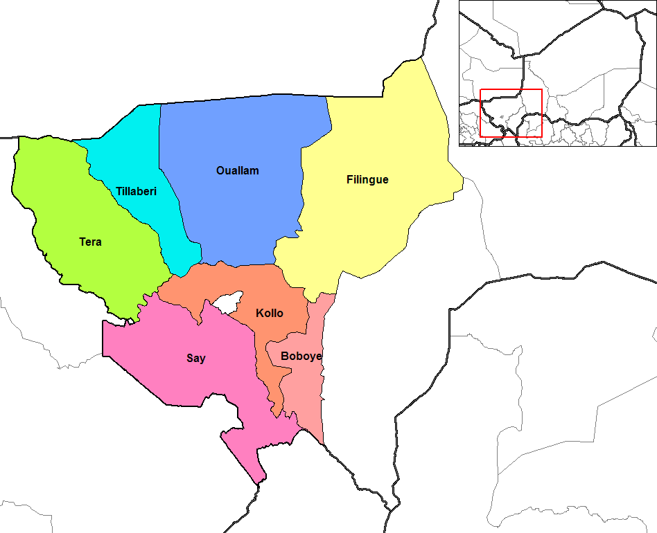
Tillaberi arrondissements