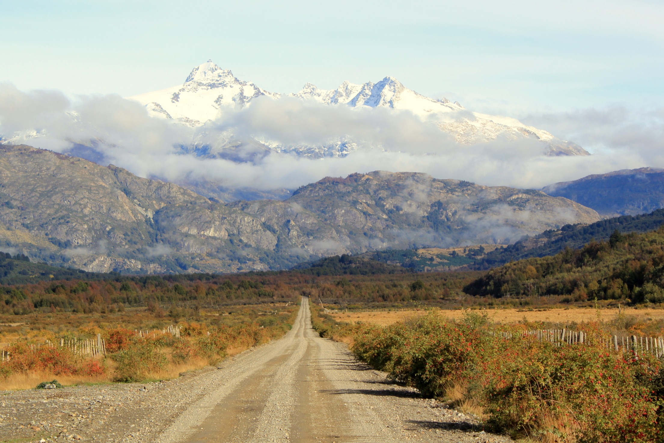
The Carretera Austral (Route CH-7) is the legendary scenic road that runs through northern Chilean Patagonia, from Puerto Montt to the remote village of Villa O'Higgins, across more than 1,200 kilometers. Crossing fjords, temperate rainforest, glaciers, turquoise rivers, lakes and mountains, it is considered one of the most spectacular and wildest road trips in the world.
It is not a conventional highway: it combines paved stretches with long sections of gravel, and it is interrupted at several points by fjords that must be crossed by ferry, which means planning the maritime connections carefully. Along the way come national parks (Pumalín, Queulat, Cerro Castillo, Patagonia), small villages, hot springs, hanging glaciers and landscapes of overwhelming beauty.
Driving the Carretera Austral is an adventure: it demands time, a suitable vehicle, supplies bought in advance and flexibility in the face of changeable weather. In return, it offers Patagonia at its most pristine and least touristed. This guide covers the main highlights of the route, how to organize the ferries and the trip, and what to keep in mind on one of the continent's great drives.
The Carretera Austral was driven forward in the 1970s and 1980s by the government of Augusto Pinochet, with the aim of integrating and connecting by land the isolated northern Chilean Patagonia, until then reachable only by sea or through Argentina. Its construction, across one of the wildest and wettest territories on the planet, was a feat of engineering that cost the lives of several workers. Opened in stages over decades, it was extended southward as far as Villa O'Higgins, and it remains a work permanently under improvement.
Read the full history ↓The deepest and emptiest Patagonia in Chile: the old Trapananda explored by Darwin and FitzRoy, the pioneer settlement and the 'Chile Chico war', the legendary Carretera Austral, the glaciers and Marble Chapels of Lake General Carrera, and the hanging glacier of Queulat.
Read the history of Aysén del General Carlos Ibáñez del Campo Region →If you book from here we earn a commission and you pay no more. Prices and availability come from Civitatis.
No exact prices: a scale from $ (budget) to $$$$$ (luxury), with 2-3 options per category.
Origins, formation and what the sources say.
Barely half a century ago, an inhabitant of Aysén who wanted to reach the rest of their own country had three options: take a boat, board a light aircraft or, most improbably, cross into Argentina, drive hundreds of kilometers across the pampa and re-enter Chile further south. There was no other way. Northern Chilean Patagonia —the vast territory of fjords, forests and glaciers in the Los Lagos and Aysén regions— was one of the most cut-off areas in the country, a piece of Chile you could not reach through Chile.
The extreme geography, with its labyrinth of channels, mountains, ice fields and impenetrable rainforest, made an overland connection with the rest of the territory practically impossible. The people of Aysén depended on shipping, on aviation or on that absurd detour through the neighboring country.
The situation produced a powerful economic, social and geopolitical isolation. The pioneer communities that had settled the region at the start of the 20th century —living off ranching, logging and fishing— were disconnected from the national territory, depending on Argentina for many services and much of their trade. For the Chilean state, integrating and asserting sovereignty over this immense southern expanse became a strategic priority.
The idea of an overland route connecting Patagonia with the rest of Chile had long been cherished, but the enormous technical and financial challenges had postponed it again and again. Building a highway across one of the wildest, wettest and most geographically complex terrains on the planet looked like a titanic undertaking.
Construction of the Carretera Austral began in the 1970s and intensified in the 1980s, driven by the military government of Augusto Pinochet, which conceived it as a strategic project to integrate Patagonia and assert national sovereignty. The work drew heavy involvement from the army's Cuerpo Militar del Trabajo, which supplied machinery and personnel to cut a road through brutally hard country.
Building the route was a feat of engineering. Mountainsides had to be dynamited, bridges thrown over countless rivers, a path forced through the densest forest and fjords and glaciers skirted, all under some of the heaviest rainfall on the planet. The work, extremely dangerous, cost the lives of several laborers, and progress was slow and expensive. The highway was opened in stages over the years, extending progressively southward.
Where the geography made it impossible to continue by land —in the deep fjords— the solution was to build ferry legs into the route, connecting its sections by sea. So the Carretera Austral was born as a combination of gravel roads and sea crossings, an unfinished work in permanent improvement that, decade by decade, brought the far south closer to the rest of Chile.
What began as a work of territorial integration became, in time, one of the most celebrated scenic routes on the planet. By opening access to landscapes that had been all but unreachable —hanging glaciers, turquoise lakes, marble chapels, mighty rivers, villages of wooden walkways— the Carretera Austral became a magnet for travelers, backpackers, cycle tourists and nature lovers from all over the world.
Along the route, national parks were created and consolidated to protect its extraordinary biodiversity: Pumalín, Queulat, Cerro Castillo, Patagonia, among others. Many of them emerged or expanded thanks to conservation projects, such as those driven by Douglas and Kristine Tompkins, which culminated in the creation of the Patagonia Parks Network. The road thus became, as well as a transport link, the spine of a world-famous conservation corridor.
Today the Carretera Austral embodies a double identity: it is the backbone connecting the communities of Chilean Patagonia and, at the same time, an epic travel experience offering Patagonian nature at its wildest. Driving it means passing through one of the great works of Chilean geography and one of the last great pristine landscapes in the world.
Construction of the Carretera Austral formally began in 1976 and advanced in stages. A first major stretch, between Chaitén and Coyhaique, was opened around 1983, and the connection as far as Cochrane was completed in 1988. The far south took far longer: reaching Puerto Yungay and the final link to Villa O'Higgins —the southernmost point of the route— were only achieved in 2000, almost a quarter of a century after work began. Every kilometer won from the fjord, the forest and the mountain was a small epic in itself.
The route never stopped changing. In recent decades stretches once of gravel have been paved, bridges improved and some ferry crossings replaced by road. Natural events have tested the connection, such as the violent 2008 eruption of the Chaitén volcano, which buried part of the town of Chaitén and forced a reorganization of the northern access, or the mudslides and floods that periodically cut sections of the road. Extreme rainfall and unstable geology make maintenance a permanent task.
Today the Carretera Austral faces the challenge of balancing connectivity, development and conservation. Its growing fame brought prosperity to villages once forgotten, but also pressure on fragile ecosystems and debates over projects —such as the dams on the Baker and Pascua rivers, ultimately rejected after the 'Patagonia Without Dams' campaign— that put the region's future at stake. The route remains, then, far more than a road: it is the stage on which Chile argues over what kind of Patagonia it wants for the future, between integrating its communities and protecting one of the last great wild territories on the planet.
At some point over the last two decades, the Carretera Austral stopped being merely a road and became a traveler's myth. Cyclists from Europe crossing the planet to pedal its 1,240 kilometers of gravel and asphalt, backpackers hitching between Chaitén and Villa O'Higgins, whole families in pickups chasing the turquoise of the Baker river: Route CH-7 took its place on the lists of 'the world's best road trips' alongside America's Route 66 or Australia's Great Ocean Road. Unlike those, though, the Austral promises no comfort, only pure adventure.
Part of its mystique lies in what it demands. This is not a highway you 'do' in a day: driving the whole thing takes one to two weeks, obliges you to book ferries weeks in advance, to fill up in every village because the next pump may be 200 kilometers away, and to surrender to weather that changes five times in an afternoon. The gravel stretches punish tires, rain turns dust into mud and the fjords cut the route, forcing you onto a ferry. That difficulty is precisely what keeps the Carretera Austral relatively safe from mass tourism and preserves its frontier aura.
In return, it delivers a run of landscapes that look unreal: the Hanging Glacier at Queulat suspended between two walls, the Marble Chapels floating on Lake General Carrera, the ancient alerces of Pumalín, the walkways of Caleta Tortel. For the traveler who drives it, the story of the Carretera Austral —an impossible work raised with dynamite and sweat to join what could not be joined— becomes tangible at every bend. Driving Route 7 is, at bottom, traveling through the account of how Chile decided not to surrender to its own geography, and of how that effort ended up giving the world one of the last great wild routes on the planet.