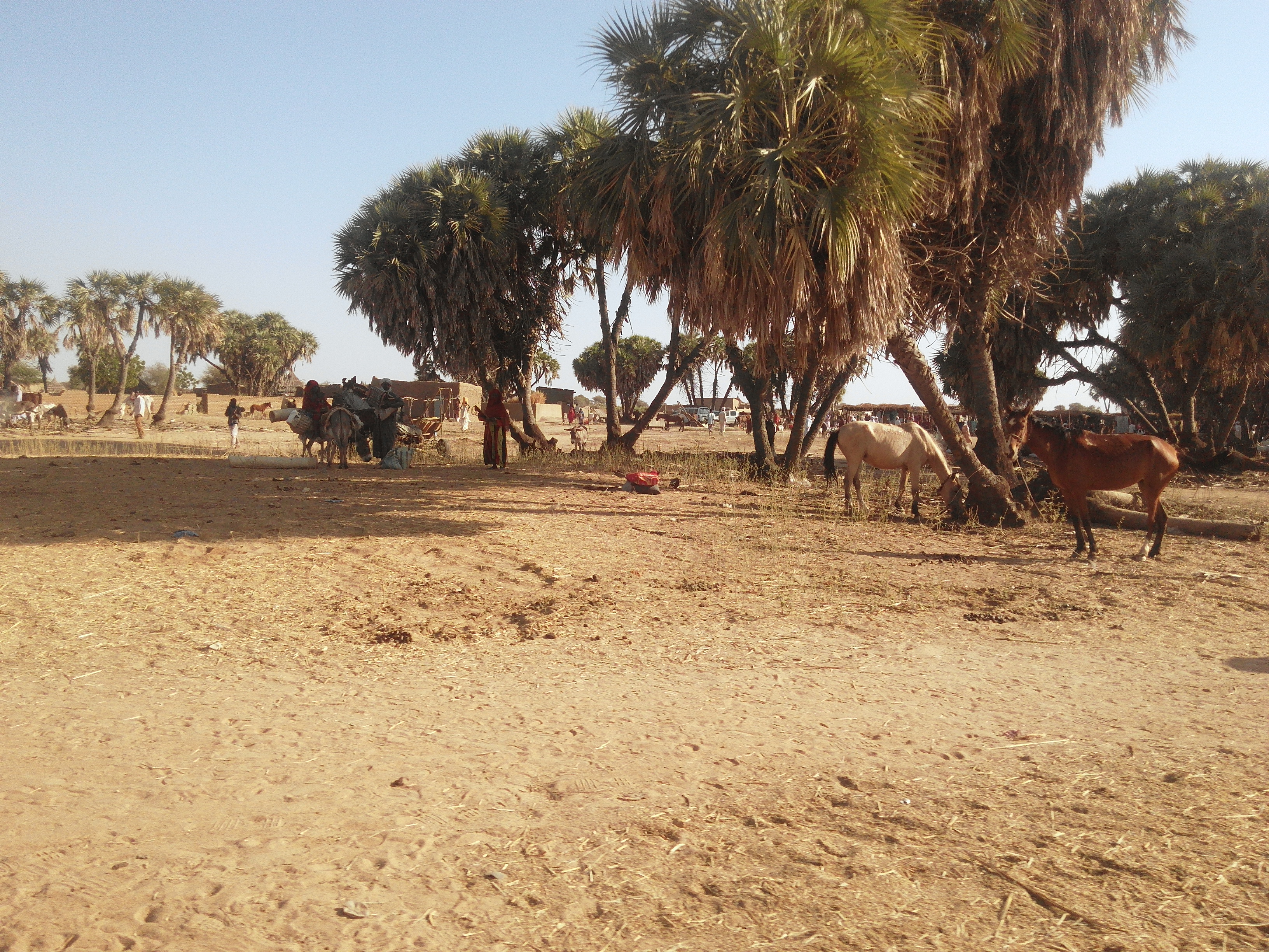
Am Timan is on no must-see list, and yet thousands of people pass through it every season: it is the overland gateway to Zakouma National Park. Capital of Salamat province, in south-eastern Chad, it is a town of earthen houses and wide sandy streets, with a large market, a mosque, government offices and the unmistakable feeling of being at the last place with services before a vast, empty territory.
Its name means «mother of twins» in Arabic, and its life revolves around water: the Bahr Salamat (the Bahr Azoum in its upper course) is a seasonal river that runs through the town when it carries water and that, in the wet season, turns the whole region into an enormous wetland. Together with those of the Bahr Aouk, these floodplains form one of the largest Ramsar sites in the world, designated on 1 May 2006: a complex of plains, hills, rivers and pools where migratory waterbirds breed and hippos, elephants, leopards and several antelope species live, and where fishing supports tens of thousands of people, with annual catches of around 15.000 tonnes.
For travellers, Am Timan is a stopover: you arrive, fill up on fuel and water, walk around the market, sleep one night and move on. But it is also the best way to see how the real Sahelian Chad works, with no tourist infrastructure of any kind, and to understand why getting to Zakouma is an expedition rather than an excursion.
Am Timan is an old market town of the eastern Sahel that became established as an administrative centre under French colonisation: a decree of 5 October 1910 created the district with Am Timan as its capital, and in 1911 its subdivisions were Am Timan and Abou Deïa, with Mangueigne added in 1916. Its history is tied to the water of the Bahr Salamat and to the transhumance and trade routes between Ouaddaï, Moyen-Chari and what is now the Central African Republic. In 1971 the French Foreign Legion upgraded its sand airstrip to handle military transports during the campaign against the FROLINAT rebellion, and since then the town has been linked to the logistics of the conflicts in eastern Chad: in October 2006 rebel groups claimed to have captured it, a claim the Government denied. Today it is the capital of Salamat province and the overland gateway to Zakouma National Park.
Read the full history ↓The land of the Wadai Sultanate, with Abéché as its caravan capital on the road to Benghazi. Today it is the border with Darfur and the region that takes in refugees from the war in Sudan.
Read the history of The Sahelian east →No exact prices: a scale from $ (budget) to $$$$$ (luxury), with 2-3 options per category.
Origins, formation and what the sources say.
To understand Am Timan, you have to understand water. The town lies in south-eastern Chad, about 407 metres above sea level, in a natural depression that stretches as far as the border with the Central African Republic. Through it runs the Bahr Salamat, known as the Bahr Azoum in its upper course: a seasonal river that flows from north-east to south-west and passes through the town only when it is carrying water.
During the wet season, between June and October, this system overflows and turns thousands of square kilometres into one continuous wetland. The area formed by the floodplains of the Bahr Aouk and Salamat was designated a Ramsar site on 1 May 2006 and is among the largest protected wetlands in the world. It is a complex of floodplains, hills, a lake, rivers and pools that serves as a breeding ground for migratory waterbirds and as habitat for hippos, elephants, leopards and several species of antelope.
Then, between November and May, the water recedes. The dry season lasts around seven months a year, and water becomes the central problem of daily life: wells are dug in the sandy riverbed, herds come down from the north looking for the last pools, and farming concentrates on the riverbank land that is still damp.
That swing explains everything else. Fishing, with annual catches of around 15,000 tonnes across these floodplains, is the main economic activity, alongside livestock and vegetable gardens. It also explains why neighbouring Zakouma National Park is what it is: in the dry season wildlife gathers around the last permanent pools, and that cycle of concentration is what makes the best safari in Central Africa possible.
For centuries, south-eastern Chad was a zone of contact and friction. To the north lay the influence of the Sultanate of Ouaddaï, the military and trading power that dominated eastern Chad from 1635. In the 19th century, under Muhammad Sabun, it pushed its expansion south as far as Dar Sila and Dar Runga. To the west were the kingdoms of the Chari and Bagirmi; to the south and south-east, the lands that now belong to the Central African Republic.
That position made the Salamat region both a corridor and a frontier. It was a transhumance corridor: for generations, Arab herders have come south following water and pasture, in seasonal migrations that shape the economy and social life. It was also a trade corridor. Goods and livestock passed through here, and so did the slave raids that the northern sultanates launched towards the south. That history deeply marked relations between settled and nomadic peoples, and its memory is still alive.
In the town and on the northern plains, most people speak Arabic and are Muslim, with settled communities of farmers and fishers along the riverbanks. The name itself confirms it: “Am Timan” is Arabic and means “mother of twins”.
Unlike Abéché or Ouara, Am Timan was never the capital of a great state and has no monumental palaces. It has always been what it still is: a meeting point, a market and a source of water in a vast territory where water decides where a town can exist.
Am Timan became an administrative centre under French colonial rule. A decree of 5 October 1910 created the Salamat district with Am Timan as its capital, just a year after French troops took Abéché and dismantled the Sultanate of Ouaddaï. In 1911 the district had two subdivisions, Am Timan and Abou Deïa, and Mangueigne was added in 1916.
That decision set the map that still applies today. Am Timan became the base for running a huge, sparsely populated territory, following a logic France repeated across the Sahel: put the seat of government where there is water and a market, and from there control transhumance, collect taxes and recruit labour.
The other major colonial-era landmark served a practical purpose too. In 1963, Zakouma National Park, Chad's first national park, was created just north-west of the town, and the region was put on the map. Am Timan automatically became its service town, a role it still plays today. It shows in the most practical detail in this whole guide: the turn-off to the park is marked with a stone post on the road, twelve kilometres from town as you come from Abou Deïa.
Chad's independence in 1960 was followed almost immediately by war. The FROLINAT rebellion, which began in 1966 in the centre and east of the country, turned the Chadian Sahel into contested territory for decades. Remote regions such as Salamat were caught between guerrillas, the army and militias.
That period left a visible mark on the town. In 1971 the French Foreign Legion upgraded Am Timan's sand airstrip so that military transport planes supplying the fight against the rebels could land. That airfield, now coded AMC, is still the province's air link.
The cycles of rebellion kept returning. In October 2006, in the middle of an offensive against President Idriss Déby, rebel forces claimed to have captured Am Timan, which the Chadian government denied. A few weeks later, on 25 November, the UFDD did take Abéché for a day. Like the whole eastern half of the country, the province remained a place where stability depends on a fragile balance.
Today the pressure comes from three directions. To the south is the border with the Central African Republic, which the UK Foreign Office describes as very insecure, with limited state presence and active armed groups. To the east is the war in Sudan, which since April 2023 has driven more than a million refugees into Chad and destabilised the whole border strip. Running through everything is the competition between farmers and herders for water and pasture, which gets worse in the Sahel with every poor rainy season.
Am Timan had 38,261 inhabitants in the 2012 census, compared with 21,269 in 1993 and an estimated 30,443 or so in 2008. It is a small town, yet it runs a huge province. Its economy rests on fishing, vegetable gardens and livestock, and life revolves around a large market that draws settled farmers, herders on the move and traders.
Services are limited. There are primary and secondary schools but no university, and healthcare is poor. One fact sums it up well: in 2018 the town launched a lay first-responder programme that trained motorcycle-taxi drivers in first aid, because there was no pre-hospital emergency service at all. Those same motorcycle taxis are the main way to get around town.
For travellers, Am Timan today is above all a stop with a purpose. It is the last town with fuel, bottled water, supplies and a bed before you enter Zakouma National Park. The park opens in the dry season, from 1 December to 15 May according to the official rate sheet for the 2026 season, and does not sell fresh food to campers. If you come overland from N'Djamena, after 12 to 14 hours of driving via Mongo and Abou Deïa, you will almost certainly pass through here.
But it would be unfair to leave it at that. Am Timan is one of those towns where absolutely nothing is set up for visitors, so what you see is what there is: tea on the street, mechanics' workshops, earthen architecture, dried fish piled high in the market, and conversations that start on their own as soon as you sit down. In a country with as little tourism as Chad, that authenticity isn't a bonus. It's what you came for.